A Note From Cyndi (currentlly in Raja Ampat, Indonesia)

June 18, 2023

Sorry for the slow-down on the posts lately, particularly since we know a few people are anxious to hear about Indonesia.

Aside from spending three weeks in a city called Tual (mostly due to the “fascinating” new adventure of contracting Covid), we’ve been moving at a pretty intense pace. This hasn’t left us much time for working on the blog.

We’re hoping to slow down a bit now that we’ve reached Raja Ampat, but as always our movements are dictated by weather, the need to re-provision, and the necessity of keeping current with our visa renewals. (And, oh yeah, the availability of internet.)

Rich and I both intend to start doing Indonesia posts, but I’ll also be writing about our time in Australia leading up to Indonesia (and then eventually picking up where I left off previously in the blog).

In the meantime, here’s our thoughts about Indonesia so far. It’s exotic, mysterious, and has so much natural beauty, but it’s also a third world country and some aspects can be frustrating, exasperating, or unpleasantly challenging. We’ve visited three cities so far (Saumlaki, Tual, and Sorong), and each of them has been an endurance trial in their own way.

On the other hand, when we get out cruising in Indonesia’s natural world, we’ve experienced beauty that is nothing short of astonishing. We’ve barely scratched the surface of seeing this country, yet already we’ve been to a few spots that will definitely go in the “most beautiful places we’ve ever seen” list, and perhaps even on the top of that list.

We haven’t been here all that long, but already we have so many experiences to share (and as anyone who reads this blog knows, we share the good, the bad, and the ugly). Rich has already done a couple of posts, but I’d like to get a bit more of Australia done before I start posting about Indonesia. I promise it won’t be long. –Cyndi

Impossible! Penem Island and Piaynemo

June 13, 2023

The Cruising Guide to Indonesia says this about where we’re anchored:

“The (bay we’re in) is much too shallow to enter.”

Basically, impossible.

And when you look at a satellite image, I’d agree…

But this is one of the very few cases we’ve found where the charts (Navionics and Cmaps) are more accurate than the satellite images…

Navionics – depth in meters

Above is a screenshot of the Navionics chart. C-maps is much the same. Note that if you follow the line into the bay, you’d hit one or two bommies. We had to weave around them a bit. There’s also an overhead wire that, fortunately, was tall enough for us to get under (we didn’t see it until we were passed it). It was a little nerve-racking getting in but so worth it.

It’s impossibly beautiful here! Here’s a 30 second clip from the air.

–Rich

Hidden Beach, Saumlaki

June 7, 2023 about our arrival in April

We spent six days trying to get checked in at Saumlaki and once we did, our first stop was a little gem called Hidden Beach. Here’s a video that shows where it is and what it’s like. It was very special.

Our anchor position was 08° 03.344′ S, 131° 16.197′ E. It wasn’t a great place to anchor but for a few hours, in calm conditions, it was fine, and well worth the effort.

The snorkeling there wasn’t special, but it’s a sweet little beach and the swimming was great, especially after coming from Oz – the land of crocks, sharks and stingers! It felt wonderful to get in the water.

From this spot, we headed about 6 miles WNW and found a great place to spend the night at 07° 59.9667′ S, 131° 11.3029′ E. We couldn’t find a name for the bay.

We’ll write about Saumaki and our check-in experience soon. -Rich


The Lesson in Action Part Two: Our Passage to Hexham Island (Queensland, Australia)

Posted June 1, 2023
about September 11, 2022

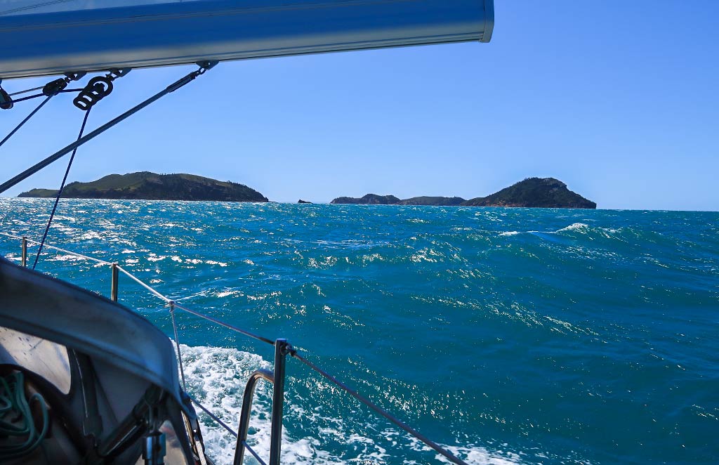
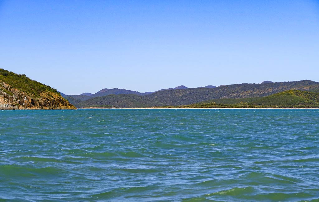
The morning was calm; then the wind suddenly picked up out of nowhere. It seemed odd, but since we were expecting 15-knot winds for our 35-mile trip from Pearl Bay to Hexham Island, we weren’t concerned. We headed out into the breezy day while friends on another boat opted to stay put. Had we known then what we know now, we would have stayed put with them. Below, a photo looking back at Pearl Bay as we left:

Once we were heading up the coast, the landscape became noticeably dryer, more typical for this part of Queensland. I’d hoped Pearl Bay signaled the beginning of more greenery, but apparently it simply gets more rain than is usual for this area.

Some time later, as we sailed by Townshend Island, the wind strengthened to 19 knots. The good news was we were on a broad reach, the wind comfortably aft of the beam. And with a 2-knot current going with us, we were making great speed. Still, I was wondering what was up with this wind—could Townshend Island be creating some sort of funnel effect? Whatever was going on, I hoped it would die down once we passed the island.

Meanwhile, Rich noticed something alarmingly close on the radar. He looked out and saw a big plume of water. After wondering if it could be an uncharted rock, we were relieved to see it was a breaching whale. As we got closer, the whale turned upside down, stuck its tail up out of the water and started slapping it down repeatedly. This went on for quite a while–every time we thought the whale was done, he’d start up again. I say “he” because this is apparently typical behavior for male whales. Maybe he thought Legacy was a pretty lady whale and wanted to show off. Here’s a link to a post Rich did about the whale’s tail. 

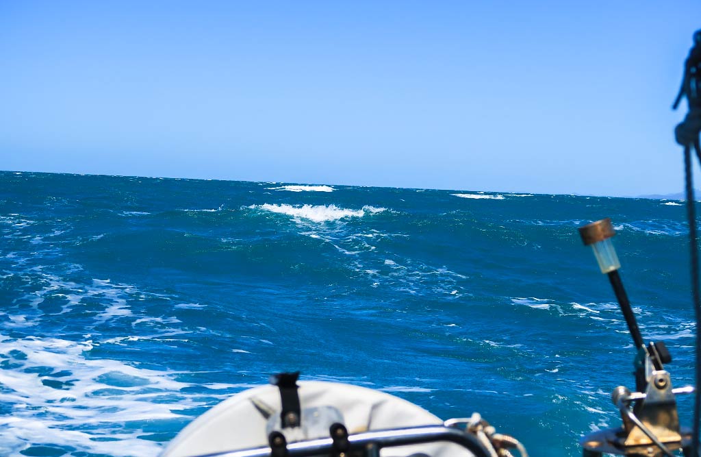
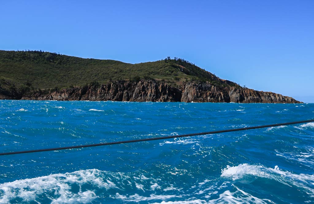
After we passed Townshend Island, I was dismayed when the wind not only didn’t die down; it continued to pick up. It was soon blowing in the low 20s, gusting up to 27 knots. The sea became covered with whitecaps and the wind waves increased to at least a meter, big enough that we started to surf along them as they came up from behind us.

Our saving grace was that we were going downwind, and as long as we didn’t maneuver, the situation would remain stable and controlled. But unless we were willing to just keep going and skip Hexham Island (not a bad idea in retrospect) we would eventually have to turn and jibe the sail as we did so (which means bringing it from one side of the boat to the other while going downwind). Jibing can be a harrowing maneuver in conditions like these, and I didn’t look forward to that ordeal.

Meanwhile, the thought going through my head: This is not safe. Things may have been under control, but I didn’t feel safe being out here in these conditions. We’ve been in many varieties of sea states, some with much bigger waves than these; but while we typically experience discomfort, it’s rare I feel endangered.

(Interestingly as I write this post, we just made a very similar passage and I never felt nervous—merely annoyed when things fell over below during particularly big swells. There was something about the sea state during that Hexham Island passage that felt menacing.)

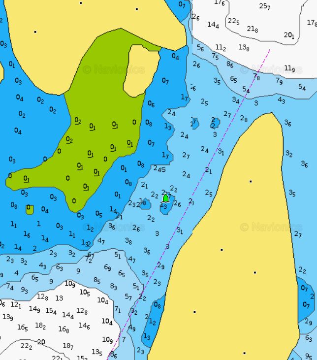
Hexham came into view, a smallish island with a tall peak. I was hoping the conditions would improve when we got behind the leeward side of the island. They didn’t; they got worse! The wind was still up, the sea rough, and now we encountered a strong current pushing us towards the rocky shore. We had to turn up the throttle in order to fight the current.

At this point I knew the jibe was coming up and was pretty nervous about it, but Rich went over the plan of how we’d work together to get it done. When the time came, it worked out with minimal drama. We were now close to the anchorage and hopeful we’d soon be out of these conditions! As they say in infomercials, though: “But wait, there’s more!”

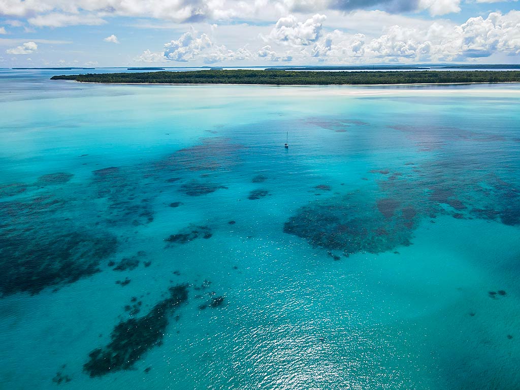
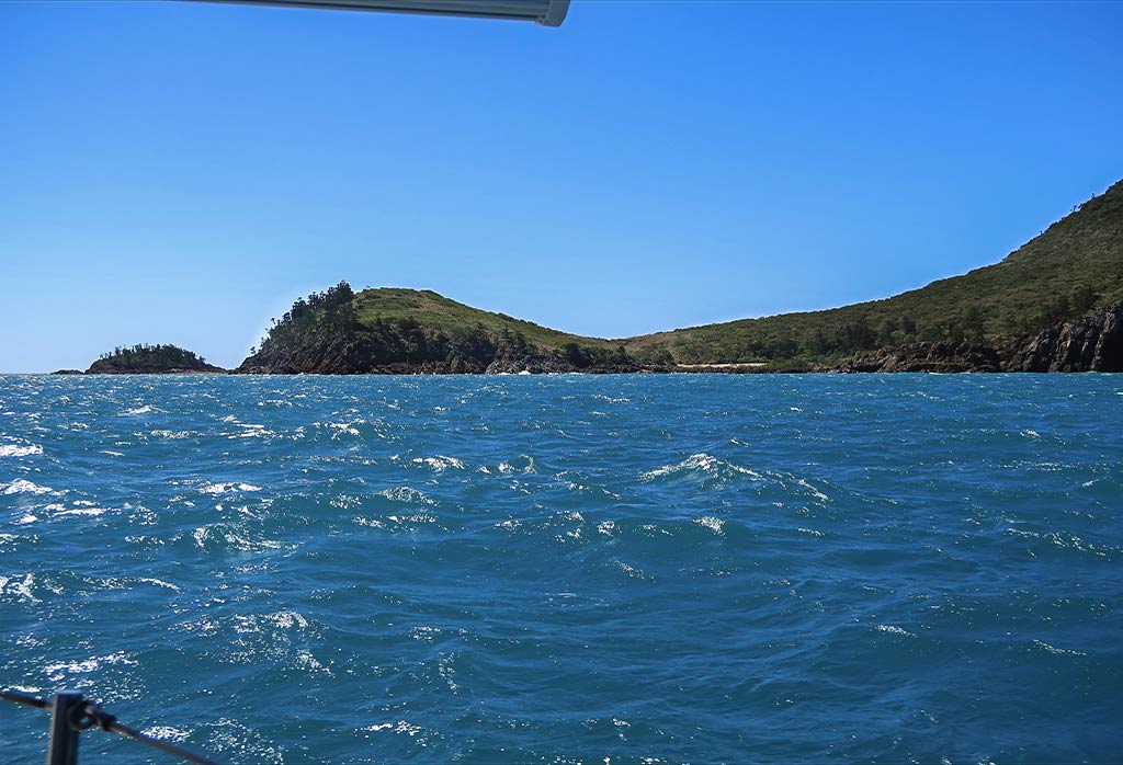
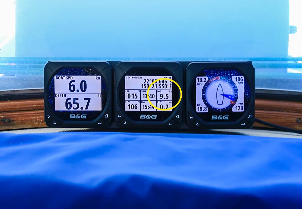
I could see ahead of us was a big patch of very disturbed water, reminding me of what happens in narrow channels between land masses, but there was no channel here. I asked Rich, “What is That!?” Well, it seemed it was a particularly bad spot of current meeting wind, and we’d have to go through it to get to the anchorage. Rich was preparing to drop the mainsail when the current suddenly picked up and had us barreling along at over 9 ½ knots! Dropping the main now became an urgent matter as we scrambled to get the sail centered and bring it down while going through this crazy current and churning waves.

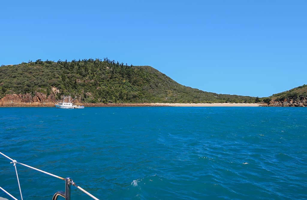
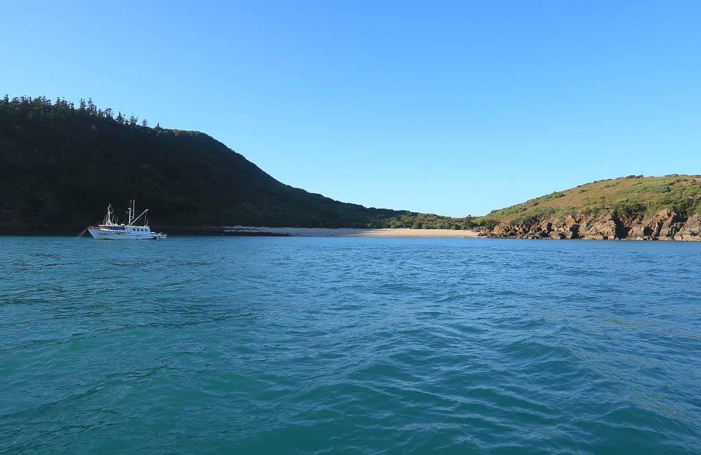
Once the sail was down and the rough water was behind us, we could turn and head into the anchorage. Unfortunately there was a fishing boat taking refuge very close to our chosen anchoring spot. There was still enough room for us, albeit not as close to shore as we would have liked. Thankfully, while it was still windy, the water in the anchorage was pretty calm.

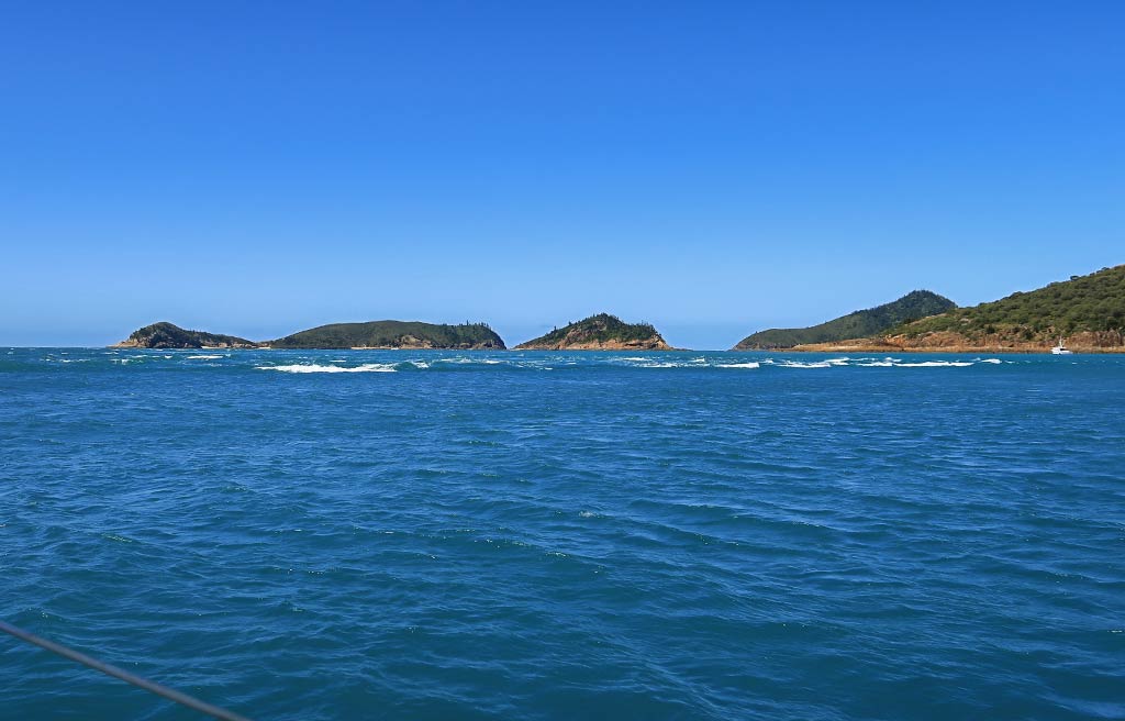
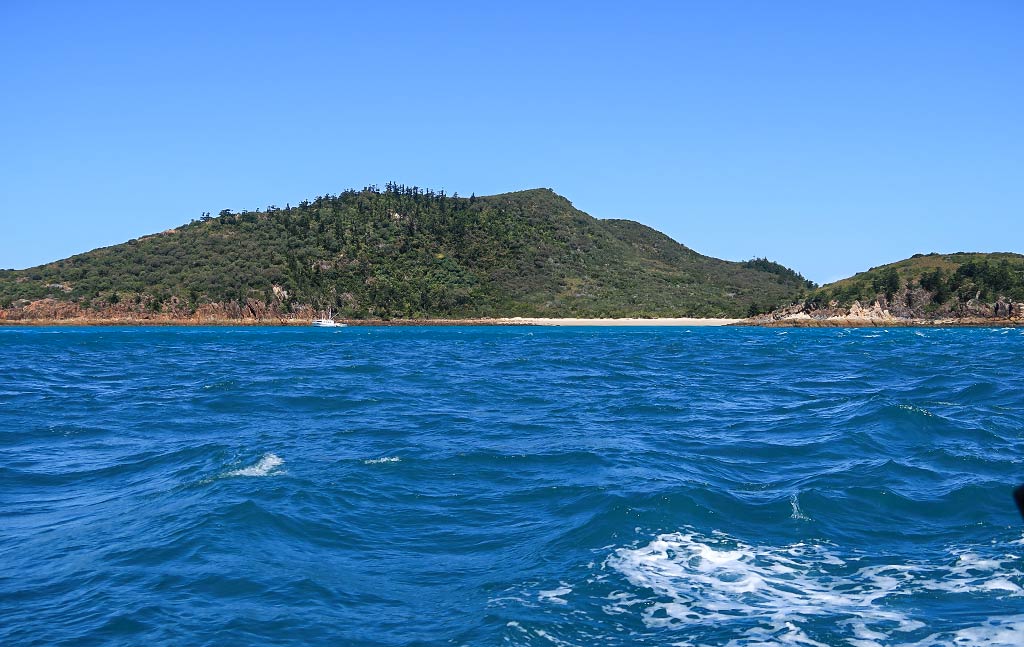
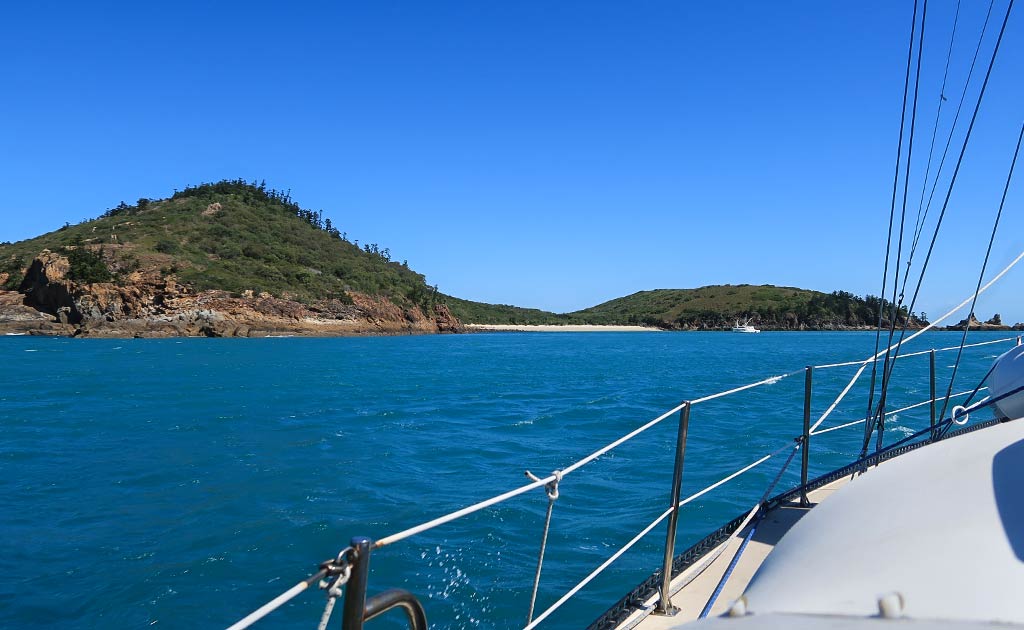
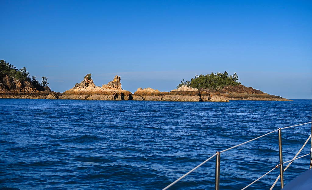
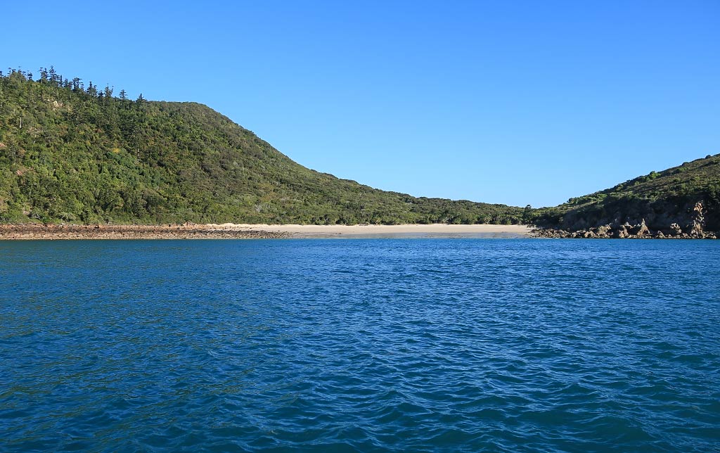
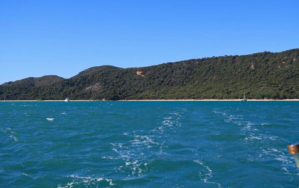
Below, a photo gallery of our trip and the approach to Hexham Island, including the rough area of water and our instruments showing our SOG (speed over ground) at 9.5 knots in the current. The final photo shows our entry into the anchorage after we got through all that and the fishing boat that we’d be sharing the anchorage with. (Click any photo to enlarge.)

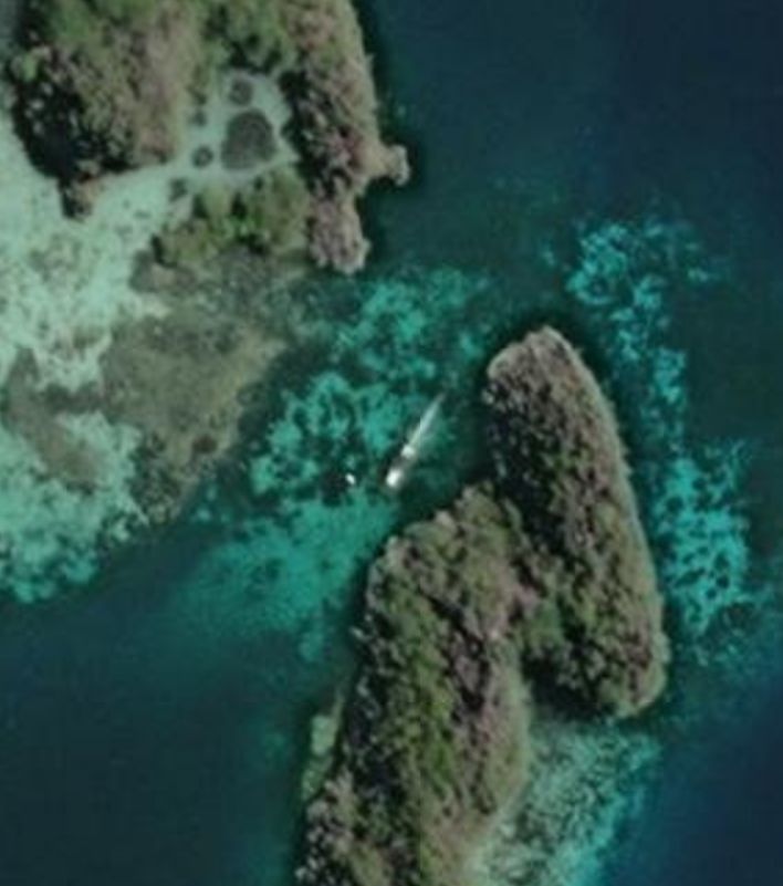
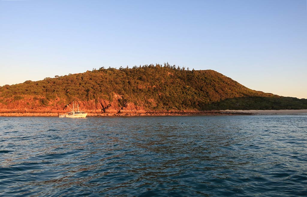
After we got anchored, I took a look at the island. It was attractive with its peaked hill with bushy greenery above the reddish rock cliffs along the shore. The hill sloped down into a low saddle behind the beach then up again into a smaller rounded hill. This hill boasted a trail with a lookout point, one of the reasons I wanted to come here.

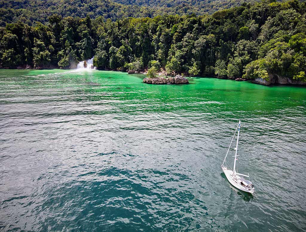
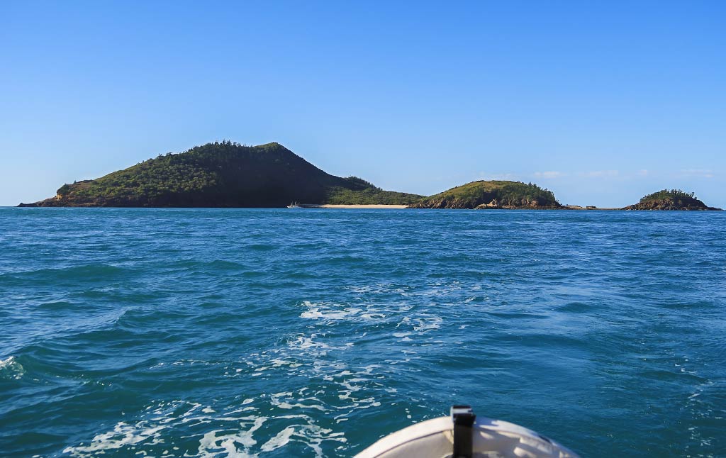
Our anchorage was protected on the west side by a low arm with two distinct rock spires, and behind another arm ending in a small headland hill. To the east was a long low point and a view of other islands nearby. Below, a few photos of Hexham Island . .

The overall look of Hexham was interesting, the jagged spire rocks giving it a hostile edge that contrasted with the inviting beach and green hills. Rich hated it on sight, but I think some of that had to do with the rough conditions coming up here.

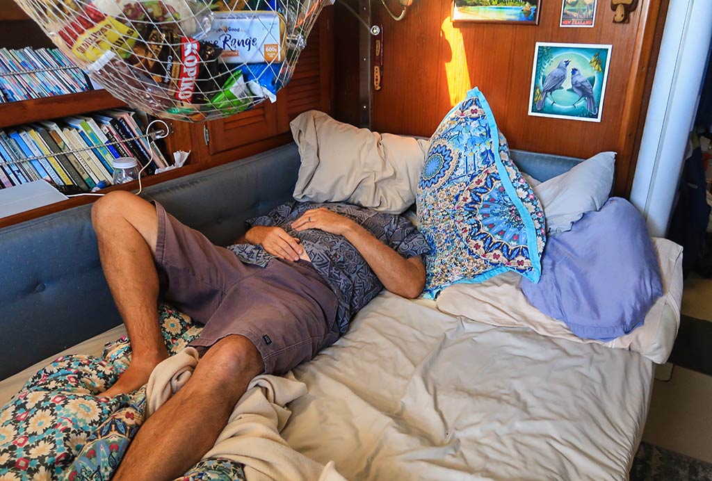
This is the point in the post where I’d usually have photos of our beach excursion and the hike up to the lookout point, but you won’t be seeing that because we never went ashore. Instead, here’s a photo of that sums up our activities after getting in: hide head under a pillow, lick wounds, and open bottle of wine not caring what time it was.

While the lookout walk would have been nice for taking photos, I have to say being here felt unnerving enough that I didn’t want to go ashore. I think our arrival ordeal left me with an uneasiness that I couldn’t shake–I felt traumatized in a way I haven’t been in a while. And usually when I do experience trauma, it’s because of extended discomfort. This trauma resulted from fear, especially during the final hour of the trip. I don’t think I’ve been so unnerved since we were swept out through a rough pass at the Fakarava atoll in French Polynesia.

I did do a forensic analysis of what happened today. The wind was obviously quite a bit stronger than forecast, not just here but where we’d been in Pearl Bay (we heard later that it had been really windy there all day). But I also remembered Alan Lucas writing something about current against wind making nasty sea conditions. I dug through the book to find it and yep, there it was: the huge tidal changes in this area create very strong currents. We’d now have to take that into account when making our next moves through these islands.

After a suitable amount of wine and TV to soothe our weary souls, we fell asleep early. The bay did become rolly at one point during the night but it wasn’t terrible. Yet it was another thing not to like about this place.

I woke up in the middle of the night and went to take a look outside. The moon was full and bright, beautiful but also the reason for the especially dramatic tidal current. The stars were only visible well away from the moon’s bright glow except for one very bright star. It seemed odd; then I realized the star must be Venus. Sometimes that planet is so bright that Rich and I joke it’s creeping closer to the Earth and all the scientists are keeping our eminent collision a secret.

Tomorrow, we planned to head on to the most popular destination in the Northumberland Island Group: Middle Percy Island in the Percy Isles. The weather was forecast to be much better than today, and the current would be with us if we left in the morning. I was a bit worried about going through that rough patch of water outside the anchorage again, but Rich didn’t think it would be an issue. I hoped he was right, and that tomorrow would be a better day. –Cyndi

Learning a Difficult Lesson (Queensland, Australia)

Posted May 12, 2023
about September 11, 2022

Our next destination after Pearl Bay was the Northumberland Islands, which actually refers to a large area of islands divided into seven smaller island groups (the Bedwell, Beverly, Duke, Flat, Broad Sound, and Percy island groups and the Guardfish Cluster). Yep, that’s a whole lot of islands, but many of these aren’t well protected or don’t have much to offer; so choosing where to stop was not as overwhelming as it might seem.

Below, an interactive map showing the area:

After some research, I chose pretty little Hexham Island, just a few hours away yet a bit off the mainstream path so it had a touch of doing something exotic. My choice was confirmed when a fellow cruiser who, after hearing where we were headed, said it was one of her favorite anchorages. Good to know, but in case it didn’t work out, I had a Plan B island picked out: Hunter Island in the more commonly visited Duke Islands group.

The weather looked good for our trip, about 15 knots from the southeast, and I we figured we were all set. Little did we know we were about to learn a very difficult lesson about boating in this area of Queensland. I can’t claim that there were no warnings, but I will take a stand that the warnings weren’t clear enough.

The Background:

First I shall mention again that we use the Alan Lucas guides for cruising in Australia (both for the New South Wales Coast and the Queensland Coast), which I consider the best. I like how the author divides the mainland coast and nearby islands into definitive areas. Then he does an intro about cruising that area that’s an informative overview before detailing every anchorage known to man in that area. It’s a lot of information to go through, but I’ve found it worth the effort.

When I had earlier researched the trip north from Pearl Bay, I saw the coast would be dropping away to the west in an area Alan Lucas described this way:

“North and west of here the land fragments into two huge bays, Shoalwater Bay and Broad Sound, where the highest tides on the Australian coast occur and tidal stream currents are swiftest. This is an area best cruised during neap tides or not at all.”

No problem. We planned to bypass that area entirely, cruising well to the east of those bays. At one point we’d be passing a channel between our  mainland coast and a large island just above it, Townshend Island. This island would continue to separate us from the bays as the mainland had. There was another channel between Townshend and another island. The book cautioned about using those channels and included this warning:

“Because big tides carry a swell beyond expected limits, very few island anchorages are calm at any time and during strong windward-tide events can be miserable, not to mention damaging. It is suggested that neap tides and light winds be chosen to cruise this area.”

Since this was in a section about the channels and didn’t mention any islands to the northeast, I didn’t pay it any heed. We weren’t going to Townshend Island or the channels, nor were we going to any islands in Shoalwater or Broad Sound. Simply, this fell under an SEP Field (Someone else’s problem). Below, a map showing the channels around Townshend Island.

Days later, when I chose Hexham Island as our next destination, I read this as part of the book’s description:

“When approaching from the southeast, typically from Island Head Creek, be aware that strong trade winds over ebb tides can produce very unpleasant sea conditions.”

At the time, I had no idea where Island Head Creek was but since we weren’t going there, I didn’t worry about it. We would coming from Pearl Bay. What I didn’t realize at the time was that Island Head Creek was just north of Pearl Bay. Below, a map showing both places:

Now I can’t say this wasn’t a warning, but I would point out that it was a very easy warning for someone not familiar with this part of Australia to miss. After our passage we learned the tides run as high as 9 meters, and the resulting currents extend beyond the bays all the way up to the city of Mackay to the north.

I also just found, in a segment buried between Island Head Creek and some other place we weren’t going, that currents most strongly affect the area between Townshend Island and the Percy Islands, right where Hexham Island and our second choice, the Duke Islands, were. Again, another warning that was very easy to miss.

But even if I had read this part of the book more carefully, it states that currents run up to 2 to 3 knots (getting up to 6 knots in the dreaded channels). Two to three knots is something good to know about so we can adjust for it, but certainly not a deal breaker.

As far as why these warnings seemed to coincide with information about Island Head Creek, it seems migrating yachties tend to stop there after visiting Pearl Bay. It didn’t look appealing to us so we weren’t stopping, confirmed when we sailed by and I snapped a photo.

Looking back, I wonder if the popularity of this stop has more to do with shortening what can be a difficult passage than any desire to experience Island Head Creek.

Having gone back to the book as I write this, I’m finding more pieces of information scattered about, including this very surprising one:

“North of Island Head Creek, along the most popular route to the Whitsunday Islands, there are no truly comfortable anchorages for around 100 miles, all being dependent on such factors as wind strength and direction according to prevailing tidal streams, which, during springs, can be very strong and influential in shaping wave form.”

This is quite a statement, but I think what the author meant to say instead of “truly comfortable” was “consistently comfortable,” as we did find very comfortable spots en route to Mackay! Still had I seen this statement, we may have made a different decision about stopping in an anchorage that was questionable, like Hexham Island.

If the guide book is ever updated, it would be nice to have one consolidated and clear warning about cruising through the area between Pearl Bay/Island Head Creek and the Percy Islands. In most cruising grounds there’s often a notoriously difficult place to be approached with caution. The Northumberland Islands to the north and east of Shoalwater Bay and Broad Sound is just such an area.

Coming Next: The Lesson in Action Part Two: Our Passage to Hexham Island. –Cyndi