
Posted May 12, 2023
about September 11, 2022
Our next destination after Pearl Bay was the Northumberland Islands, which actually refers to a large area of islands divided into seven smaller island groups (the Bedwell, Beverly, Duke, Flat, Broad Sound, and Percy island groups and the Guardfish Cluster). Yep, that’s a whole lot of islands, but many of these aren’t well protected or don’t have much to offer; so choosing where to stop was not as overwhelming as it might seem.
Below, an interactive map showing the area:
After some research, I chose pretty little Hexham Island, just a few hours away yet a bit off the mainstream path so it had a touch of doing something exotic. My choice was confirmed when a fellow cruiser who, after hearing where we were headed, said it was one of her favorite anchorages. Good to know, but in case it didn’t work out, I had a Plan B island picked out: Hunter Island in the more commonly visited Duke Islands group.
The weather looked good for our trip, about 15 knots from the southeast, and I we figured we were all set. Little did we know we were about to learn a very difficult lesson about boating in this area of Queensland. I can’t claim that there were no warnings, but I will take a stand that the warnings weren’t clear enough.
The Background:
First I shall mention again that we use the Alan Lucas guides for cruising in Australia (both for the New South Wales Coast and the Queensland Coast), which I consider the best. I like how the author divides the mainland coast and nearby islands into definitive areas. Then he does an intro about cruising that area that’s an informative overview before detailing every anchorage known to man in that area. It’s a lot of information to go through, but I’ve found it worth the effort.
When I had earlier researched the trip north from Pearl Bay, I saw the coast would be dropping away to the west in an area Alan Lucas described this way:
“North and west of here the land fragments into two huge bays, Shoalwater Bay and Broad Sound, where the highest tides on the Australian coast occur and tidal stream currents are swiftest. This is an area best cruised during neap tides or not at all.”
No problem. We planned to bypass that area entirely, cruising well to the east of those bays. At one point we’d be passing a channel between our mainland coast and a large island just above it, Townshend Island. This island would continue to separate us from the bays as the mainland had. There was another channel between Townshend and another island. The book cautioned about using those channels and included this warning:
“Because big tides carry a swell beyond expected limits, very few island anchorages are calm at any time and during strong windward-tide events can be miserable, not to mention damaging. It is suggested that neap tides and light winds be chosen to cruise this area.”
Since this was in a section about the channels and didn’t mention any islands to the northeast, I didn’t pay it any heed. We weren’t going to Townshend Island or the channels, nor were we going to any islands in Shoalwater or Broad Sound. Simply, this fell under an SEP Field (Someone else’s problem). Below, a map showing the channels around Townshend Island.
Days later, when I chose Hexham Island as our next destination, I read this as part of the book’s description:
“When approaching from the southeast, typically from Island Head Creek, be aware that strong trade winds over ebb tides can produce very unpleasant sea conditions.”
At the time, I had no idea where Island Head Creek was but since we weren’t going there, I didn’t worry about it. We would coming from Pearl Bay. What I didn’t realize at the time was that Island Head Creek was just north of Pearl Bay. Below, a map showing both places:
Now I can’t say this wasn’t a warning, but I would point out that it was a very easy warning for someone not familiar with this part of Australia to miss. After our passage we learned the tides run as high as 9 meters, and the resulting currents extend beyond the bays all the way up to the city of Mackay to the north.
I also just found, in a segment buried between Island Head Creek and some other place we weren’t going, that currents most strongly affect the area between Townshend Island and the Percy Islands, right where Hexham Island and our second choice, the Duke Islands, were. Again, another warning that was very easy to miss.
But even if I had read this part of the book more carefully, it states that currents run up to 2 to 3 knots (getting up to 6 knots in the dreaded channels). Two to three knots is something good to know about so we can adjust for it, but certainly not a deal breaker.
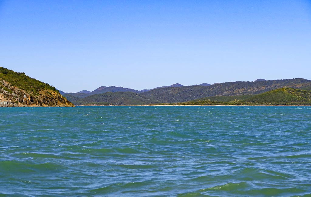
As far as why these warnings seemed to coincide with information about Island Head Creek, it seems migrating yachties tend to stop there after visiting Pearl Bay. It didn’t look appealing to us so we weren’t stopping, confirmed when we sailed by and I snapped a photo.
Looking back, I wonder if the popularity of this stop has more to do with shortening what can be a difficult passage than any desire to experience Island Head Creek.
Having gone back to the book as I write this, I’m finding more pieces of information scattered about, including this very surprising one:
“North of Island Head Creek, along the most popular route to the Whitsunday Islands, there are no truly comfortable anchorages for around 100 miles, all being dependent on such factors as wind strength and direction according to prevailing tidal streams, which, during springs, can be very strong and influential in shaping wave form.”
This is quite a statement, but I think what the author meant to say instead of “truly comfortable” was “consistently comfortable,” as we did find very comfortable spots en route to Mackay! Still had I seen this statement, we may have made a different decision about stopping in an anchorage that was questionable, like Hexham Island.
If the guide book is ever updated, it would be nice to have one consolidated and clear warning about cruising through the area between Pearl Bay/Island Head Creek and the Percy Islands. In most cruising grounds there’s often a notoriously difficult place to be approached with caution. The Northumberland Islands to the north and east of Shoalwater Bay and Broad Sound is just such an area.
Coming Next: The Lesson in Action Part Two: Our Passage to Hexham Island. –Cyndi


