Heading Towards The French Pass: Homestead to Elmslie Bay (New Zealand)

April 18, 2016

The northerlies had passed, and now was our time to leave the sounds and make our way 30 miles across Tasman Bay, a wide body of water that lies between the outer edge of the Marlborough Sounds and Able Tasman National Park. At Tasman Bay’s southernmost point is the city of Nelson.  (Below, an interactive map of the area.  You can zoom in to see our route line to Elmslie Bay.)


But first we’d have to get there.  A 12-mile trip from Pelorus Sound’s entry to Tasman Bay sounds simple enough, but there’s a big issue, and it’s called the French Pass. It’s formed by the presence of a very large island (D’Urville Island) sitting just above the final peninsula before Tasman Bay, creating a channel about a third of a mile wide. Here is where two large bodies of water meet with all the ensuing drama: fast-ripping currents, strong eddies, standing waves, and whirlpools, one big enough to have a name and to have claimed several lives: Jacobs Pool. The French Pass is pretty notorious in these parts, and people frequently asked us if we’d been through it. It’s kind of a badge of honor to have done it, I guess.

While some boaters are so wary of the French Pass they’ll travel miles out of the way to avoid it, it isn’t actaully so bad if you take the proper precautions. It’s much like an atoll where you need to wait for slack tide to pass through. What’s important to understand here is that slack water in the French Pass does not correspond with high and low tide, and thus you need to consult the proper current table. Boats who miss on this timing do so at their peril.

(The New Zealand government publishes a table of currents in the French Pass. You can find them here. We caution you that we did not find them all that accurate and we have heard the same complaint from others.)

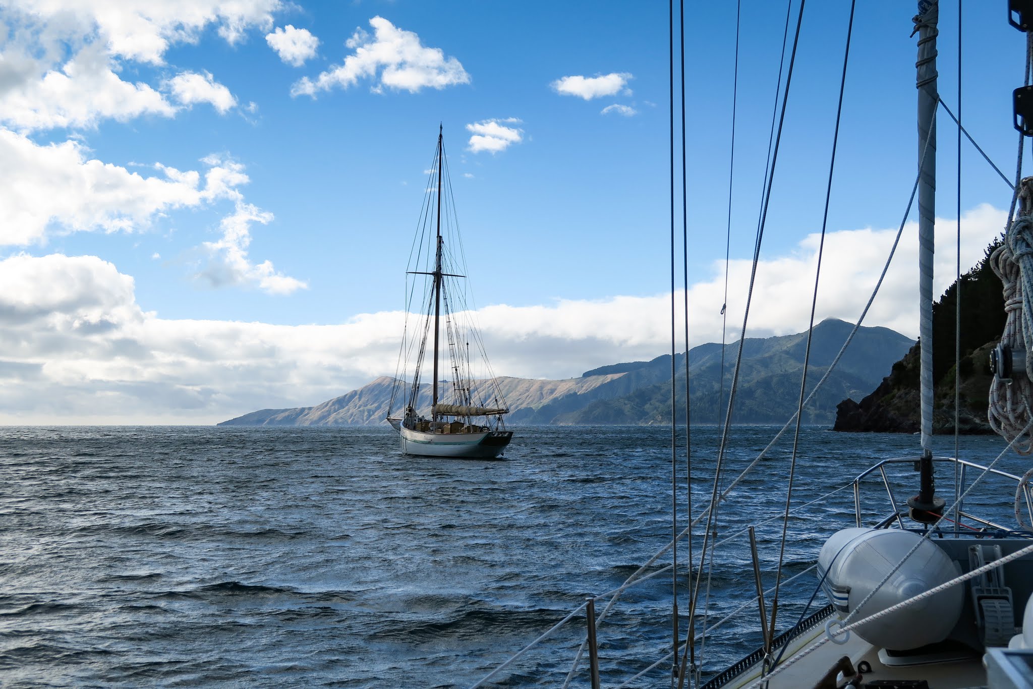
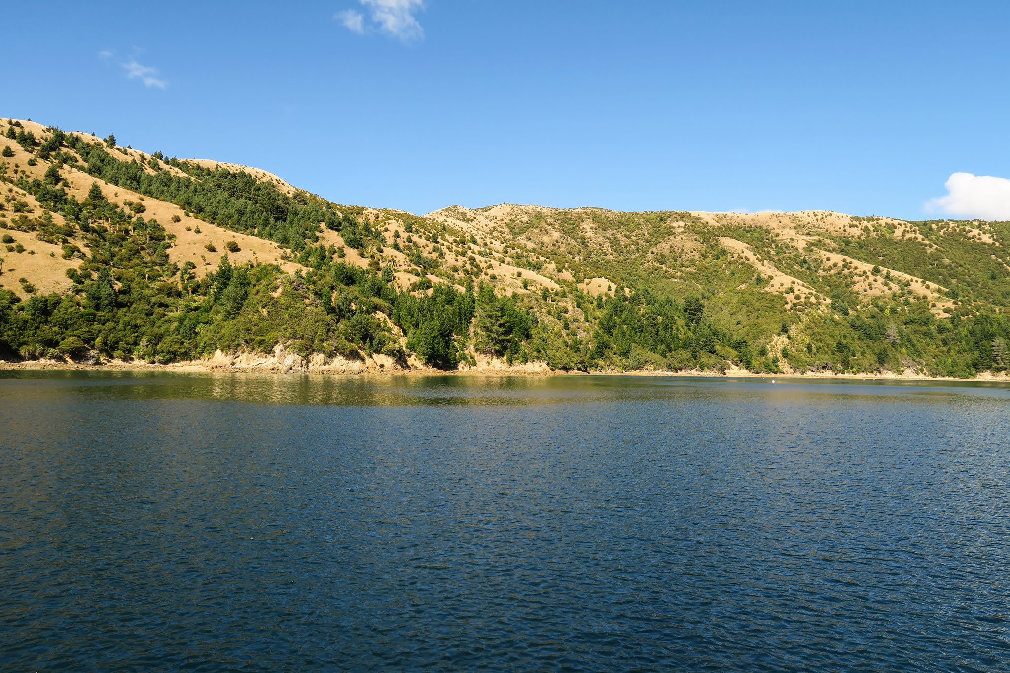
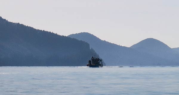
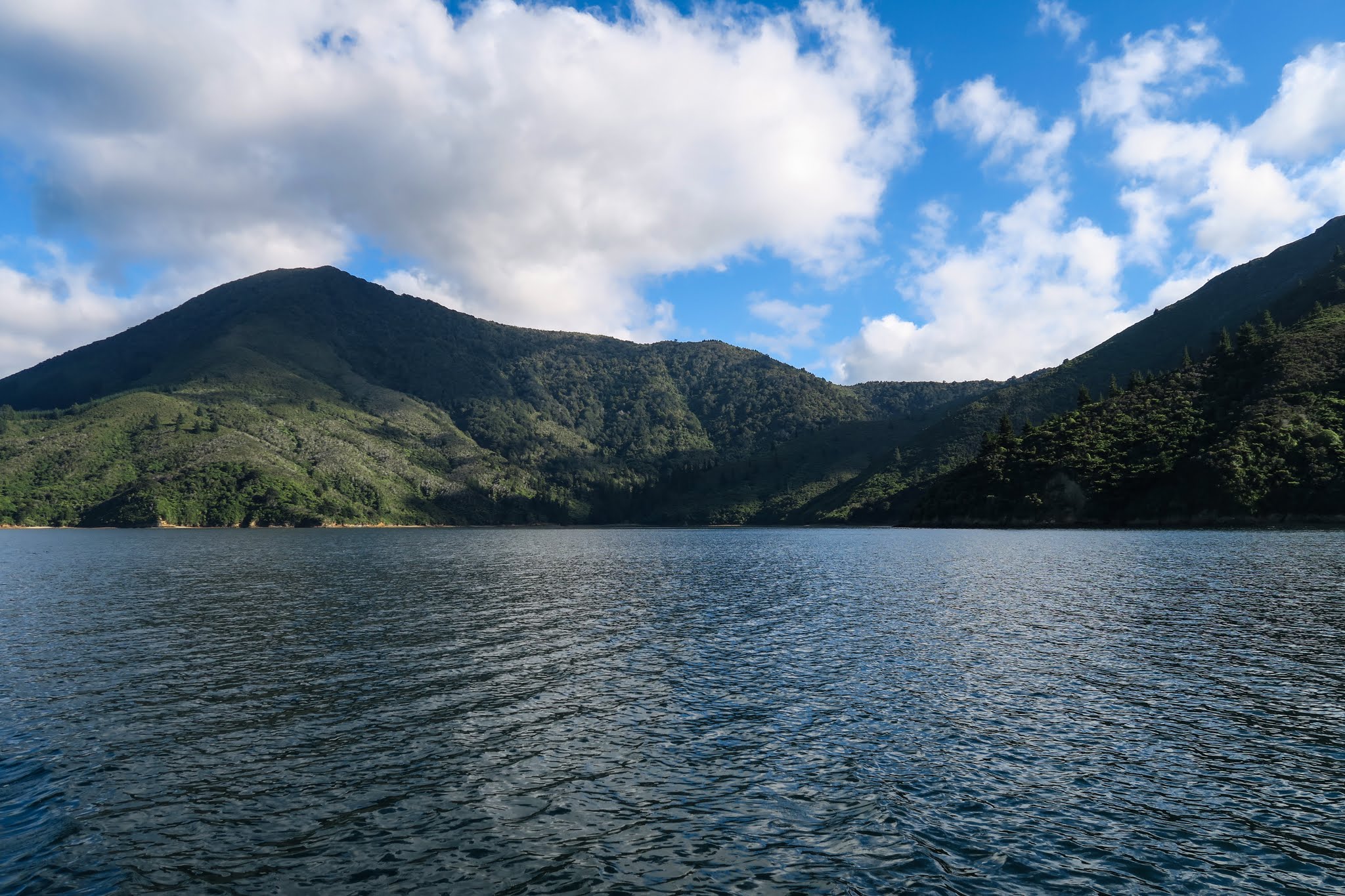
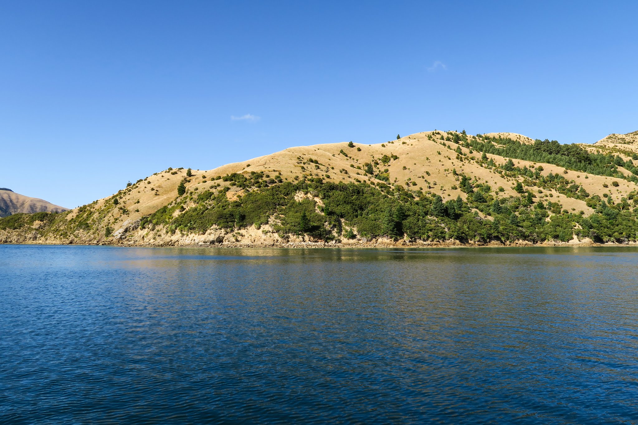
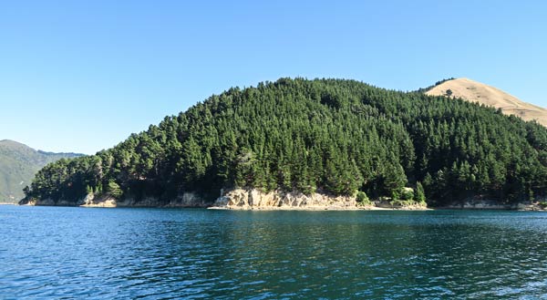
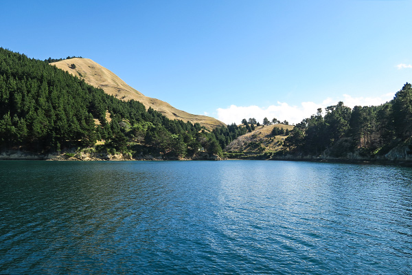
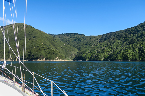
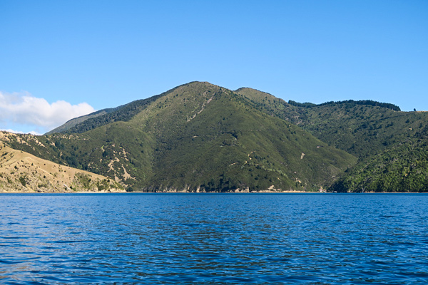
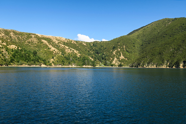
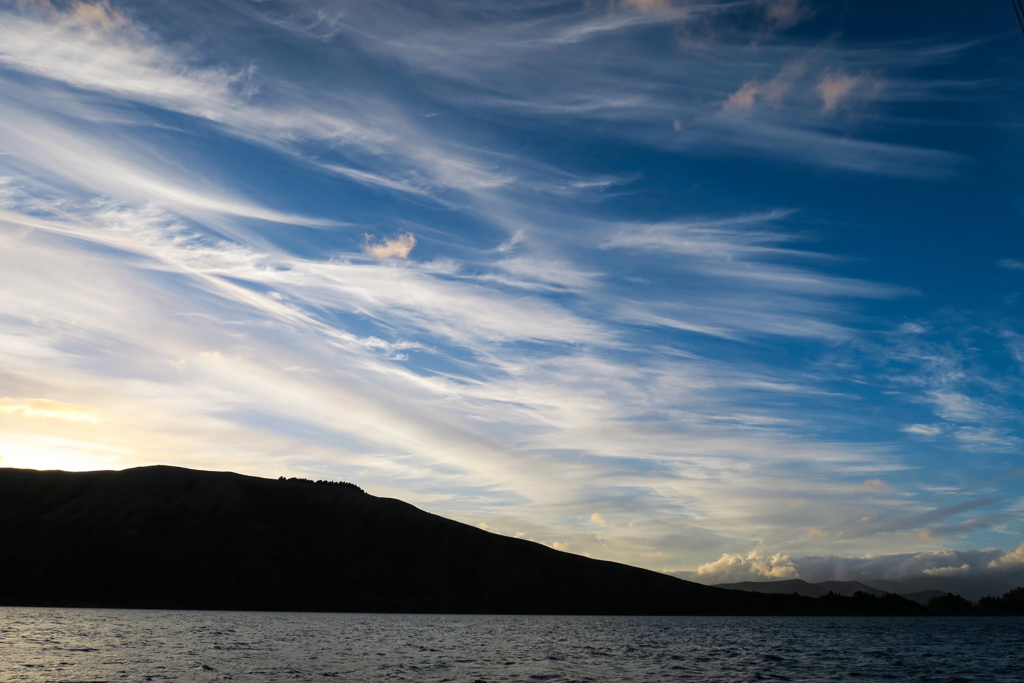
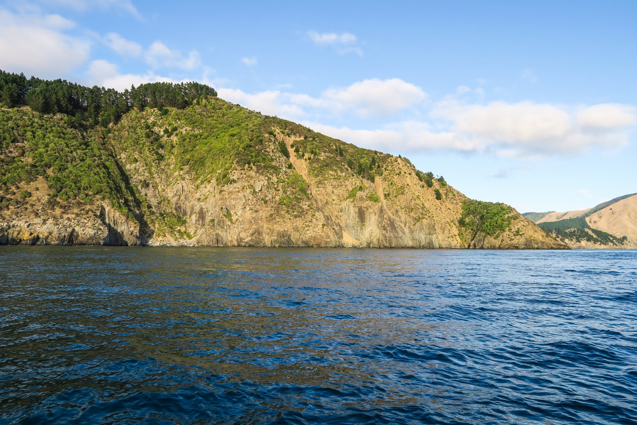
When we pulled anchor early in the morning, the sky was filled with mare’s tails (cloud formations that look like horses tails) which, when combined with mackerel skies, foretell wind coming. We didn’t see any mackerel skies, but maybe the horse tails were trying to tell us something (maybe they were raised, foretelling horse doo-doo?). The winds were calm when we motored down Port Ligar, then rounded the west headland marking the entry to (and exit from) the Pelorus Sound. Our trip along the outer mountains and cliffs was uneventful, but when we turned southwest to head towards the pass, the seas got very mixed and the wind started to pick up.  (Below a gallery of photos from our ride to the French Pass.  Click to enlarge/scroll through either of galleries below.)

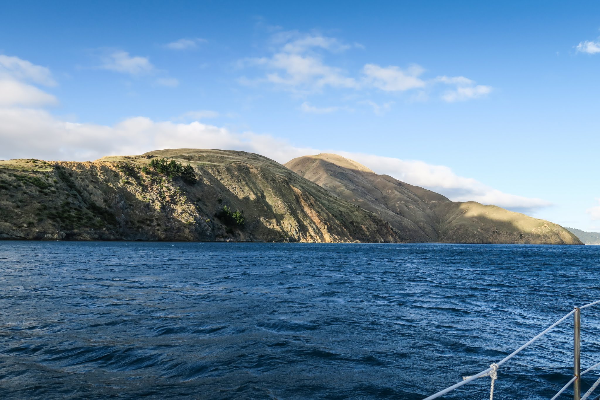
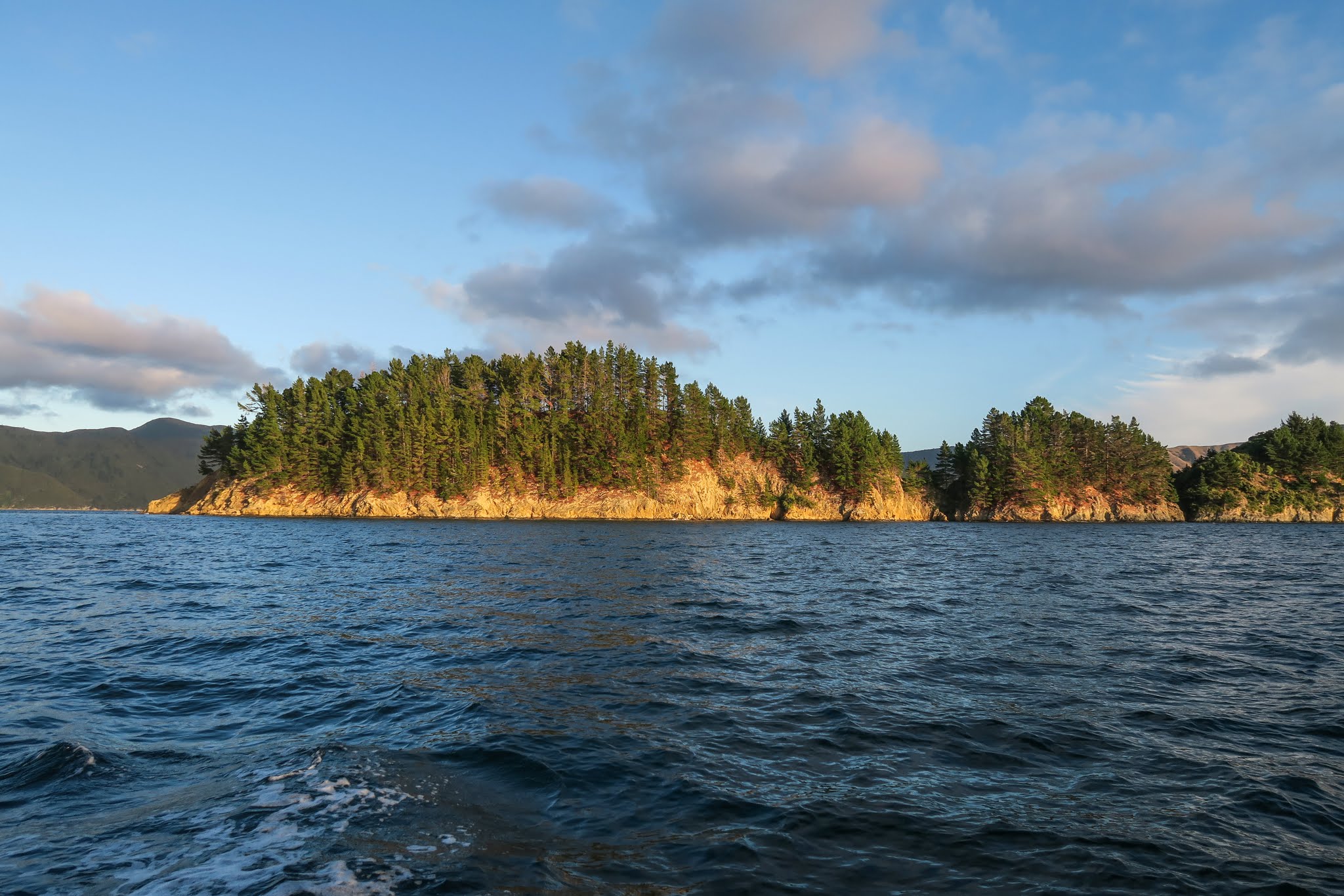
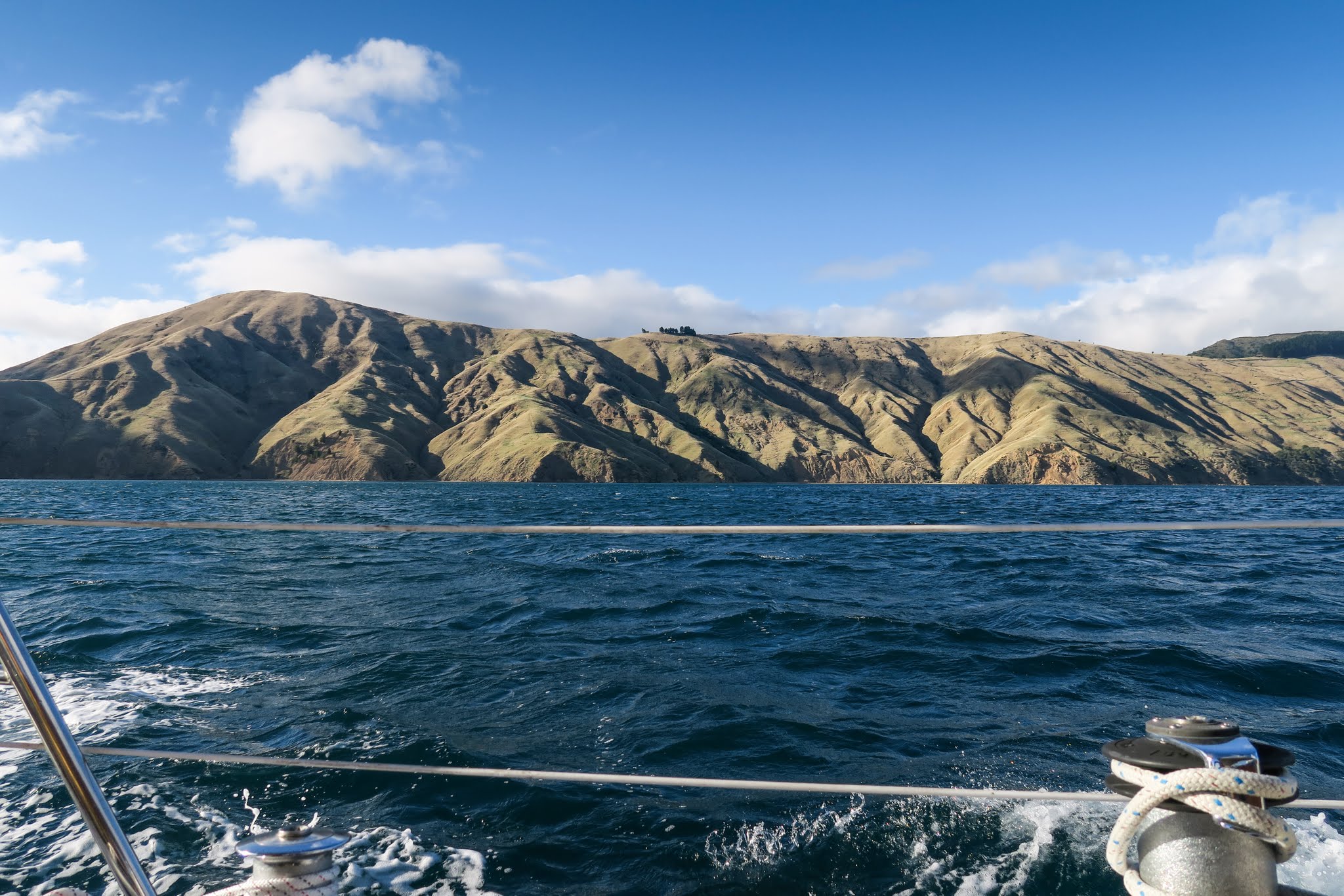
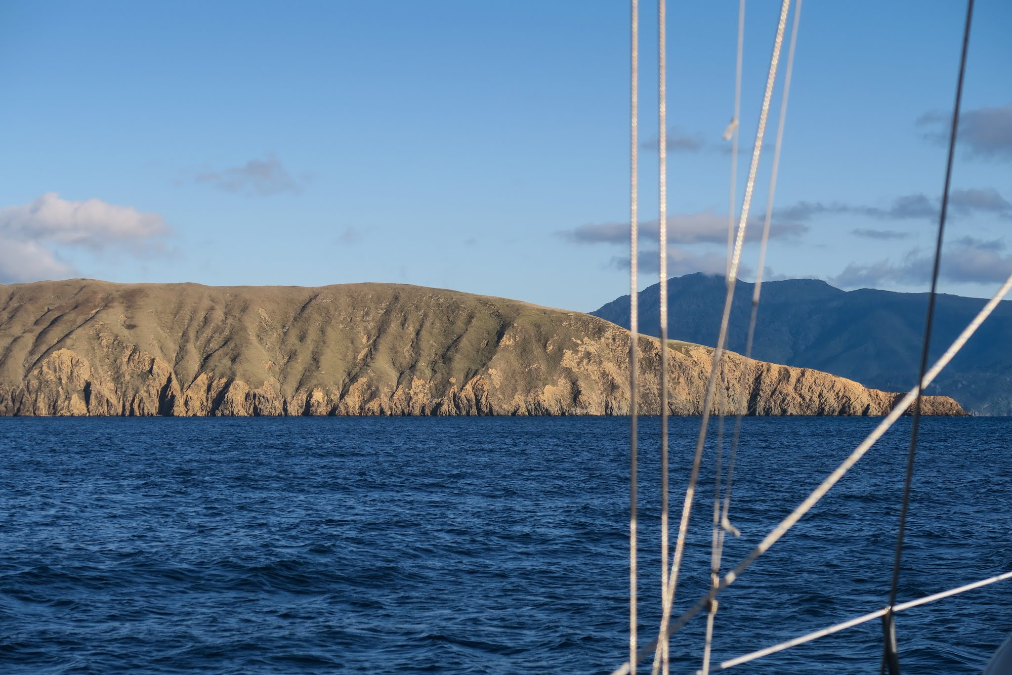
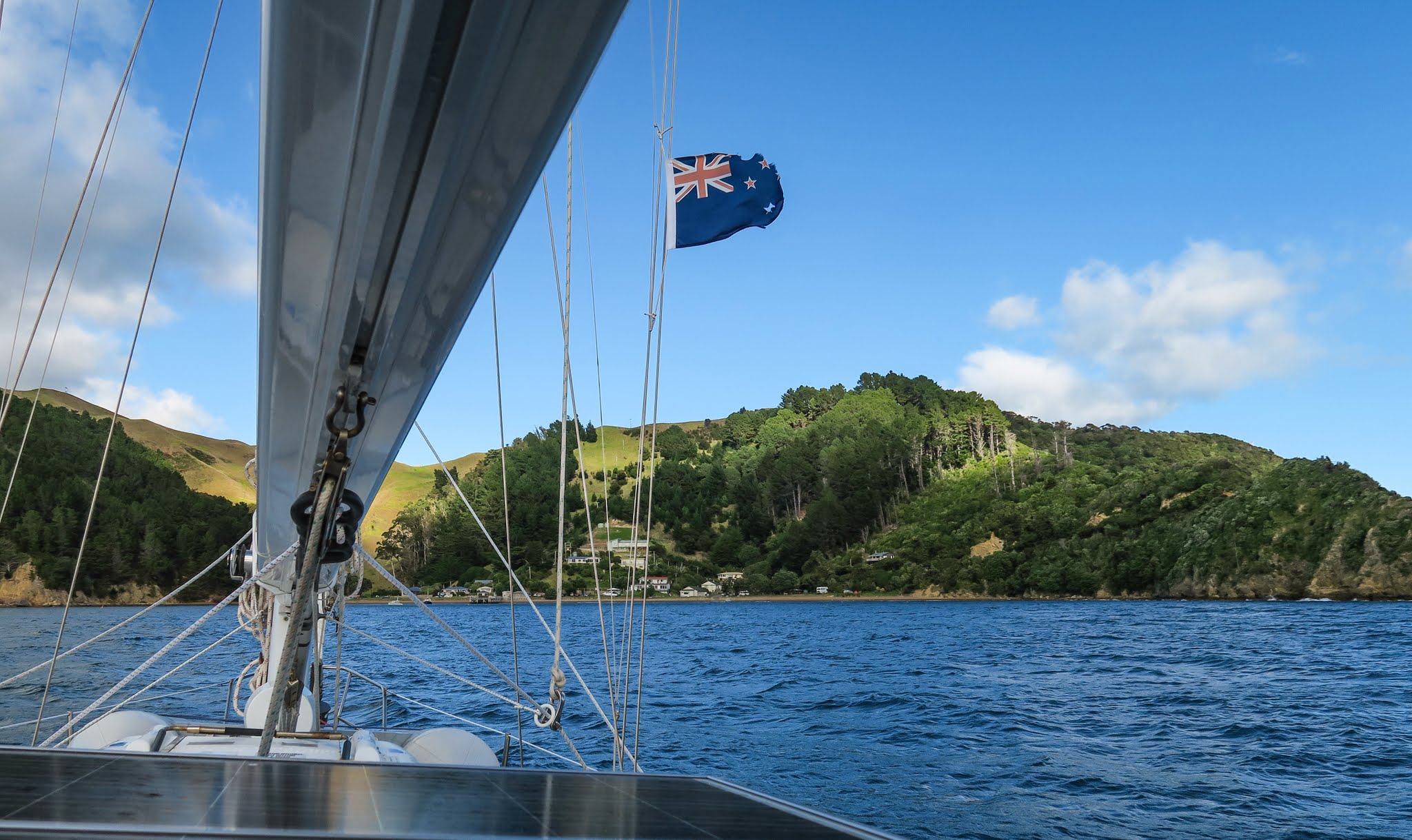
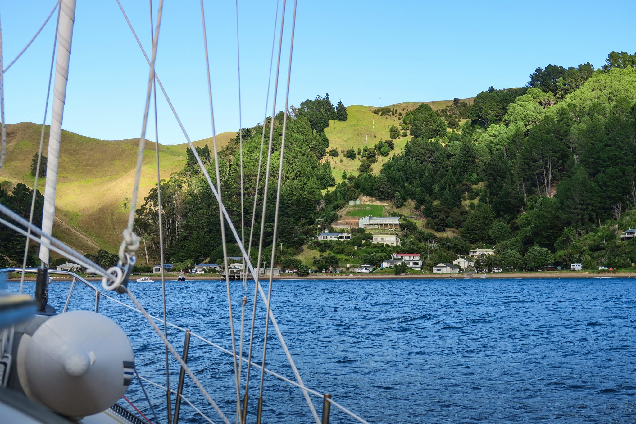
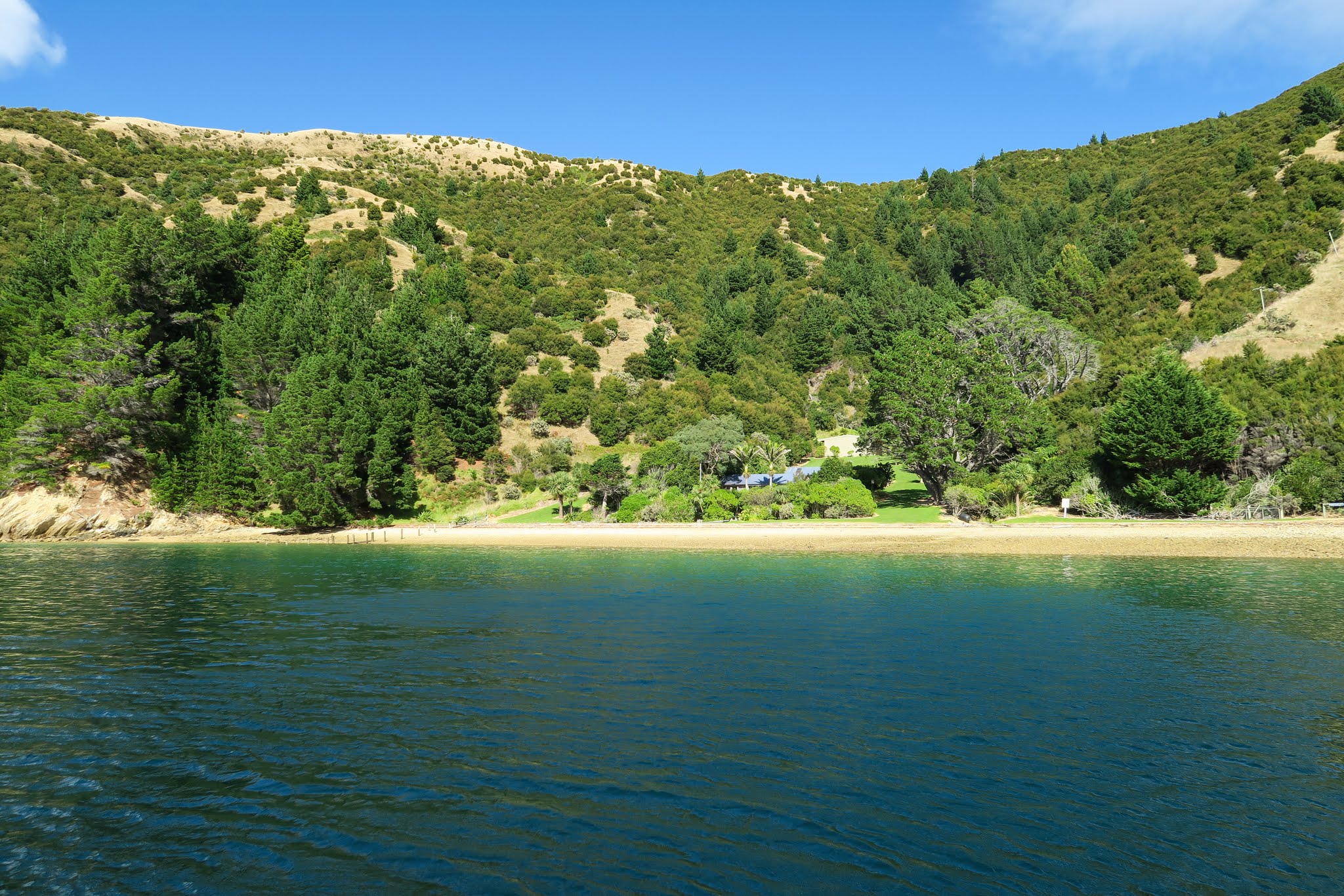
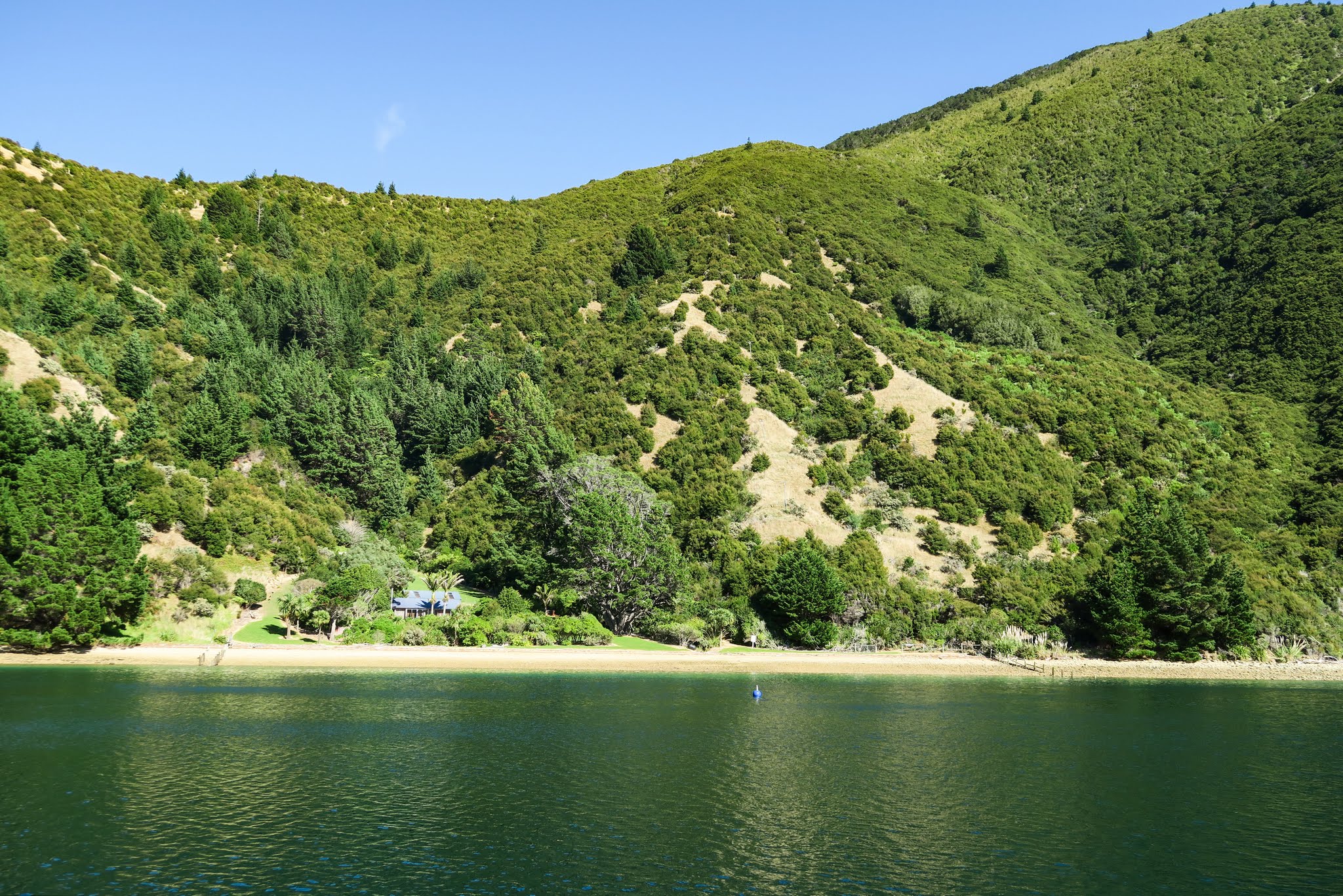
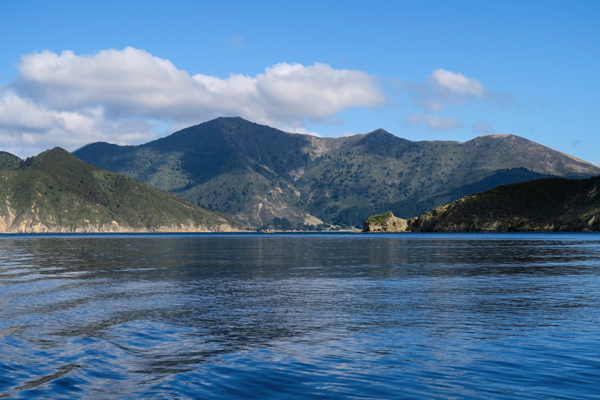
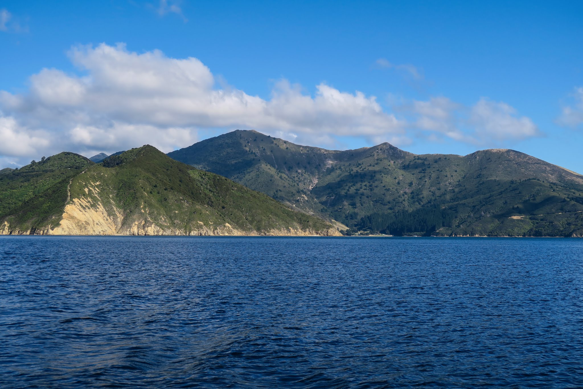
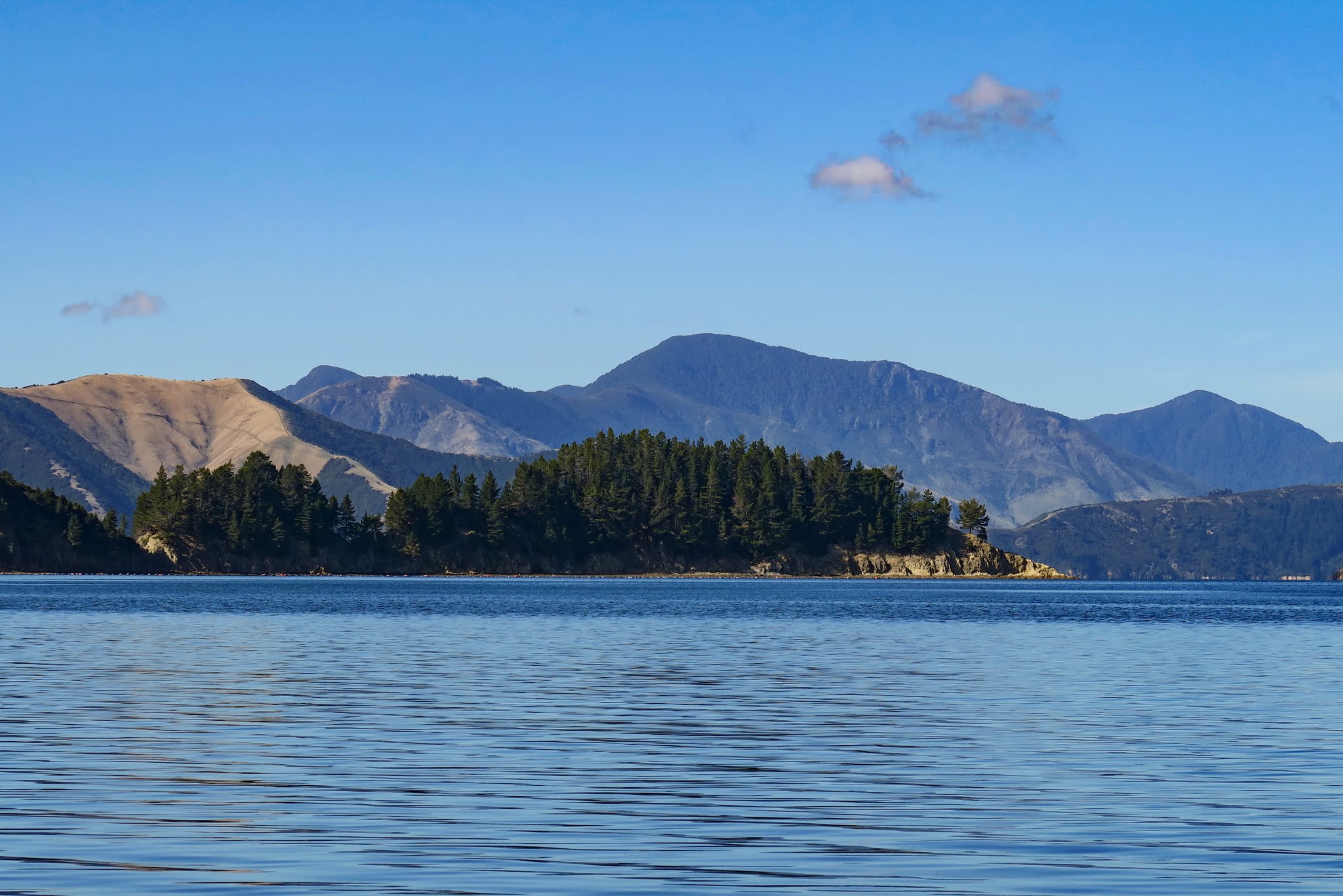
Soon, we were getting winds 20 to 25 knots with boisterous seas. Not life threatening, but not pleasant. Meanwhile, the current seemed changeable, alternating being with us and against us. We ended up arriving near the pass about 30 minutes too early, and rather than motoring around in 25-knot winds, we took some refuge in Elmslie Bay, right next to the pass.

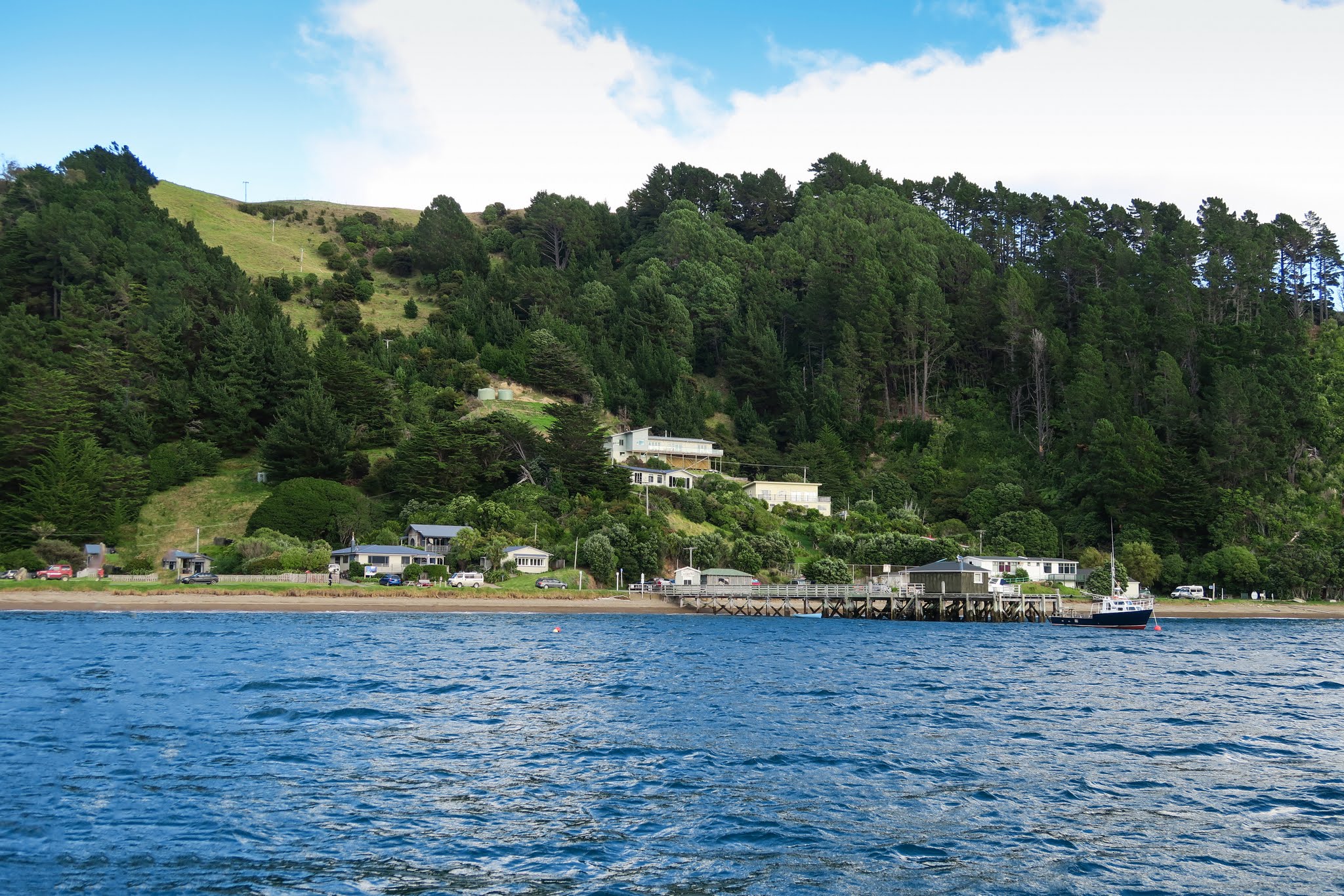
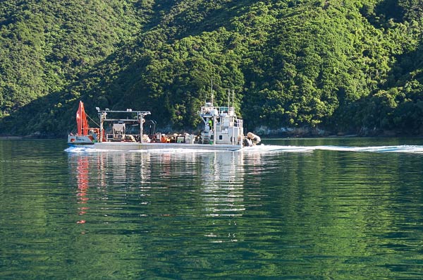
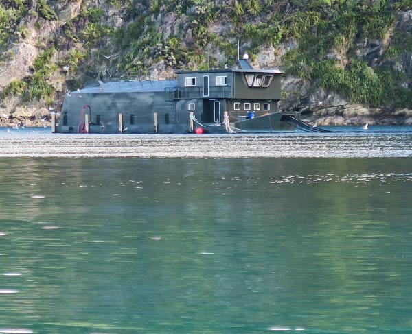
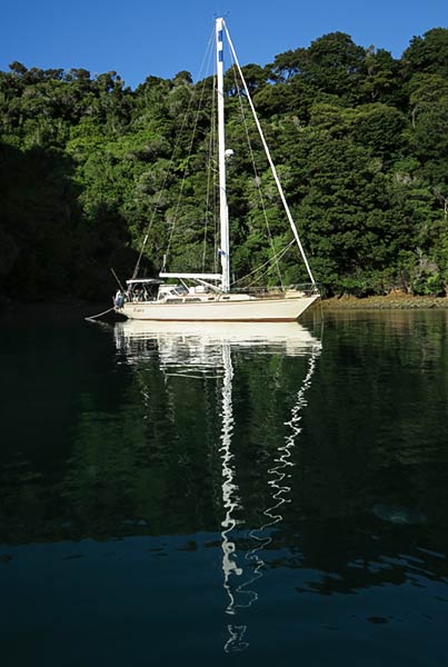
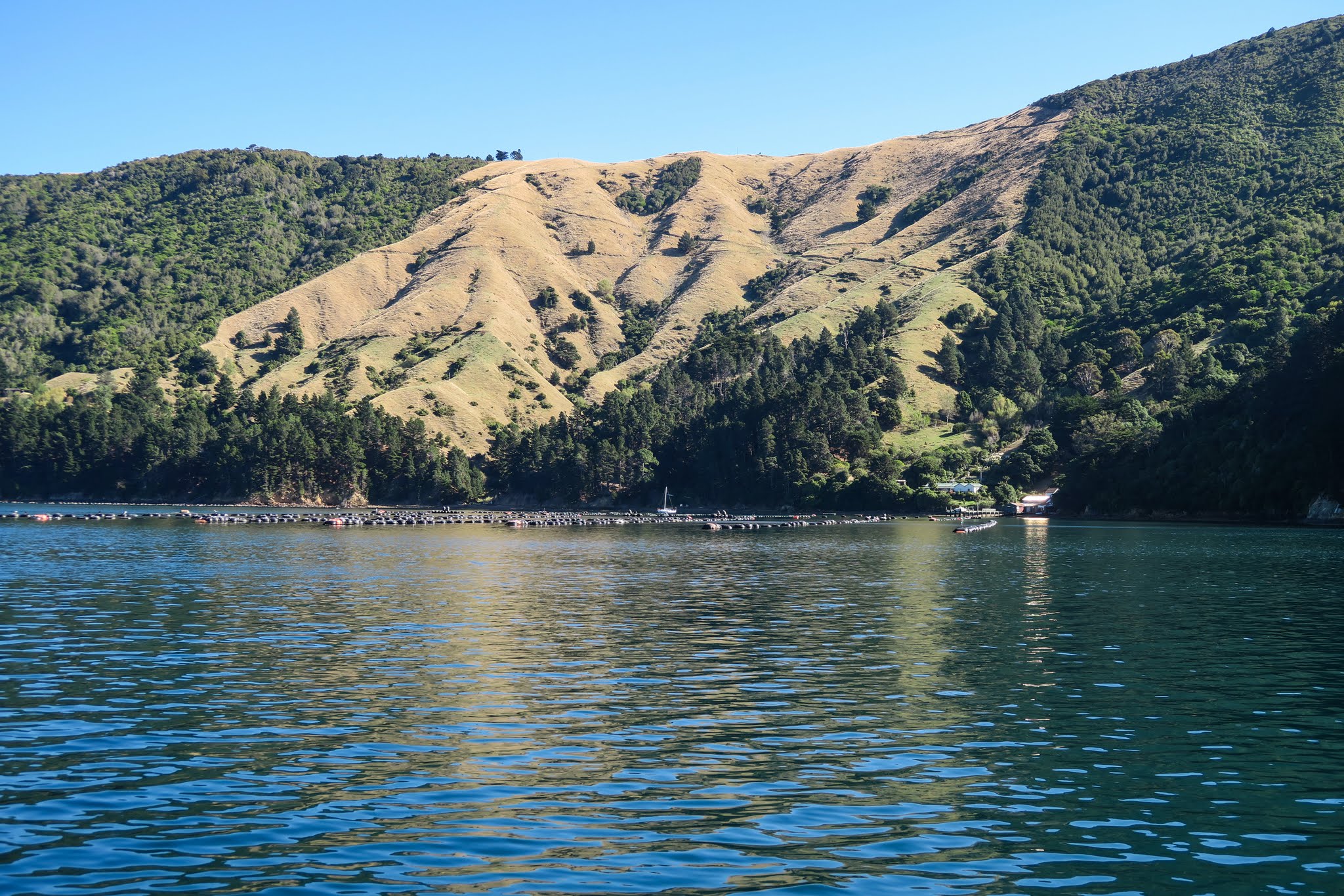
This attractive bay with hillside homes and fishing boats would probably be a wonderful stop in calm conditions. But there was nothing wonderful about it today: the winds were wrapping around the headland and whipping right into the anchorage at a solid 20 knots. It wasn’t much of a refuge, but it was better than motoring around in circles in washtub seas. Nothing to do now but wait. –Cyndi  (Below, a gallery of Elmslie Bay.)

(It was difficult to anchor in Elmslie. The area that’s shallow enough is taken up with moorings. The rest, too deep. We borrowed someone’s mooring. As we were only going to be about 30 minutes, we didn’t feel too bad about doing this. An overnight stay might be difficult. -Rich)

Holing Up in Homestead Bay (Port Ligar, Pelorus Sound, New Zealand)

April 16 – 18, 2016

For 48 hours, we sat out the winds in Homestead Bay. We’d picked a good spot and were fairly well protected. Aside from our surroundings being more representative of Baja than New Zealand, they were pretty nice. We were surrounded by dry, grassy hills. At the head of the bay was a lovely home off a long, light pebbly beach.

There was absolutely nothing wrong with this place, yet as soon as we dropped our anchor I felt somewhat melancholy. It felt like being stuck between two worlds, one behind us, the other waiting ahead. It didn’t help that it was windy and we were stuck on the boat. We’d hoped to take the dinghy over to greener and prettier Waterfall Bay, check out the lodge and do a hike, but the wind was strong enough we didn’t feel comfortable leaving the boat.

In all, this place would be fine for an afternoon and overnight, but two days here felt like a long time. When the winds let up, we were very happy to go. I would love to have visited Waterfall Bay, but not enough to make it worth staying in this area any longer.

Below, a gallery of Homestead Bay (click to enlarge/scroll). –Cyndi

What the Heck???

April 17, 2016

In cruising this great big mussel farm called Marlborough Sounds, we found our selves saying that a lot. “What the heck is that?” and “Which way is it going!?” Here’s one…

what-the

When we got closer (it was coming our way, despite my earlier opinion to the contrary), we could see that it was just another strange craft used in the production of delectable mussels.

mussel-boat

And how about this one? I think it’s part of a salmon farm but that’s only a guess.

salmon-farm

I thought we’d seen it all living in Los Angeles Harbor, but no. There are some strange boats out here. -Rich

3/4 Times per Year

April 17, 2016

Yep, less than once per year. That’s how many times we’ve used a stern line on this cruise. The first one was at Hiva Oa where there were too many boats crowded in too small a space. Next it was Bay of Islands in Fiji where there was a bommie that limited our swinging room. And yesterday, at Tawhitinui, it was a deep bay with a steep slope near the shore. Here…

Legacy anchored at Tawhitinui Island, Marlborough Sounds, New Zealand.

Cyndi has asked me why anyone would want to put out a stern line. Her question was prompted by the guide book she’s using. It seems the author believes that you need to put out a stern line (most often, tied to a tree) in almost all the bays in the Marlborough Sounds. This is the first time we’d felt the need.

I guess in answer to Cyndi’s question, it’s used to limit the boat’s swing to avoid obstacles, such as the shore, rocks, bommies, or other boats. I am guessing that the author is mostly concerned about other boats. That’s not been a problem for us as we are cruising this area after most locals have left the water and gone back to “real life.” We also try to pick bays without other boats.

I am not entirely sold on using a stern line or anchor in most cases. I worry about the way it increases the strain on the anchor should the wind come from the beam. According to my possibly erroneous math, just 500 lbs. of wind force on the beam would produce about 1,250 lbs. of strain on the anchor, and the same on the stern line. (that’s assuming 20′ deflection and 100′ of anchor chain.)

Sorry to ramble on. This post was mostly an excuse to use the above picture of Legacy in yet another idealic bay! -Rich

Tawhitinui Island to Port Ligar (Pelorus Sound, New Zealand)

April 16, 2016

Still enveloped by the floral smell from the island, we untied from the tree branch and brought up anchor, reluctantly leaving this special place. The next round of winds was coming, and we hoped to make it to our next anchorage before it arrived. Sadly, our time in the sounds was coming to an end. Our final anchorage would be in the deep bay called Port Ligar near the entrance to Pelorus Sound. This is where we planned to sit out the wind for a couple of nights before heading on. (Below an interactive map of our route: you can zoom in and out and click on the markers to see what’s what.)


Heading up Pelorus Sound, the mountains went from green to beige as the vegetation became increasingly dry. We saw some strange watercraft  (see previous post), plus dolphins and fur seas feeding near a salmon farm. (Below, a gallery of photos heading up Pelorus Sound. Click to enlarge/scroll).

Two hours later, we were turning into Port Ligar. With its high, dry mountains, patches of farmed pine trees, and mussel farms filling its entry bays, this area felt so much different from the nature reserves in the sounds. It had its own beauty, but to me it felt remote, kind of isolated. While were technically still in the sounds, it felt like we’d said good-bye to them as we neared the entrance to Pelorus Sound. This felt like being in limbo, no longer in the sounds, yet not yet anywhere else. We were just passing time in this strange, dry place until we could really leave. Below, a gallery of photos from heading into Port Liger.

We had three possible anchorages in Port Ligar. While we were pretty sure where we’d end up, we went to check out the other two. The first was Te Kopi Bay. It had a pine farm on a white sandstone shore, more strange-looking than beautiful. It also had a mussel farm, but one of our nice neighbors in Picton offered that we could use the private mooring there as it belonged to a friend of his. We found the mooring and considered his kind offer, but our guidebook warned that this bay gets gusty in strong northwest winds. Remembering what happened the last time we ignored this warning: being blasted with wind gusts all night, we decided to head to another bay.

The white sandstone shoreline and pine farm near at Te Kopi Bay. (Port Ligar, Pelorus Sound, New Zealand)
Te Kopi Bay was a nice looking place, but we worried about winds gusting right over the hill and onto us. (Port Ligar, Pelorus Sound, New Zealand)

Our next possibility was Waterfall Bay, highly recommended by someone else we met. I was intrigued by the rustic lodge there and the appealing-sounding hike in the area. But the only viable anchorage was a small indent in the shoreline near the entrance to this bay, and two boats were already there. We also worried about winds funneling down the steep hillsides along the anchorage. With that, we went with the only real choice we had: Homestead Bay.

Looking down into Waterfall Bay in Port Ligar. The only anchorage is where the two sailboats are. (Waterfall Bay, Pelorus Sound, New Zealand)
This photo shows Waterfall Bay on the (viewer's) far right, and Homestead Bay on the left.
This photo shows Waterfall Bay on the (viewer’s) far right, and Homestead Bay on the left.

Homestead was a wide bay surrounded by dry grassy hills, protected by a large headland dividing it from Waterfall Bay. It had Combined Club moorings, but with the coming winds we feared the arrival of club members wanting to use them. Instead, we found a nice spot not far from beach, tucked in behind the headland. We dropped our anchor, and just as we were finishing up the wind started picking up. Perfect timing! –Cyndi

Heading into Homestead Bay. (Port Ligar, Pelorus Sound, New Zealand)