
April 10, 2020
Today, I spoke with a sailor about the upcoming strong winds. He surprised me by talking about forecast to be southerly. I sure didn’t see that. “How can I have it so wrong?” I thought. This happens over and over and seldom is the case that I’m the one who’s gotten it wrong (I don’t mean to brag here). I think I know why this happens.
Below is a big overview of the ECMWF weather model for New Zealand’s South Island this coming Wednesday night.
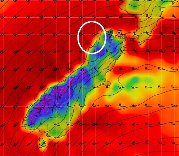
If you just look at the overall image, especially in the area I’ve circled in white, you might think that the wind will be southerly, or at least southwest. If you make decisions about where to anchor based on that, or which direction to sail, or when to sail, you’ll probably get it wrong.
Looking closer at the area we’re in at the same time and using the same weather model gives a very different picture. See below.
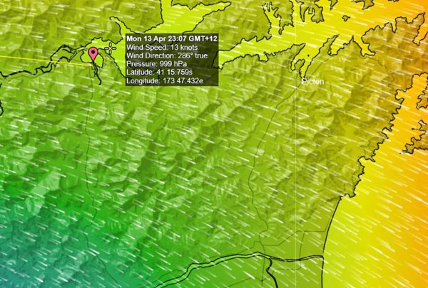
Here we can see that the actual forecast wind for this specific location is west-northwest which would require a totally different anchorage. Also, the “big view” gives the impression of very strong wind – 30 knots or higher. The closeup view shows that in our area, the forecast winds are just 13 knots.
We can use tools to view even higher resolution data. PredictWind, the weather service we use to provide weather model data, offers spot forecasts or “destination forecasts” that use their highest resolution data. Below is an example of that.
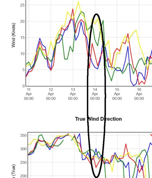
This tabular data shows that the wind at the exact spot we’re interested in will be be between 5 and 20 knots and from the west to west-northwest. It also allows us to compare the output of four different weather models. (For the most part, we look at the yellow and blue lines, or the ECMWF and PWG models respectively.)
I probably alienated a friend a couple of years ago by chastising not looking closely at weather data. I told him that hundreds of meteorologists, scientists, and mathematicians have spent their entire careers to make this data as accurate as possible and when we don’t look at it carefully, it’s a slap in their over-educated faces!
This, in part, may be why we find the Metservice in New Zealand so unreliable. They give very general forecasts for large areas, not the specifics we need. I guess I can’t expect Metservice to provide a specific forecast for the each bay we might want to anchor in.
Looking at the big picture may give you the wrong information, but it can tell you important things. For example, in this part of the world, with a southerly anywhere in the vicinity, the wind will be coming up from Antarctica it it will be cold!
The moral of the story: Look Closely!


