September 19, 2013 in Bay of Islands, Vanua Balavu, Fiji
On our first cruise to Hawaii 15 years ago, we started out with our refrigerator set very cold and running as a freezer. We loaded up with frozen foods. About half way there, we couldn’t keep up with the energy demands and turned the temperature up to refrigerator land. We ate like crazy to use up all the frozen food and we’ve been running it as a refrigerator ever since.
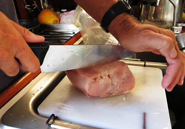
On or first outings in Fiji, we only bought enough chicken and steak to last as long as it would keep without being frozen. We ran out quickly. On our trip to Fulaga, we decided to try a compromise. I turned the temperature down so that stuff in the bottom might stay frozen. It’s working great! We are using 50% more electricity this way but we can keep up. We bought a bunch of frozen meat and it’s staying frozen! Not only that…
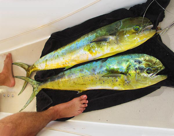
The Mornings Catch
We caught a couple of mahi mahi on the way to Vanua Balavu – normally too much for us to eat by it’s expiration date – and it froze!
Frozen Fish!
We’re slicing the frozen blocks into “steaks” and it’s been wonderful. We’ve been eating mahi meals sometimes twice a day. Fish and eggs for breakfast, wasabi mayonnaise fish, fish herdez, grilled fish, fish pancakes 😉 and more. Also, it’s always seemed to us that the way to guarantee that we catch fish is to have chicken and steak on board that we need to eat. It worked again. -Rich
September 19, 2013 in the Bay if Islands, Vanua Balavu, Fiji
Sorry, no pictures again. We went from a very slow internet connection near the village – about 15 bytes per minute, to what we have now which is zero bytes per ever so I’m posting this via satellite phone (read $$$).
We’ve been busy since our arrival at Vanua Balavu. First, sevusevu in the village of Dalconi. (Sevusevu is the ritual presentation of visitors to the local village’s chief and the presentation of kava – a dried pepper tree root – to the chief by the visitor. From then on, you’re considered part of the village.)
Yesterday was “shopping” in Lomolomo – a 15 minute bus ride, well really a truck with bench seats in back, from Malaka where we were anchored. We found eggs and onions and a few other items we needed. We were also able to buy fresh bread!
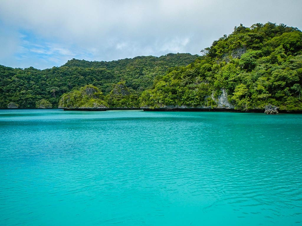
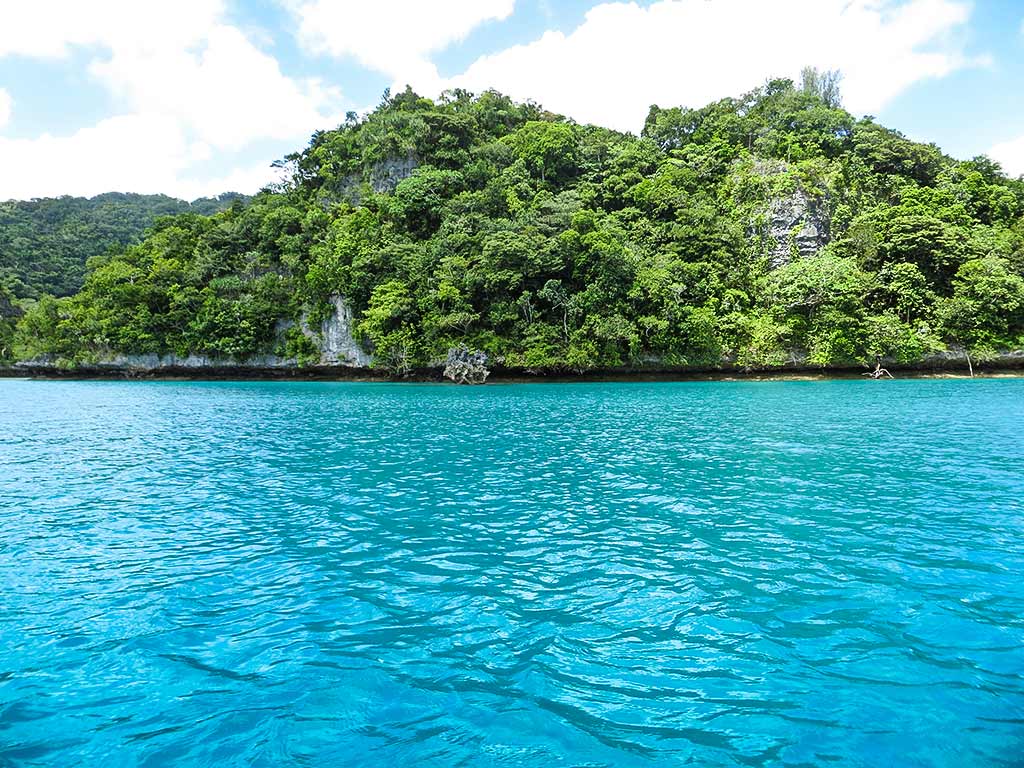
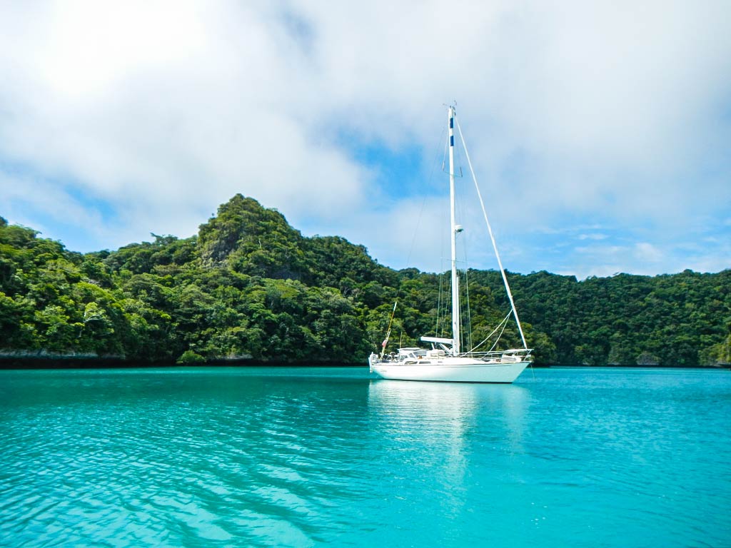
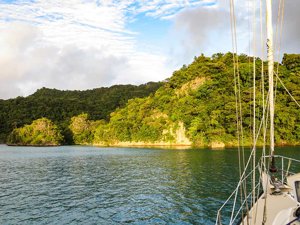
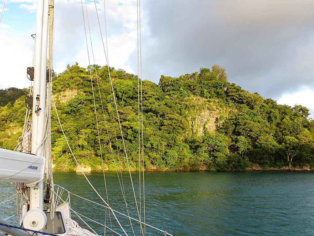
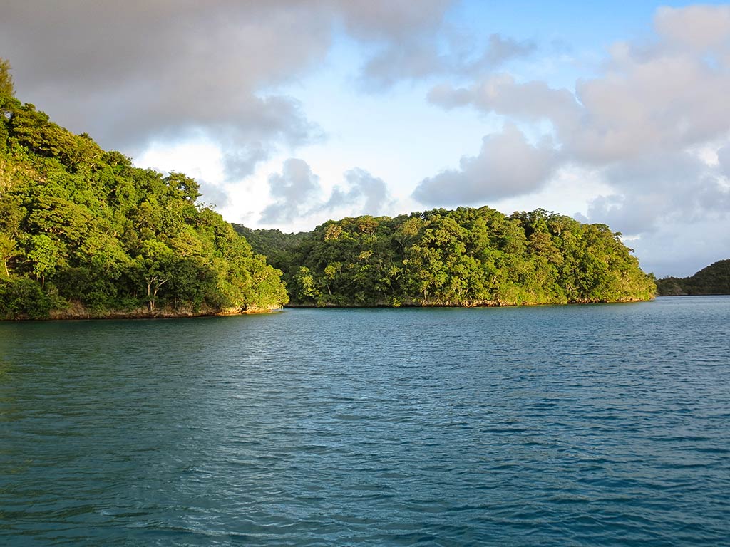
Then we moved here. The Bay of Islands. Wow, it’s pretty here. This has to be one of the prettiest anchorages of our whole trip. We’re in a very small bay and we are surrounded by little islands that are covered with vegetation that goes right down to the water. We have the entire Bay of Islands to ourselves. The water is clear and warm and as soon as our anchor was set, we jumped in for a swim. (Did I mention that since we are alone here, this is a clothing optional anchorage?)
Rich checked the weather and Houston, we had a problem. We were in for a windy spell, and in spite of how well protected our anchorage seemed, the winds would affect us. The problem was that wind tended to gust through this area while the current just sort of swirled around, leaving Legacy facing in any number of directions. This was not an issue in light winds, but with heavier gusts we’d probably end up all over the anchorage, not something we’d want with all the coral bommies around, nor did we want to end up beam-on to the gusts.
Rich had thought about going to a different spot, but I was already attached to this one and really wanted to stay. The solution: a stern anchor!
It was already gusty enough to make this job difficult–we were using the dinghy to pull the boat’s stern over and would make progress only to have a gust of wind stubbornly knock it back. But we kept at it and made progress in this tug-of-war with nature. Finally we succeeded in setting the stern anchor (and boat) just where we wanted them. We then pulled the boat back towards shore and out of the channel of wind blowing through the middle of anchorage. Suddenly it was calm and smooth, Legacy sitting nicely. We were ready now for whatever nature planned to throw at us over the coming days (uh, within reason).
Later in the afternoon conditions calmed and we decided to head out and do some exploring. Unfortunately we had an unpleasant new ritual whenever we used the dinghy: the struggle to get our electric outboard engine started. It would begin with the worrisome efforts to get it working, followed by relief when Rich finally got it started, then fear that this could well be the last time it would run. Not having a dinghy engine here would be a disaster as we had so much exploring to do, way too much ground to cover for rowing.
Below, an interactive map with a few of the places we’d end up visiting over the coming week, most of them more than once. Unfortunately, the satellite image is blown out for part of the area, so I’ve just marked favorite areas on our side of the channel. We’ll put in a map showing other areas when they become relevant.
I’ve decided to focus coming blog posts on particular places we saw during our time here; so the photo galleries will feature pictures from various days and different cameras. The changing light could have a huge effect on the look and feel of these places; so the same place can look remarkably different depending on when the photo was taken. The names I’ve mentioned aren’t official; I’m pretty much making them up as I go along.
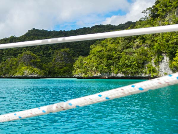
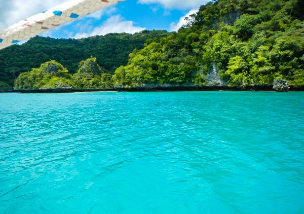
Below, just because this is as good a place as any to put them, are a couple of views out a porthole in our boat. It’s pretty cool to look out and see a scenes like this filling the view space. –Cyndi
September 25, 2013 in Mbvatu Bay, Vanua Balavu, Fiji
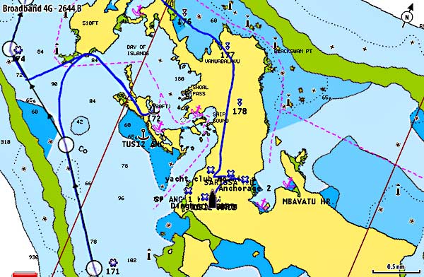
I guess a boat is really one of the original off-road vehicles, though ideally only traveling on the water. According to our Navionics electronic charts, Legacy is doing some land-cruising here in Vanua Balavu. On the picture below, the yellow areas are land. The blue line is the track showing where Legacy’s been. According to this, right now, we’re anchored on a mountain.
Navionics Chart of Vanua Balavu.
Our charts are about ½ mile off here and it’s very distracting as we motor around the island. I guess I can’t whine about it too much… just 10 years ago, it was rare for a small sailboat to have a chartplotter at the helm. In Vanua Balavu, we’re back to doing things like they did in the last millennium!
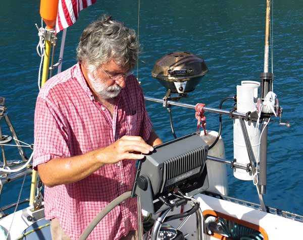
This sorry chart situation is giving me the opportunity to see a bit more. Cyndi always jokes that I should look up once in a while and enjoy the view. Here’s my usual stance behind the wheel.
“What? There’s a beautiful world out there?”
Actually, our charts have been pretty good, or at least OK, for most of Fiji and only off to this extent in Vanua Balavu. Fortunately, we now have another tool – Google Earth images.
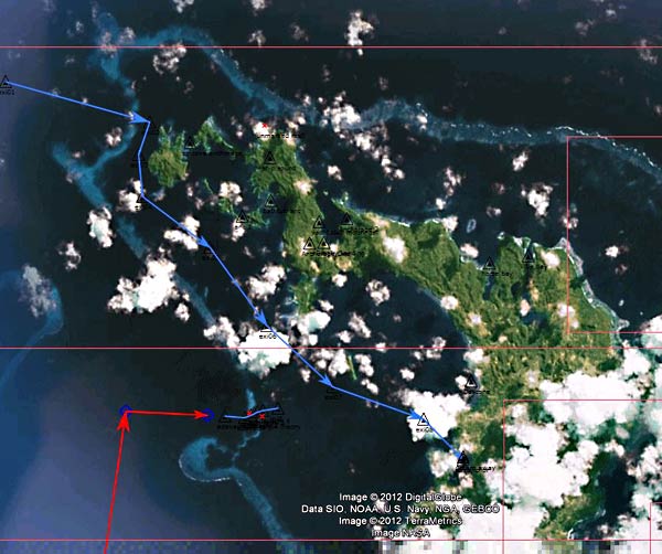
Google Earth image on openCPN navigation program.
There are a couple of ways to download Google Earth images and a couple of navigation programs to display them. The above is displayed in a wonderful, free, open-source navigation program called openCPN. Since it’s on our computer and not at the helm, we use it mostly for planning – as another source of data to check our waypoints and routes. It’s also a great way to check the accuracy of charts. If the charts don’t line up with the satellite picture, something’s wrong. Sometimes it can be a little hard, or impossible, to find images without clouds of your areas of interest, but using the historical data that Google gives us access to in Google Earth, we’ve done pretty well.
Next season, I think we’ll make sure we have a windows tablet computer with a built-in gps and a waterproof case to run openCPN at the helm (it doesn’t run on the iPad). In my opinion, Google Earth images represent a major change in the way we navigate. I think in a few years, it will be very rare for anyone to voyage without consulting the satellite imagery. Viva technology (when it works!). -Rich
Update: February 2016
Just a couple of notes:
The Google satellite images for this area have gotten much better. I used to be hard to find images without clouds. It’s pretty easy now, selecting from among the images in View/Historical Imagery.
I’ve been using a $100 program called ChartAid recently to capture satellite images. For me, it’s easier than GE2KAP.
SAS Planet is also a good alternative. With it, you can cache images to use offline. You can also use GE2KAP to grab those images, make KAP files and use them in OpenCPN.
We didn’t get a Windows tablet. Instead, we’re using OpenCPN on our Android phone (the $10 paid version vs. the free version).
Update, January 2017
Here in Australia, we’re finding serious errors in the depths depicted on both Navionics standard charts as well as on their SonarCharts. More here.
Just after we arrived in the Bay of Islands and got our anchor set, I was thinking about how great it would be to do something we never do: jump in and swim right away. You would think we’d do this all the time, but the reality is there’s always stuff that needs to get done first: a meal prepared, the dinghy launched, or a multitude of other small things. Plus when there’s a lot to explore, we generally start with a dinghy ride followed sometime later by a snorkeling trip–the see-and-do stuff. Swimming is a pure indulgence and tends to fall last on our list.
Thus it was a surprise as I was looking at the water to hear a splash behind me: Rich had just stripped down and jumped in! I proceeded to do the same, choosing for once in my life not to worry about sunscreen. What a great way to start our time here! Rich swam over to check the anchor and to make sure a worrisome coral bombie would be deep enough under our keel if we floated over it. I indulged in one of my favorite things: making dives off the boat. The sensation of plunging down into the water headfirst and going as deep as gravity takes me, then letting myself float slowly up to the surface, is one of my favorite things in the world.
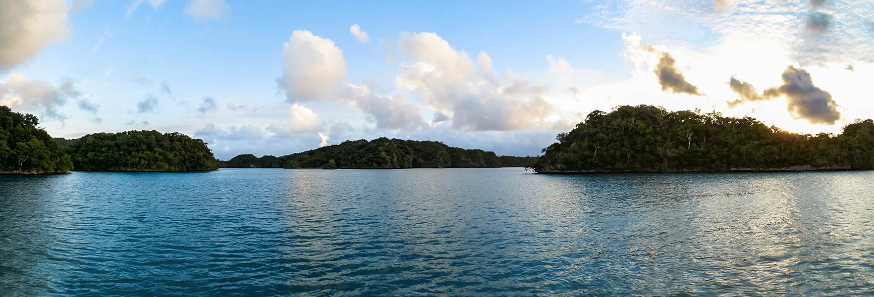
Below, a few dinghy’s eye view of the anchorage (taken on different days–I didn’t have the camera with me during our first swim). Click to enlarge/scroll through any photo galleries below.
By the time we’d finished our post-swim showers followed by a very late lunch, it was sundowner time. The evening sun lit up the islands closest to us before disappearing behind the hills. A few bats flew overhead, and we could hear the woff-woffing of barking pigeons from the land around us.
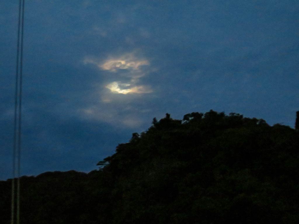
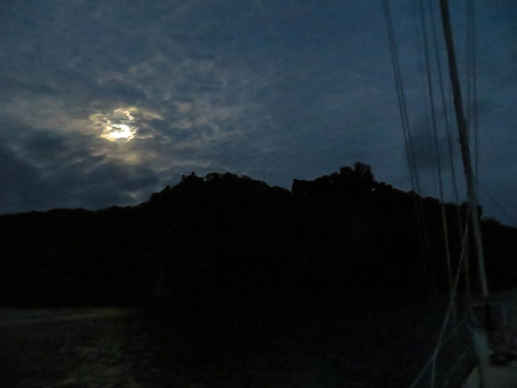
We stayed out as the evening deepened, watching the moon rise behind filmy clouds, making a wonderful purple-blue dusk. Beautiful!