Ngawhakawhiti Bay (Tennyson Inlet, Pelorus Sound, New Zealand)

April 7, 2012

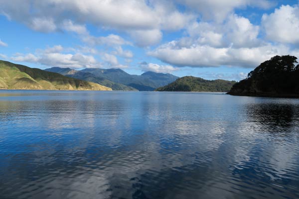
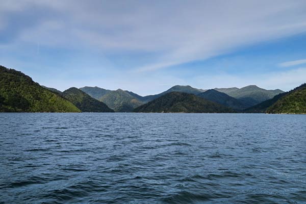
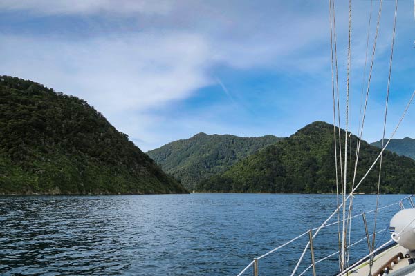
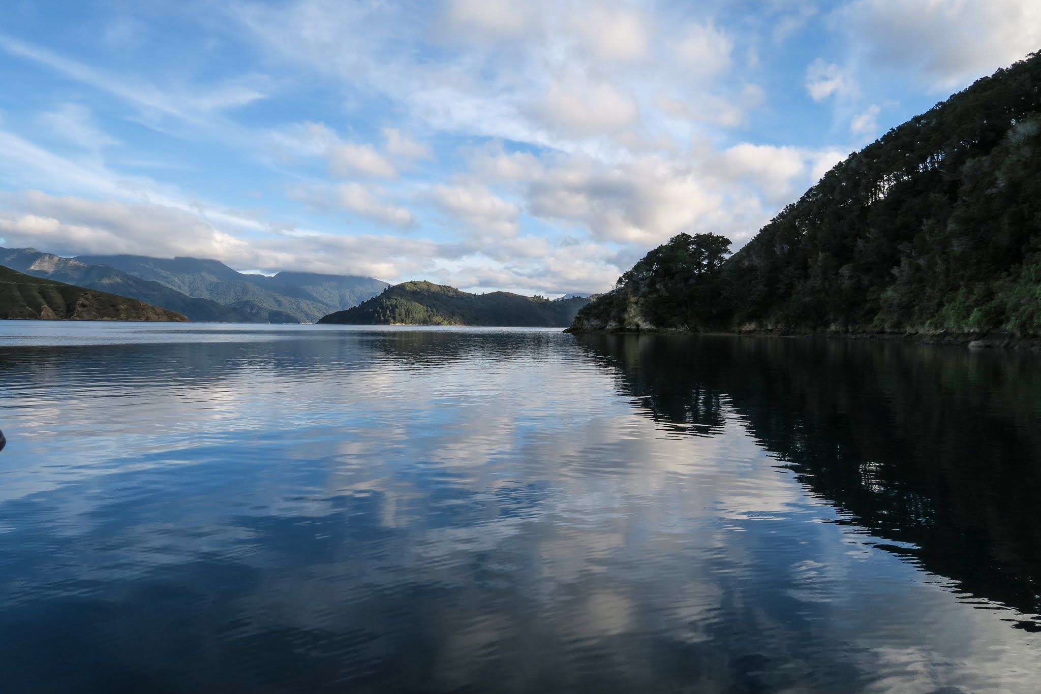
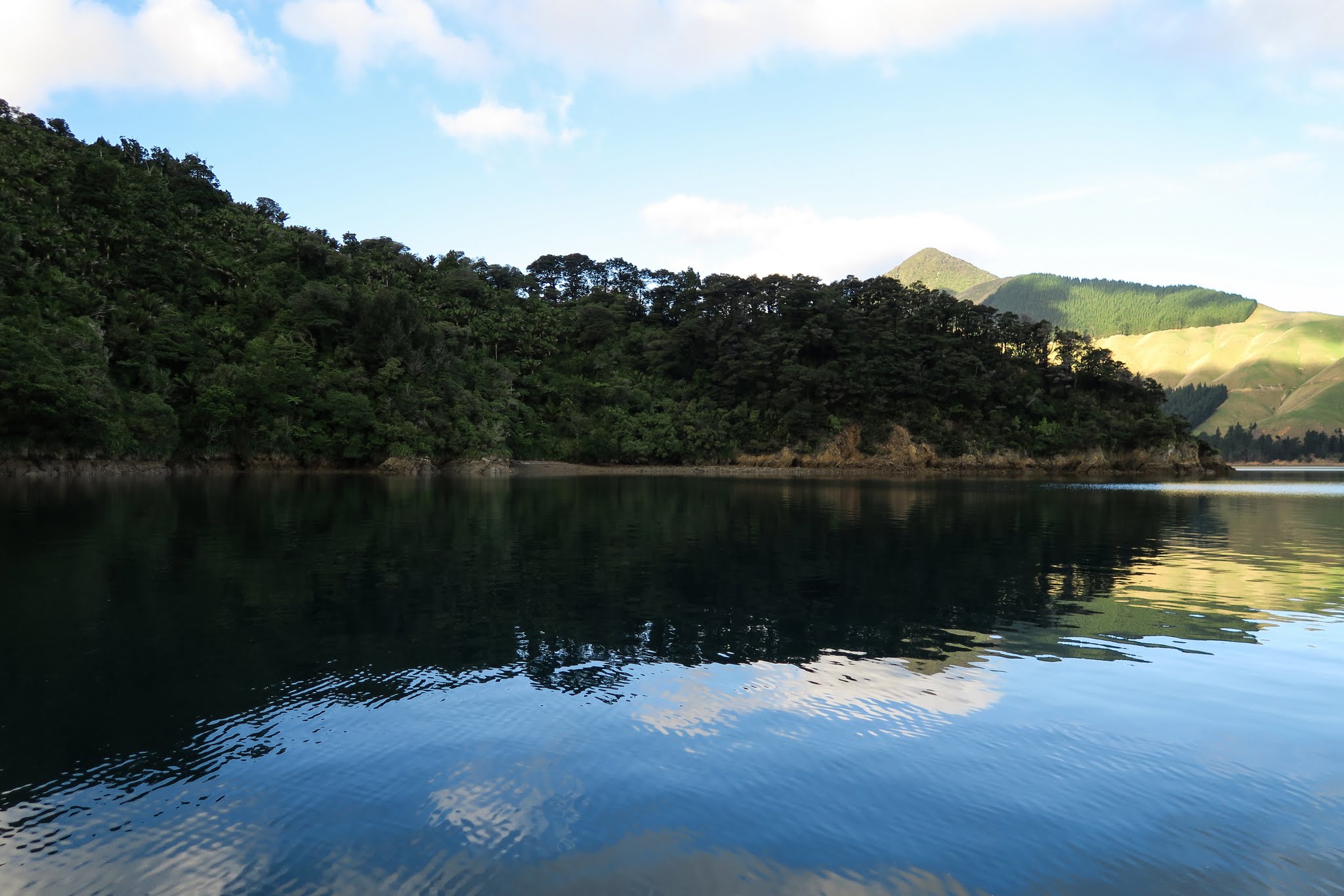
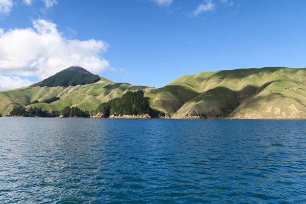
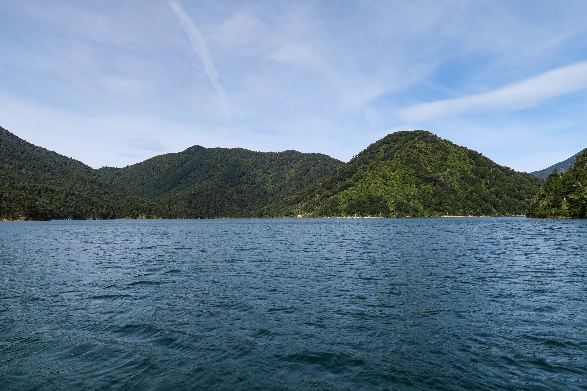
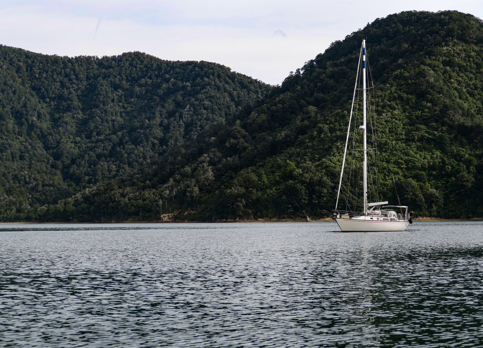
From World’s End, we made a left turn at the cone-shaped mountain, going through a relatively narrow opening into Ngawhakawhiti Bay (though at mile wide it looked less like a bay than a small lake). In fact, this bay had four anchorages to choose from.

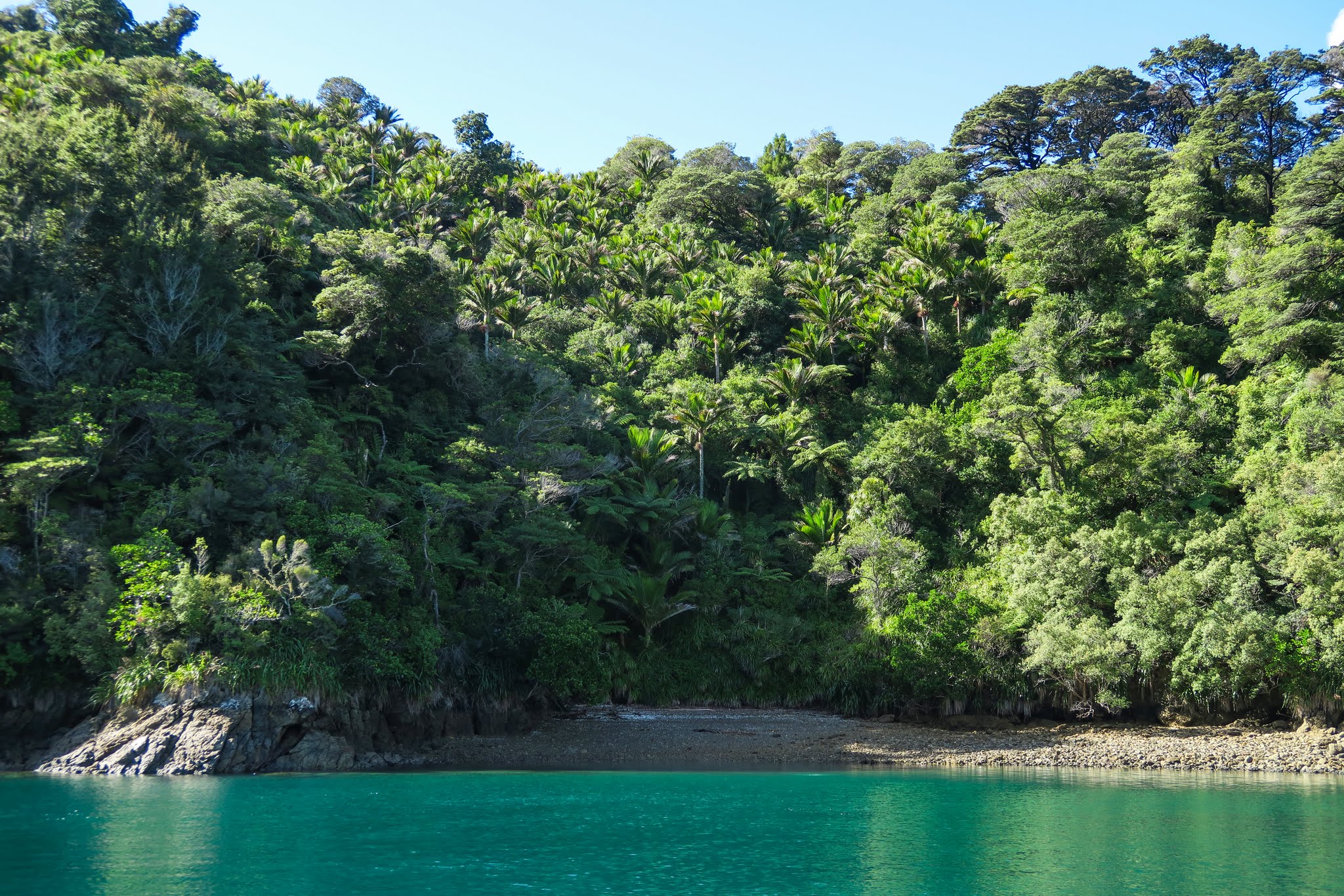
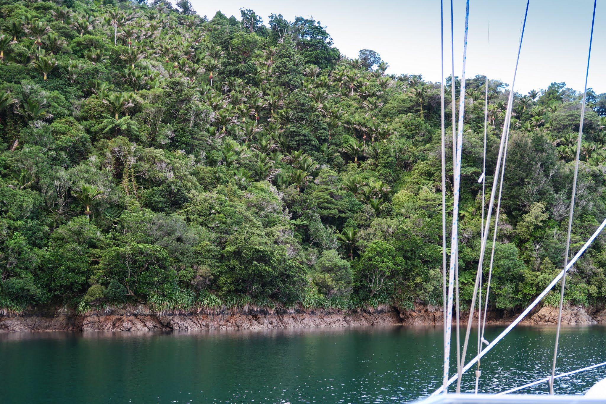
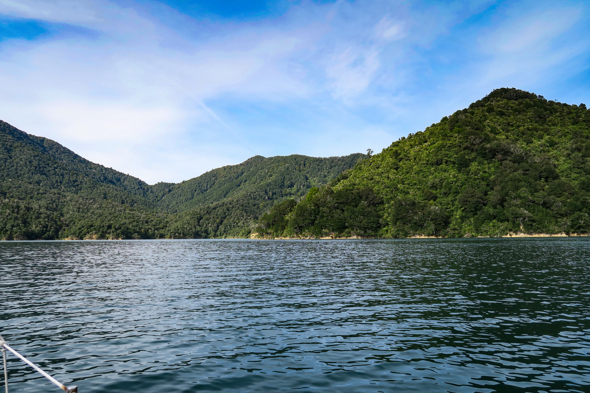
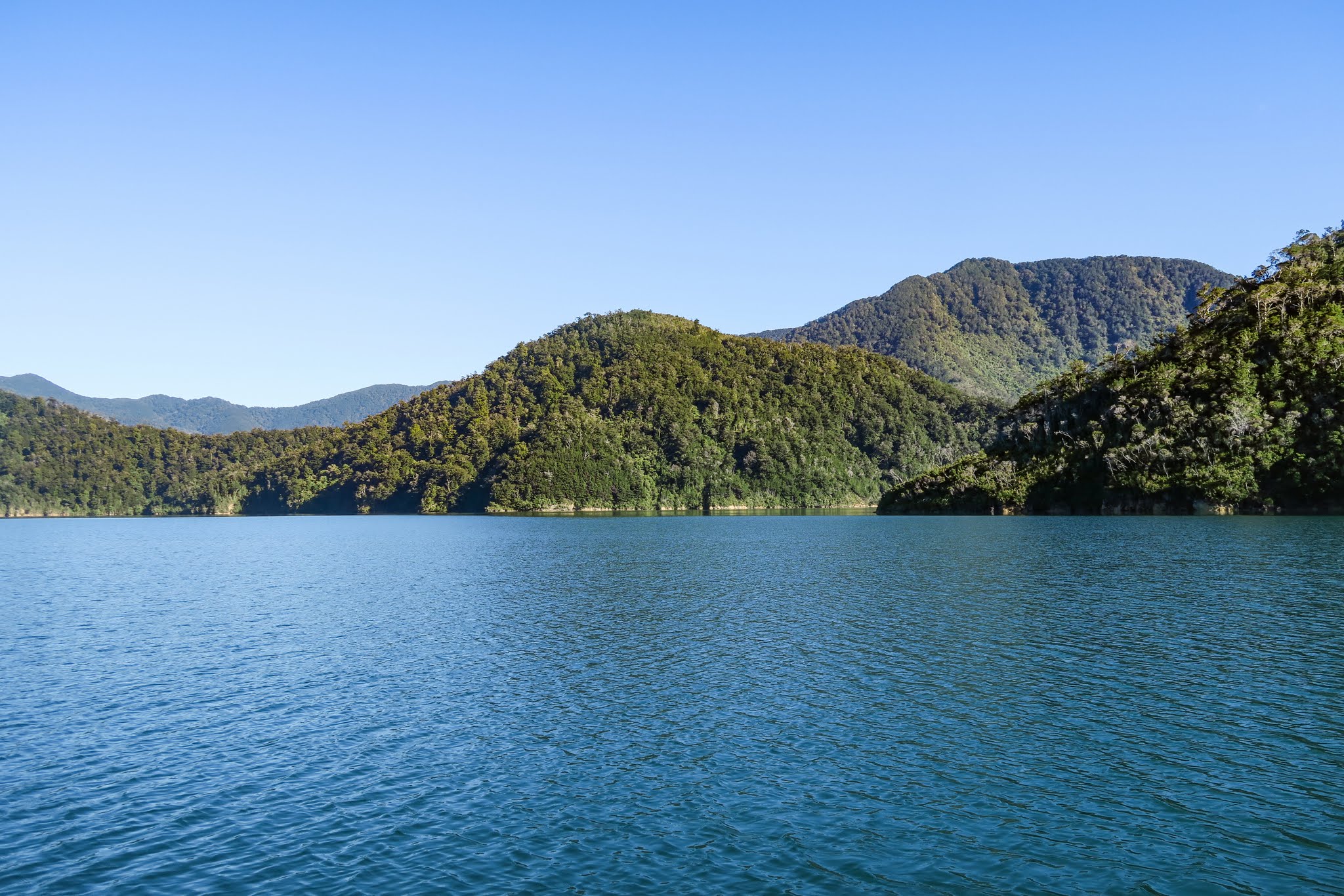
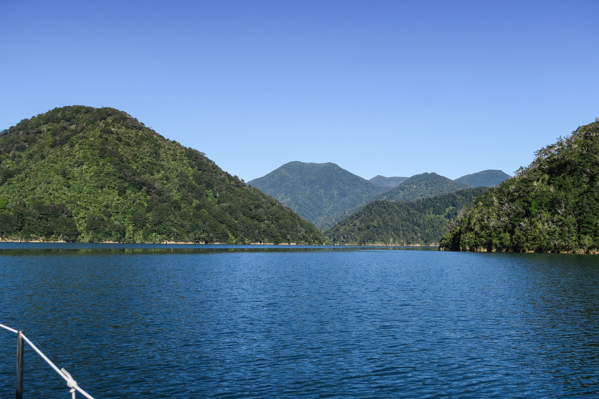
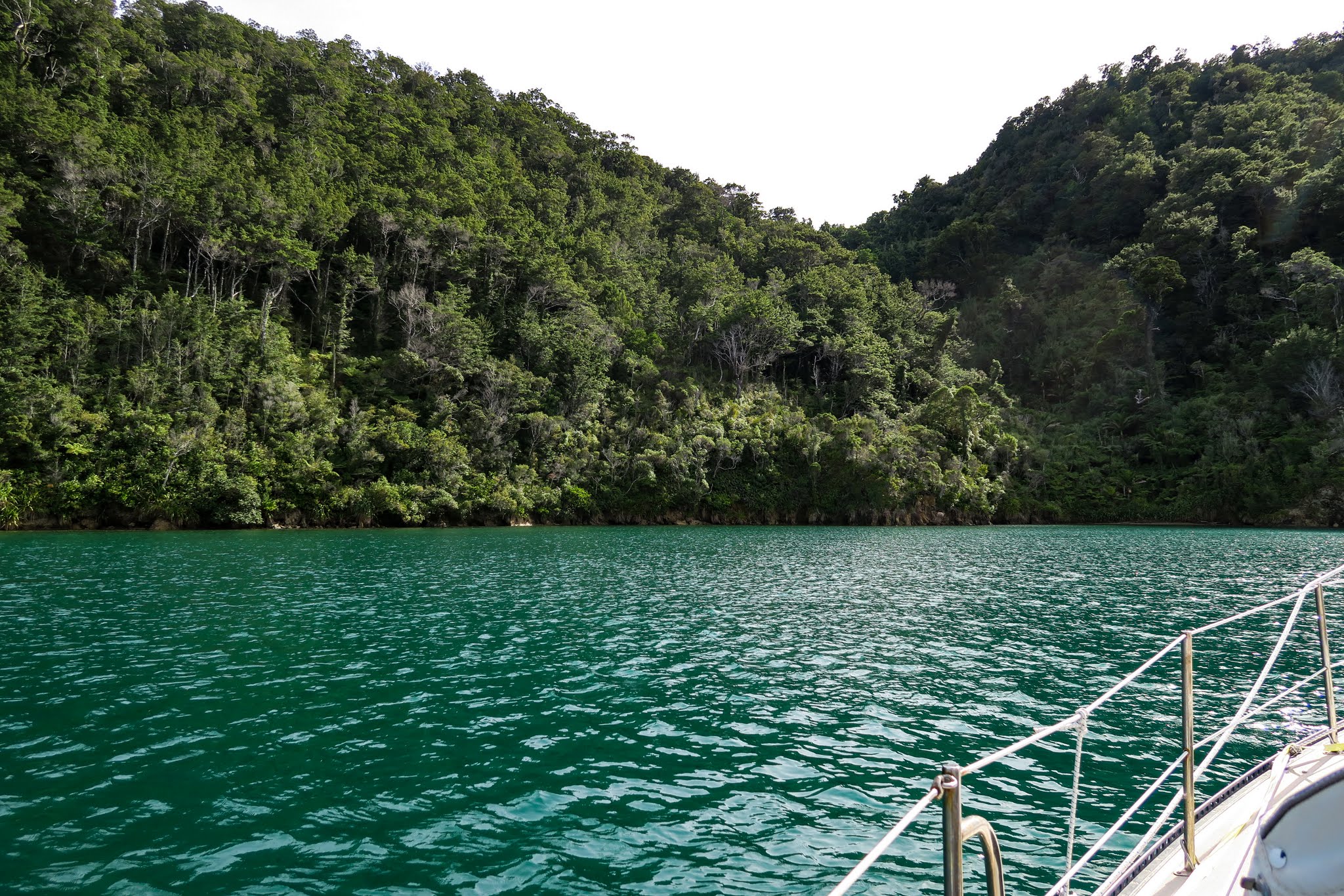
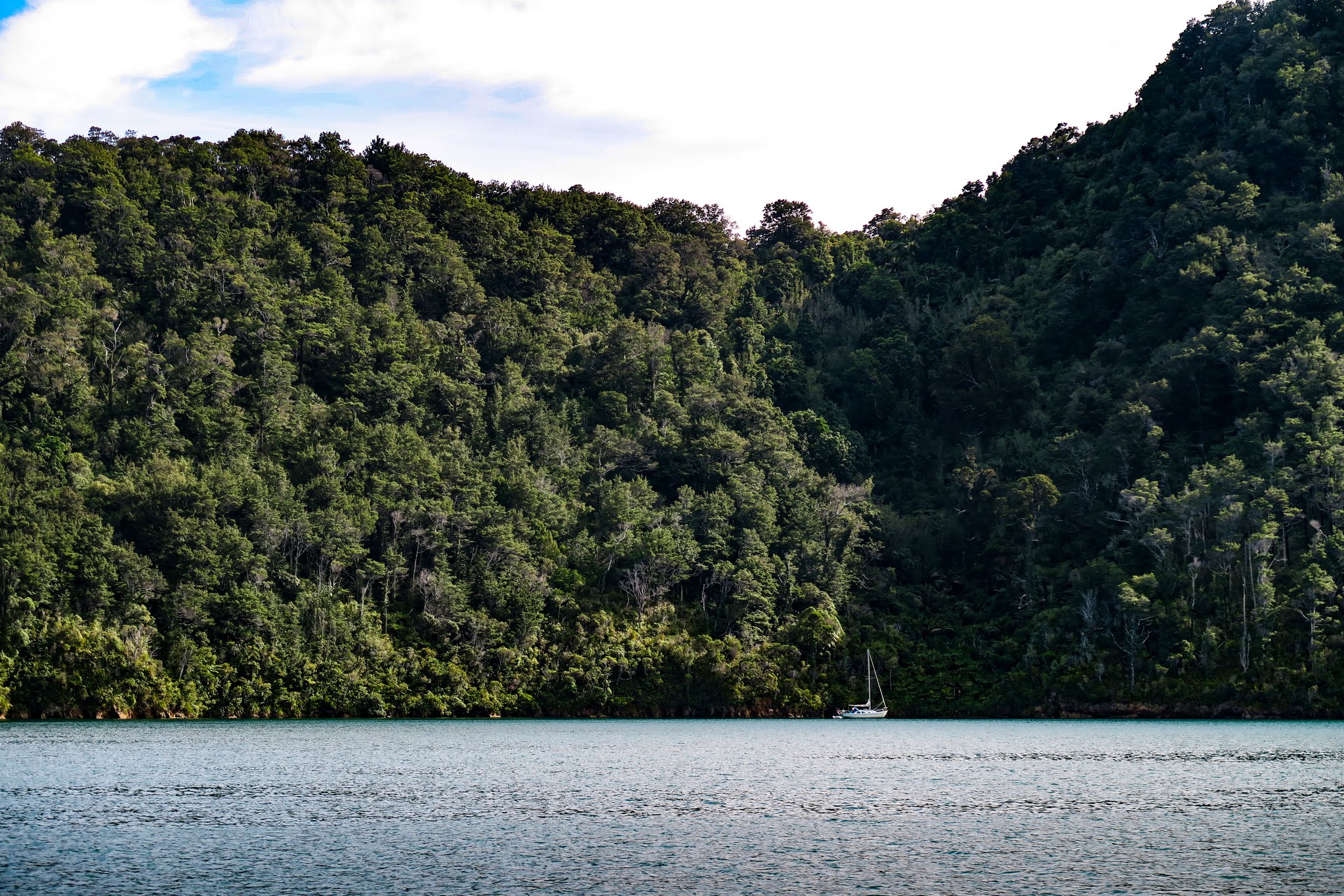
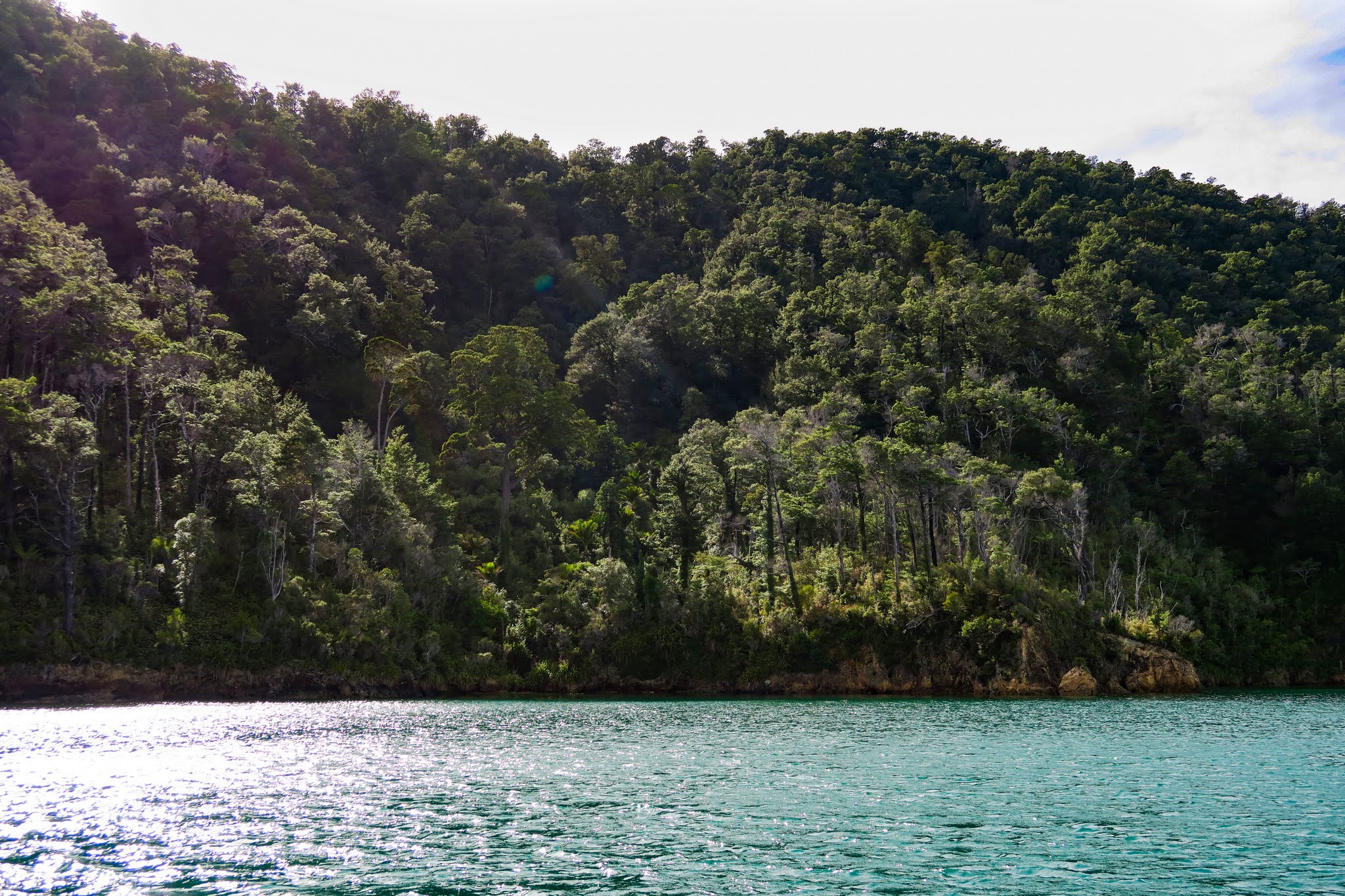
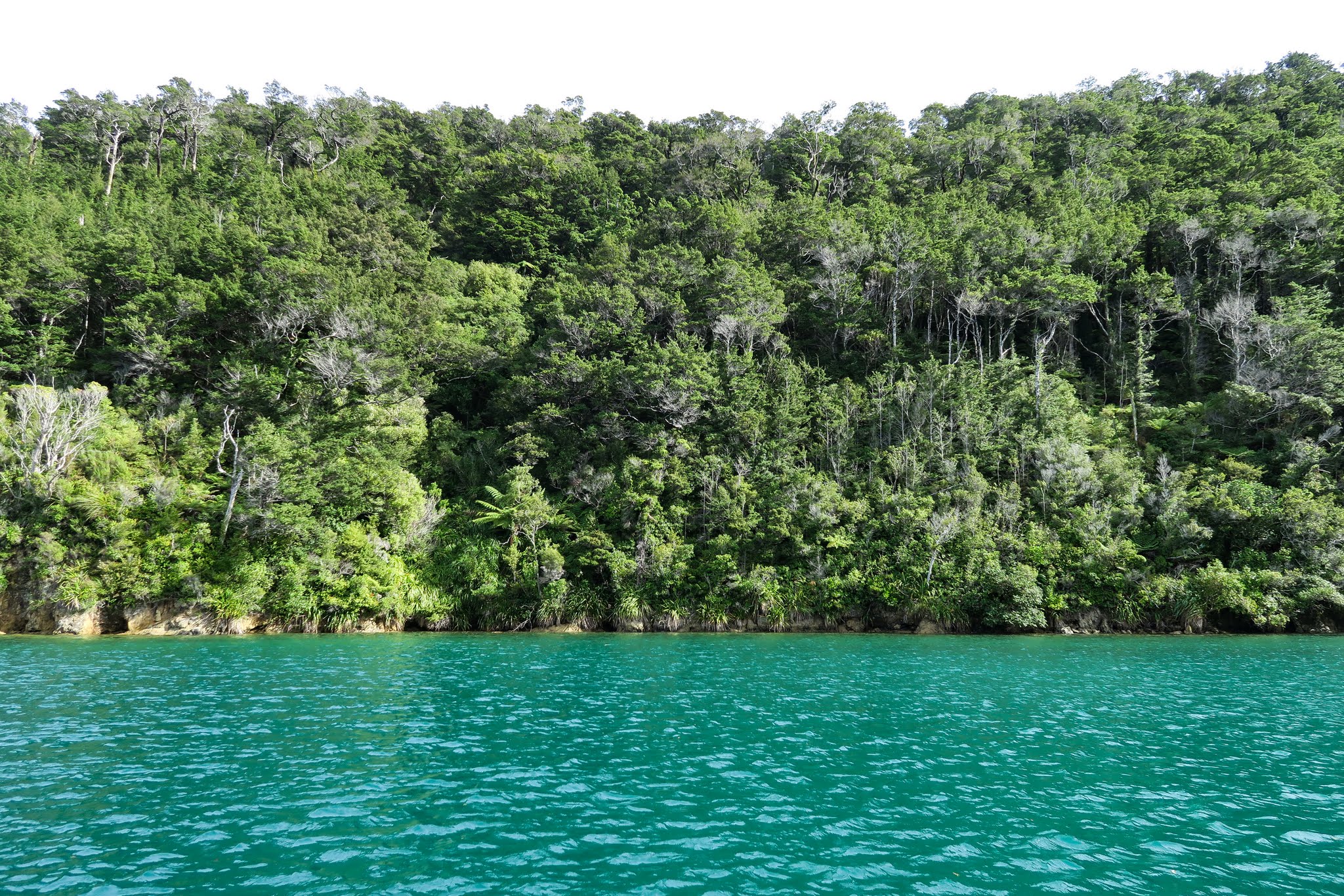
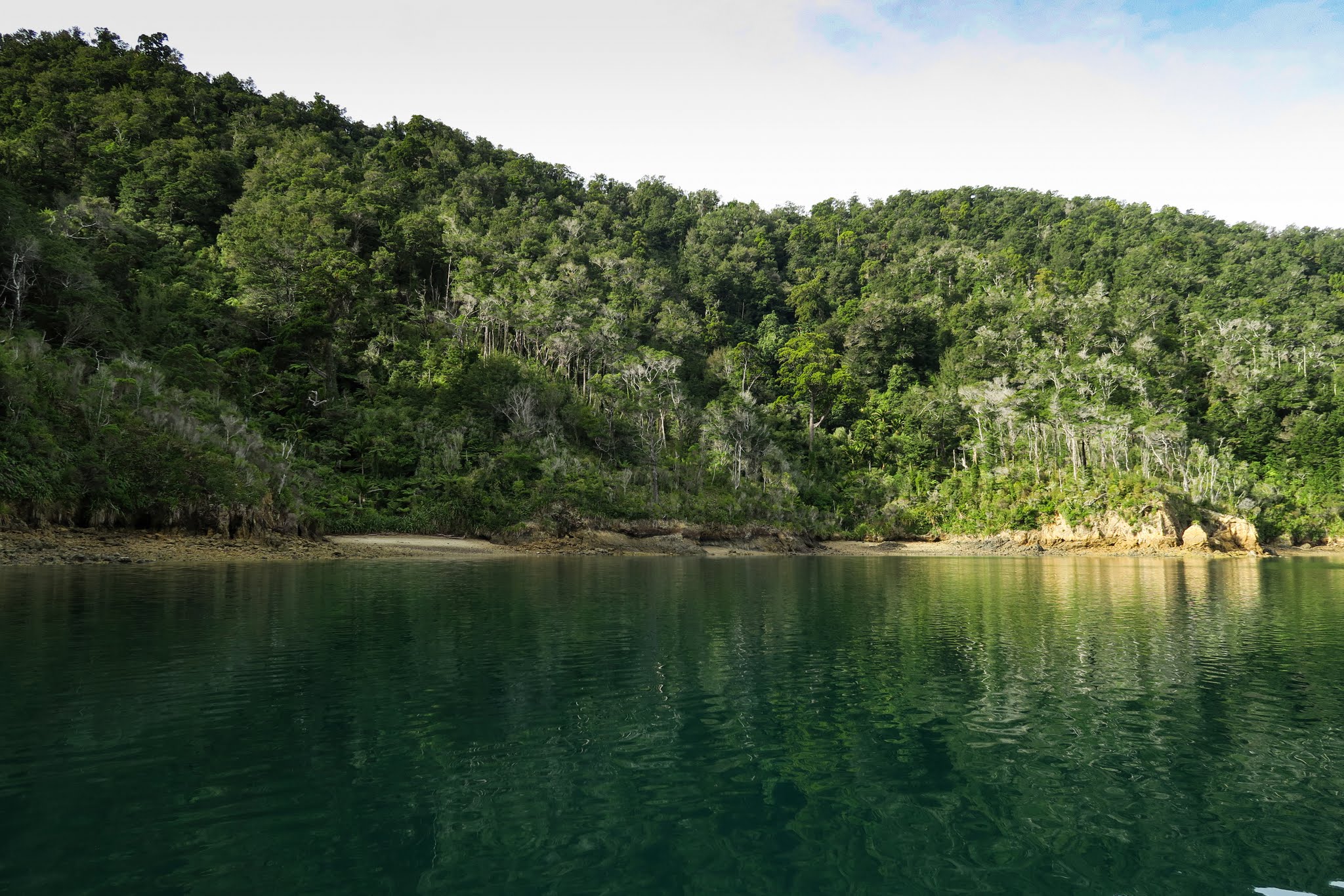
Because we’d gone through a channel to get in here, Ngawhakawhiti Bay felt very much like its own world. Mountains surrounded the bay; then seemed to go on endlessly in the view outside the channel. It really did feel like the world’s end. (Below, a gallery of photos from around the bay and looking out through the channel. Click to enlarge and scroll.)

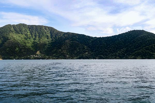
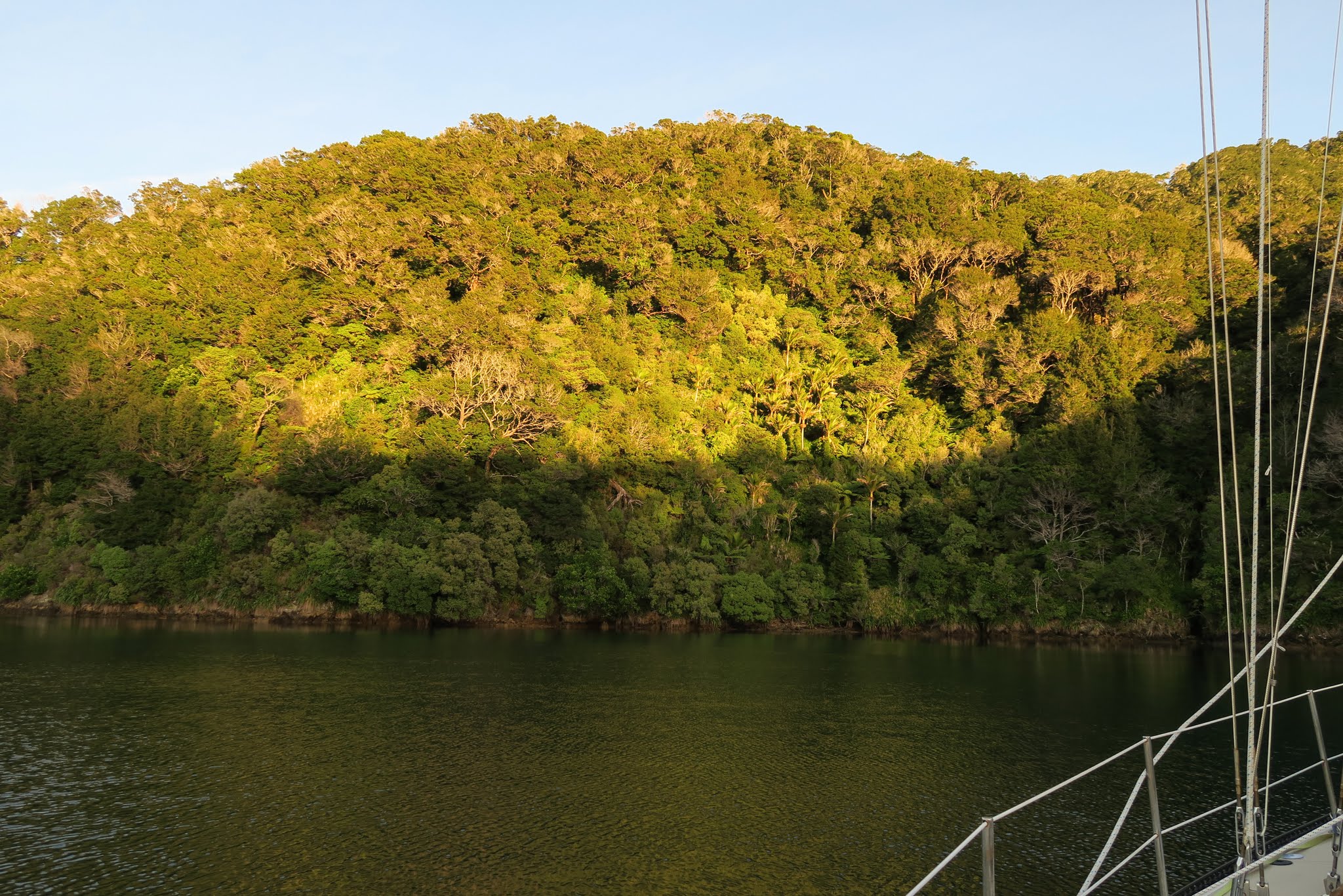
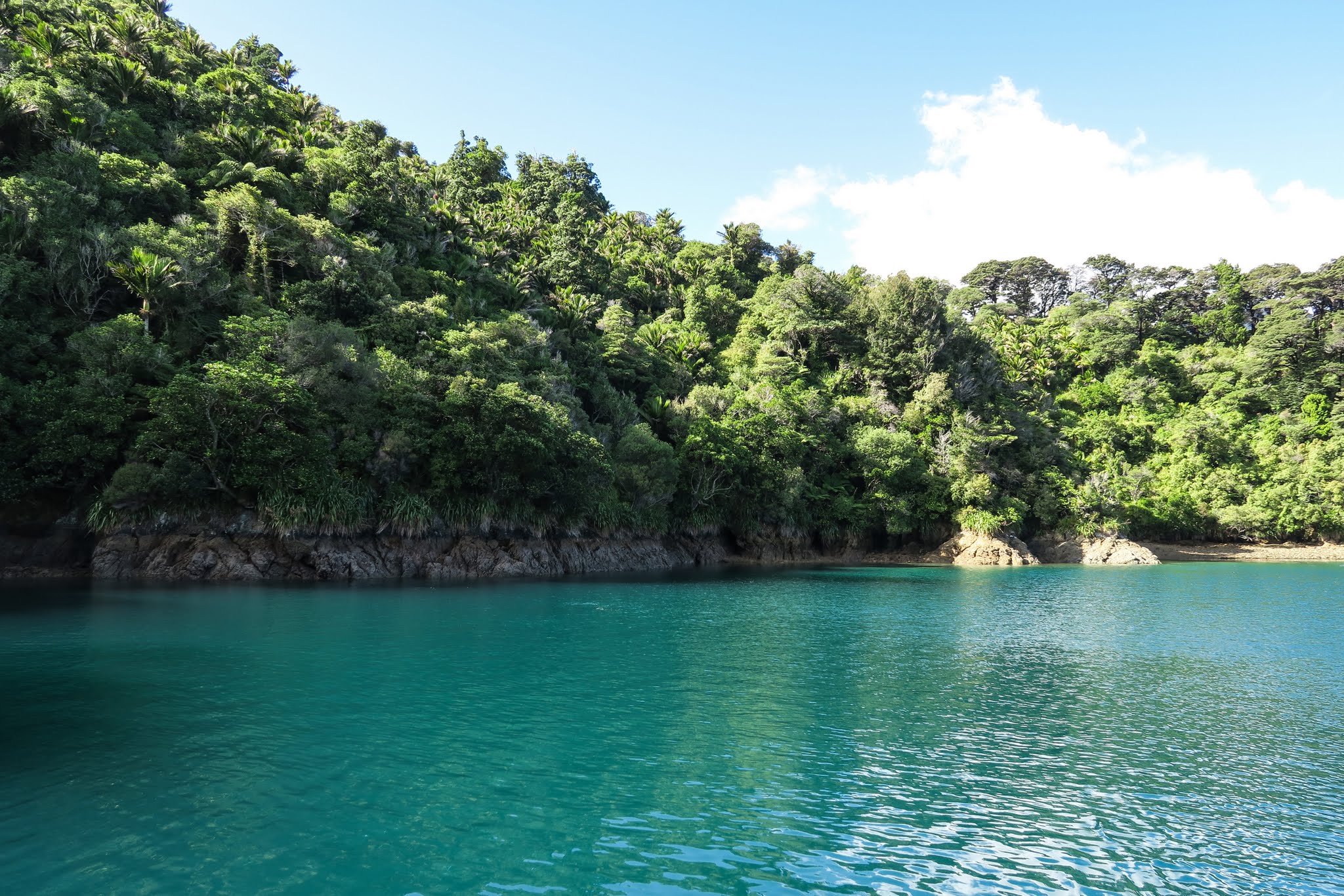
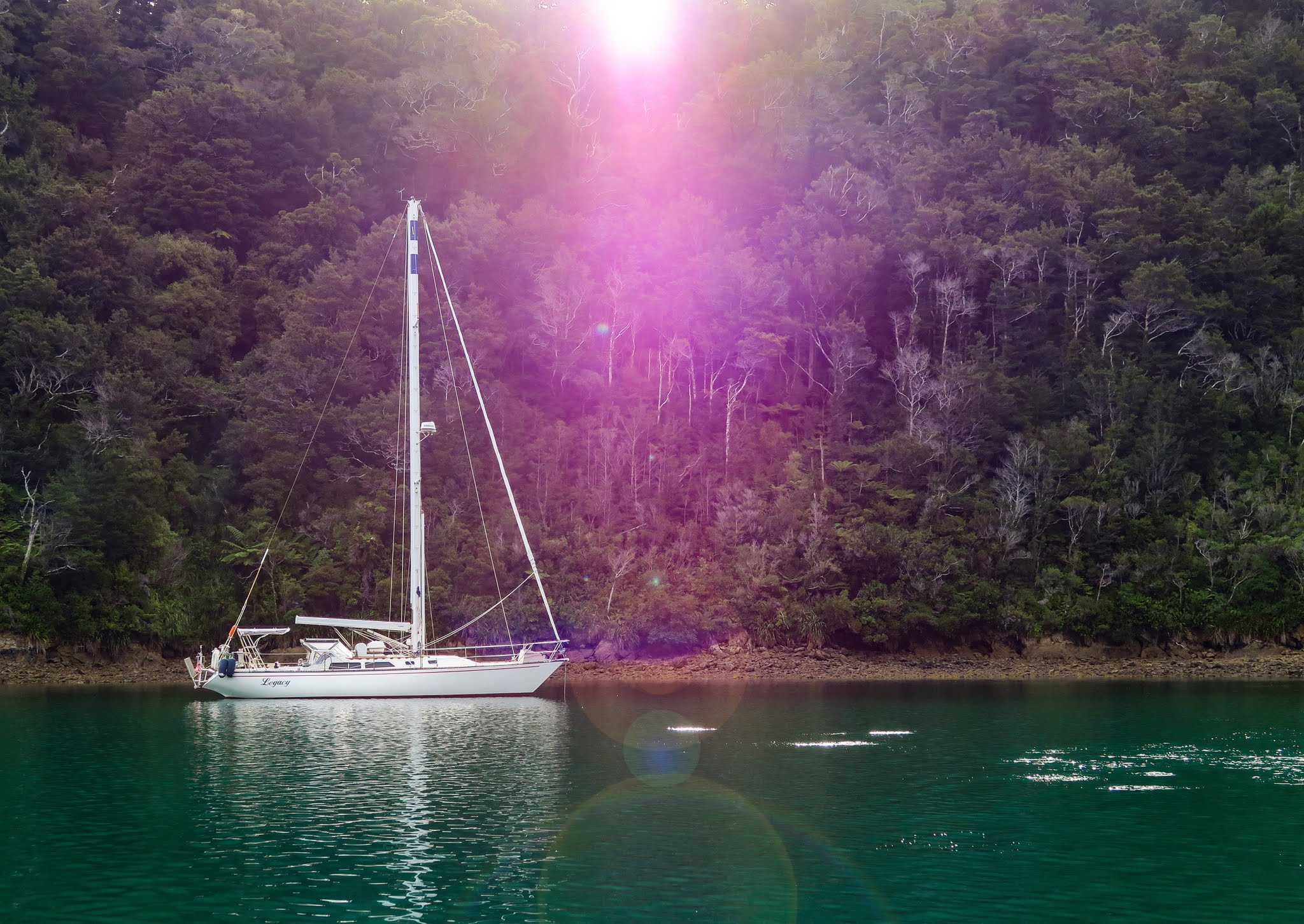
There was one other boat in the area, but it pulled anchor and left as we approached, giving us the entire place to ourselves. We dropped our hook in the northernmost anchorage in preparation for predicted overnight northerly winds. The breeze had been light up until this point, but as we anchored we had some disconcerting gusts come down side of the mountain and hit us even though we were tucked in behind it. Keith Murray (author of a guide book we use here) had mentioned that in strong conditions you’ll want to tie a line to shore, but he didn’t define “strong conditions.” We just figured that it wouldn’t apply to tonight’s winds.

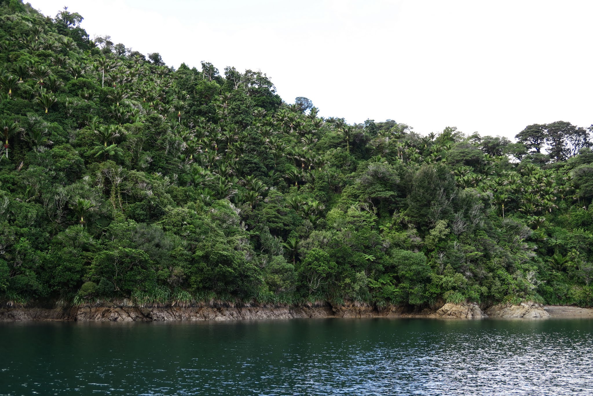
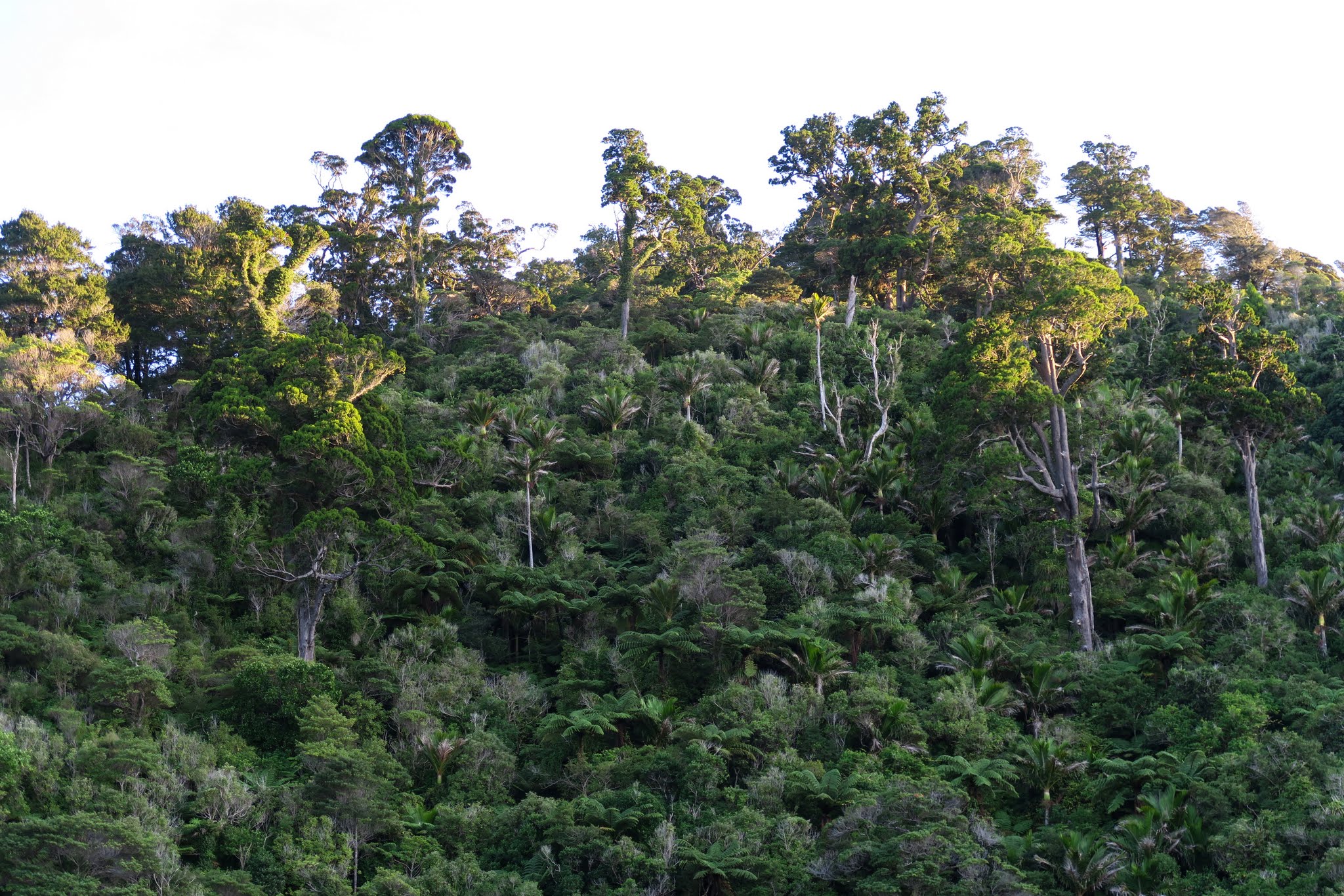
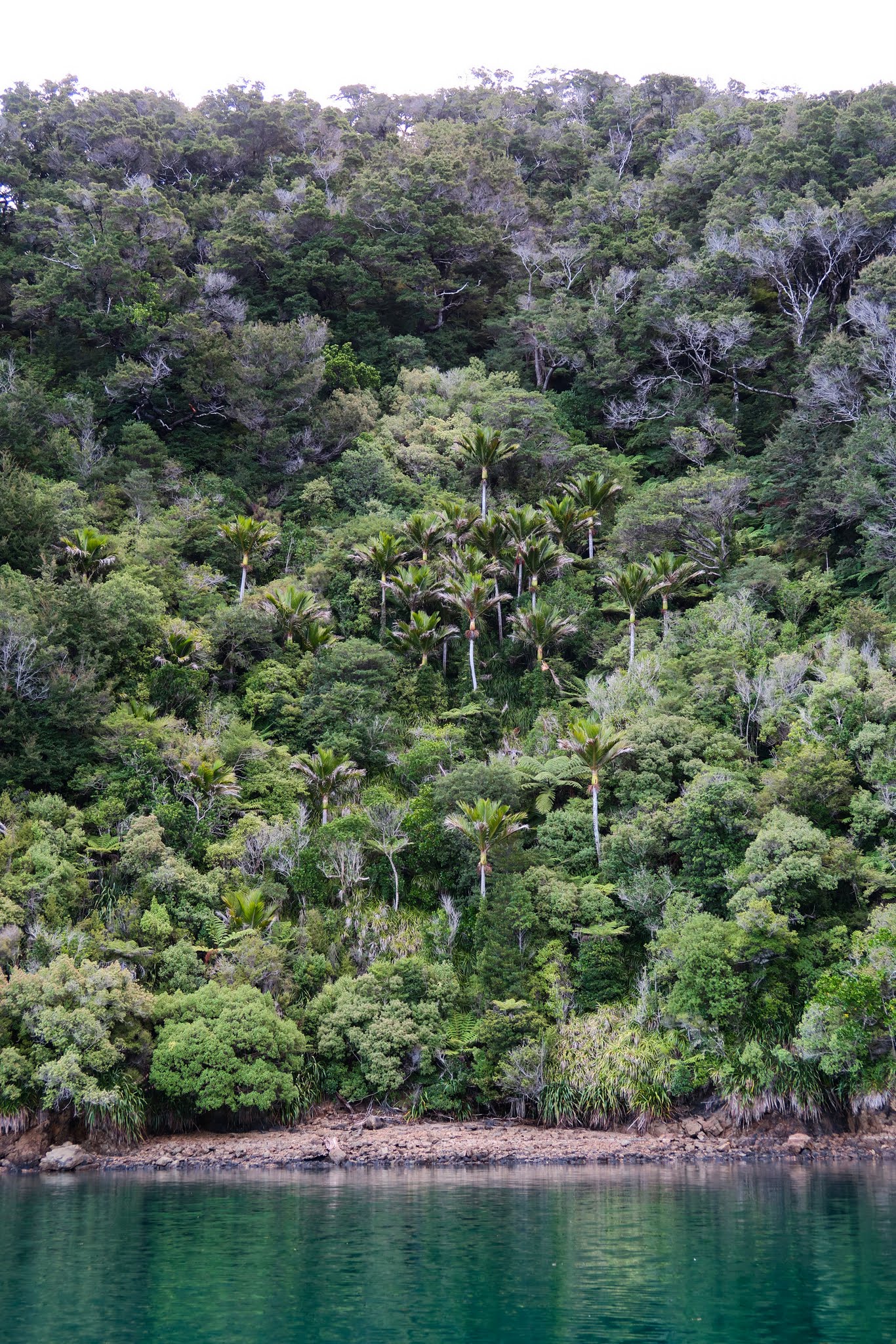
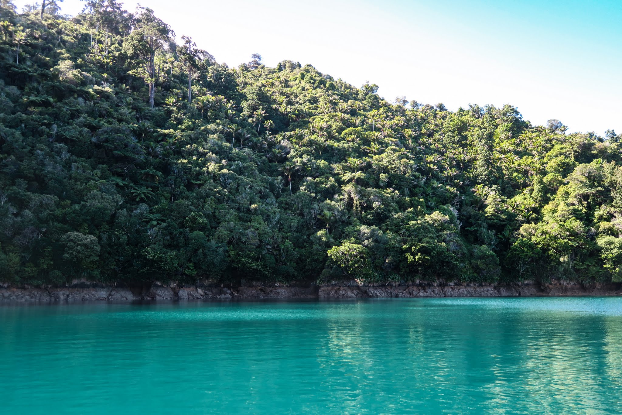
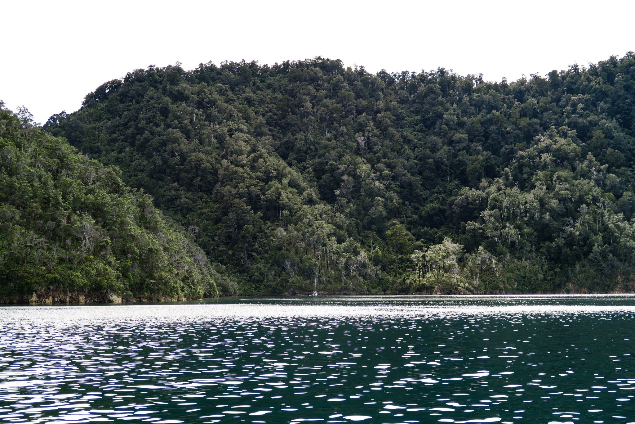
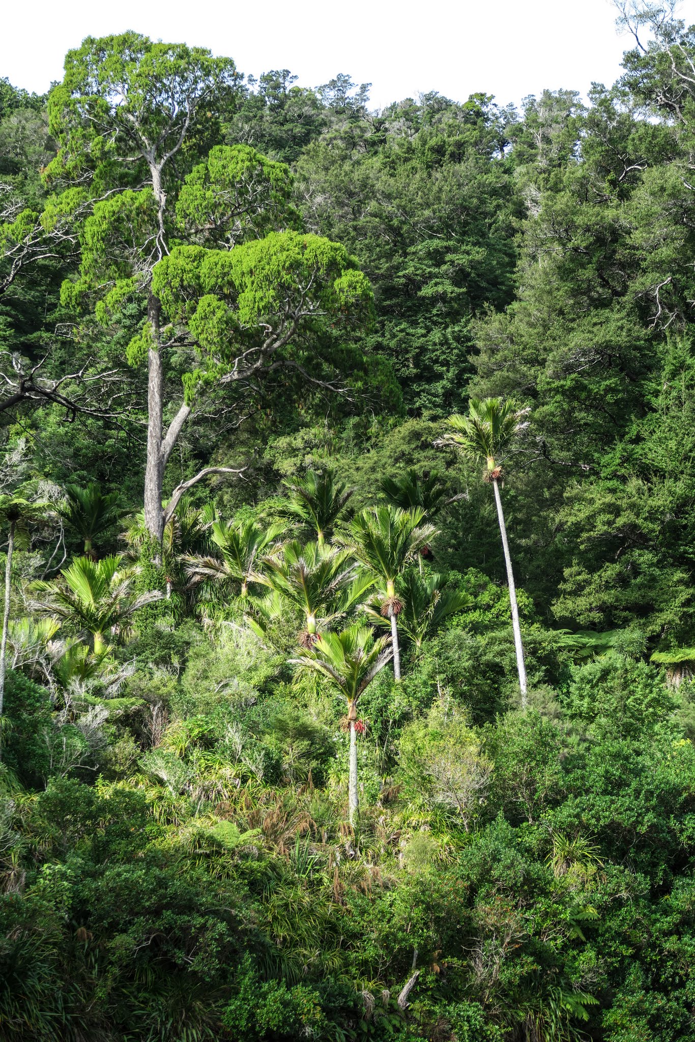
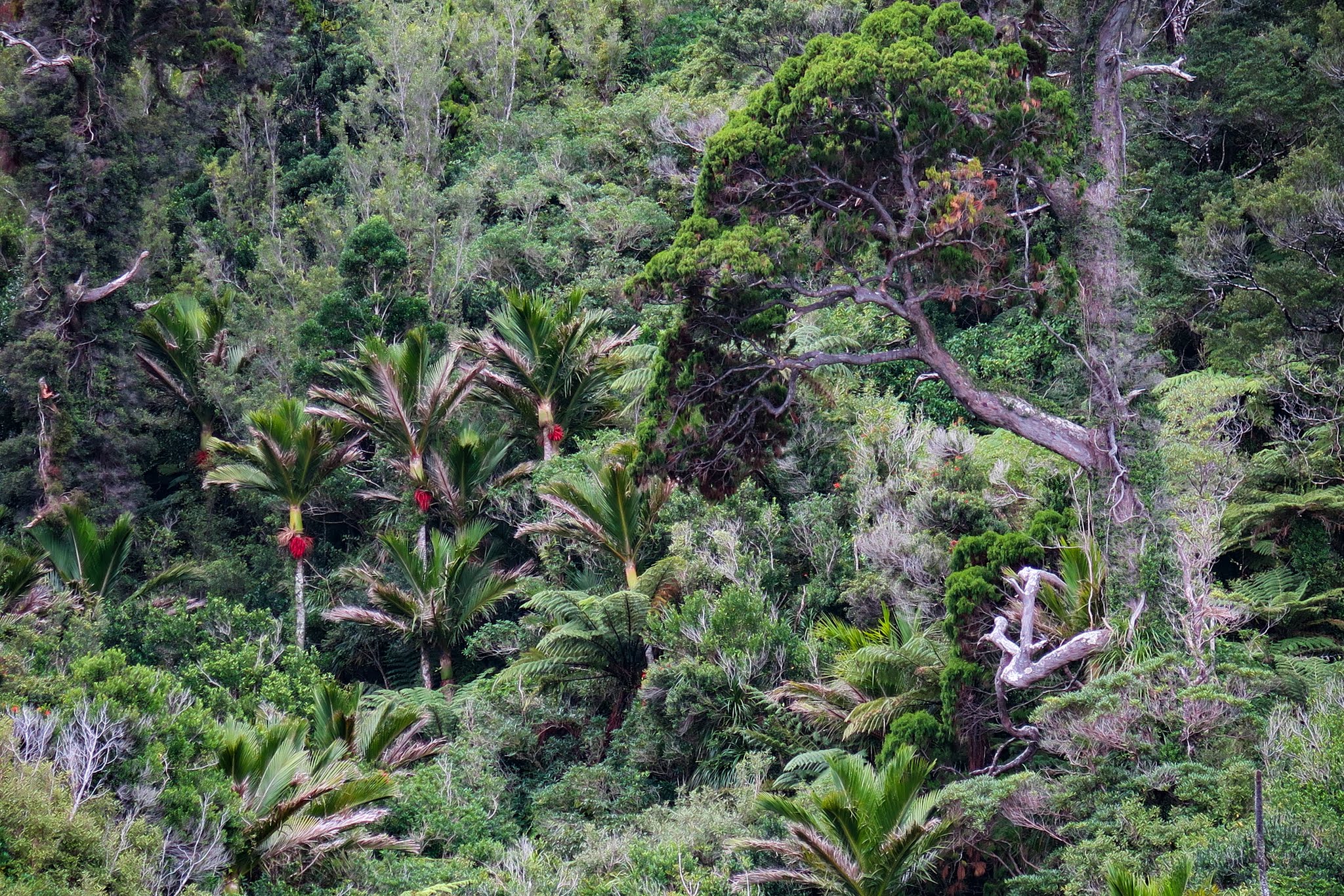
Thankfully the gusts quickly passed, along with all worries about having to move. We now floated serenely on this beautiful bay. Steeply sided, heavily forested hills surrounded us. Once again we were enjoying what seemed to be the uniquely south island mix of thick bush, very large trees, nikau palms and kiekie. Some of the palms were loaded with red fruit, making them especially striking amid the all the grays and greens on the mountainside. (Below a gallery of photos of our north bay–click to enlarge and scroll.)

Meanwhile, like yesterday, the water danced with fish that left silvery ripples around the boat, while shags (commorants) hung out on the shoreline. Between Ngawhakawhiti Bay and Flopper Bay, we were rapidly becoming big fans of Pelorus Sound. –Cyndi

Heading Down the Tennyson Inlet (Pelorus Sound, Marlborough Sounds, New Zealand)

April 7, 2016

Our next course took us out of Hallam Cove, across the big cul-de-sac of Fitzroy Bay, and into an area called the Tennyson Inlet.

Leaving Hallam Cove
Leaving Hallam Cove. (Pelorus Sound, Marlborough Sounds, New Zealand)

The Tennyson Inlet is a large, deep branch off the Tawhitinui Reach, about five miles long. It came highly recommended by the locals, the one “must do” in the Pelorus Sounds. Looking down the Tennyson Inlet, we were happy to see it looked green and forested, the sort of scenery we’d been hoping to find in this area.

Heading down into the Tennyson Inlet.
Looking down into the Tennyson Inlet. (Pelorus Sound, Marlborough Sounds, New Zealand)

The first part of the inlet is wide but divided by three islands in its middle. Further on, it narrows into a neck leading down to two deep bays, while off to the side, another channel leads into a wider bay. This general area is known as World’s End.

The map below shows where we started in Hallam Cove, and where we ended up:  World’s End and Ngawhakawhiti Bay.  (You can zoom in and out to get a better look.)


As we approached Word’s End, I was struck by the overlapping mountains covered with natural vegetation—no pine farms here.

Looking down into World's End.
Looking down into World’s End. (Pelorus Sound, Marlborough Sounds, New Zealand)
Penzance, an appealing small neighborhood and mooring field in the World's End area.
Penzance, an appealing small neighborhood and mooring field in the World’s End area.

The narrowness and the towering green mountains of Tuna and Te Mako Bays were pretty spectacular, but aside from private moorings there’s little in the way of protected anchorages there (at least from the northerly winds we were expecting overnight).

Looking down into Te Mako Bay.
Looking down into Te Mako Bay. (Pelorus Sound, Marlborough Sounds, New Zealand)
Looking down into Te Mako Bay's east bight (called Duncan).
Looking down into Te Mako Bay’s east bight (called Duncan). (Pelorus Sound, New Zealand)

Our destination was Ngawhakawhiti Bay (yes, that’s really how it’s spelled). We made a left turn into the bay.–Cyndi

The entrance to Ngawakawhiti Bay lies just off to the left.
The entrance to Ngawakawhiti Bay lies just off to the left. (Pelorus Sound, New Zealand)

“Flopper Bay” (Hallam Cove, Pelorus Sounds, Marlborough Sounds, New Zealand)

April 6, 2016

Motoring into a bay can feel like a first glimpse into a new world, no matter how obsessively you’ve been staring at it on approach. There’s just a moment where it suddenly seems to unfold and reveal itself, for better or worse.

This particular bay popped right into gorgeousness. Lushly vegetated hills rose straight up from the waterline, encircling the bay. The water was still and green, yet we were surrounded by continual silver circles of water left by jumping fish that seemed to surround our boat. A flock of seabirds flew out low over the water, while a few shags and herons remained perched onshore, totally unconcerned with our presence. From a chasm between two hills we could hear the sound of a waterfall, hidden from view by thick vegetation. This was one of those places that felt so alive it seemed almost spiritual.

Of course, we were now attached the idea of staying here, and while it was deep, we were able to anchor well enough for the current calm conditions. We sat outside to admire the scenery and noticed it looked familiar. I realized it had a lot in common with a favorite bay of ours in the Queen Charlotte Sound: Flipper.

Both bays are like indents in the surrounding hills and have fairly deep water, making them fair-weather anchorages. Both bays have very lush vegetation, beautiful emerald water, and mini brown beaches at low tide. Both bays are teeming with sea and bird life. And while Flipper Bay has more kiekie (climbing plants that resemble spider plants) interspersed in its dense foliage , this bay has thick patches of nikau palms, giving it a Garden of Eden feeling. Other than this, these bays could almost be twins. Thus, we decided to name this one Flopper (since apparently no one has yet bothered to name it – we liked the idea of being able to say “two of our favorite bays in the Sounds were Flipper and Flopper!”).

In the end, Hallam Cove didn’t have a lot going for it aside from this bay, but in our opinion, having this bay was enough. One drawback is it’s only big enough for one boat. Luckily for us it was empty when we arrived, but the power boat lurking outside hoping we might leave probably wasn’t thrilled. This is the sort of destination that needs a Plan B in case it doesn’t work out.

Below, a gallery of photos from “Flopper” Bay. Click to enlarge and scroll. –Cyndi

Hallam Cove (Pelorus Sounds, Marlborough Sounds, New Zealand)

April 6, 2016

I’d picked Hallam Cove because Keith Murray (author of New Zealand Cruising Guide, Central Area) labeled it “extremely attractive.” I’ve come to trust his judgement; so I was surprised to find Hallam Cove not so appealing. In fact, I wouldn’t even rate it “attractive.” It had a bizarre split personality: the east side was dry and grassy, while the west side was mostly pine farm in various stages of growth.

On top of that, the most likely anchorage was filled by mussel farms. This split personality appeared most bizarre in the neighborhood at the head of Hallam Cove (Cissy Bay). Half the houses were on dry grassy slopes, the other half in pine forest. None of it was very appealing, but in Keith Murray’s defense, it probably looked very different when he wrote his guidebook.

Motoring by green pastureland as we rounded the corner into Hallam Cove. (Pelorus Sounds, Marlborough Sounds, New Zealand)
The east side of Hallam Cove. (Pelorus Sounds, Marlborough Sounds, New Zealand)
This photo (looking back behind us towards its entrance) shows the multiple personalities of the Hallam Cove area. The headland on the left is dry; the one on the right has lush native forest. The background hills, while green, are drier with regenerating pine forest and natural brush. The mountain furthest in the background is covered with dense pine forest. (Pelorus Sounds, Marlborough Sounds, New Zealand)

It was looking like Hallam Cove would be another disappointment. Then I spotted it: a small unnamed recess in a patch of natural New Zealand forest on the west side of Hallam Cove.  It seemed awfully small, but our guidebook had marked as an anchorage so I suggested we head over and get a closer look. It can be hard to judge little places like this from afar, and something that looks mildly interesting can be quite stunning up close. The only way to find out for sure is to go right up in there. Thus poor Rich has had to motor into more uninteresting places than he’d care to but has to admit we’ve found some gems this way.

Anyway, we turned and headed for the indent. As we got closer, lush native forest began to fill our view, covering the hills down to the shoreline, and our little indent was starting to look big enough to anchor in. It looked like Keith Murray was going to be redeemed. –Cyndi

Approaching the small unnamed anchorage on the west side of Hallam Cove (Pelorus Sounds, New Zealand).