Navigation

Navigation

Tutorial: How to Make AT5 Satellite Charts for Display on Navico Chartplotters (Simrad, Lowrance and B&G)


Open-Ocean Chart Errors


Animated GIF showing radar overlaid on the chart, before and after calibration.

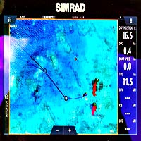
Compass Calibration – Why do I need to calibrate an electronic fluxgate compass?


OpenCPN Tracks
OpenCPN Tracks

Cherish your Tracks


"Did you just drive Legacy over that mountain?!"
“Did you just drive Legacy over that mountain?!”

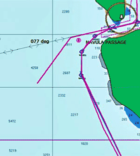
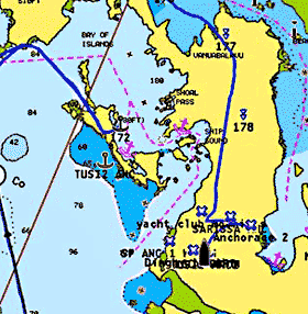
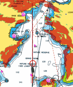
Chart Error or Off-Road Vehicle?


AOCPN-on-phone-small2jpg

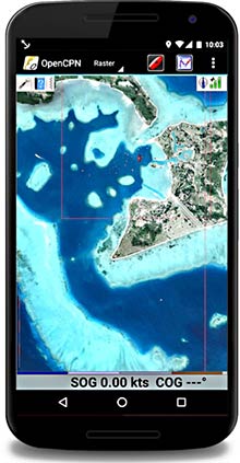
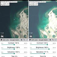
Satellite Images in the Cockpit

openCPN comes to Android, and it’s great! Make sure you get the right version – there are two. The paid version is the one to choose. (Don’t panic, it’s only $10.)