
September 8, 2018
We first started to use satellite images on openCPN about five years ago and what a difference they’ve made. I’ve dreamed about having those satellite images on my chartplotter, and with Navico chartplotters, it’s possible.
After a year of trial and error, I’ve finally, in my opinion, perfected my method of making satellite charts for our Simrad EVO3 chartplotters. I made a set of instructions for myself to remind me of the steps. Those instructions have now turned in to four videos and accompanying PDFs. I hope you’ll find these step-by-step tutorials on the method I’ve been using useful.
Here’s a link to the info on our Cruising Info pages.
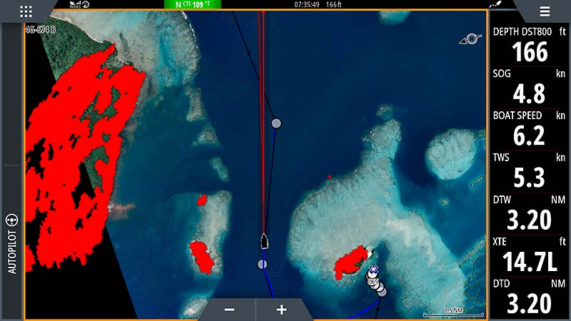
And here’s an example of the result. Below is a screenshot from our chartplotter while we were going between reefs that Navionics doesn’t show with any reasonable accuracy.
-Rich


