Mutton Cove Beach (Abel Tasman National Park, New Zealand)

April 20, 2016

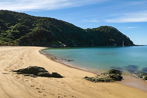
Our first stop on our exploration of the Mutton Cove area was Mutton Cove Beach.

Heading into the beach at Mutton Cove.
Emerald water, golden sand, and lush forest beckoned as we approached Mutton Cove beach.

As we pulled our dingy onto the beach, our feet sunk into the sand necessitating that we carry, rather than roll, the dinghy up to the high tide mark. The sand was coarser than we’re used to, the kind that gives you an involuntary foot exfoliation as you walk on it. We opted to keep our sandals on.

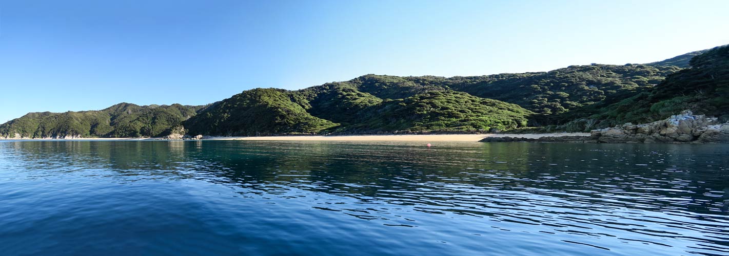
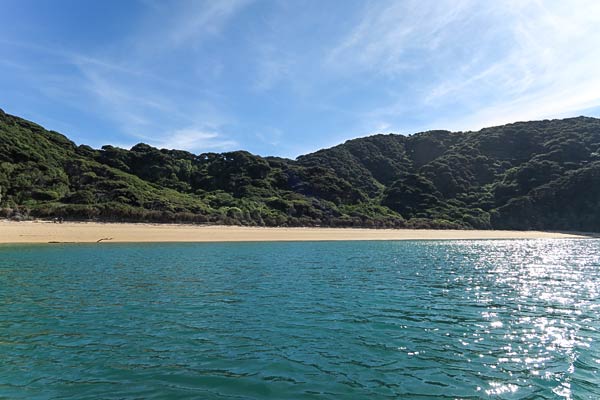
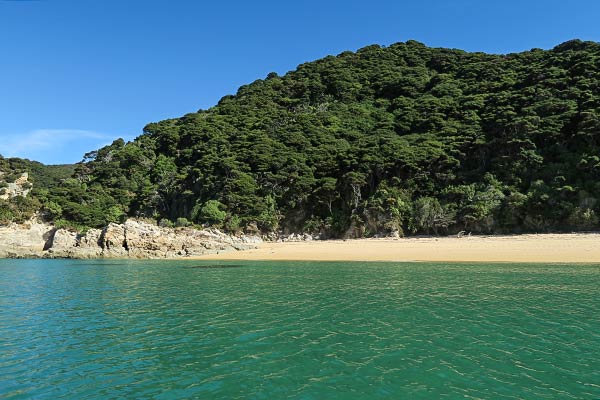
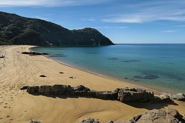
While it wasn’t the softest sand to walk on, it was a beautiful beach. This was our first introduction to the look of many of the beaches here: the sand distinctly golden and beautifully offset by emerald water near the shore. Behind us the forest was thick and lush. I had no doubt there would be beautiful scenery along the trail, but for now we were focused on the beaches.

Looking down towards our boat at Mutton Cove.

After taking in the beautiful scenery, we planned to walk over the headland to the next beach south. From afar it looked easy, but up close we found we’d have to climb over a big rocky area. No thanks; we’ll take the dinghy.

A sweeping view of Mutton Cove beach from the headland.
The reason we decided to take our dinghy rather than walk to the next beach at Anatakapau Bay.

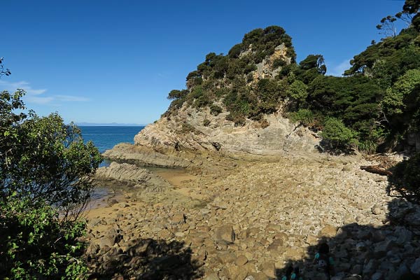
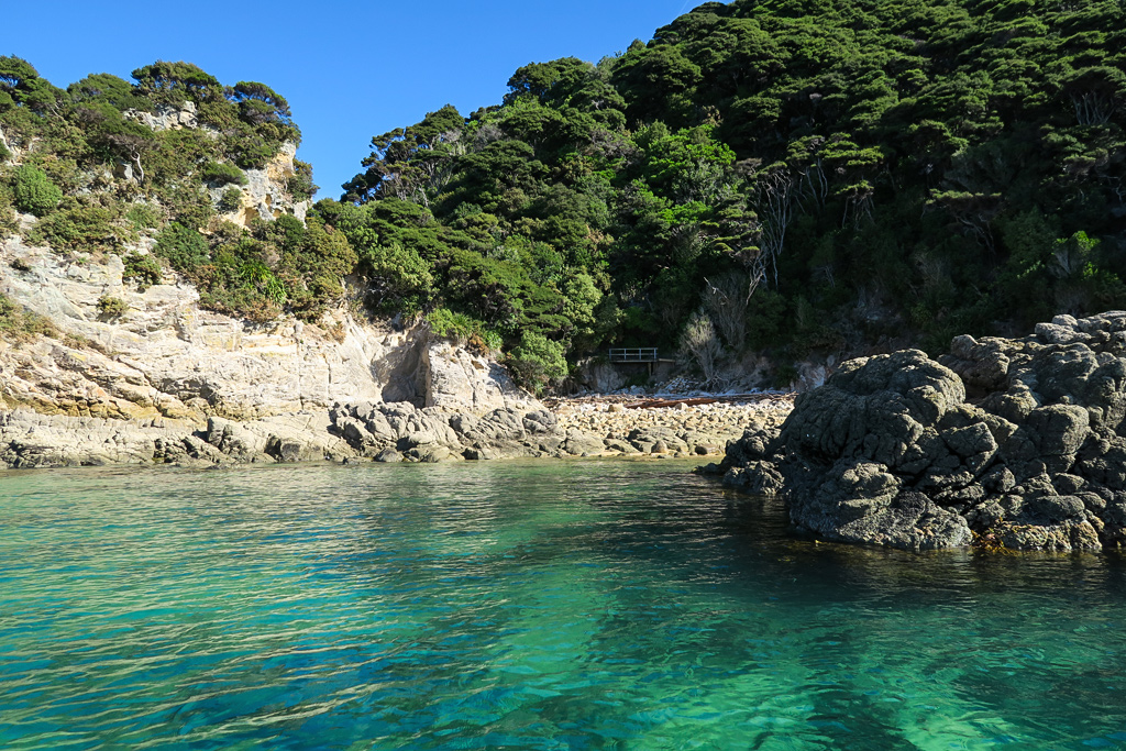
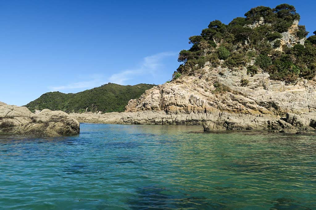
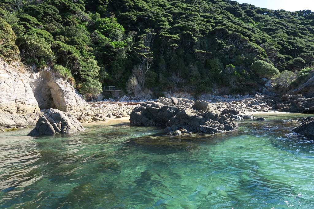
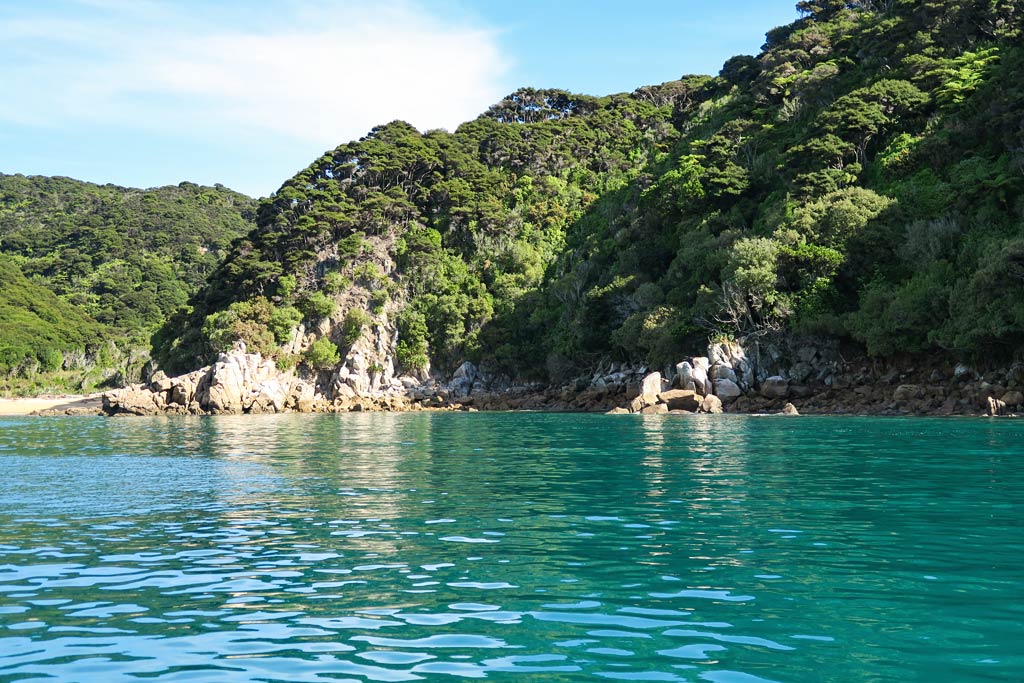
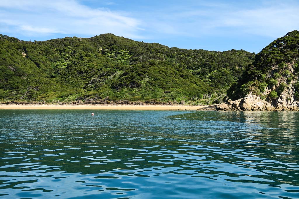
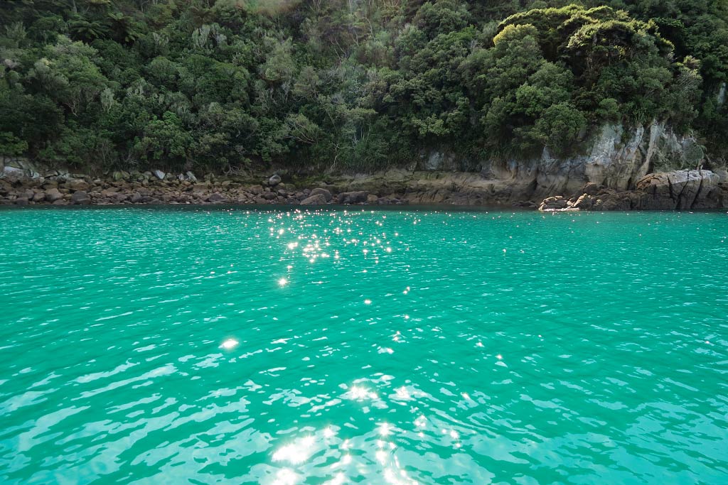
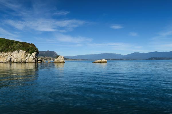
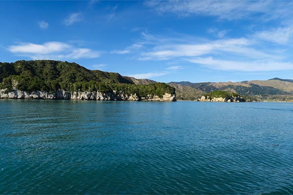
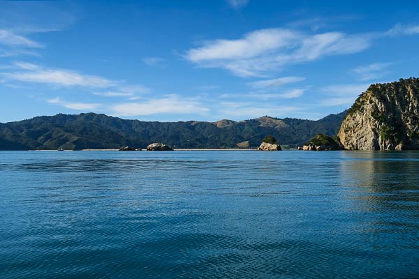
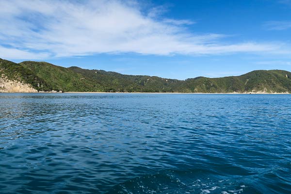
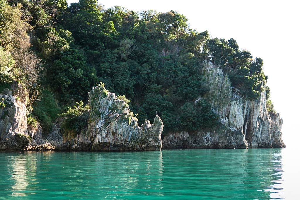
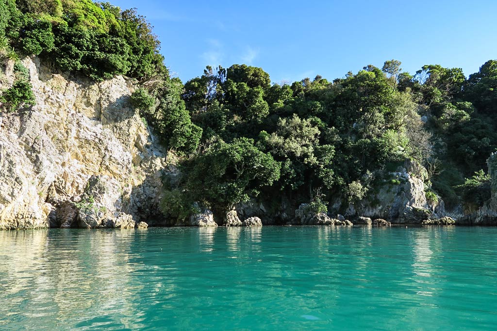
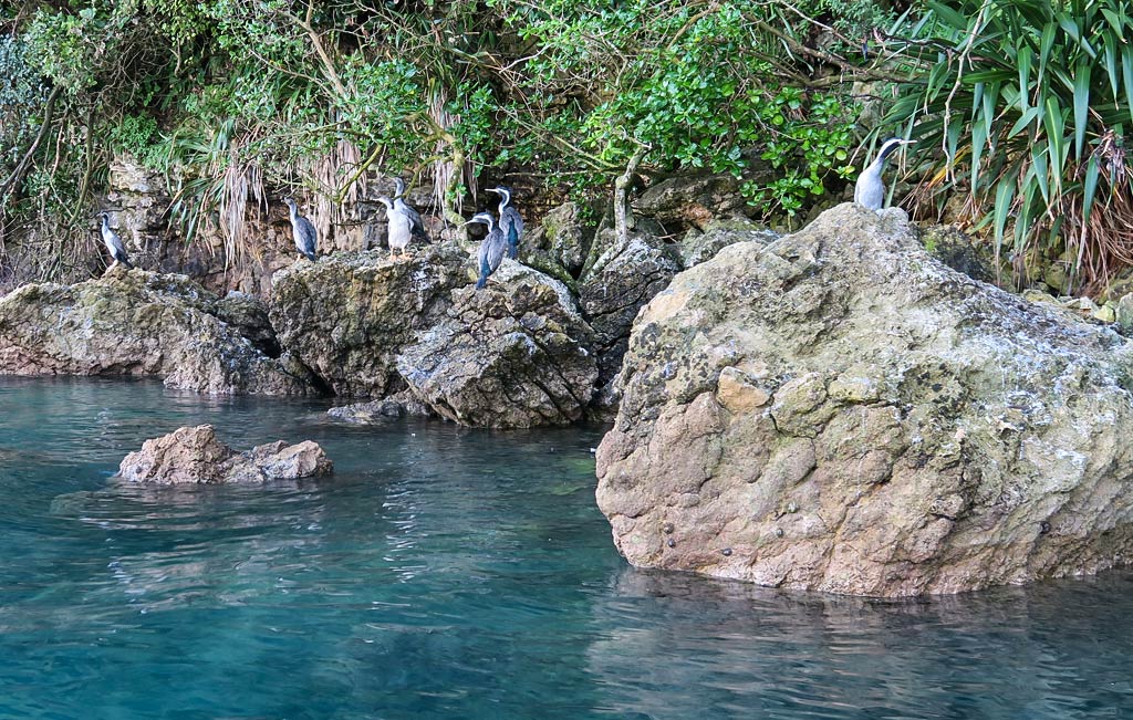
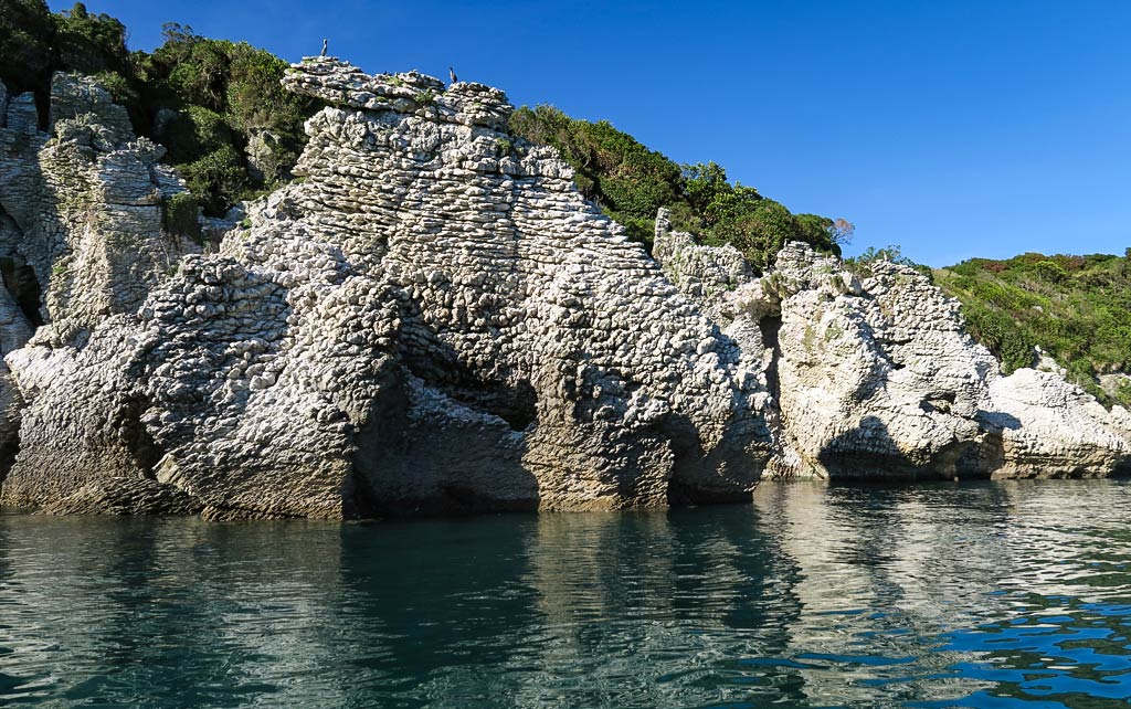
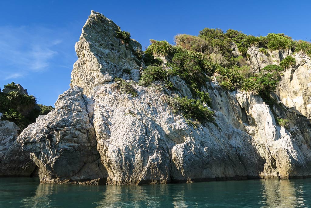
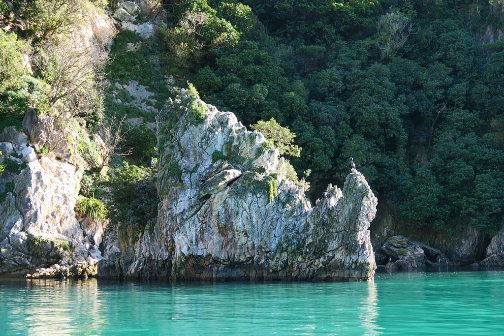
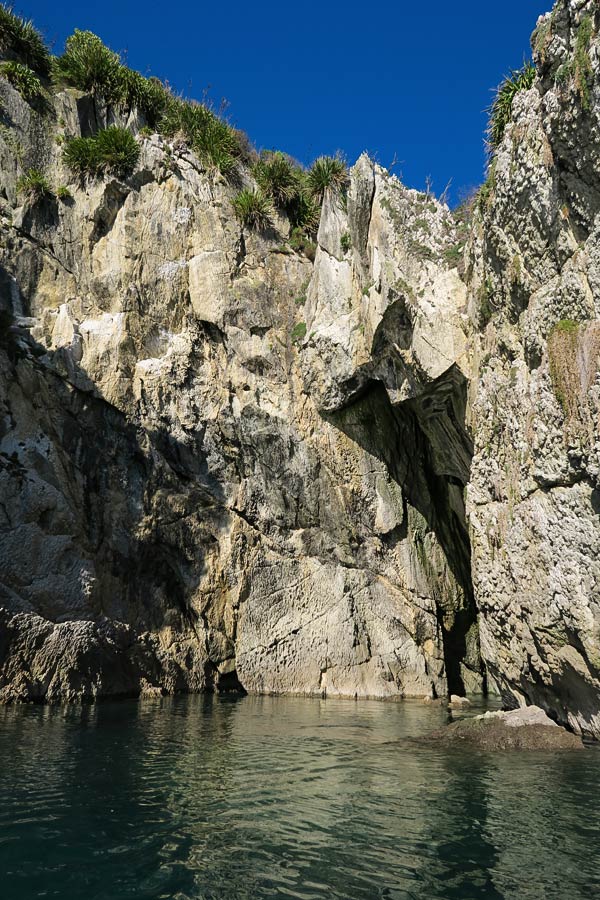
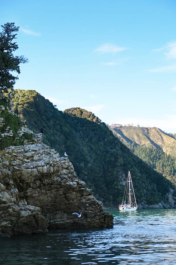
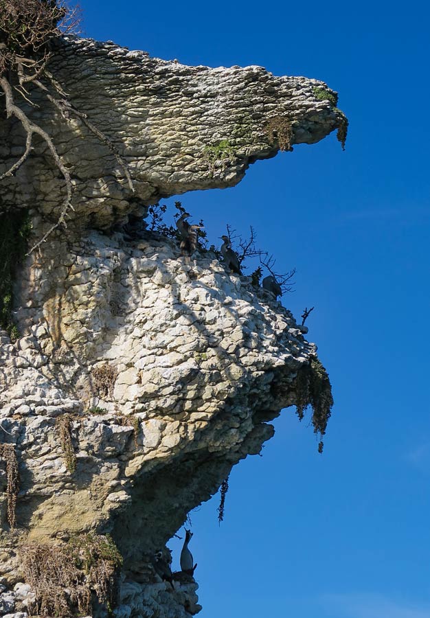
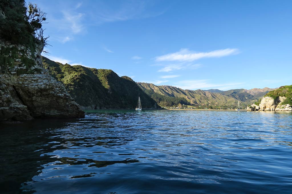
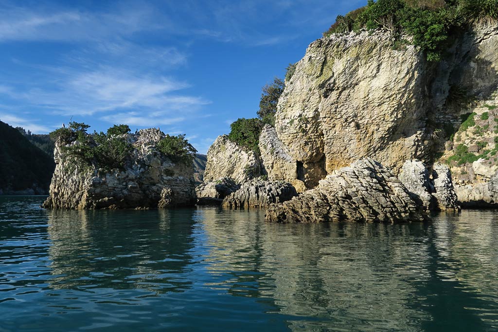
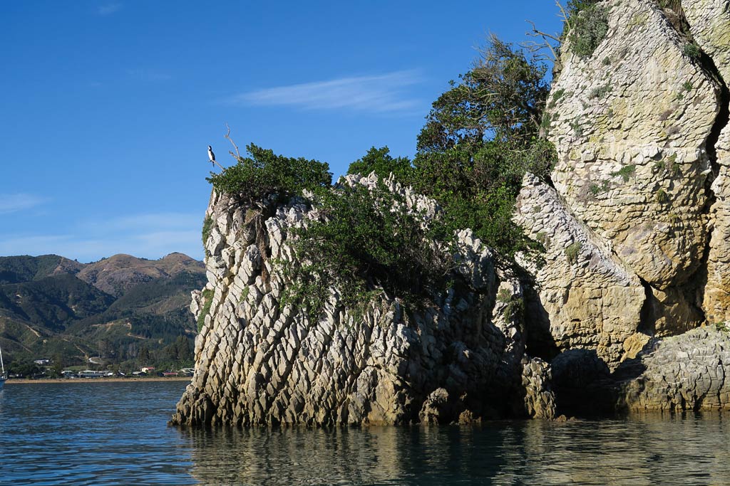
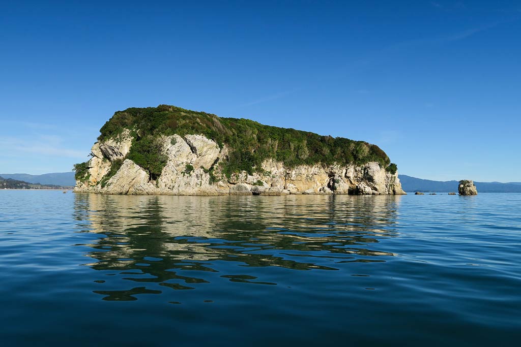
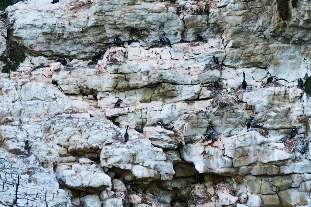
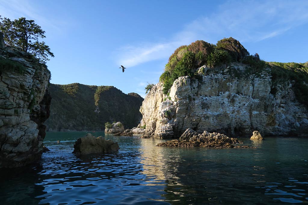
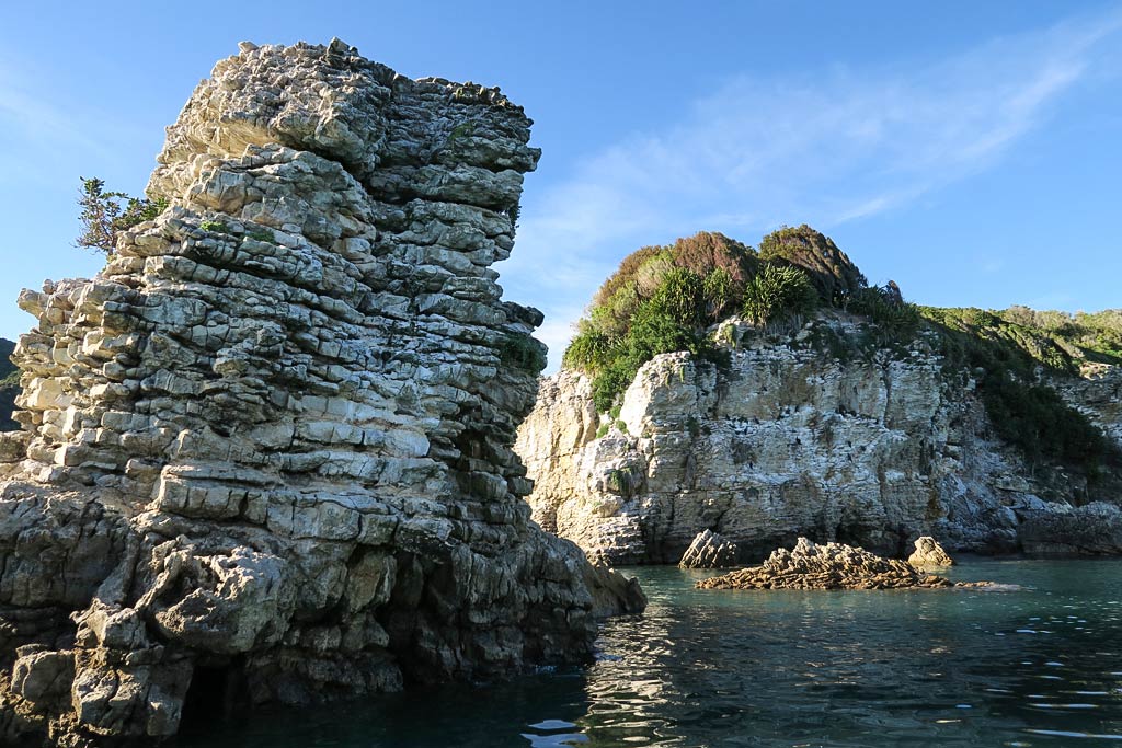
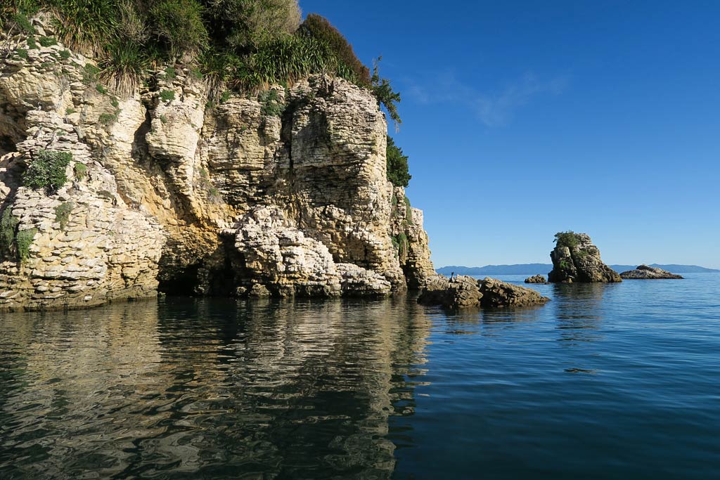
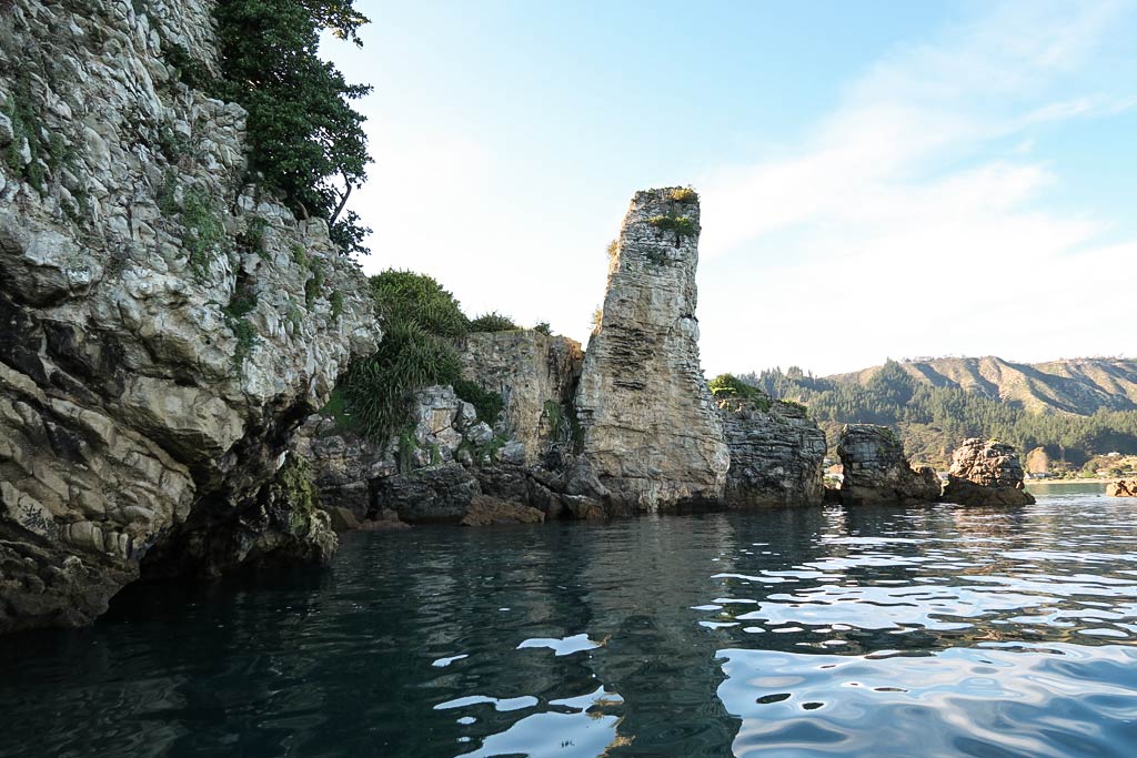
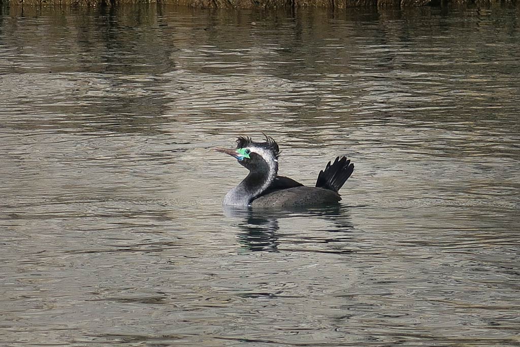
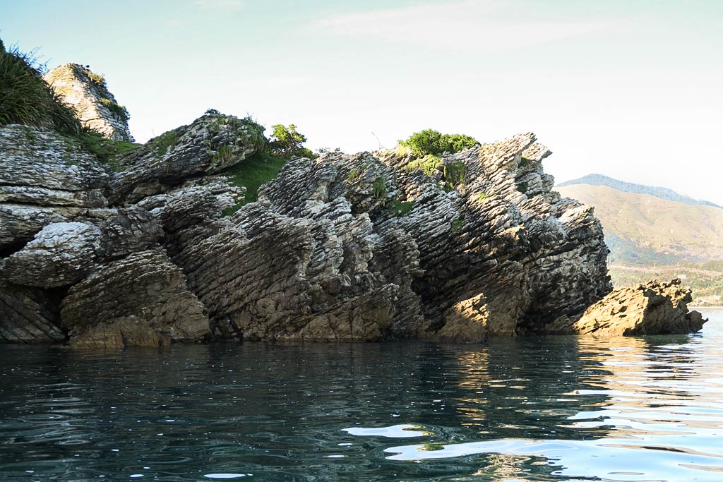
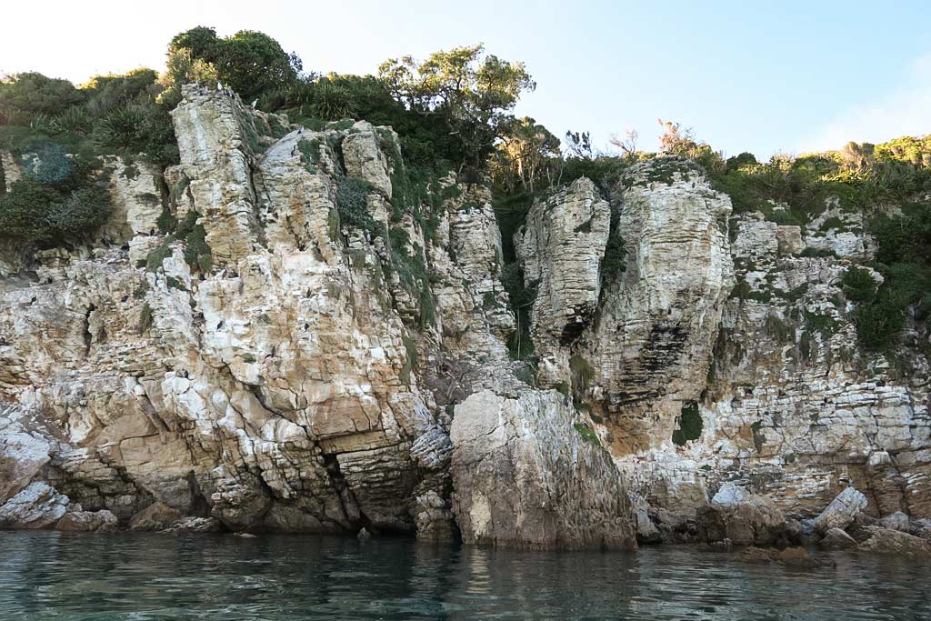
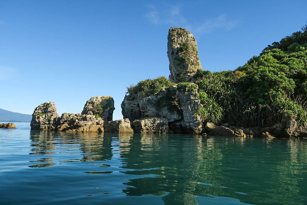
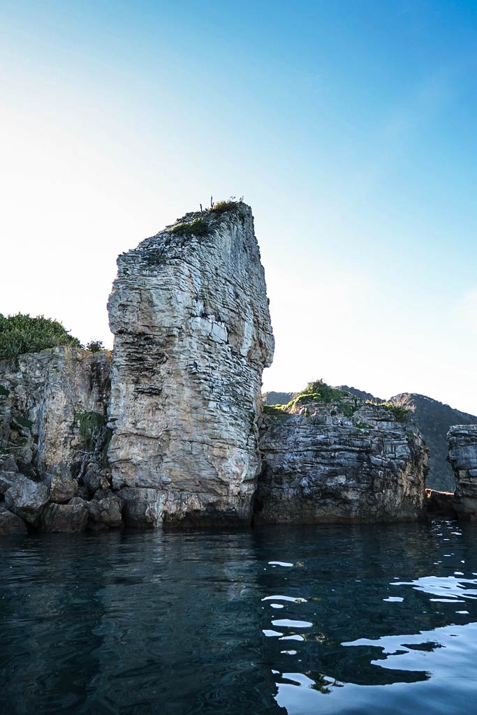
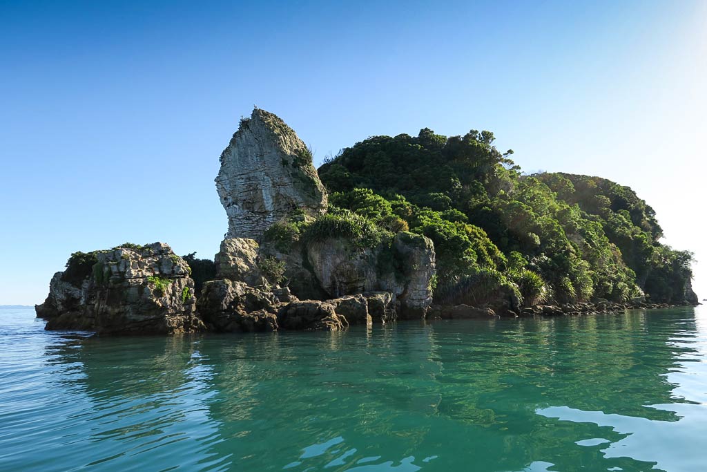
As we motored around the headland to the next beach, we had our first experience with the reason some choose to kayak rather than hike the area: these headlands have beautiful sandstone formations and colorful pools not visible from the shore. From now on we’d take the dinghy around every headland. (Below, photos from our dinghy ride around the headland–click to enlarge/scroll.) –Cyndi

Abel Tasman National Park and Mutton Cove (Tasman Bay, New Zealand)

April 20, 2016

able-tasman-pacture
This iconic aerial photo, borrowed from the internet, shows only a small portion of the park but manages to sum up its general look.

Our arrival in Tasman Bay marked our unofficial entry into Abel Tasman National Park.

Mutton Cove marks the north end of this famous coastline filled with miles of golden beaches, weather-carved sandstone headlands, quiet coves, and jungle-like river inlets. All this is backed by hills covered with native forest. Because the area is protected by various land masses, the beaches have no waves, giving it a peaceful, lake-like effect.

The interactive map below shows the Abel Tasman National Park’s coastline from it’s northernmost to southernmost points.

That’s not to say that weather isn’t a factor. It’s fairly mild, but morning northwesterlies generally switch to late-afternoon southeasterlies, which can make the anchorages choppy and uncomfortable if the breeze is strong. When an actual weather front comes along, boats need to be in a well-protected anchorage because the associated winds can get pretty strong.

Our strategy was to enjoy the several-day period of very light winds (enough so the evening breezes wouldn’t be an issue), and work our way south to a protected anchorage in time for a coming front.

We made our way into Mutton Cove, tucking in behind a small peninsula called Separation Point. This anchorage would give us dinghy access to three beautiful beaches: Mutton Cove, Anatakapau, and Anapai, and after several days on the boat we were anxious get out and do some walking!

Below, a few photos of our Mutton Cove anchorage. (Click to enlarge/scroll).

Incidentally, this area has a famous hiking trail: the Abel Tasman Coast Track. Like the Queen Charlotte Track (in the Marlborough Sounds), hikers can opt to do the entire 37-mile-long track over several days, or just do pieces of the track via water taxis and day hikes.

The other option is to do the coastline by kayak, stopping at whatever beach strikes your fancy. Kayakers see less of the forested trails, but some of the headlands and coves not accessible by trail are pretty spectacular. –Cyndi

Motoring from Golden Bay to Tasman Bay and Abel Tasman National Park (South Island, New Zealand)

April 20, 2016

Able Tasman National Park encompasses the forested, hilly area that acts as a giant headland separating Golden and Tasman Bays. Our plan was to motor up over the top of it, arriving at an anchorage on its east side. This would put us at the north end of the park, and from there we could spend a few days working our way south along the park’s famous coastline.


We headed off on our hour-long ride after we got back from exploring the Tata Islands.

Some of the expanse of Golden Bay. (South Island, New Zealand)
Motoring past the Tata Islands. (Golden Bay, New Zealand)
Starting to motor past the outer edge of Abel Tasman National Park. (South Island, New Zealand)

Along the north coast we passed Wainui Bay and its inlet, a interesting-looking place. After that came the first of Abel Tasman Park’s big beaches: Whariwharangi Beach. It looked intriguing, but it faced north and was not a protected anchorage, making suitable only for an afternoon stop. Anxious to get to our next anchorage, we opted to keep going. We figured we could always hike back there if we felt like it. –Cyndi

Turning east with Wainui Bay just around the corner. (Golden Bay, New Zealand)
Motoring along Wainui Bay. (Abel Tasman National Park, New Zealand)
Intriguing Whariwharangi Beach. (Abel Tasman National Park, New Zealand)

The Tata Islands: Motoring Around Motu Island (Golden Bay, New Zealand)

April 20, 2016

We headed next to Motu Island. It was a bit different than Ngawhiti Island, with more vegetation, whiter sandstone, and pretty blue-green water. Of course, there were plenty of shags, and like Ngawhiti, what looked plain from a distance was dramatically beautiful up close. Below, a gallery of photos from our ride around the island (click to enlarge/scroll). –Cyndi

The Tata Islands: Motoring Around Ngawhiti Island (Golden Bay, New Zealand)

April 20, 2016

We headed over in the dinghy to explore the little islands, starting with Ngawhiti Island. What seemed like a nondescript little hump of land from the afar became, up close, a wonderland of rock formations, pancake rocks, pools, and wildlife. Come to find out there are 12 local species of shags (aka cormorants) in New Zealand, several of which like to hang out in this area. Especially in the Tata Islands, it seems, as they and their nests seemed to fill every nook and cranny of the steep rock walls. Our favorite were the spotted shags with their green faces and bad-hair-day tufts on their heads.

A young man on a paddle board happened by and told us to be sure to check out the other island. We definitely planned to do that. This experience was a good reminder not to judge things from afar, as so often places will only reveal their magic if you’re willing to come in close. The Tata Islands are a perfect example of this. Below, a gallery of our dinghy ride around Ngawhiti Island. (Click to enlarge and scroll.) –Cyndi