
August 31, 2025
Finding reliable navigation data out here is a challenge. I’m absolutely convinced that Navionics and C-Maps re-rendered versions of Captain Cook’s original hand-drawn charts. They are both wildly inaccurate. Satellite images are really the only way to go.
And it’s not always easy to find good satellite images. For years, we’ve been using a free PC program called SAS Planet to select the best satellite images from about 6 sources and make .mbtiles files that we can use in another free PC program (also on Android and maybe Mac) called OpenCPN.
Recently a cruiser we met introduced us to Offline Maps – a free Android App that views satellite images from several sources and saves them to your device so you can use them when you don’t have an internet connection.
There are several apps by that name. Make sure you get the right one. Here’s what the icon looks like:
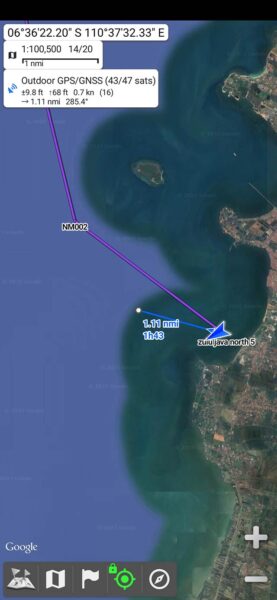
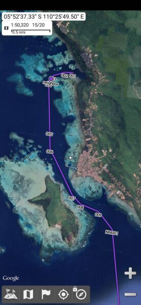
 The app has a bunch of very useful features. Here are a few:
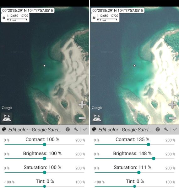
While the app is intuitive with a very well-designed user interface, you can really unlock its power by reading the help pages.
If you give it a try, I hope you find it as useful as I did.
-Rich


