The Magnificent Coromandel Peninsula, Part 1: Hot Water Beach (North Island, New Zealand)

March 12, 2014

One of the North Island’s unique features is the Coromandel Peninsula, which sticks out from the mainland like a thumb sticks up from a hand, parallel but also separate.


At 50 miles long and 20 miles wide, it’s a big place, but its mountainous terrain, single-lane winding highway, and rugged individualist residents give it a remoteness that’s both appealing and challenging. In fact, while the Coromandel Peninsula is a favorite travel destination for New Zealand residents, it’s too off the beaten path for most foreign visitors trying to cover a lot of ground in limited time.

Rich and I had visited some of the Coromandel’s anchorages on its west side, but the best part of this peninsula would definitely be on its east side. This area is famous for having magnificent beaches, a scattering of charming little towns, vacation homes, and beautiful scenery. I couldn’t wait to see it!

Below, a map showing our first destination of the day, Hot Water Beach, and the town where we’d be staying, Whitianga.


Our first hurdle would be the drive to the town of Whitianga part way up the peninsula. From our boat it was an easy hour-long drive to the base of the peninsula, but then the road started to wind up into the mountains. Since it’s only one lane each way, you can imagine how frustrating it is to get stuck behind slow cars and trucks, of which there are plenty, with few turnouts or bypass lanes. It takes a lot of patience to drive on this road, and Rich’s was sorely tested on this drive. Since then, I’ve heard more than one New Zealander say they would never want a vacation home on the Coromandel simply because of this road. There is one area where people fly their own planes in, but that will be the subject of a future post.

Aside from the nerve-wracking road, the scenery is pretty impressive, although getting a good photo from the car was challenging with all winding curves and sudden view-blocking trees. I’ve managed to get a couple of reasonable quality (OK, maybe dubious quality ) to post below.

As we made our way up the peninsula, we passed towns I hoped to visit on the way back. Our first stop today would be a place called Hot Water Beach. The name comes from an area of the beach where hot springs filter up through the sand within 2 hours of low tide. If you dig in the sand, you can make your own hot water pool to soak in. Many people actually bring their own shovels to do this, but they can also be rented on site.

We parked and walked down a pretty path to the beach. My first reaction was to be impressed by this huge stretch of sand! We’d come to see the hot water, but I felt like this area was beautiful enough to be an attraction in itself! The beach was party divided by a rocky area, and we noticed a lot of people seemed to be gathered there while the rest of the beach was nearly empty. We figured this must be where the hot water was located and headed over. Below, a couple of photos from our arrival at the beach. (You can click on any photo to enlarge.)

We soon found ourselves in a small crowd of people who were either digging pits or sitting in the pools they’d dug. We had no plans to dig a pit ourselves but instead went to scout out an abandoned one, stepping into the pool to find it wasn’t very hot. It quickly became apparent the hot water here varies—some spots are hotter than others which was made apparent by only a few of the pools being steamy. We also learned that one has to dig reasonably deep to get hot water; so maybe that was the difference, but when we walked by pits at the shoreline, I merely dug my foot down in the sand and found a hot spot.

It was pretty interesting to watch the crowd all bunched together, sitting in pools ranging from shallow to a couple of feet deep, partying while trying to enjoy sitting in hot water under the summer sun. Yes, the whole thing seemed rather silly, but everyone seemed to be having fun. Below, a gallery of the hot water area…..

Plus a panorama of the crowd……

And another….

Rich had taken the panorama photos while I stepped into the ocean to get the best view of the beaches. What a contrast to see the quiet majestic beauty of this entire beach vs the little “Disneyland” over by the rocks where the hot water was. Below, some photos of the quieter areas away from the hot water.

It was time to head on as I had more in store for us today, an area close by called Cathedral Cove. –Cyndi

A Traveler’s Dilemma (Tauranga, North Island, New Zealand)

March 9 – 11, 2014

To travel is a wonderful thing, but it’s not generally easy or restful. There’s always too much to see in the time allotted, so choices, some of them difficult, need to be made along the way.

I was facing just such a choice after we returned to Tauranga from our road trip. It would have been nice to relax for awhile, but bad weather was due to arrive in the coming days; then we had friends coming to visit sometime in the following week or so. Since the nights were getting colder, we’d just purchased a space heater, a reminder that fall was on the horizon and our time in New Zealand getting shorter. I figured if we could fit in one more trip while before the weather system arrived, it would put is in a better position to wrap things up when we had good conditions again.

What could we do in two or three days? The Coromandel Peninsula would take a little longer than that, but if I broke that up into two trips, we could do the furthest reaches of it now and closer areas later, as day trips. With that, I got on Wot-If to look for a hotel deal in an area called Whitianga. When I found one, I approached Rich about it, not sure he’d be thrilled about another trip so soon. But he was agreeable; so I booked the hotel and made plans for us to leave the following morning.

Now the most intensive planning really began as I figured out how best to do things. As it happened, the two biggest sights needed to be done around low tide; so I had to plan our timing for those; then figure out how best to fit in other things nearby. Travel planning is like putting together a puzzle, and it always takes more time and work than one might think. Each round of planning brought up more questions that needed to be researched; so I worked on this off and on over the course of the day. Finally, I had a plan that would work out for us; the best news being that we didn’t have to leave until 9am.

This may seem like an unusual thing to be writing about, and normally I wouldn’t think to do it. But I met someone months later, a woman cruising with her spouse and children in New Caledonia, on whose shoulders it had fallen to plan family outings in this place where the language was French and travel information was not well laid out or even downright elusive. I was telling her about a small road trip Rich and I were doing there, and she wondered how I managed to pull it together. So I told her about sitting in front of the computer with whatever brochures I had, my Lonely Planet Guide, and then Google to hopefully answer my questions and map out our route. Sometimes I ‘d end up combing through other people’s travel blogs to get my answers (thank you travel bloggers) or use Google Street View to “drive” down a road and figure out where something actually was.

Bottom line: this type of planning takes more time and effort than it seems it should; but if you put in the work, the rewards are great. Thankfully during the years we’ve been cruising, this process has gotten much easier as Google has gotten better. Later I ran into my friend and she’d planned a similar outing, saying she just imitated me; sat in front of her computer with brochures and books and Google and pulled it together. I was happy this worked out and have to say this was one of the nicest compliments I’ve ever gotten.

Meanwhile, for this post, I have a round-up of the second-choice pics that didn’t make it into photo galleries from our previous trip down to Taupo, Tongariro, New Plymouth, and Waitomo. (You can click on any photo to enlarge.) –Cyndi

Inventory Photos

December 28, 2021

Where the heck did I put that extra thru-hull fitting? Where did I put the extra solder? These are daily questions aboard Legacy. But we have an easy answer: Look in the Inventory Photos folder!

I can’t seem to make myself keep an accurate, up-to-date inventory of what’s where. I can manage to take photos as I add and remove things from their cubbyholes. Then to find something, I just flip through the photos on the computer.

Every so often, when I clean out a bin, I retake the photos for an up-to-date inventory. This system has been working great for about six years now.

Just today I found this in Bin 6…

As you can see, the photos don’t need to be good, just recognizable.

-Rich


Upcoming Trip???

December 29, 2021

We’re just sharing this possibly embarrassing plan with you to show you our thought process at this time. I think it’s similar to that of many other cruisers – not the specifics but the basic concept of trying to figure out what to do in these challenging Covid-19 times.

We started talking a while back about sailing back down to Stewart Island this (southern) summer. In the interactive Google map below, you’ll see that it has evolved somewhat. (Click on the leg number to see the to and froms.)


The total voyage distance would be 3,088 nautical miles and at an average speed of 5.2 knots, would mean sailing for 594 hours or 24 days. Yea, there’d be stops along the way, but that’s a lot of time at sea. Our longest passage ever was almost 3,000 miles from Hawaii back to California.

This would also mean sailing much of the trip in extreme (for us) southern latitudes where it can get very rough. Sure, we’d wait, and wait, and wait for weather but still…

Man, I hope we come to our senses before we try this stupidity! -Rich

Road Trip Part 12: Waitomo’s Glow Worm Caves (North Island, New Zealand)

March 08, 2014

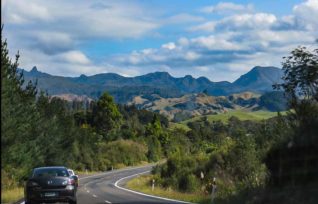
I had one more plan in mind for this particular road trip. Looking at routes back to our boat in Tauranga, I’d noticed one of them would take us through an area called Waitomo, an area on my must-do list for this season. It was near the west coast and rather out of the way; so what better time to do it?

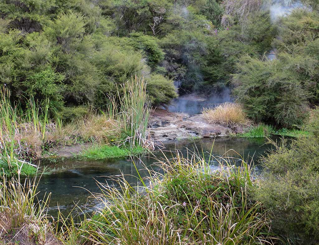
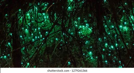
What’s so special about Waitomo? Glow worms! These worms are actually the larval stage of a particular gnat. They make sticky threads to capture small flying insects that are attracted to a bioluminescent light that emanates from their bodies. They’re generally found in caves but can sometimes be found in the thick bush around dells or hollows. The common element to these places is that they are dark and have a stream or river running through them.

Bug larvae may not sound very glamorous, but to witness the emergence of their bluish glow, gradually materializing when lights are turned off (or dusk turns to dark), is a wonderous experience! In caves, glow-worms look like thousands of stars on the ceiling above, and along riverbanks they look like fairy lights peeking out from bushes or hollowed out logs.

While the worms’ preferred environments are common throughout New Zealand, glow-worms are actually not common at all; it’s not like a person can just go into any suitable forest and find them. Thus places where they dwell are fairly well-known.

Rarely these are small, local spots like one nestled in McLaren Falls park which we’d visited the previous year. Sometimes the spots are more mainstream, such as Waiomio Caves near the Bay of Islands or Abbey and Waipu Caves, not far from Whangarei (the latter two free of charge because they’re located in New Zealand conservation parkland).

But without a doubt, an area known as Waitomo is the superstar destination for glow worm caves. It’s basically a small rural area, but the caves here are one of New Zealand’s “big gun” attractions, a stop on every tour-bus itinerary. In fact I’d been there years ago on just such a bus, but I wanted Rich to see it, too. Actually the attraction aspect of the Waitomo caves had developed quite a bit since I was last in New Zealand. Not since Rotorua had we seen such an extravaganza of tourist activities!

Of course there’s an i-Site Centre (New Zealand’s main visitors centers) where one can stop to get information on the options offered and book activities. Options to choose from include their most famous cave, called the Glowworm Caves. This tour entails a walk through a network of cave passages and ends with a boat ride through glowworm grottos.

Second in line is the Aranui Cave which doesn’t have glowworms but does have spectacular stalactite and stalagmite formations. There’s also the Ruakuri bushwalk and cave, guided hikes into the backcountry to see even more remote caves, and finally, thrill-seeking activities such as black water rafting (rafting in caves), abseiling down into sinkholes, and climbing adventures. It should not come as a shock that these activities aren’t cheap.

Thankfully I had chosen our options ahead of time; coming to this i-Site without having done some research would be overwhelming. I’d hoped to go blackwater rafting at some point, but for today the obvious choice was the two-package deal for the most famous of the caves, the Glowworm Caves and the Aranui Cave.

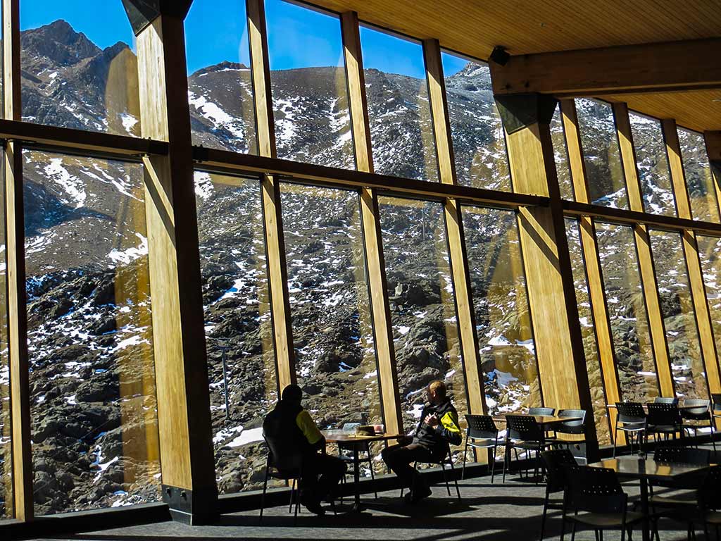
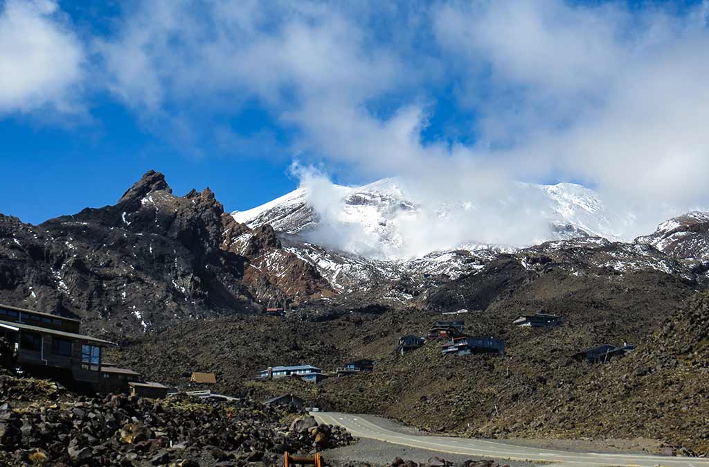
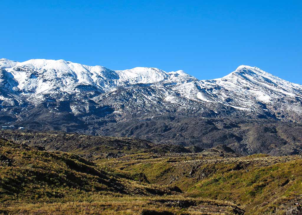
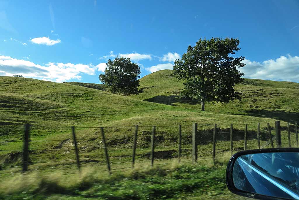
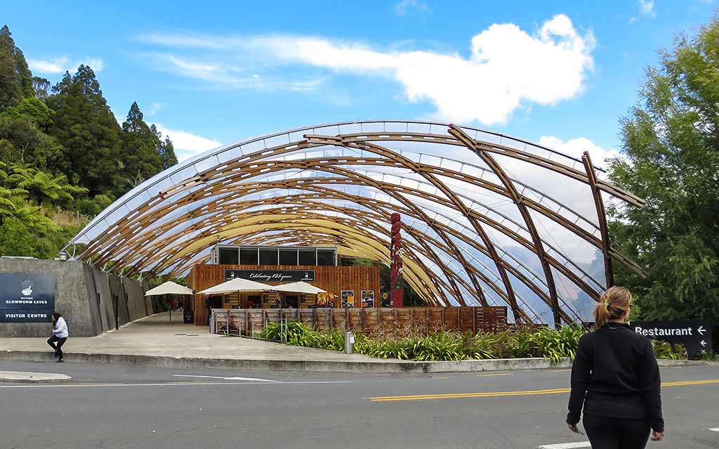
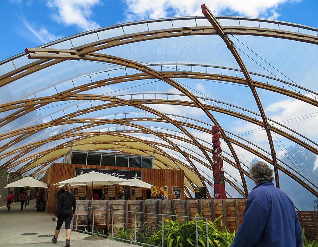
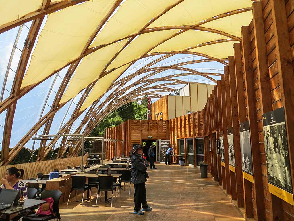
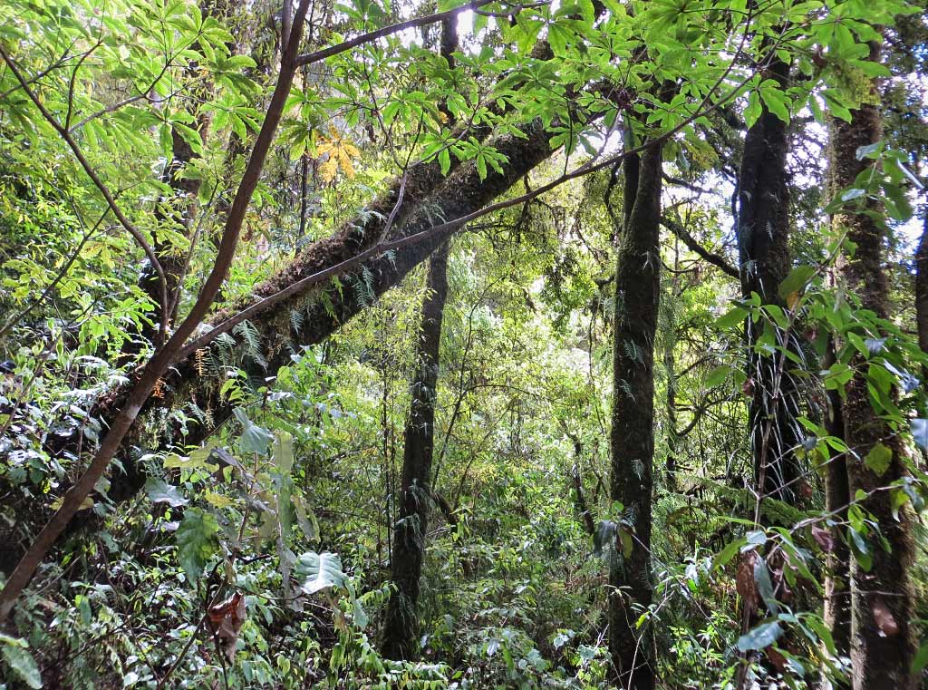
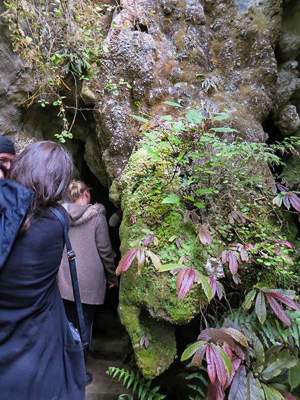
Arriving at the caves we were impressed by the Maori-themed visitors center. This beautiful structure included a restaurant, theater, exhibitions, a cafe, gift shop and, of course, ticket purchase counters. Since this area is Maori-owned land, the guides and workers are of Maori descent. Below a few photos of the visitors center and a photo from one of the trails leading to the caves.

We made the short hike to the first cave system, the Glowworm Caves. Our guide was an older woman who, like many people who’ve been in the tour business a long time, was somewhat cranky with us tourists (who admittedly can be annoying). This guide reminded me of an elementary school teacher who’s seen it all and is tired of dealing with children. She began our tour of the cave by ordering us NOT to use our cameras. Of course people were sneaking and using their phones, and she admonished the group, “Turn off your cameras; I can see you!” People dutifully turned off their phones, at least until they were out of view of the guide.

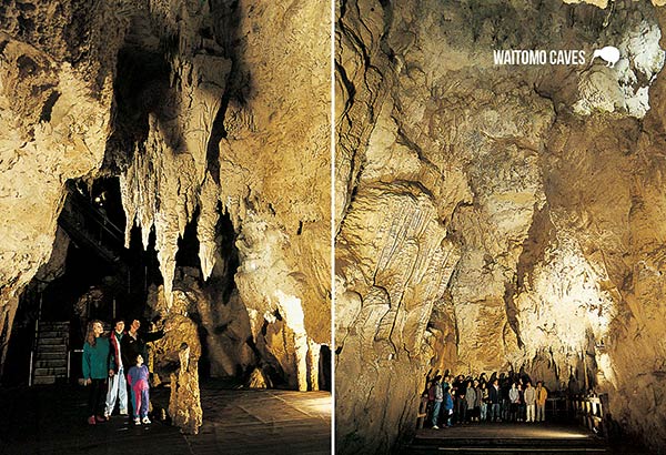
We had managed to get a couple of photos but with no flash they didn’t turn out well, which is too bad because this cave was impressive. It was beautifully lit and had three levels linked by a vertical limestone shaft. After making our way through an area called The Catacombs then down a level to the Banquet Chamber (it seems the cave’s first visitors would light a fire and eat here), we descended to the third level. Here, we entered The Cathedral, a high-ceiling area that makes an acoustically perfect auditorium. Aside from the glow-worms, the Cathedral is the cave’s most famous feature. The Vienna Boys’ Choir are among the many famous singers who have made trips to perform here, but tour groups always stop so anyone with a beautiful voice can give it a go.

Earlier a group of guys from India had joined our group at the last minute before we started this tour. My initial reaction was to hope they’d go with the group behind us so we’d have fewer people, but I ended up being so glad they were with us. After telling us about the Cathedral, the guide asked if anyone would sing, but there were no takers. She was stubborn, though, and eyed the Indian guys. They were shy and didn’t want to sing, but after getting the stink eye from the all-knowing “teacher,” they gave in. The song was an Indian Swami song, and it was perfect for this atmosphere! What a moment sitting there in that spot listening to those beautiful voices singing an Indian hymn. I realized how lucky we were because we haven’t heard singing from any of the groups ahead of us or behind us.

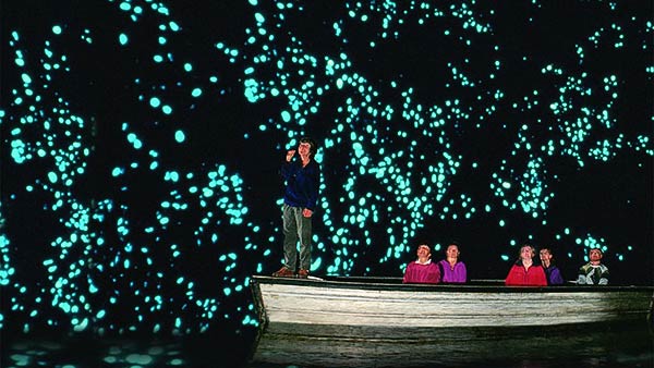
We next headed to a cave area with our first few glowworms and our guide gave a talk about them. A bit later one of the Indian guys asked how the glow worms get in here, and she snapped that she’d already explained that and if they’d quit talking among themselves they would have heard! Rich remarked, “Yes mam!” Realizing she was being snappish, she softened and answered the question. We then walked down to the cave’s waterway where we boarded a boat. From here, a guide on the boat pulls on ropes stretched above the river to quietly move it through the water as glowworms best show themselves in silence.

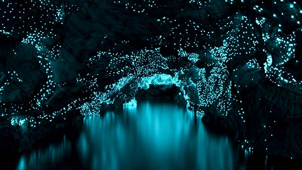
Our boat headed into the darkness, and a starry sky of glow-worms began to appear overhead. It was very dark, but there were so many glow worms covering the surfaces of the cave that we could see the rocky shape of the cave’s surfaces  which made for a surreal 3-D effect, elevating the experience beyond that of simply looking at a starry sky into a feeling of being in it and floating through it. It was a beautiful and wonderous experience, and I wished we could stay here and camp out for a night. Sadly about 10 minutes later, we emerged from the cave.

Because we weren’t allowed to take photos, I’ve borrowed a few from the internet. They include (from top left) a photo showing what glow-worms look like in the bush (not at Waitomo), photos of The Cathedral from a postcard, a photo of the Glow Worm Grotto, and a promotional photo of a cave boat from a brochure.

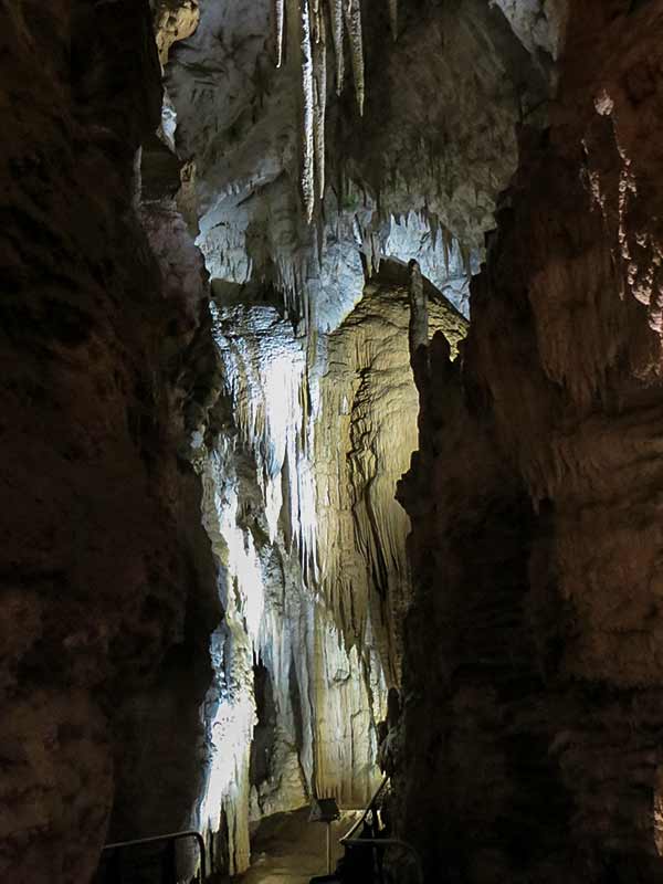
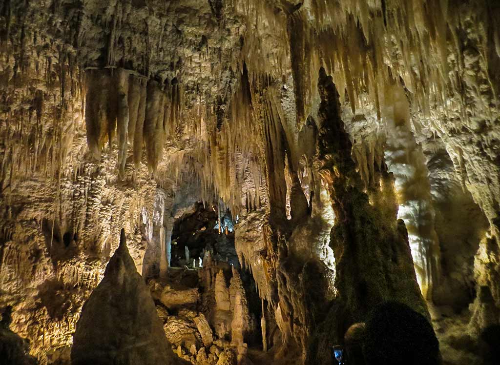
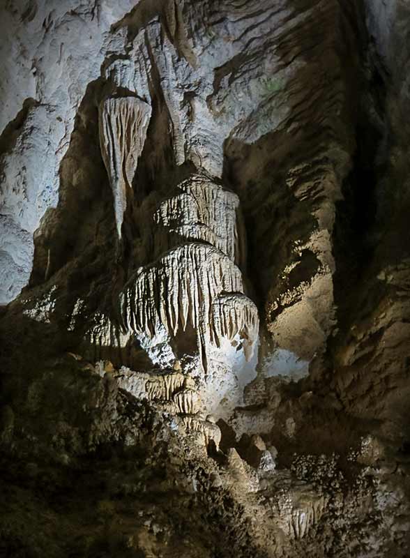
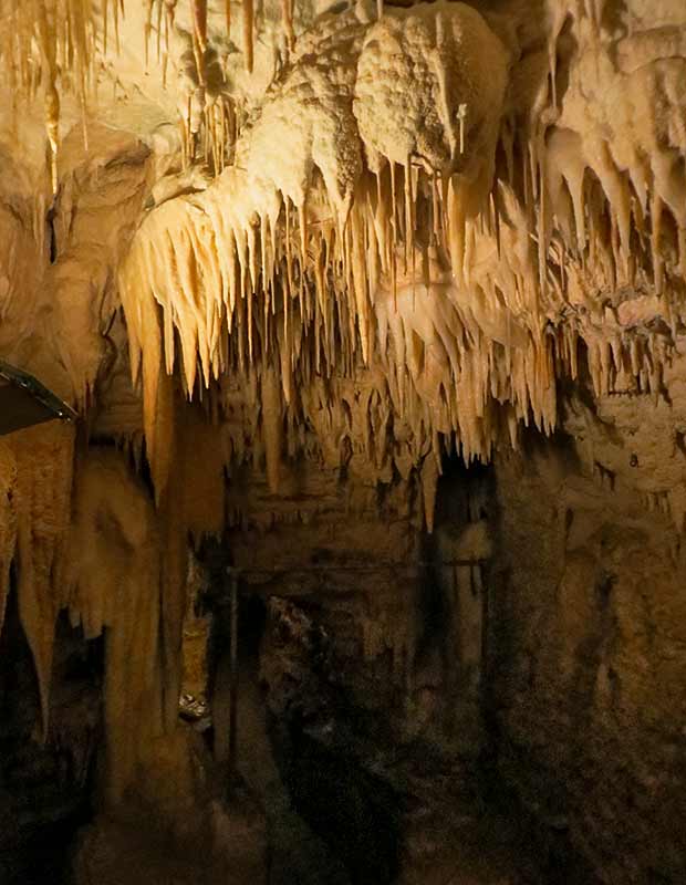
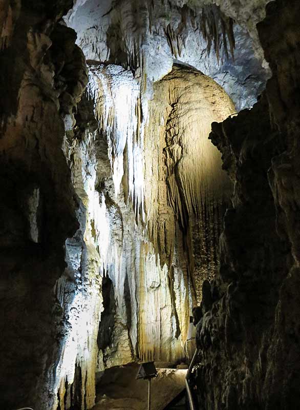
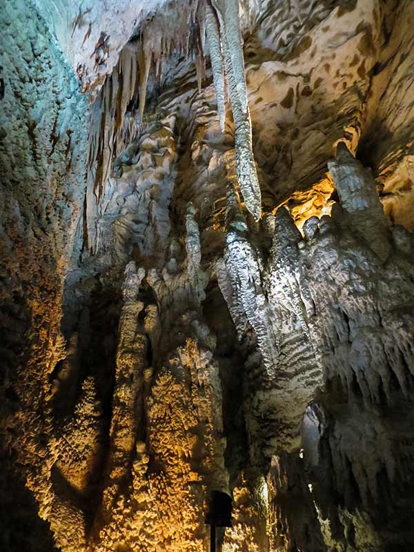
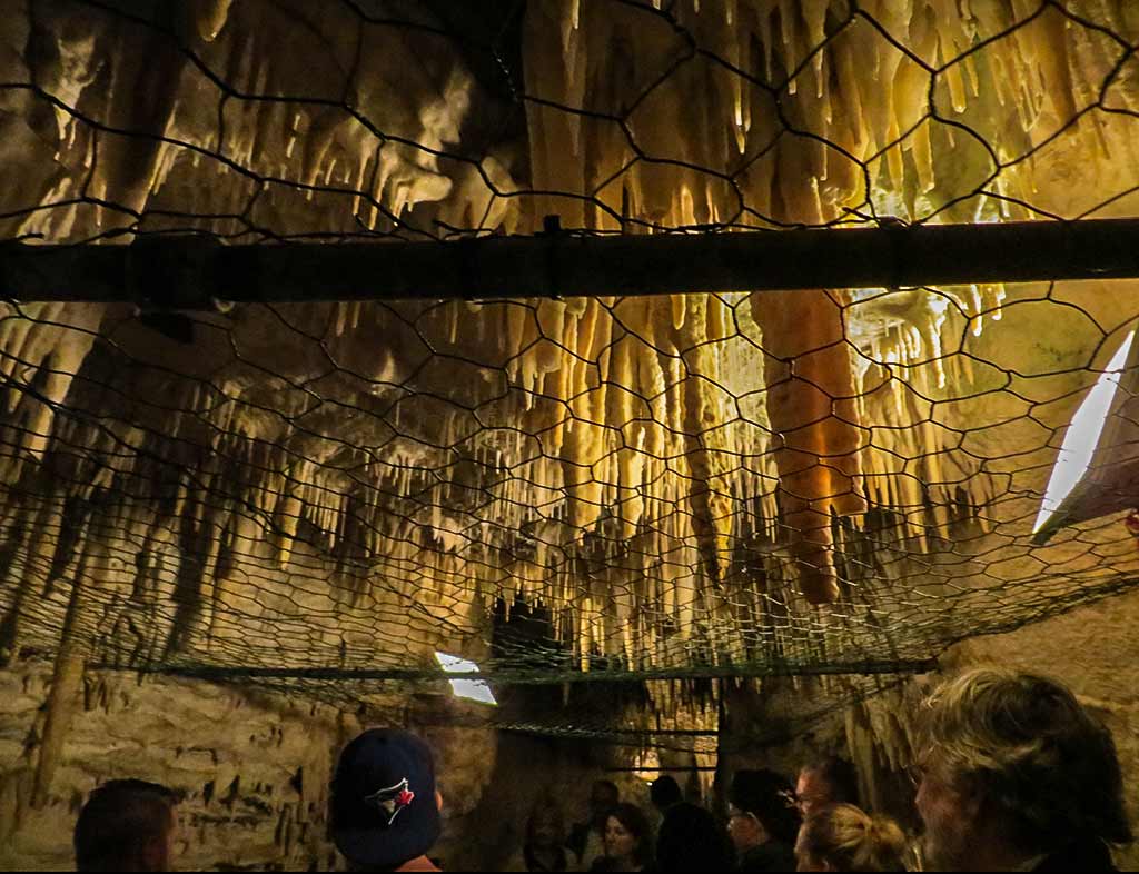
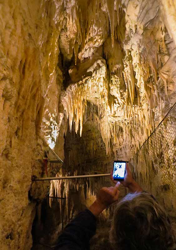
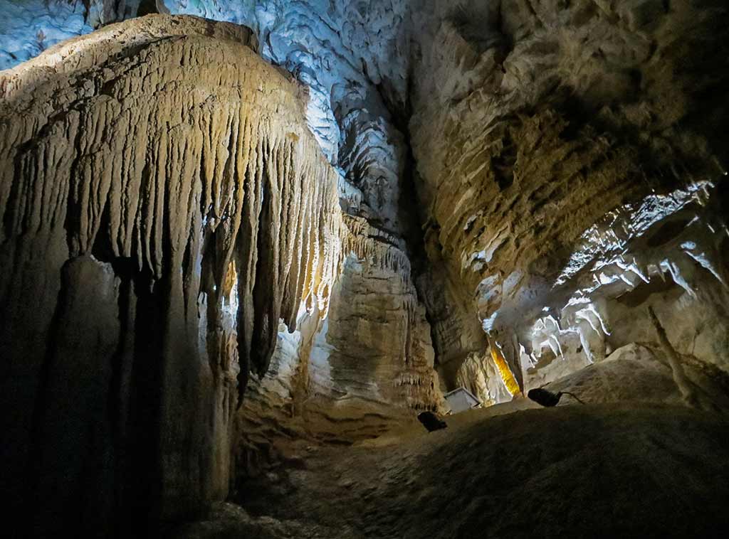
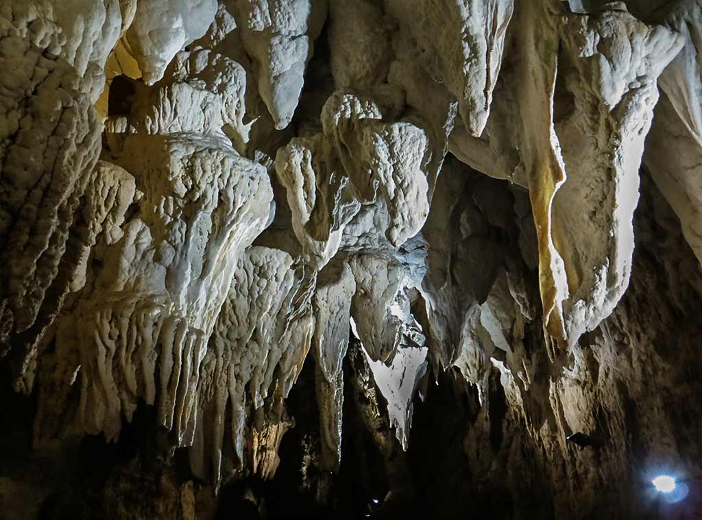
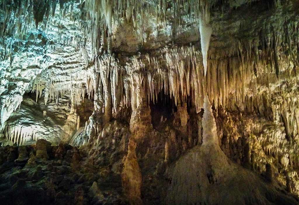
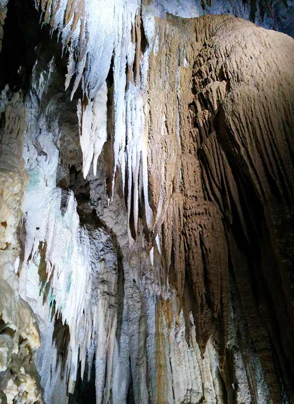
After heading to the Visitors Centre and checking out the cafe, we decided to skip lunch and head to the next cave. It was a good choice as this time, we ended up with a kind and lovely young Maori woman as our guide, who had plenty of stories about what it was like to grow up here. To start our tour we went through a deceptively small opening before emerging into to a spectacular scene of stalactites and stalagmites. From here we took a series of stairways and paths to the back of the cave, marveling at what looked to be an amusement park attraction or movie set come to life. Thankfully we were allowed to use our cameras in this cave, from which I’ve made the gallery below (click to enlarge any photo).

What a treat this was–I was very happy with our choices today! Now it was time to head home. We passed through a couple of interesting towns, one of which was Otorohanga known for its murals of Kiwiana, nostalgic New Zealand classic items such as a toy bee most children have owned, gumboots, a kiwi bird, and other items.  The other area was called Cambridge, a lovely country area where horses grazed in roadside pastures. I had no need to ever see Otorohanga again, but Cambridge would be worth a visit.

It actually felt good to arrive back in Tauranga late that afternoon. Our trip had only lasted a few days, but there was so much packed into it that it felt like we’d been on a grand adventure. To celebrate we had some champagne and looked at our photos before settling in to watch Survivor. Tomorrow, I’d start thinking about the next trip. –Cyndi