Heading to Great Keppel Island (Queensland, Australia)

Posted March 11, 2023 about
August 31, 2022

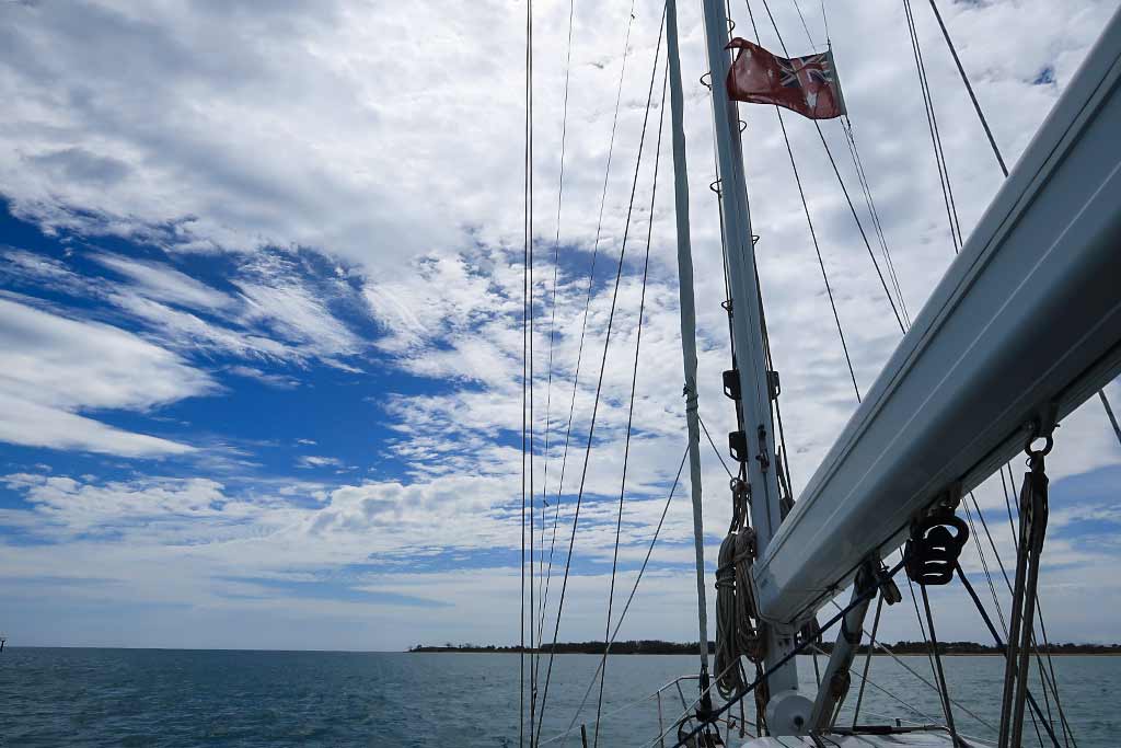
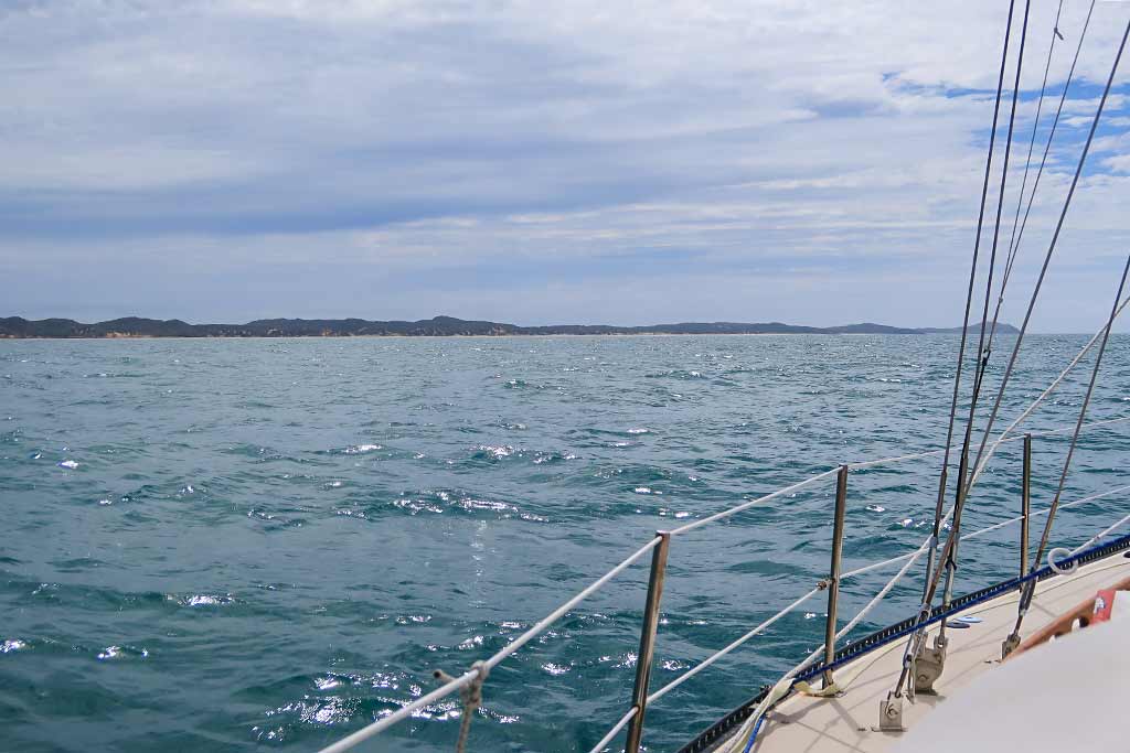
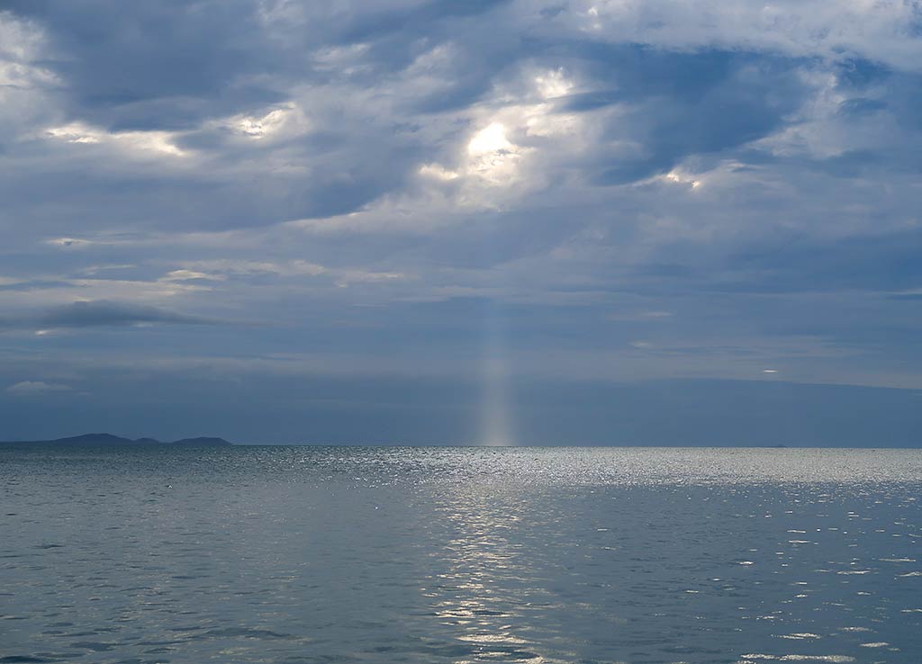
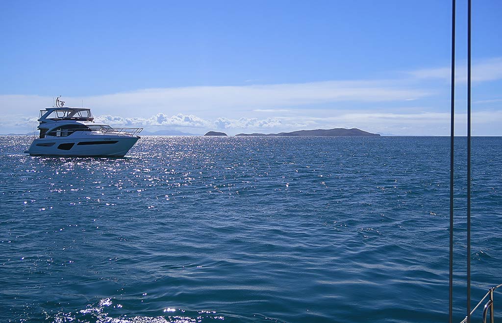
After a leisurely morning we pulled up our anchor and set off on the 27-mile trip to Great Keppel Island. The weather conditions were much nicer today as we motor-sailed along in moderately light wind, 12-knots on a broad reach, the sea only marginally bumpy.

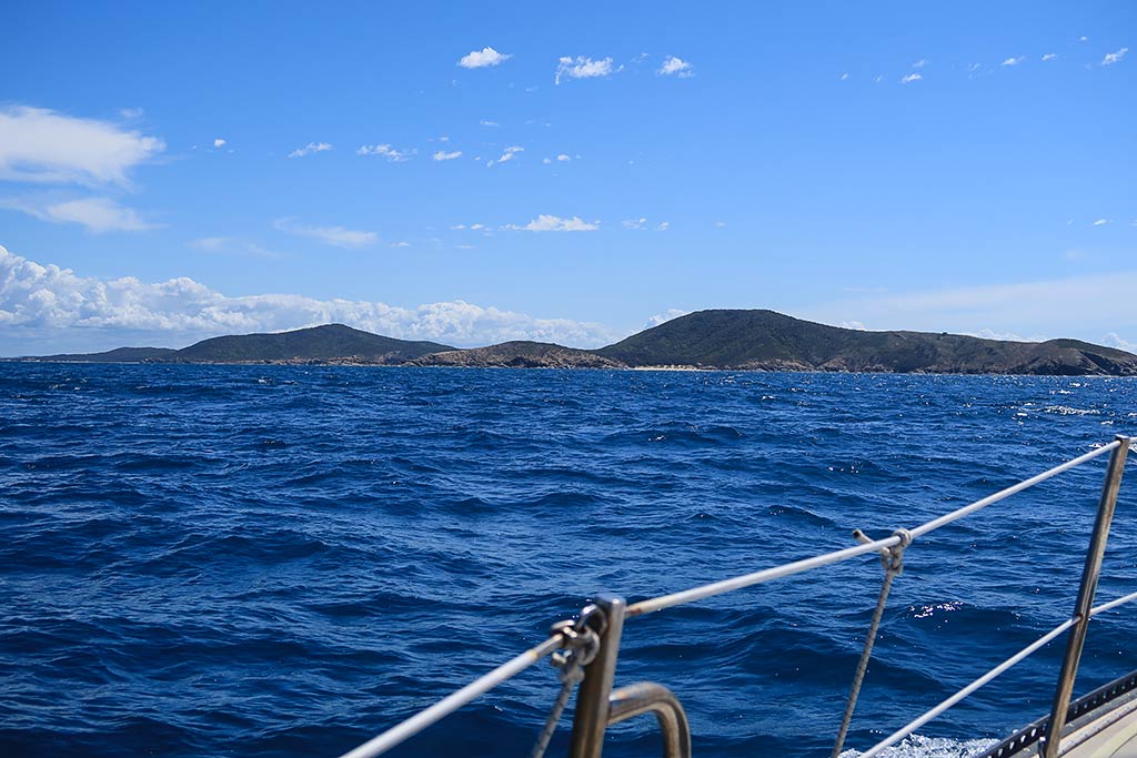
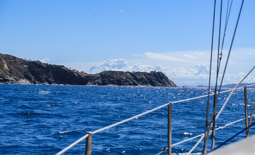
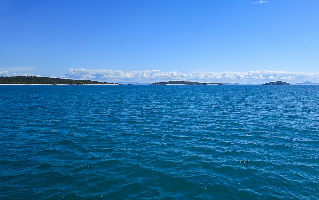
As we neared Great Keppel, we passed by the little island just south of it, Humpy Island. It was tempting to stop and check out its bay and pretty beach, but we really didn’t have the luxury of time to do so. Conditions were now picking up as the wind shifted to our beam, now stronger at 15 knots, the sea getting bumpier. At this point we were just anxious to get to our anchorage.

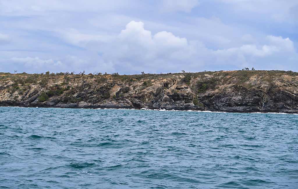
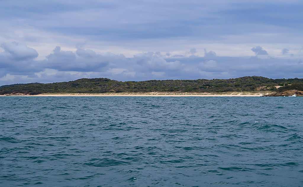
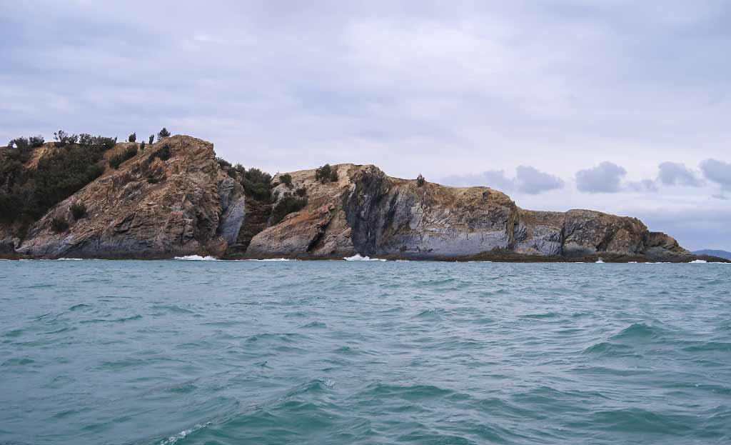
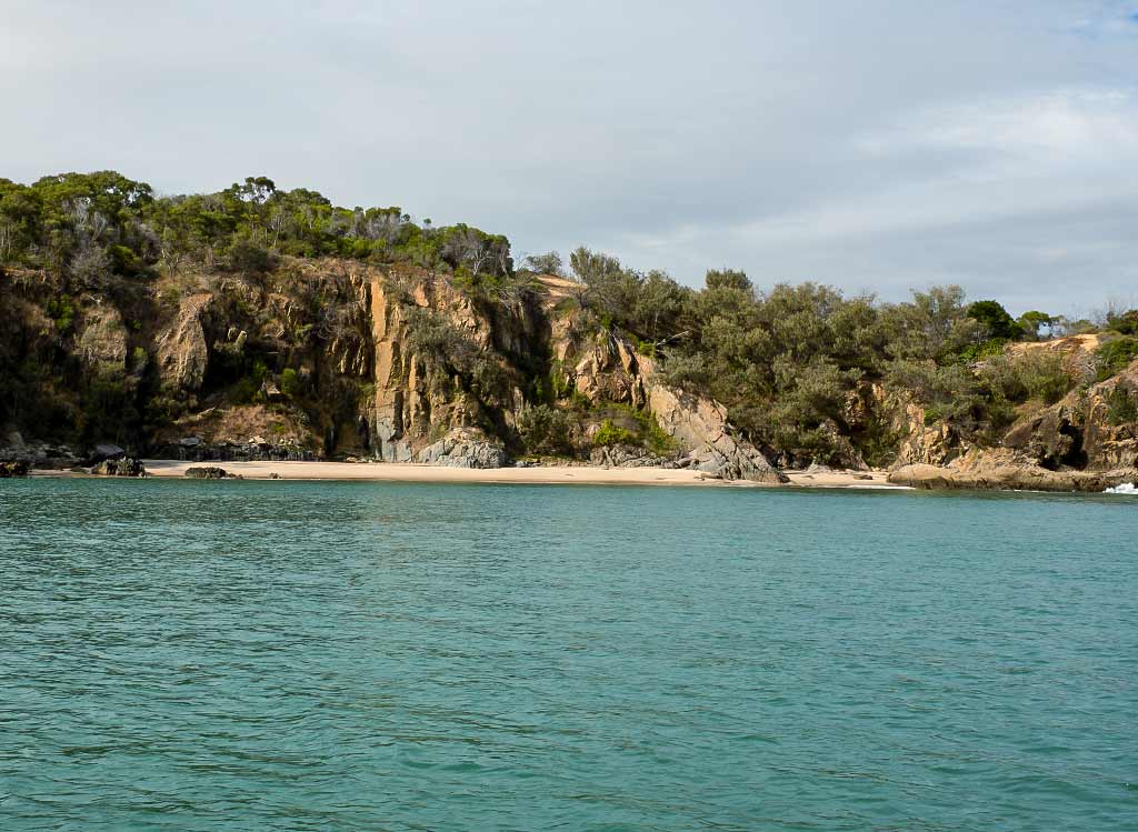
Soon we were motoring up the east side of Great Keppel and getting our first close look at the island. Huh. It wasn’t that it didn’t look nice, but it was hardly the “remote tropical paradise,” that we’d heard about. I realized at this point that I might need to temper my expectations (Rich didn’t really have any expectations to temper).

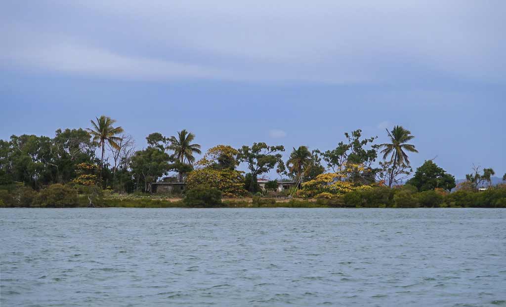
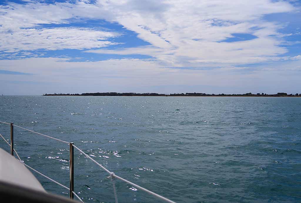
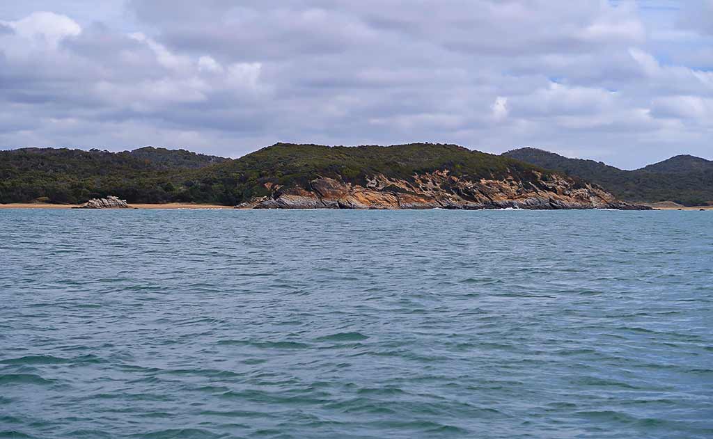
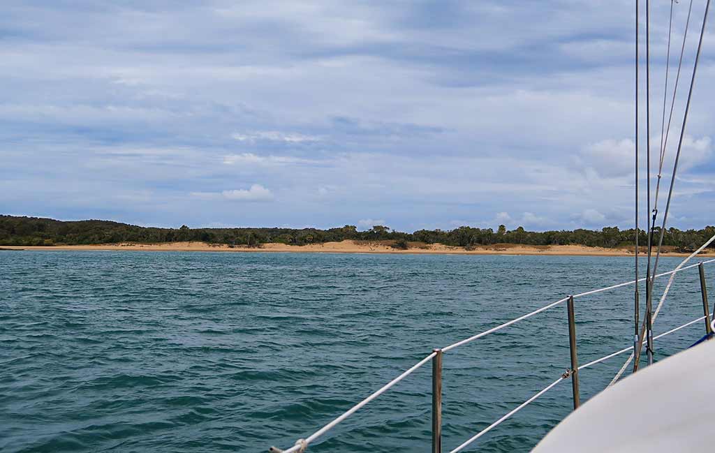
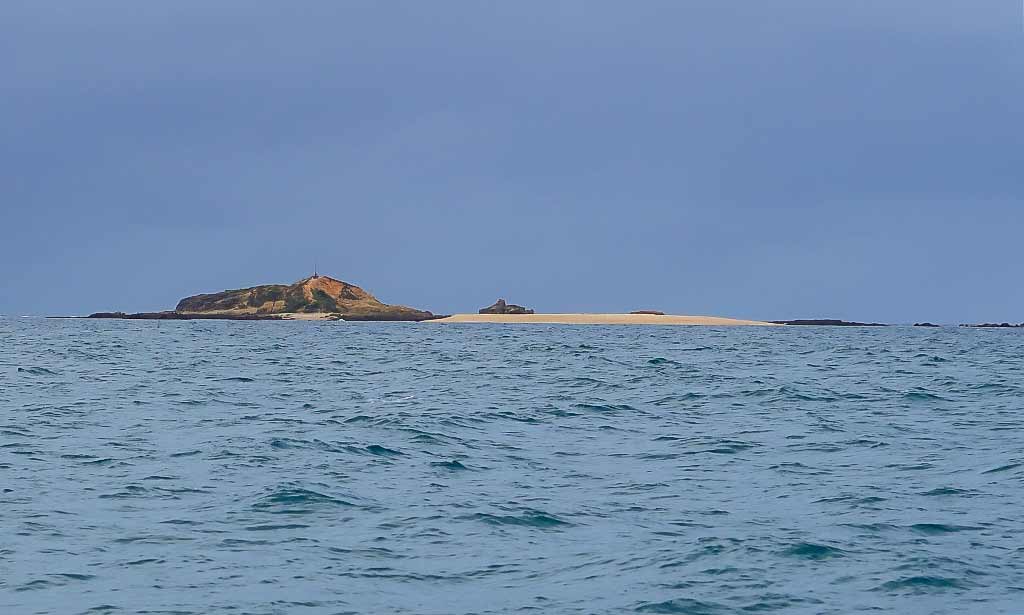
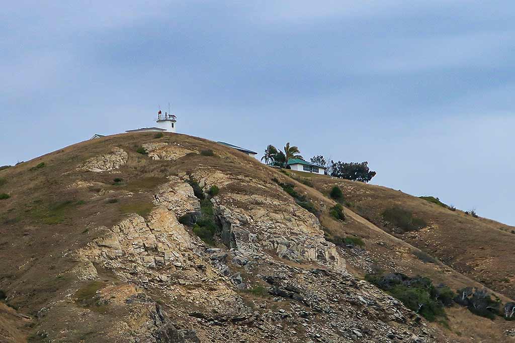
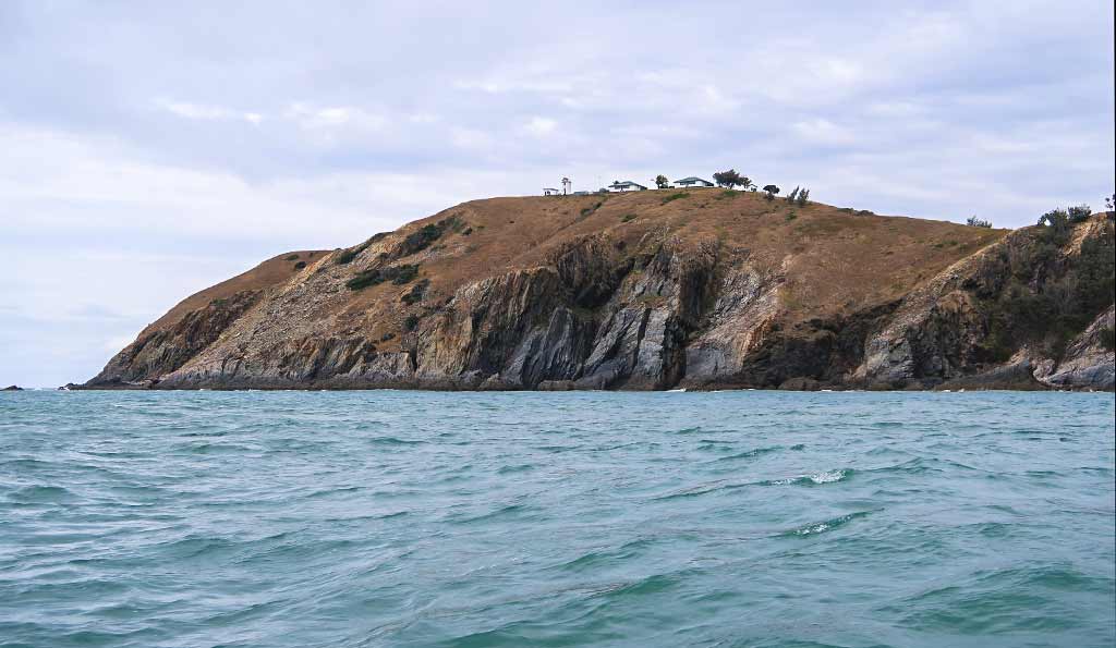
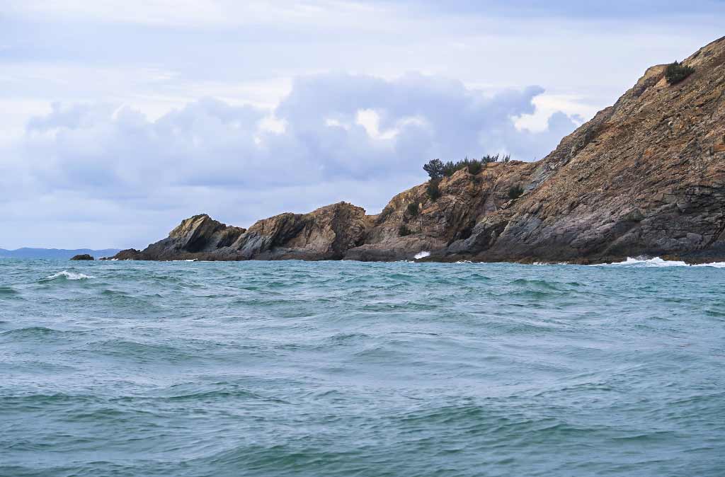
Below, a few photos as we motored up past Great Keppel to our anchorage (Click to enlarge and scroll on any of the photos below.)

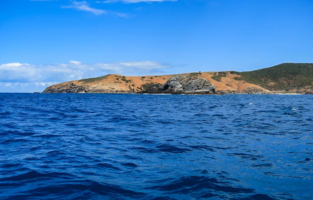
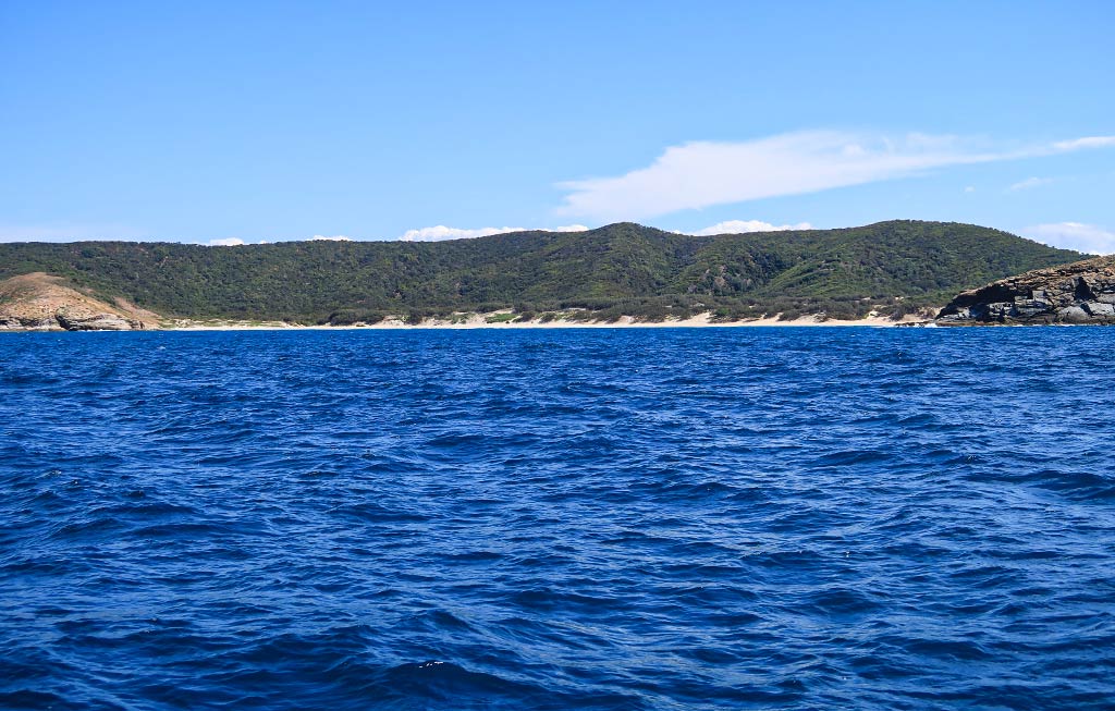
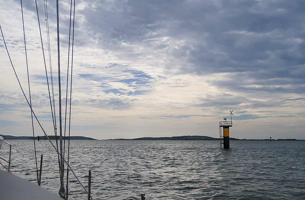
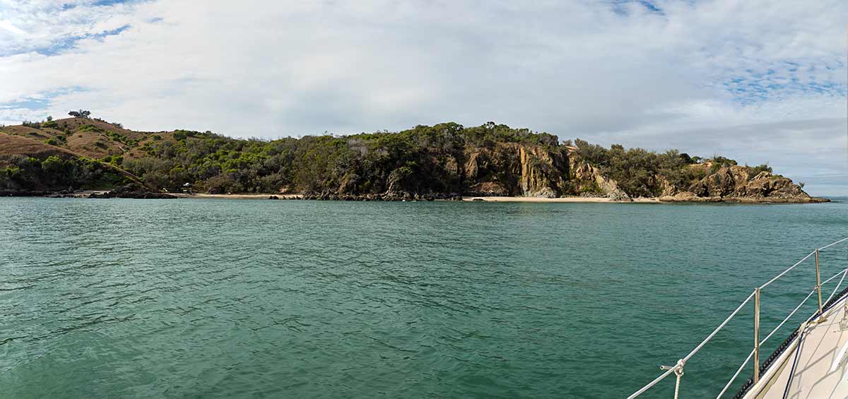
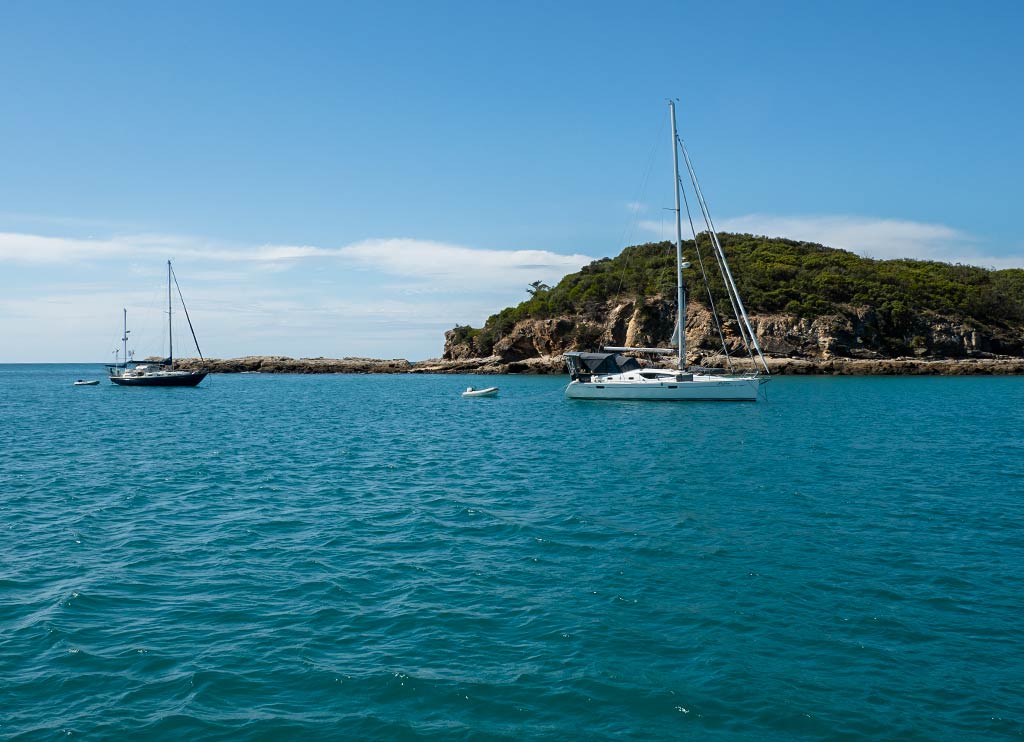
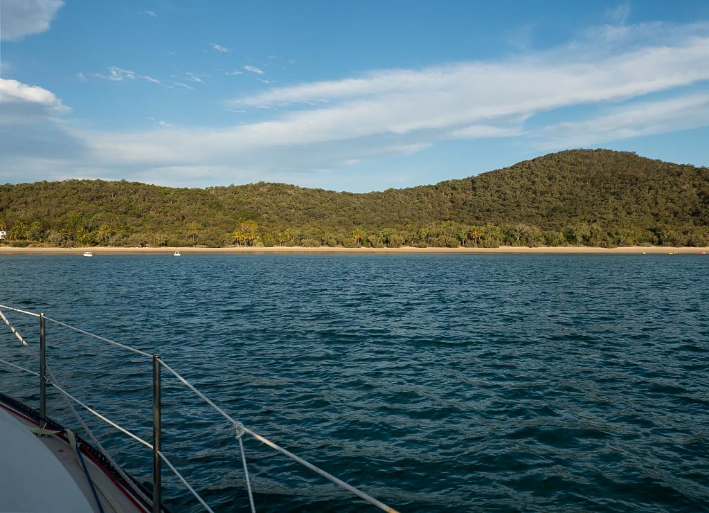
We rounded the NE point and passed by a couple of small but exposed beaches before getting a first look at our anchorage, the bay off Svendsens Beach. The bay looked alarmingly crowded with boats, the last thing one wants to encounter on arriving!

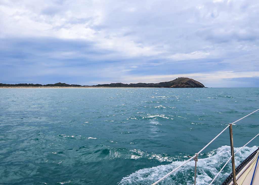
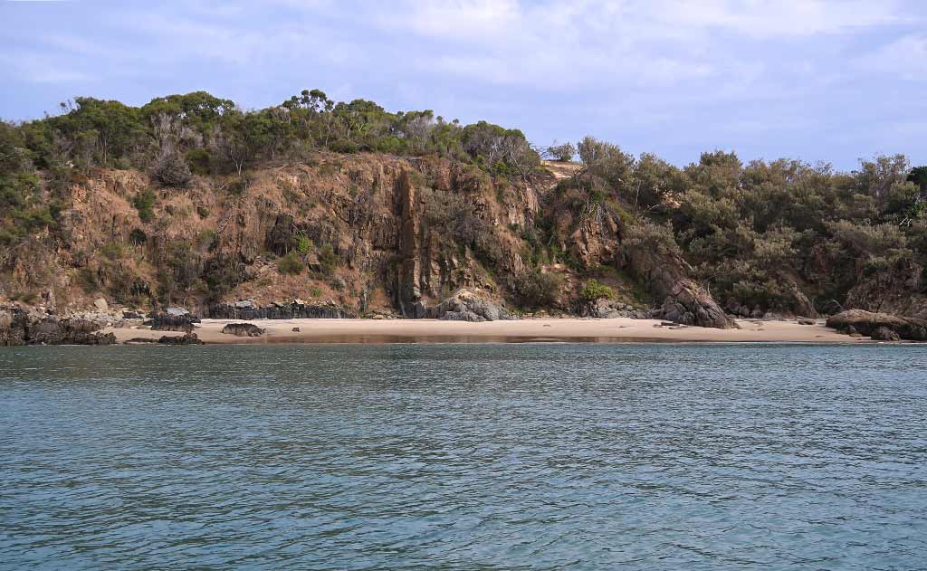
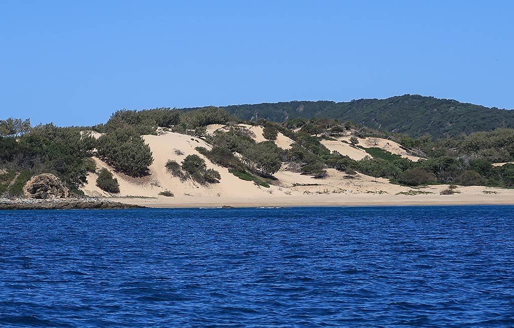
We motored past the long, low rock arm which stretched out from the east headland, creating a natural breakwater for this part of the anchorage. Still, enough swell wrapped around it to create waves that enabled a paddle-boarder to surf alongside it. It looked fun for him, but our objective was to get in close enough to shore to avoid the swell effect known as “The Keppel Roll.”

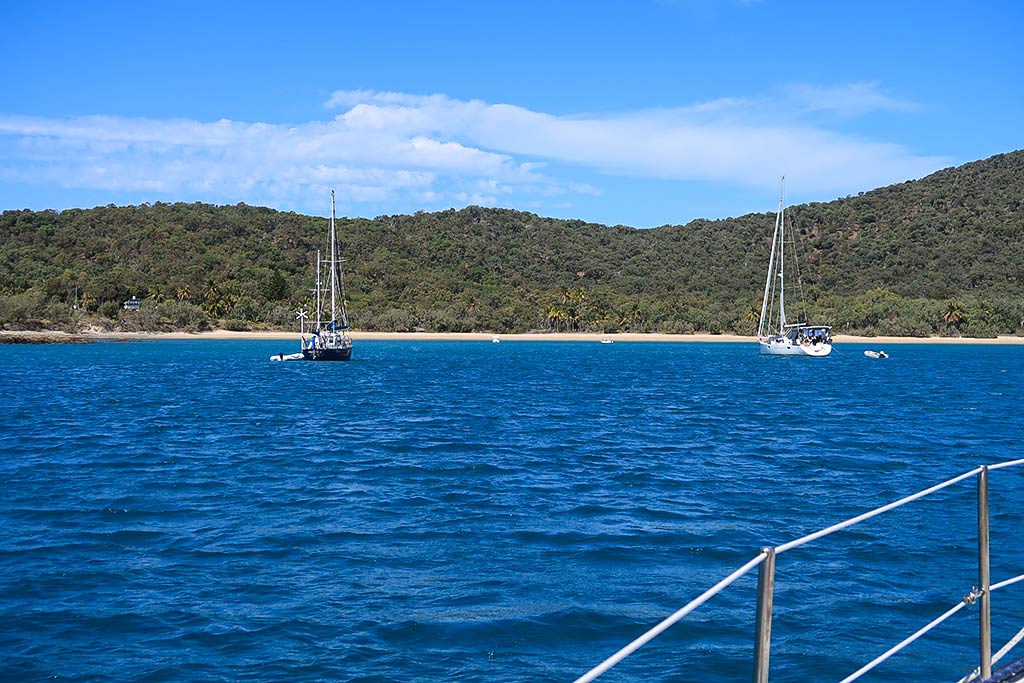
What a relief as we motored past two boats to find there was enough room between them and the shore for our boat. As we set our anchor, the wind that had been behind us now felt like a wonderfully refreshing breeze coming over the island, keeping us cool and comfortable. Best yet, we were out of the swell! I couldn’t say the same for the boats anchored further away from shore, where we could see some visible roll going on.

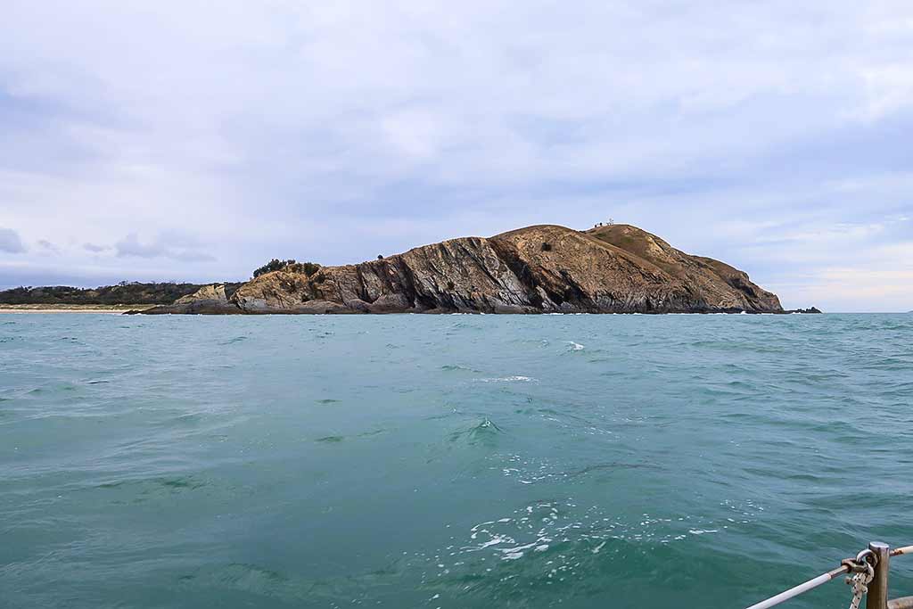
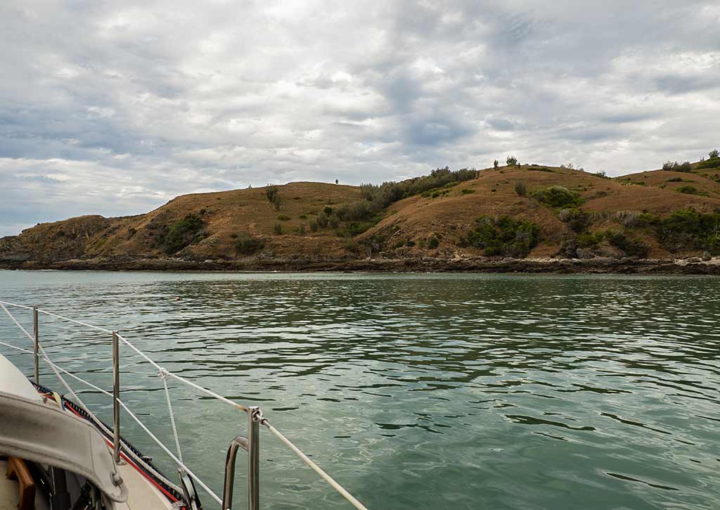
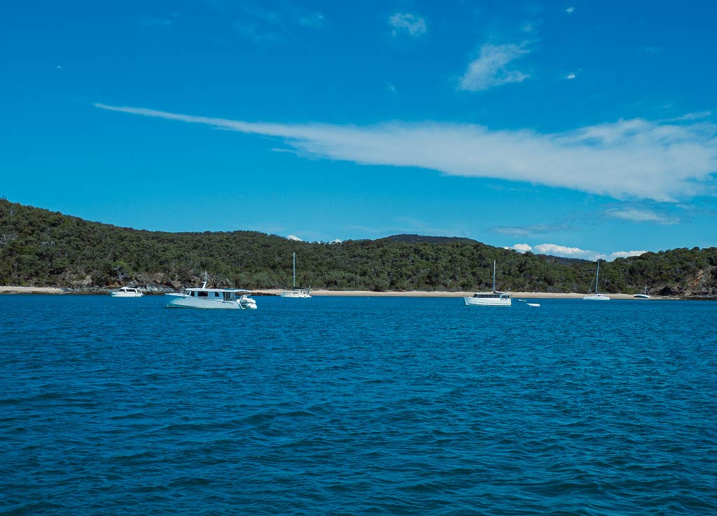
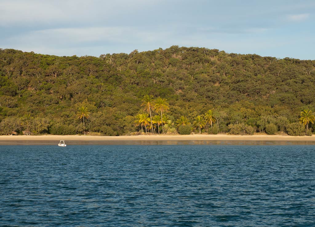
As far as the scenery, we were in a large, semi-circular bay with two light-sand beaches (Svendsens Beach and Second Beach) divided by a high bushy outcrop. The island was hilly, densely covered with tree and bush-type vegetation. It wasn’t what we’d consider tropical–it looked more like the drier forests of the outback. There were a few palm trees by the beach, probably planted by the owner of a vacation retreat as, from what we’ve observed, palm trees are not native to the Barrier Reef islands.

Beyond the west headland we could see part of a longer, more deeply indented beach called Leekes Beach. It looked lovely; so I was surprised to see only one boat over there. What gives? Only when I looked at the chart did I realize its best-protected area was quite shallow. (Those people with shallow draft boats sure get a lot of places to themselves!)

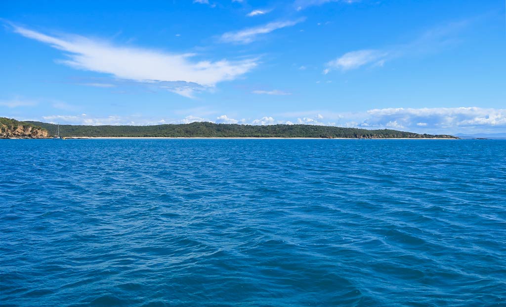
To the west, adding to the attractive view, was a nearly-adjoining island called Middle Island and just above that, Miall Island. They were smaller, lower and drier versions of Great Keppel with beautiful-looking beaches that belied the fact they were actually exposed to prevailing wind and sea conditions. The fact is that the weather would have to be unusually calm to anchor off those beaches comfortably.

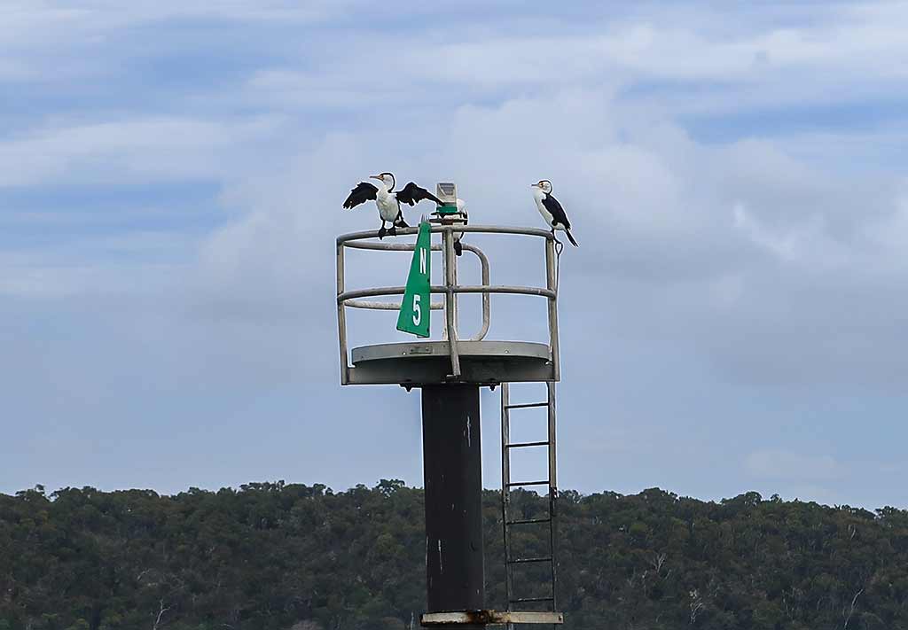
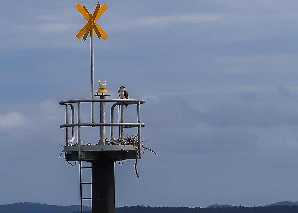
Scattered to the east were rock islets and off in the distance, the North Keppel Island group. These gave our anchorage the always-appealing look of being surrounded by islands.

I sat outside to gather my impressions of this place, held in such high regard by so many. We’d officially crossed the border into the tropics as we sailed over the Tropic of Capricorn latitude after leaving Gladstone. But in spite of a few fledgling signs, like slightly warmer weather and streakier clouds, this didn’t look or feel like the tropics yet. Meanwhile the scenery, while not exactly jaw-dropping, was plenty attractive enough to make me see this as a worthwhile stop.

It was a sunny day and we considered going ashore, but the prospect of blowing up our dinghy and making the effort to do a land excursion in our late-afternoon tired state wasn’t very appealing. Why not just do it tomorrow? (Spoiler Alert: tomorrow might be cloudy.)

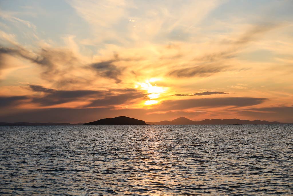
For now, we enjoyed a relaxed afternoon and a lovely evening in blessedly calm spot, something we would come to appreciate when later hearing how rolly it had been for others.

Tomorrow we would go ashore.–Cyndi

Our New All Electric* Galley

March 10, 2023

No, not that one.

This one…

(*All Electric Toasting and Coffee Water Heating)

There seems to be a big move to all electric galleys in boats. I’m not sure that idea really works for me. Electricity is an expensive and scarce commodity on a small boat. I suspect that many people that go to electric cooking end up running the engine and/or generator often to keep up with the electrical demands.

But we took a small step in that direction. Cyndi always wanted a toaster but I was Mr. No-That-Uses-Too-Much-Electricity. With our new lithium batteries (over a year old now, but still feels new to me), I thought what the heck. We could spare a few amp hours. So off to the discount warehouse we went to buy a $7.50 toaster (Australian Dollars).

This toaster is amazing! It’s better than any expensive toaster we’ve ever had, always producing golden brown, perfectly toasted toast. Now Cyndi calls me Mr. Toast. This worked out so well, we decided to take another step into the new millennium – an electric water kettle.

Propane is getting hard to find…

Probably 80 percent of the cooking gas we use (propane or LPG) is for heating water for coffee or tea. Propane is getting harder and harder to come by, with most gas filling stations in the South Pacific disappearing and the widespread adoption of exchange tanks instead. We can’t use the exchange tanks without major boat reworking as we have a horizontal tank on the cabin top. An electric kettle could save us so much aggravation.

Our horizontal propane tank behind our liferaft. We’ve been asked about this a lot. Our favorites: Is it your sewing machine? A dog house?

Now that we have the electric kettle…

I don’t know how we lived without it. I fill the kettle before bed and plug it in. In the morning, I roll out of bed and turn on the inverter. Three minutes later, coffee water is ready. A couple of hours later, when Cyndi finally wakes up, I repeat the process for her coffee. Now she calls me Mr. Electric-Kettle.

Nerdy stuff follows…

The little travel-kettle we found uses 300 watts at 240 volts. Our 1000 watt inverter handles it easily. 300 watts at 13.2 volts is about 23 amps. It takes 3 minutes to heat water for a cup of coffee – 2 cups a day – that’s 2.3 amp-hours each day for coffee. We can afford that.

The toaster uses 750 watts at 240 volts. That’s about 57 amps. Toasting bread for 5 minutes a day is 4.7 amp-hours. Again, we can afford that.

Where I take exception with the electric galley concept is for stove top cooking and especially baking. Most electric ovens use about 2400 watts of electricity. Running the oven for 30 minutes to bake something uses 1200 watts of electricity (about 45 amp-hours at 12 volts). We have 500 watts of solar and it would take our panels about two and a half hours to replace that power – in full sunlight. Add 30 minutes of stove top cooking to that and now we’re getting close to our full day’s solar output, leaving nothing for charging computers or watching dumb movies (our favorite kind).

For me to feel comfortable with this power draw, I’d want double or even triple the solar and about three times the battery capacity (we now have 400 amp-hours at 12 volts or about 4800 watts). But what happens during a week of clouds? The engine or the generator would need to be switched into noise-making mode.

Nope, for us, I think this is as far as we’ll go into the electric galley world. Well, I guess we’d have a microwave but there’s a problem with that idea – absolutely no room for it! Wait, maybe I can find some space. Maybe Cyndi will be calling me Mr. Microwave in the future.

I’ll leave you with this appetizing photo…

-Rich

Thoughts on Cruising the Great Barrier Reef Islands (Queensland, Australia)

Posted March 3, 2023 about
August 31-9/1, 2022

The Great Barrier Reef, approximately 1,400 miles long and shown as a dark area in the map above, lies off the east coast of Queensland, Australia.

Its south end (at Lady Elliot Island) sits about 50 miles off the mainland coast. From there, the reef gradually angles in towards the coast, as little as 6 miles away at its closest point.

Scattered between the Great Barrier Reef and the mainland Australian coast are hundreds of islands. Glancing at a map, one might assume these barrier-reef protected islands provide an easy, ideal cruising ground, but the map images don’t convey the whole story.

The Barrier Reef isn’t actually a solid object but is instead a structure made up of 3000 smaller reefs. At its south end, the reefs are more scattered, providing less protection to the islands in that area. Further north, the reefs become more densely packed, creating more of a protective barrier for the islands inside them.

Near the Barrier Reef’s north end, it’s easier to find swell-free anchorages. But no islands are immune to the wind waves created by the sometimes-strong trade winds in this area. These wind waves have an amazing ability to wrap around even sizeable islands.

But the wind waves aren’t the only issue to contend with as the tides are also an issue. In one area the tidal range goes as high as 28 feet! Near the Whitsunday Islands it’s more like 16 feet, not as extreme but still considerable. It’s easy to see that a reef that might offer protection at low tide could be much less helpful at high tide.

As if these things weren’t complicated enough, there’s another issue: the strong, fast currents these big tides create, especially when they go against the wind which creates nasty wave and sea conditions. Of course we’ve had past dealings with wind against current conditions, mostly when going through channels between land masses. What we didn’t fully grasp was the extremes that can happen in wide open areas. We’d eventually come to learn more about that the hard way.

At this point, early in this season’s Queensland coastal cruise, we knew that many anchorages could potentially be rolly, especially the smaller islands further away from the reef. We’d always have to take several factors–wind strength, wind direction, swell conditions outside (and inside) the reef, wind waves, and proximity to protective reefs and/or surrounding islands (which could be very handy at blocking swell)–into account when choosing a passage window and/or anchorage. Soon we’d be adding current to that list.

During our night in the anchorage behind Cape Capricorn, we did get some light roll, probably near peak high tide, but it gentled once again into a pleasant calm. I didn’t mind the movement at all and enjoyed hearing small wavelets breaking on shore during that time.

My standard for anchorage rolliness could be defined by what I call the  wineglass principle.

AI generated Image made with DALL-E.

Can I set a glass wineglass (with wine) down on a countertop and expect it to stay put? If the answer is yes, it’s a comfortable anchorage even if there’s some movement. If I have to use a plastic glass (the marine and campervan-type that’s short and stout), conditions may not be as serene but still tolerable as long as that glass stays secure. At the point the plastic glass falls over, well, things are not so good (especially if it was a full glass of wine!). In this case, I think a glass wineglass would have worked through the night.

Rich didn’t seem to mind the late-night movement, but in what turned out to be another harbinger of things to come: he did take notice of it and didn’t seem particularly pleased.

For now we had a nice night, waking up in the morning in no rush to leave. What a pleasure to be nestled in our chairs in the morning air, mildly cool so we were cozied up in sweatpants and pullovers, drinking our coffee, and noticing how much prettier this anchorage looked in the light of the morning sun.

Meanwhile, I had mentally put this place in the category of a stop along the road, not a destination anchorage, but suddenly Rich seemed concerned that Great Keppel Island might be a letdown if it were too much like this. I wasn’t worried in that no one talks about coming to this spot, but everyone gushes about Great Keppel, considered a Must-Do when cruising through the Great Barrier Reef islands.

Below is a map of Great Keppel Island. At first glance it looks like an island with a lot of appealing, beach-ringed anchorages. But in reality the bays on the east and south side of island are often untenable because of prevailing southeasterly winds. Even when the wind is northerly, there could still be some roll depending on the swell activity outside the reef.

On this map, I’ve added some lines, an amateur depiction indicating conditions we encountered during our coastal cruise. The green line shows the anchorages that would be too exposed in a south or eastly wind. I’ve added the pink line to show areas where the swell would wrap around and affect what might look like otherwise appealing anchorages. (Of course boats with a very shallow draft, that can tuck in close to shore, might not have to worry so much about wrap-around swell.)

Finally, I’ve added a small yellow line to show an area that we would have considered safe from swell while we were there that was, in fact, quite rolly during that time (as we later heard from friends who were anchored there).

Bottom line: It’s occasionally possible to visit the south and easterly  bays on Great Keppel, but usually it’s the bays on the north or west side that are do-able. And even then, those anchorages can be affected by swell.

Below is an image (AI generated) of an extreme but not uncommon case of waves wrapping around an island…

–Cyndi


There’s nothing it can’t do!

February 27, 2023

Are you tired of my songs of praise to ChatGPT yet? No, OK…

We keep our boat maintenance data in a spreadsheet. I note the dates and places we fill our propane tank (LPG). Usually, I just search for “propane” and look for the latest date, but what fun is that!?

This time, I copied the data from the spreadsheet, pasted it in a ChatGPT window and asked it: when was the last time I filled the tank. After a little refining, I got this:

Based on the provided CSV data, these are the dates when the propane tank was filled:

    • 02/18/21
    • 07/05/21
    • 10/17/21
    • 12/20/21
    • 09/18/22
    • 02/28/23

The intervals between these dates, calculated in days, are as follows:

    • 136 days between 02/18/21 and 07/05/21
    • 104 days between 07/05/21 and 10/17/21
    • 64 days between 10/17/21 and 12/20/21
    • 144 days between 12/20/21 and 05/13/22
    • 128 days between 05/13/22 and 09/18/22
    • 163 days between 09/18/22 and 02/28/23

That only took thirty minutes to do, compared  to the usual three minutes! I don’t care. I still love this thing!

-Rich

Heading North to Cape Capricorn (Queensland, Australia)

Posted February 26, 2023 about
August 30, 2022

After we’ve spent some time in a new place, creating a haven of the known amidst the unknown, I sometimes experience a bout of anxiety just before we leave.

In this case, I had an attack of nerves in the middle of the night. What is it about 3am that makes things seem much more arduous and intimidating than they actually are? Being a fan of better living through chemistry, I have no qualms about using a sleep aid. It did the trick and when I woke the next morning, I felt good to go.

We took a final look at the weather forecast and saw less-than-ideal conditions. Rich was thinking we might put off leaving another day, but I pointed out some reasons why, in my opinion, heading north today would be better. Thankfully he agreed, because at this point I would have been terribly disappointed not to get going.

We said our good-byes to the staff and our neighbors, cringing to hear one friend–someone we’d spent time with on the shuttle bus and at the mall the previous day–had just tested positive for Covid. This is not exactly the sort of thing one likes to hear just as they’ve started motoring down the fairway, but what can you do? I was very glad we’d made the effort to get Covid boosters shortly after arriving in Australia.

Our first stop was the fuel dock where a woman was standing, seemingly waiting for us. I assumed she worked there as she took our bow line and ordered me not to jump off the boat (the “leap of death” she later called it). I ignored her and made that death leap so I could get our stern line tied up, a good move because the current was already pushing it out and away from the dock.

Come to find out she didn’t work there at all; so luckily I didn’t follow her orders or else Legacy’s bow would have been tied to the dock, our stern sticking way out into the water positioned much like a horse tied to a post. And neither one of us having cowboy skills, tossing a lasso all the way from the cockpit to the dock is a no-can-do. We would have been in a right pickle. (Why am I suddenly talking like a British cowboy?)

People trying to help on the dock are generally well meaning, but they don’t know our boat. Thus, we’re very careful about letting people take our lines. Generally I jump off with a bow line and direct helpers on the dock to grab a stern line from Rich. Rarely do I let anyone take the bow line as I often end up regretting it. On the other hand, there are times when people who really know what they’re doing can be a great help. It can be a difficult call to make.

In this case, the woman was simply a fellow cruiser. She and her partner had been making their way north to the Whitsunday Islands but were now giving up and turning back south. This year’s weather had been so difficult that it was just taking them too long. Wow, interesting; I sure hoped it would be better for us. We did have an advantage in not having to plan for the dreaded southerly journey against prevailing winds at the end of the season (something so many Australian cruisers have to do).

After fueling up, we headed out to the main channel. The weather was chilly, with a mild southerly wind. The overcast, cloudy skies made things feel a bit shaded and dreary, but the sky lightened up as the morning went on.

Once we entered the pass, we were in a plethora of lowlands and islands, rocky and bushy, surrounded by dark water. It was about what I’d envisioned, not beautiful but interesting. Not being able to see into the water definitely made this a marker-to-marker kind of pass.

Rich felt let down from his expectations as this pass wasn’t as interesting as he hoped. In my view, beauty is where you look for it, where you choose to see it. But it’s understandable that some might want a more obvious display. For both of us, the highlight of this trip was the channel markers being used by various birds for nesting and hunting, giving this lonely area a spark of life. Especially impressive was the biggest osprey nest we’ve ever seen!

(Below, photos taken while going through the North Pass. Click on any photo to enlarge. The huge osprey nest is in the bottom right photo in the gallery.)

At times this pass felt intimidatingly shallow, but we only saw 14 feet minimum so in the end it was no sweat, and we didn’t see any current as we excited out into the open ocean.

Once we got outside, conditions, while not bad, were also not that pleasant. It was bumpy and difficult to do anything below decks. We hoped it would improve, but an hour or so later we took a look at an anchorage called Turtle Street. We went in but the swell was going right in there. It was a no-go, not a surprise but had been worth a look.

And so we continued on what would be a 5-hour trip. Along the way the shoreline had what I’d call a pretty typical look for the Australian coast, rather craggy with low bush and an occasional beach. Below, a few photos from the trip . . .

Finally we were approaching Cape Capricorn with its long, low peninsula capped off by a high rock hill. On top of the hill was a lighthouse and two cottages. Aside from a handful of small trees, the area had the desolate, barren and windswept look that comes with being exposed to harsh, windy conditions.

I had a strange feeling when, for a moment, it looked so much like Cape Brett in New Zealand, a point we’ve rounded a few times. I wouldn’t call it a nostalgic feeling but a harbinger of something I’d end up struggling with the rest of this season. I’d describe it as a loss of a sense of place, of new sights reminding me so much of old ones that I’d feel off balance, and sometimes having to remind myself what country I’m in, what time zone I’m in, and a feeling of not being tethered to my surroundings. At this point the feeling was momentary so I didn’t think much of it.

Below, a few photos of Cape Capricorn . . .

After rounding the point we headed towards the bay. At first it looked dubious as the southeast swell was wrapping around the point and towards the bay. But if we could tuck in far enough it might not reach us. As Rich slowly motored in, the water calmed, and we dropped our hook off a nice-looking beach at the base of a cliff. We set the anchor, stopped the engine, and felt only gentle movement, a kind we actually enjoy because it makes us feel like we’re out cruising, away from the dock.

We set up our chairs in the cockpit and took in our surroundings. Off to the east was a line of squalls, the sky streaked with gray and white clouds. These clouds were actually pretty, but they made the anchorage seem more dreary than it was. Most of this area was cliffy with lots of black rock, brown dirt, some washed-out green scrubby bush, and faded orange-y grass on the hill above the cliffs. On a rocky part of the shore was a scraggy lean-to and an old truck. The water was dark, but the area with the beach was nice, especially later when the sun peeked out and lit it up. Below, a panorama of our anchorage during a moment of light.

At this moment, while this wasn’t the most attractive place we’d been; it felt like a triumph to have gotten here. We did get a bit of rain, but most of the squalls were passing safely by. As long as it didn’t get rolly this would be a fine place to spend the night.

Below a photo gallery of our anchorage, one of which I took to show the view out through the cockpit at the beach behind us. This one kind of captures the feeling of the afternoon for me.

After enjoying a glass of wine outside, exhaustion started to take over and we went below. I could feel the weeks of uncertainty and stress fall away. Mentally we’d been like young seabirds standing on a cliff top, and now we’d finally spread our wings and flown, going through the North Pass, up the coast, and now finding a place to land for the night. I knew there was so much ahead of us, much of it we could only learn by doing, This definitely marked the beginning of a new phase of our lives.

Late in the afternoon, it was pretty cool to get a beautiful God Ray display just to the north.–Cyndi