Mysterious Curlew Island (Queensland, Australia)

Posted July 31, 2022, about September 13, 2023

We had one final stop in the Northumberland region: an island group known as the Guardfish Cluster, specifically a place called Curlew Island. Aside from looking like a worthwhile stop, Curlew also happened to be en route to the mainland, our upcoming destination.

Below, a map of our approximate 30-mile route to Curlew and the following day’s route to Mackay.

As we motored out of our Middle Percy anchorage we spotted a large sea turtle, reminding me once again that we were in the tropics, surprisingly easy to forget amid all this Australian-bush terrain, not a tropical rainforest in sight. A recurring theme for me in Queensland was spotting a turtle or some coral and experiencing a brief feeling of confusion—what are those doing here? Oh that’s right, we’re in the tropics.

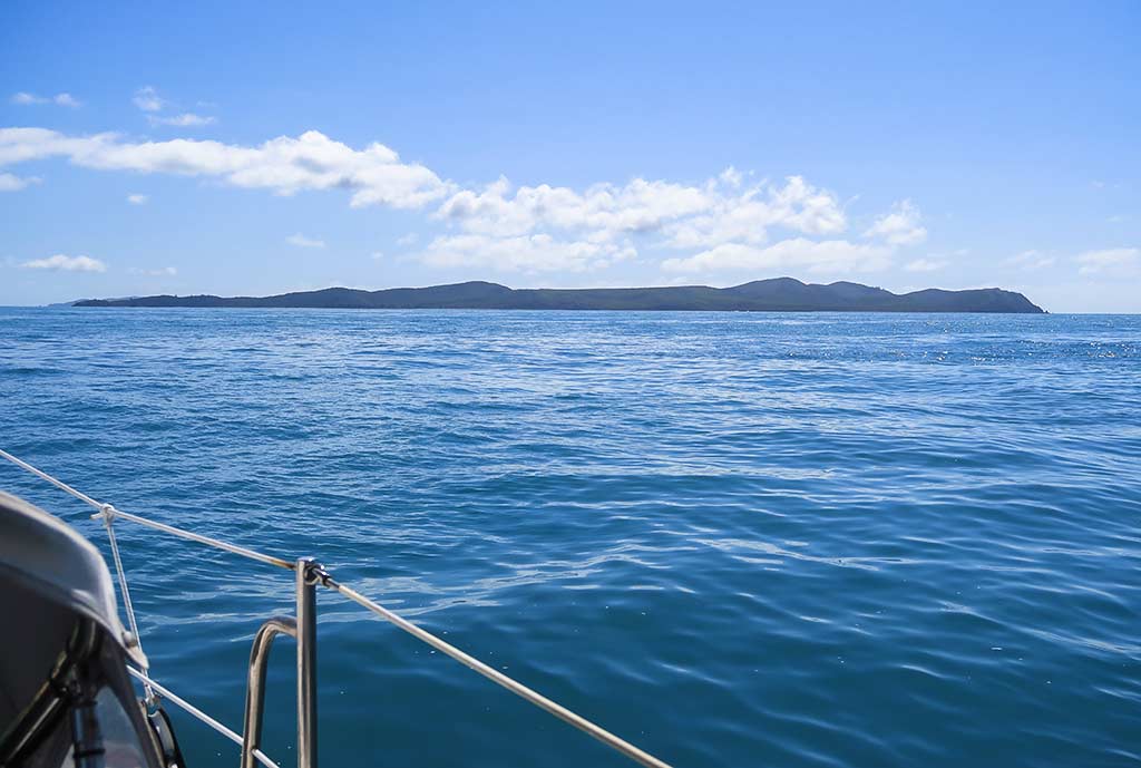
We settled into the day’s sail on a broad reach, riding the incoming current as we headed west. It was a beautiful day, warm with a breeze. It reminded me of certain days back home in Los Angeles, early in the summer when it felt particularly good to sit in the warmth of the morning sun. Today I was inspired to call this getting “sundorphins.” Rich and I aren’t generally sunbathers, but in this instance we both situated ourselves to soak it in.

Rich suddenly stood up after noticing something on our radar, something that had snuck up on us. It turned out to be a group of humpback whales! They were breaching, fin slapping, spy hopping and being very playful in general. We were enthralled and kept thinking they’d dive and disappear any minute; so we didn’t want to miss anything by going below to retrieve cameras. But the whales continued their antics the entire time we were passing by, eventually fading out of sight behind us. When the show was done, Rich’s face hurt from smiling so much. In the past 24 hours we’d enjoyed a beautiful anchorage, met nice people, and watched whales frolicking—a nice way to re-balance our E/A (agony/ecstasy) quotient after our previous difficulties.

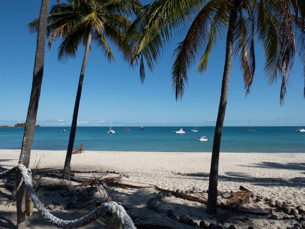
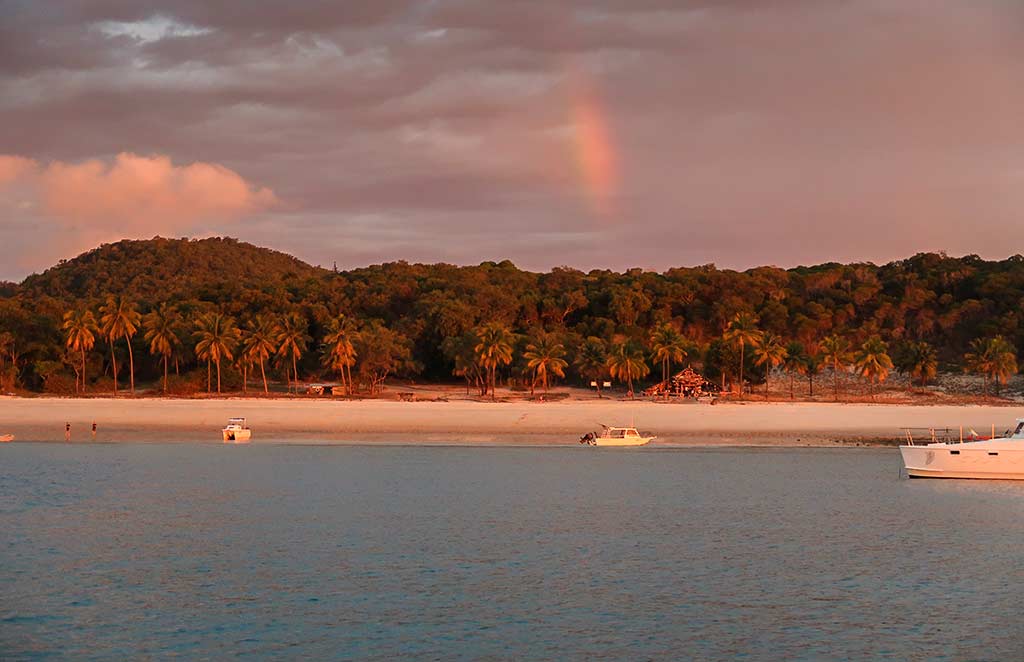
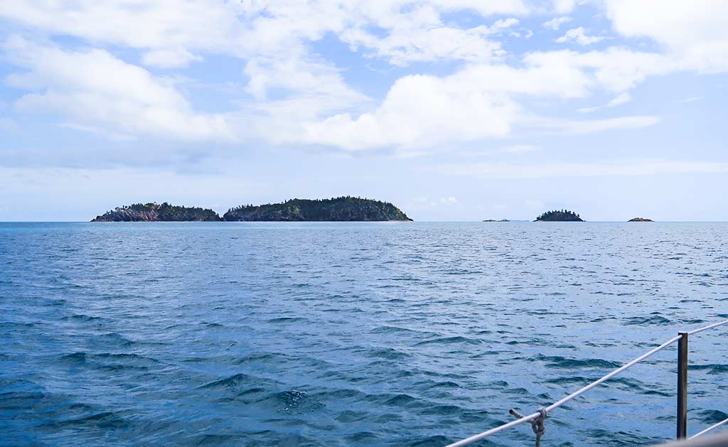
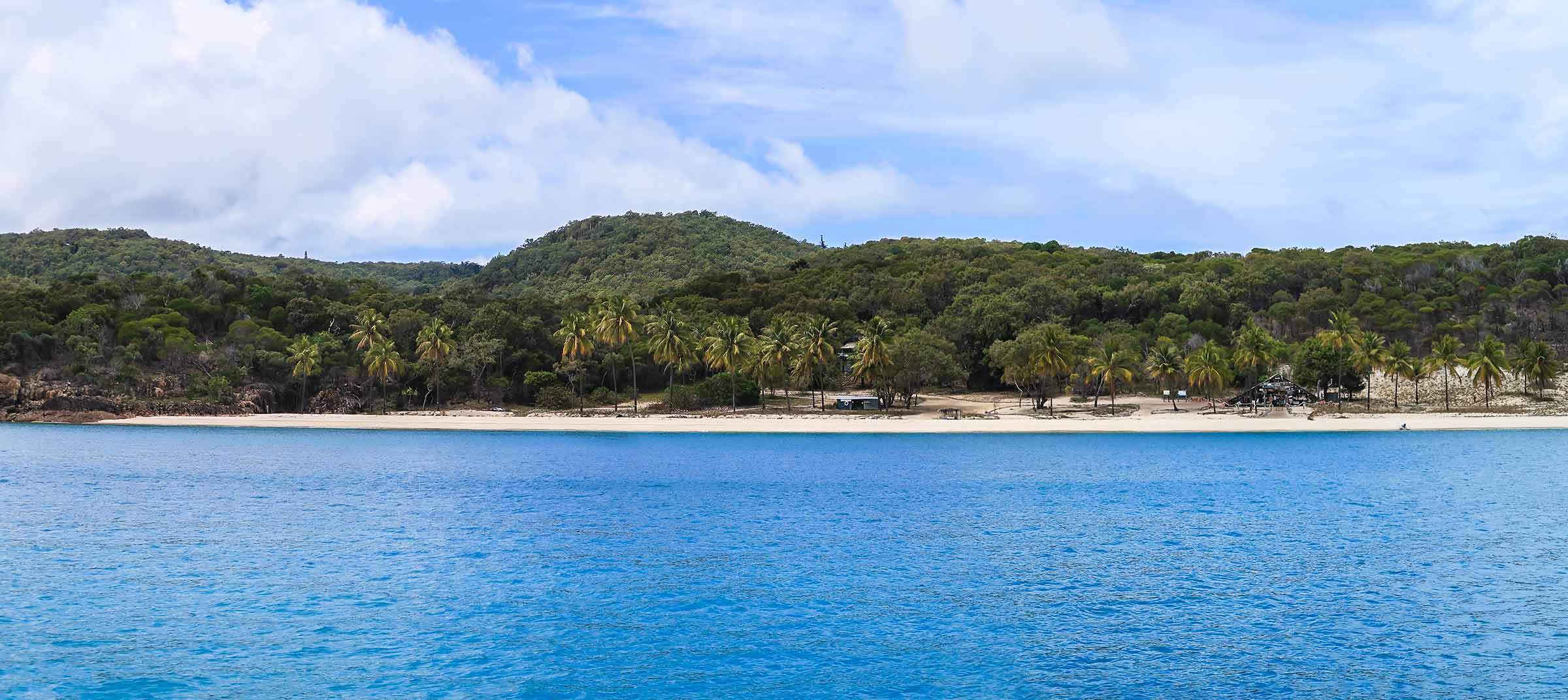
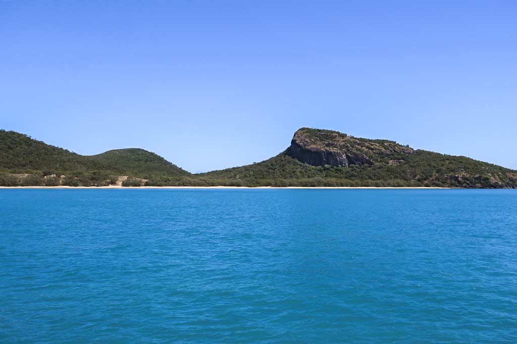
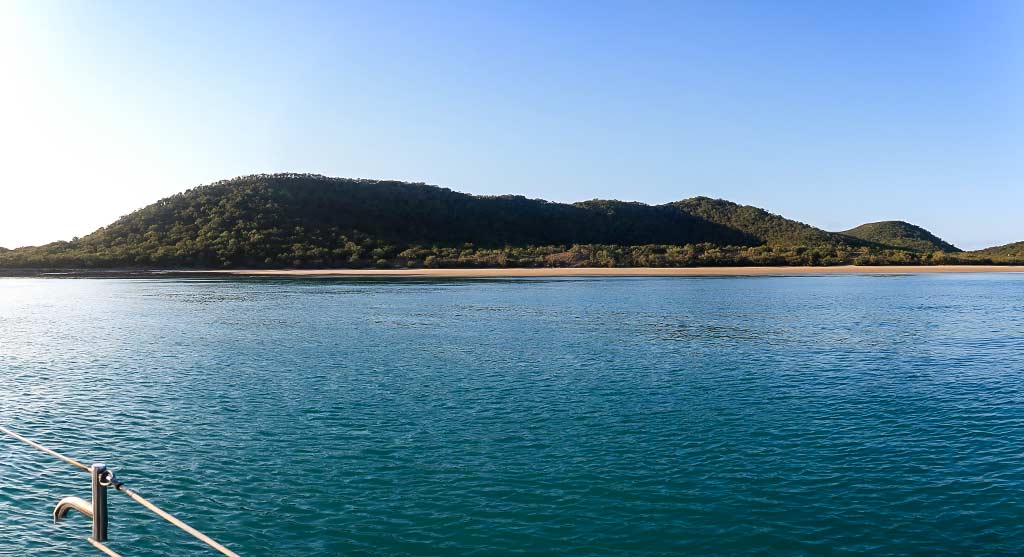
Later that afternoon we arrived at the Guardfish cluster, passing a steep-sided island with a flat top and very little vegetation. We soon reached Curlew Island and as we motored up its east side, I counted 20 islands, all scattered about in the sparkling sea.

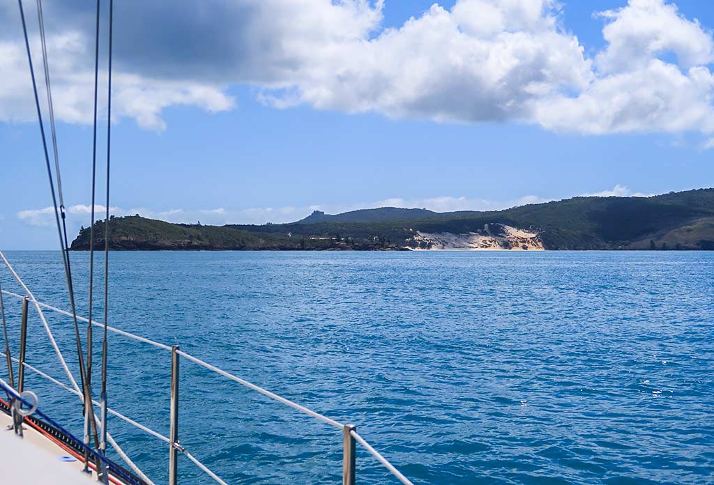
We turned west to go over the north side of Curlew, passing a broad headland before going down into a wide bay.

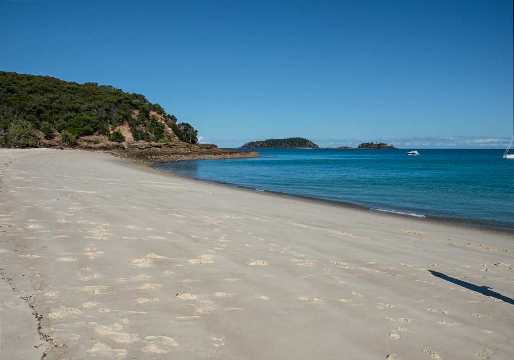
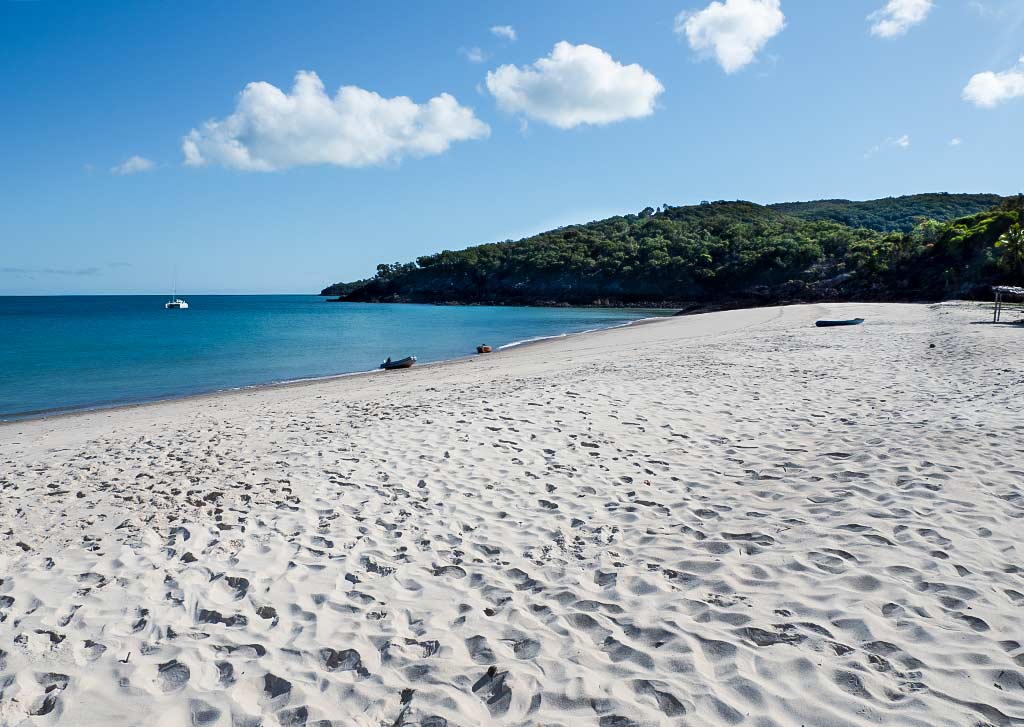
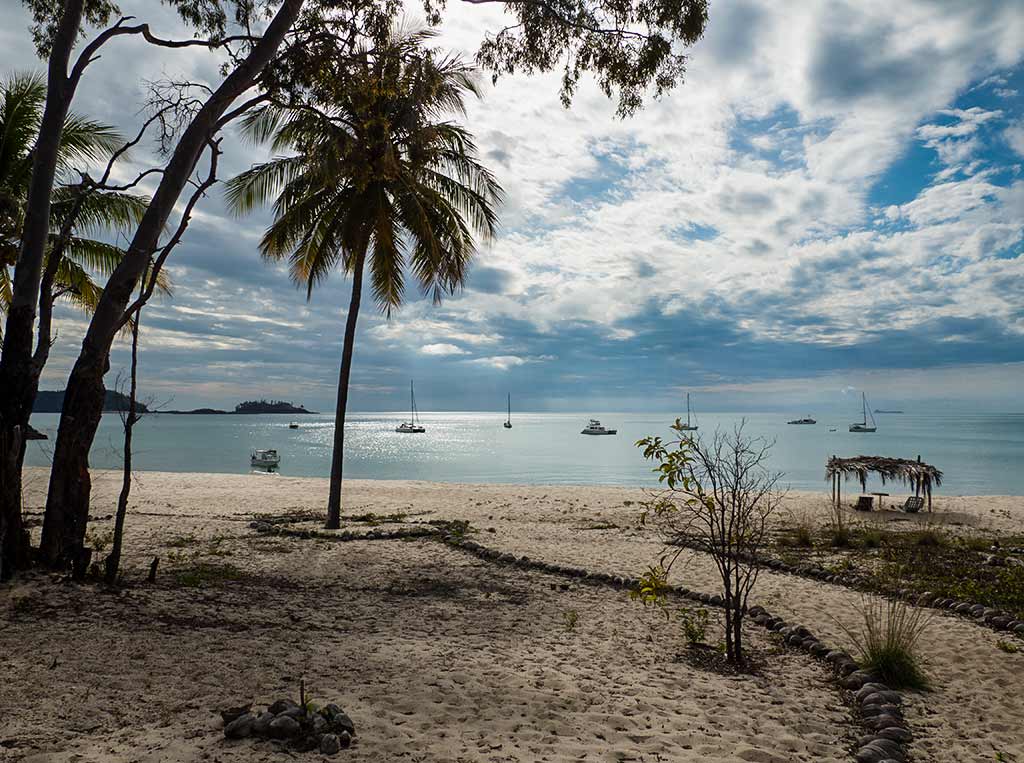
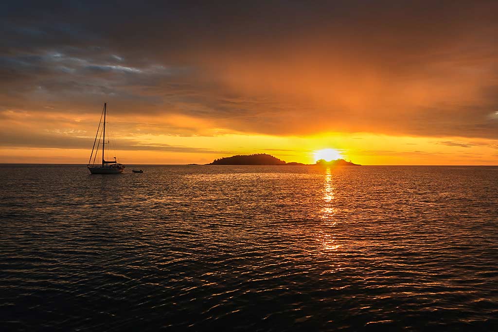
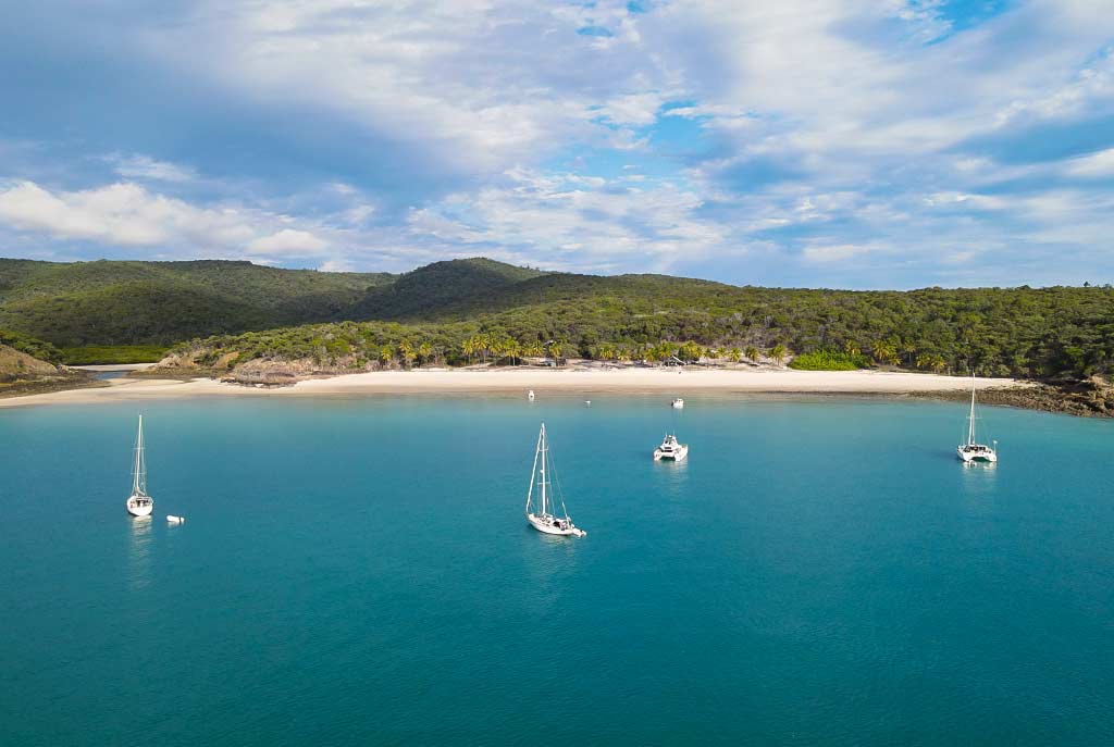
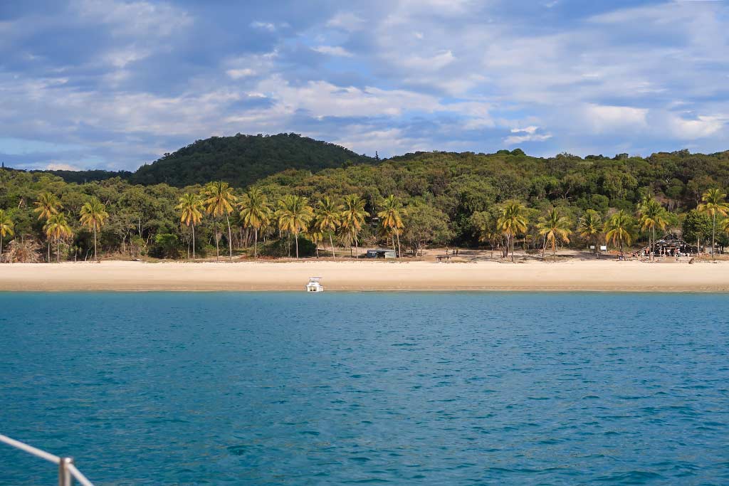
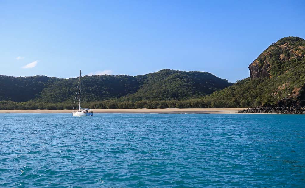
At first sight, the anchorage looked appealing with its long beach and a distinctive rock peak that towered over the scene. A sailing yacht was anchored by the headland on the far side of the bay. What was he doing way over there? We soon found out as we motored into the bay and realized wraparound swell was making its way in, the east headland not as protective as we’d hoped. Dismayed, I figured this might be one of those “lively” bays (as Alan Lucas would call it).

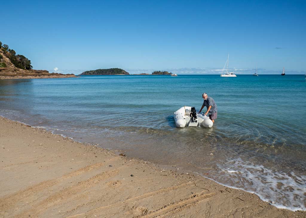
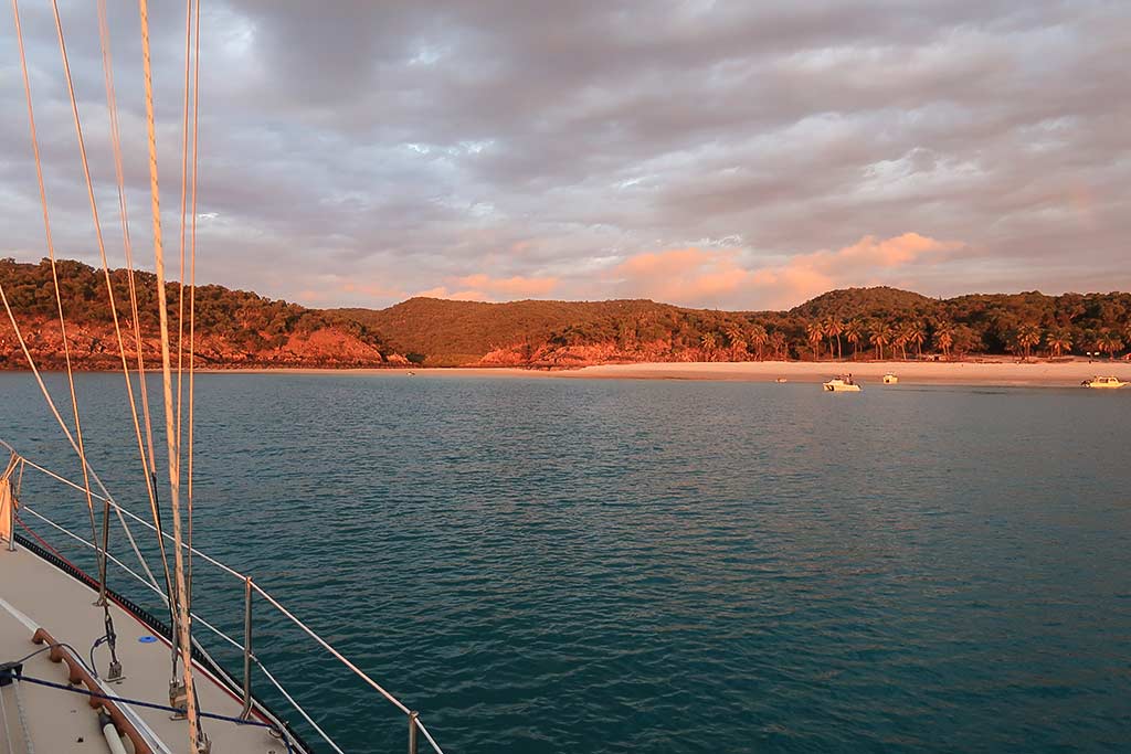
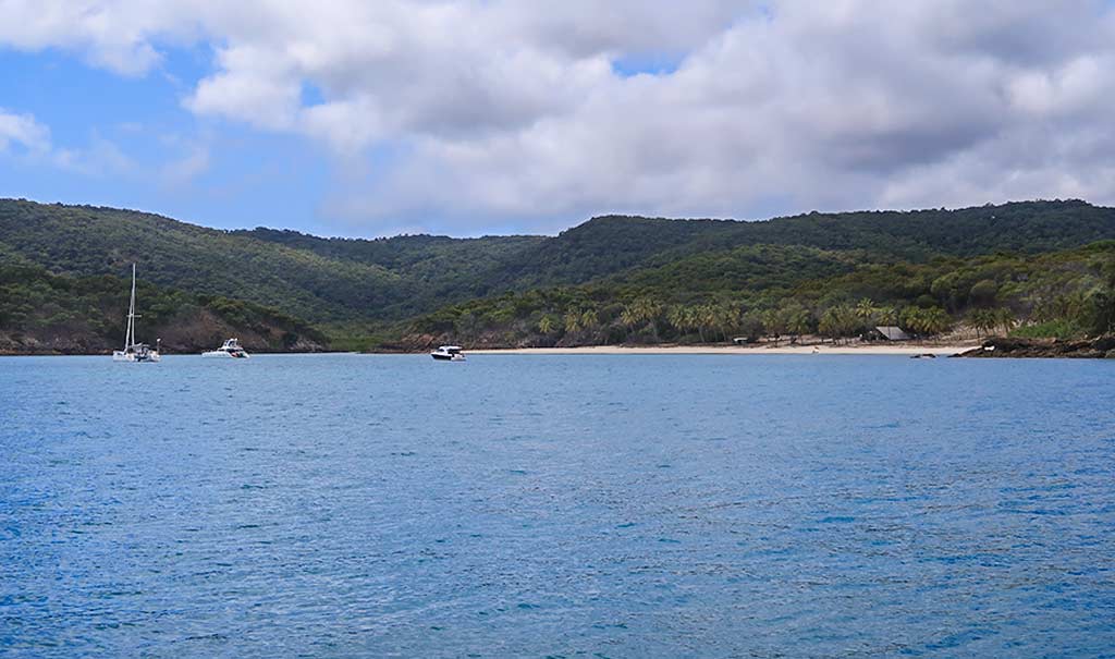
We decided to motor to the far end of the bay as the other boat appeared to be sitting calmly, unaffected by swell. As I’d hoped, the further along we got, the more the swell died down. Rich got Legacy in as close to the beach as he could, but these days because of the huge tidal range, we were anchoring at a minimum depth of 26 feet and couldn’t tuck in very well. In this case, the swell thankfully died off by the time we got anchored.

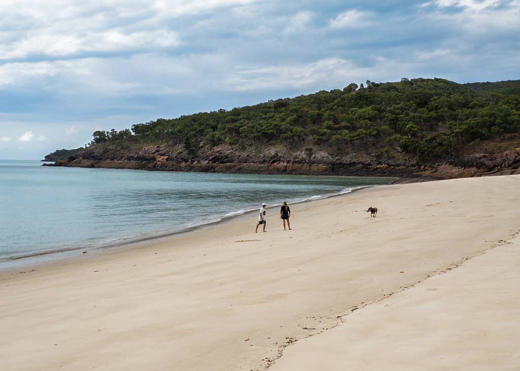
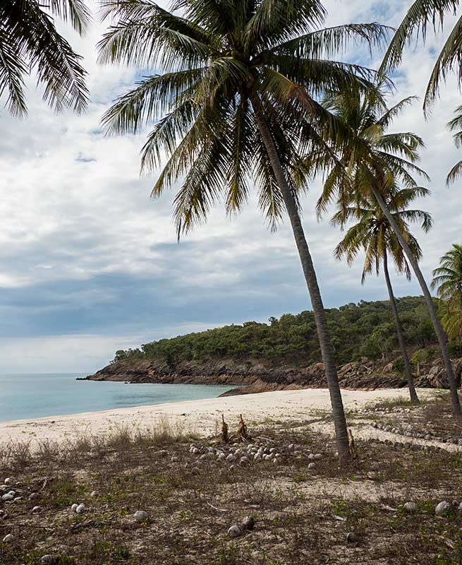
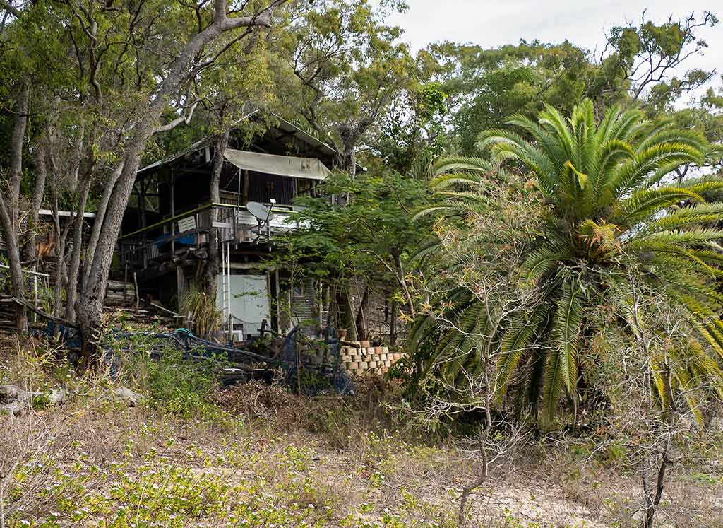
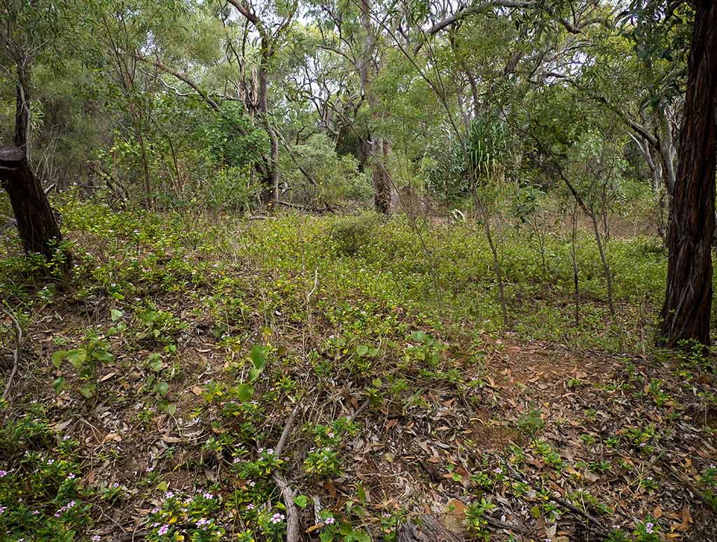
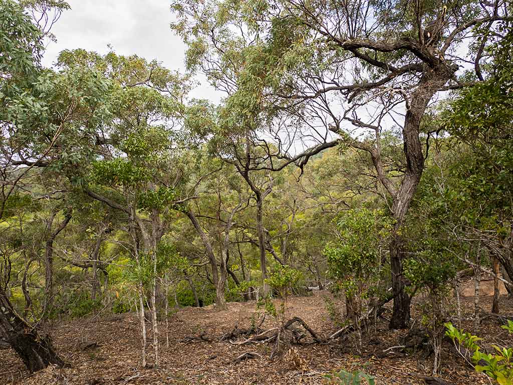
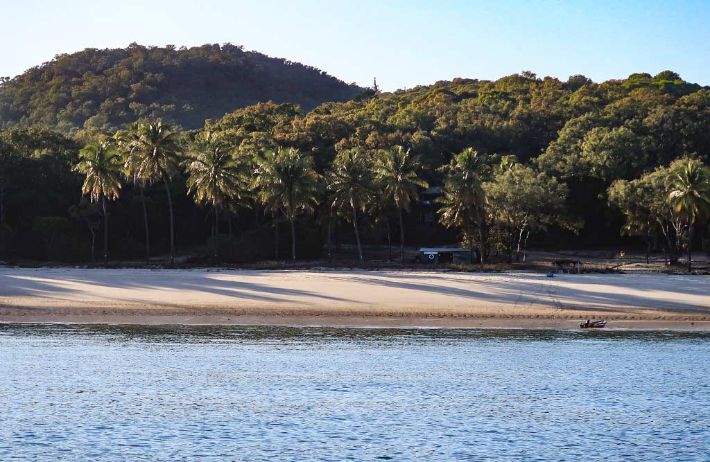
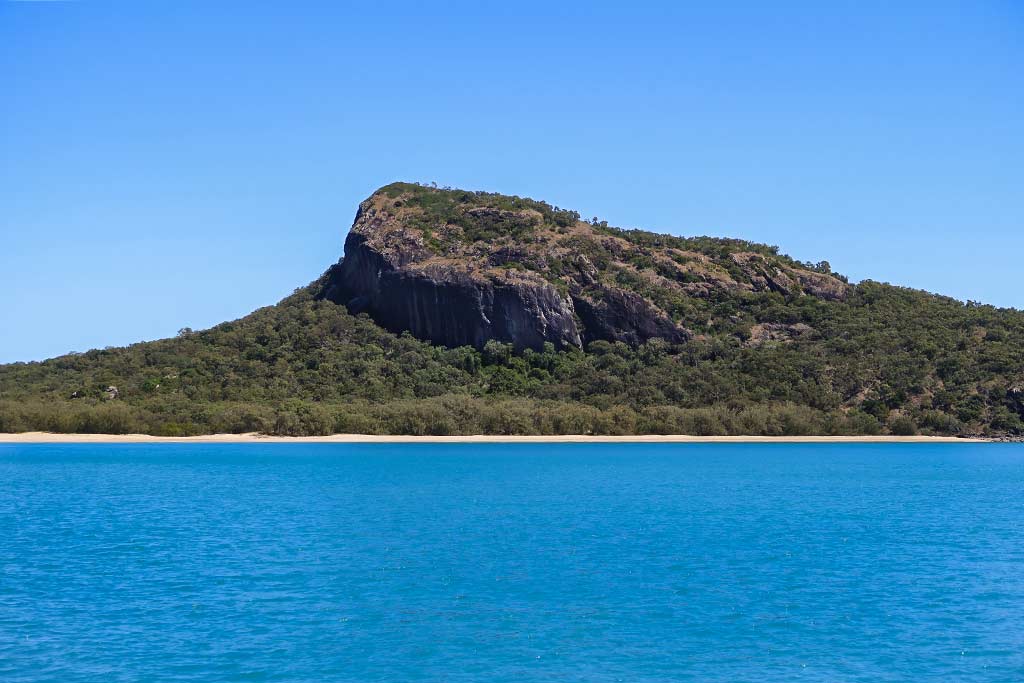
I lingered outside to take in the view of this unusual-looking place. My first impression was its attractiveness would definitely rest in the eye of the beholder. I could see why some would find this place worthwhile, and I wouldn’t argue that it is unique. The most striking feature was the volcanic peak, its top sheared off at an angle. Other than that, the hills on this land were low. A tan beach lined the shore, backed by a thick band of green bush. Overall the island had scrubby vegetation with areas that were quite dry, much like the the islands that surrounded it (Rich would later dub them “the death islands”).

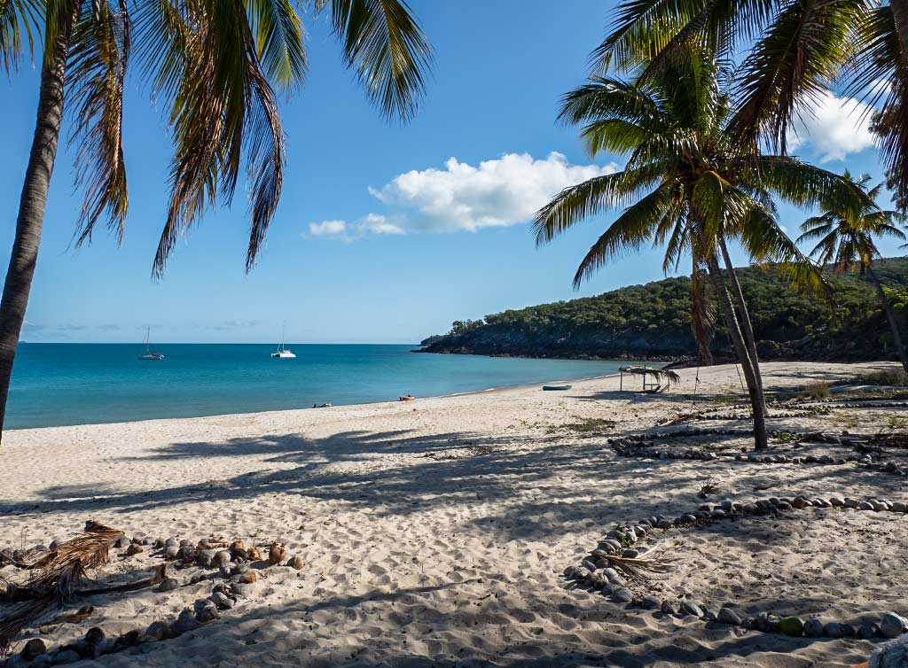
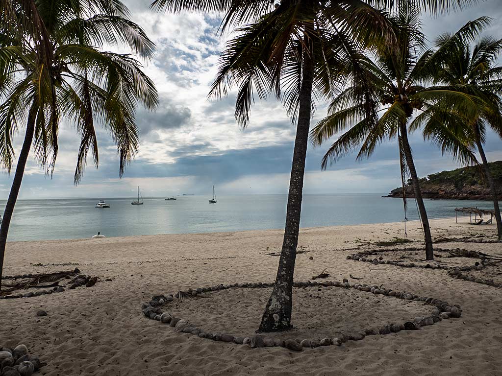
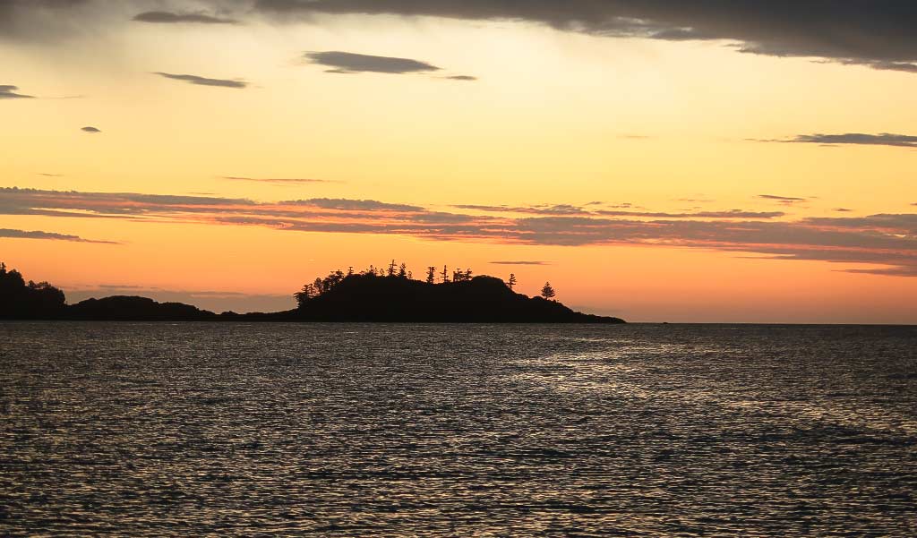
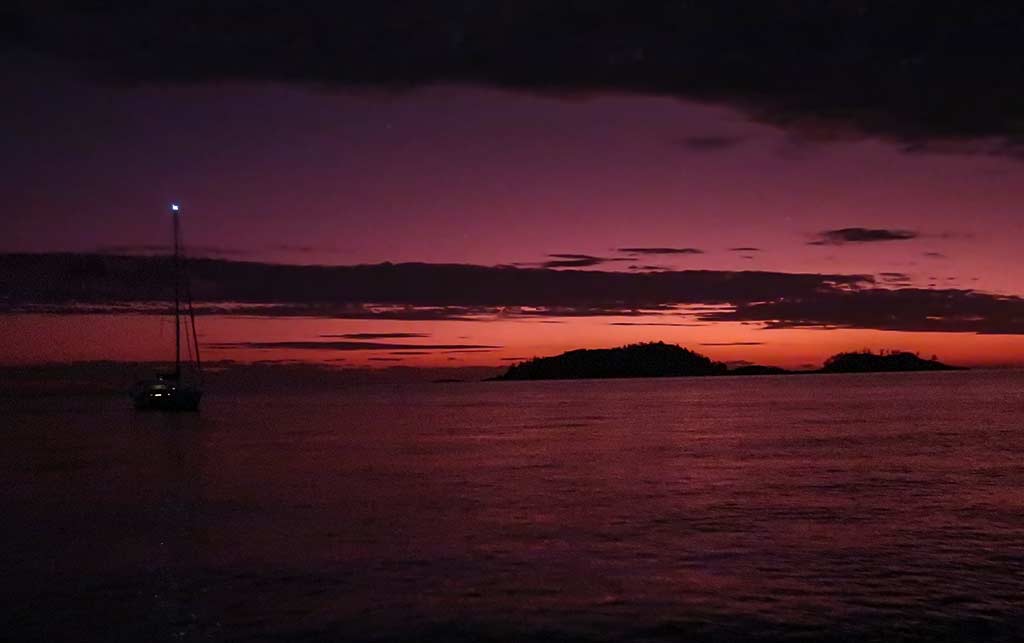
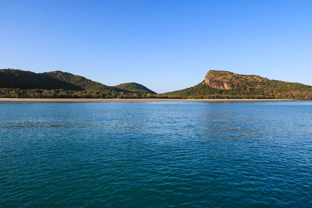
Below, some photos of the bay as day progressed into evening, capped off by a beautiful sunset (click any photo to enlarge).

The feeling here was a lonely one, I think created by the width and openness of this bay and the dry vegetation. Rich didn’t like it at all, and maybe I was affected by his opinion because I started to get a weird and vaguely menaced feeling. Sometimes in a new place, I’ll sit out in the cockpit and try to get a feeling from the land. I did that here, and I picked up something strange, a feeling like the island demanded respect. I sent out thoughts that we would respect it, then I got this feeling I should stop trying to connect any further. I don’t think I’ve ever reacted this way to a place. It probably goes without saying that neither one of us wanted to go ashore.

Looking at the island again later that evening, I felt a darker energy, a sense of something almost demonic. Nervous, I headed below. The next morning I chided myself that I’d been silly, the feeling must have been a reflection of my mood at the time. Still, Rich and I both felt uneasy here. In spite of conditions looking better the following day, we decided it was best to leave this area and head for the city of Mackay. –Cyndi

If you find this information useful, or entertaining, perhaps…

Wayag Island, Raja Ampat, Indonesia

July 21, 2023 about our visit there on July 1-5, 2023

Wayag is the crown jewel of Raja Ampat and yet not all that many people visit this amazing island. It’s a bit out of the way and apart from a small rangers station, there’s nothing on the island. (I say “Island” but it’s actually hundreds of small islands grouped in an area called Wayag.)

We spent about 5 days there and even after 11 years in the South Pacific, this wins the #1 spot on our most-beautiful-places-we’ve-seen list.

I’ll shut up now and let you see for yourselves in the video below (turn on the sound for accompanying music), except for one more introductory item: We anchored in three places there – all great. We call them A, B and C in the video. (Hint: C is our #1 anchorage ever!)

Hike to Viewpoint

The “path” to the viewpoint from the Cruising Guide to Indonesia is in the middle of the beach pictured at about 2:00 in the video – just go past the big information sign. The “path” itself roughly follows our drone starting at 2:08.

I didn’t attempt this hike. I have something called common sense (and a will to live and a drone). Cyndi did and it almost killed her. She went up with two Indonesian guides and three young women who were camping on Wayag. It almost killed the women too. It didn’t seem to bother the guides.

The “path” that I keep putting in quotes was almost impossible to find and involved a lot of rock climbing. One of the young women came down after going to the top and threw herself into the water and said she wasn’t going to get out until she stopped shaking! Cyndi said it was the hardest thing she’d ever done.

And the guide book says…

Mount Pindito: Looks more challenging than it is… but the climb is actually relatively easy and most visitors, young and old, make it to the top in less than 20 minutes. This should be an obligatory hike for all visitors to Wayag.

Maybe he’s got some kind of secret path (that defies physics?).

The guide book also mentions moorings in the area of B. Nope. There were no moorings when we were there. The area around B is a somewhat difficult place to anchor as it’s mostly very deep. We found a place about 60 feet deep. (That’s not bad for this part of Indonesia!) In area A, we anchored in about 45 feet of water and C was around 30 feet deep.

Here are the routes we used for the three spots we anchored. Standard disclaimer: For entertainment purposes only. You’d have to be a complete fool to use these. You’d die!

wayag routes

Anchorage C really was the prettiest place we’ve ever anchored. It was easy to get into with no less than 20 feet on the entrance into the small bay.

The guide book says that the inner lagoon area of Wayag is very deep and mostly suitable for superyachts. We didn’t find this to be true. With satellite maps, we spotted quite a few suitable looking anchorages and riding around in the dinghy with our hand-held depth finder, we saw a few very close to C where we would have anchored if not for the upcoming weather.

It was forecast to blow for about a week and while we didn’t worry about this in the amazing protection of the places we’d anchored, we did need to get moving and if we stayed longer, it would be either another week at Wayag or a miserable beat back to the south. In retrospect, and after looking at this video again, I’m wondering why we didn’t stay the extra week!

-Rich

If you find this information useful, or entertaining, perhaps…

We’re in Ternate (and have fuel!)

July 17, 2023

We’re in Ternate (ter-nah-tey). Here:

And we have (mostly) full fuel tanks and fuel jugs, thanks to these two great guys…

They brought us 250 liters of diesel in ten big jugs.

They we had the pleasure (read: hard work and mess) of transferring it into Legacy. And, oh yeah, just when we started, the rain also started.

Despite the mostly minor mess, this was so much easier than our last fill-up in Indonesia. In Sorong, it took three days and three kind-of-expensive trips in a van to a gas station with our jugs. It seems that at least in this part of Indonesia, fuel docks aren’t a practiced concept.

I think I’ll also mention here that it seems we finally found a city we like in Indonesia. The scenery and the people in Indonesia have been amazing. The cities-not so much. We’ve only been here two days but we already like it.

There’s a shopping mall that had Cyndi near tears of joy. We found a pretty nice supermarket where we were able to get much of what we needed. And the “dinghy dock” is much nicer than anything we’ve experienced so far in Indonesia.

We’re going to hang out here until we get weather to make about a 150-mile passage west to Bitung. It looks like it’ll be about ten days until this strong southerly wind abates. We have to get to a check-in city like Bitung to renew our visas before the August 5th. I think we’ll make it. In the meantime, it’s restaurant meals for us! – Rich

An Afternoon at Middle Percy Island (Queensland, Australia)

Posted July 9, 2023
about September 12, 2023

After we’d gotten settled in Middle Percy Island’s West Bay, we headed ashore to visit the beach and yacht club. The water became quite clear as we neared the shore, the sand smooth and soft under our feet as we landed.

Below, a few photos of the beach from various times of the day (click any photo to enlarge).

Already we could see that the yacht club, a little A-frame structure, was heavily decorated with tokens people had left to mark their visits there. We made our way up to an entry path bordered with coconut shells and surrounded by palm trees, with a sign identifying the Percy Island Yacht Club. How fitting that two yachties happened to be sitting in front of the club, Rich taking a moment to chat with them while I took photos.

We went inside, surprised to find this place quite a bit larger than it looked from afar. It was absolutely chock full of mementos left by cruisers, made from whatever materials they could find: boat bits, wood, buoys, rocks, etc. All the items stated the boat’s name, the date they visited, and usually where boat was from. Some pieces were slapdash, but other people had put in real effort and made works of art. We wanted to look around and see if we recognized any boat names, but the sheer number of items was overwhelming—there must have been thousands of bits in there. It would take us all day to look through everything!

Aside from all the flotsam and jetsam, we found fire pits and cooking utensils out behind the hut, visitors welcome to use them. A little room inside was stocked with jars of local honey, homemade chutneys and jams, and fresh eggs for sale, the resident family who oversees this place trusting people to pay on the honor system. We also discovered a loft with still more stuff upstairs. Below, a gallery of photos from the yacht club . . .

We hadn’t initially planned on leaving anything, but after seeing all these mementos I couldn’t imagine not doing so. They had a ghostly feel, snapshots from moments in so many lives, frozen in time and going back years. I, too, wanted to freeze this moment in our life and let it join the “ghosts” of the yacht club. Rich agreed, suggesting we use a beautiful flat pearlescent shell we’d recently found. That would be perfect—we could bring it back in before leaving the next morning!

Satisfied we’d properly visited the yacht club, we took a walk to see some of the inland area. A trail angled up into a eucalyptus forest behind the beach. The vegetation was on the dry side, the trees not very tall but really lovely.

One particularly charming area was rather open, the trees widely scattered. Here, bushy ground cover with purple flowers was alight with small yellow butterflies. Crickets provided the soundtrack, chirping even though it was daylight. A flock of rainbow lorikeets alerted us with their squeaky cries as they flew above, and I could hear the sad cawing of the local ravens nearby. It may have felt ghostly in the yacht club, but outside this island was vivid with life.

We continued walking to the “tree house,” a cabin where guests can stay, then caught a view of an inland lagoon before turning back. The walk towards the shore gave us a view of the boats in the bay, a beautiful image through a frame of palm trees. Light cloud cover gave the scene a cozy, dreamy feeling, while the water sparkled in the sunlight that filtered through. By this point I was pretty enchanted with Middle Percy Island and could see why it’s revered in the boating community. Below, photos from our walk . . .

On a final cruiserly note in this cruising mecca: a young man, one of two guys on a small power boat, approached us with a bag in his hand. He said he and his friend had caught too many fish to fit in their freezer; would we like some? Oh my gosh, yes! He gave us the bag with two huge fillets, enough for two meals. What a wonderful treat!

Dinner in hand, it was time to head back to our boat, but part of me wished I could stay and hang out onshore, just soaking in the atmosphere. It had been awhile since I’d felt this way about a place, and I wanted to linger with the feeling.

Once back on the boat, though, it was awfully nice to wash the insect repellent off our legs and sit in the cockpit with a glass of wine. Following that we had a delicious dinner featuring the fresh fish grilled in foil packets with butter, grilled onion and bell pepper, and wasabi mayo served over a bed of rice (this is one of our favorite things to do with freshly-caught fish).

After dinner we went out to the cockpit again to enjoy a beautiful sunset . . .

Later that night, I stepped out to admire the bay in the moonlight. We now were surrounded by nine boats, and it felt good to be back among cruisers even if we didn’t know any of them. Tomorrow we’d be heading on; so I appreciated this moment while I was in it.

Enjoying coffee the next morning, after watching the sun come up from behind the hills, we wrote Legacy’s name on our chosen shell with a felt pen, drilled a hole at the top of it, and used fishing line as a tie (the best we could do as we lacked art supplies).

We headed ashore, first stopping at the guys’ power boat to give them a weather forecast (as there was no phone service/internet here) and a six-pack of Corona beer. Both the forecast and the beer were much appreciated, but then so was the fish we had for dinner and would have again this night. We then headed ashore to the Yacht Club and found a nice spot for our token, leaving it to represent us among the other happy ghosts who reside there.

By the time we got back to our boat, the breeze was starting to pick up. It was time to head to our next destination. While it was sad to hurry off, we had a plan to get to a marina in the city of Mackay before the next period of enhanced trade winds set in. En route we had time for one more stop: a place called Curlew Island. –Cyndi

The Percy Isles: Our Trip to Middle Percy Island (Queensland, Australia)

Posted June, 2023
about September 12, 2022

Today’s destination was the well-known and much-loved Middle Percy Island. After our experience yesterday I had some trepidation about this next trip, but this time we were better prepared. We planned to do the passage during an incoming tide, which meant the current would be flowing in a beneficial direction for us and it would match the direction of the wind. For this area of the coast, avoiding wind vs swell conditions and making sure we didn’t waste time and fuel fighting a current would now become our biggest priorities.

Below, a map of our route to the Percy Island Group. While there are two other islands in this group (South Island and North East Island), Middle Island has the best anchorages. The one we were headed to was called West Bay, an easy choice in that looked attractive, was protected from prevailing winds, and was the location of a memento-filled cruisers’ shrine known as the Percy Island Yacht Club.

Arriving at Middle Percy would put us north of the strongest current. In fact our only issue might be, according to the Lucas guide, some swell rolling into the anchorage. It was hard to imagine how this could be as the wind would be coming from the southeast and our bay was well up the island’s west side. But then again the swell in this area is pretty relentless, adept at going around corners and finding every nook and cranny.

We took a look at the swell conditions out at sea and, of course, the wind strength. Both looked promisingly mild, but after the weather surprise yesterday, we didn’t have as much faith in the forecast.

I went outside to enjoy some morning coffee and laid a hard eyeball on the area of rough water outside the anchorage. At the moment it looked encouragingly calm, the breeze light and pleasant. But our anchorage was getting more rolly as the tide was starting to come up.

I went below and was getting ready when Rich said we needed to go, like, now. I ran out to get the anchor up and found the roll had steadily been escalating. It was time to get out of this place; so what a time for the anchor to get turned sideways and wedged in the chain guard, something that can happen if it’s brought up too quickly. Rich came up to the bow and got it unstuck, but now we were entering the area of disturbed water and I still needed to secure the anchor. It wasn’t choppy enough to be dangerous, but it did look potentially splashy. Thankfully, though, I stayed dry and once the anchor was secured I remained at the bow to watch as we motored through the swirling, choppy water.

When we got further north of Hexham Island, conditions became so calm! It seems the forecast was off once again, but this time the winds were lighter than advertised. After yesterday, I wasn’t going to complain. But one thing I was learning about this area was the weather forecasts can be a bit iffy.

We ended up having a lovely 5-hour motor trip to our anchorage at Middle Percy Island, our boat making a sparkling wake through the glassy sea. The air was warm and pleasant, and getting away from Hexham made this feel even better! Below a video:

The first thing I noticed as we approached the Percy Islands was how green they were. The anchorage on South Island looked particularly pretty with a long white beach and green hills, but the inevitably of wrap-around swell would make it intolerably rolly. We continued past and headed up the west side of Middle Island, noticing sand flows showing through otherwise heavy forest. Below, a photo gallery or our trip from Hexham to Middle Percy Island, ending with arriving at West Bay. (Click any photo in the following galleries to enlarge.)

When West Bay came into view I felt a sense of relief. We could see 3 boats in the bay, none of them rolling, and there was plenty of room. Plus it was lovely: blue water surrounded by high green hills with a wide beach stretching across the head of bay. A long line of palm trees ran behind the beach, and tucked in among them was the Robinson Crusoe-style “yacht club,” an A-frame cabin where cruisers could mark their visit by leaving a memento. My reaction: “Now this is what we’re talking about!”

We dropped our anchor in 27 feet of water to give us extra depth for the low tide. The current tidal range was 19 feet, but there was no sense of current affecting us. Just offshore was a small island called Pine Islet, which gave the bay a cozy, protected feeling. I loved this place already, but with all that it took to get here, my enthusiasm was muffled by a world-weary fatigue.

Below, some photos of the anchorage, starting with a panorama taken shortly after we arrived . . .

And a gallery with photos of the anchorage from the camera and the drone at various times of day.

Our first order of business was to have lunch, then we would head ashore. –Cyndi