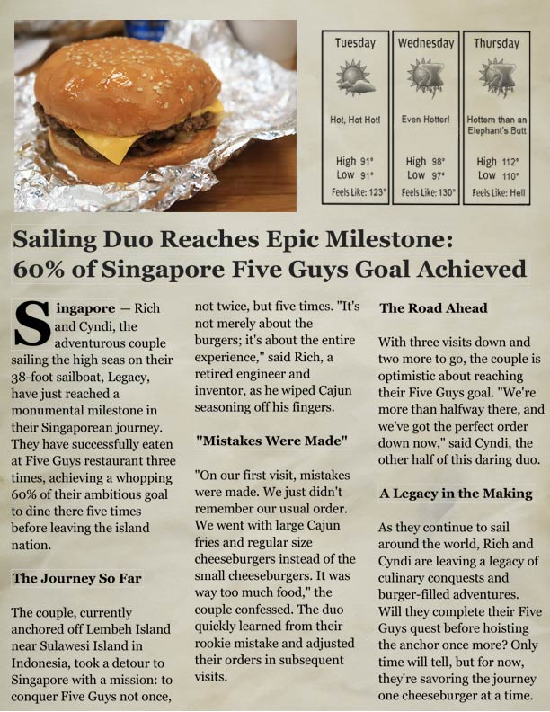
We’re here to renew our visas for Indonesia. Yep, that sounds crazy, but the only way to renew them is to leave the country. A search of airfares on Google showed that Singapore was our least expensive travel option from North Sulawesi, where Legacy is patiently waiting for our return in a few days.
This is the second time we’ve had to leave a country to renew visas. The first time was in New Zealand, and it was just cheaper to fly to Australia for the renewal, even with hotel and airfares ($1,600 for a straight renewal and $1,200 for the ‘four-day vacation’). For Indonesian visas, we had no choice—renewal can only be done from outside of the country.
Posted October 1, 2023 about
about September 18, 2022
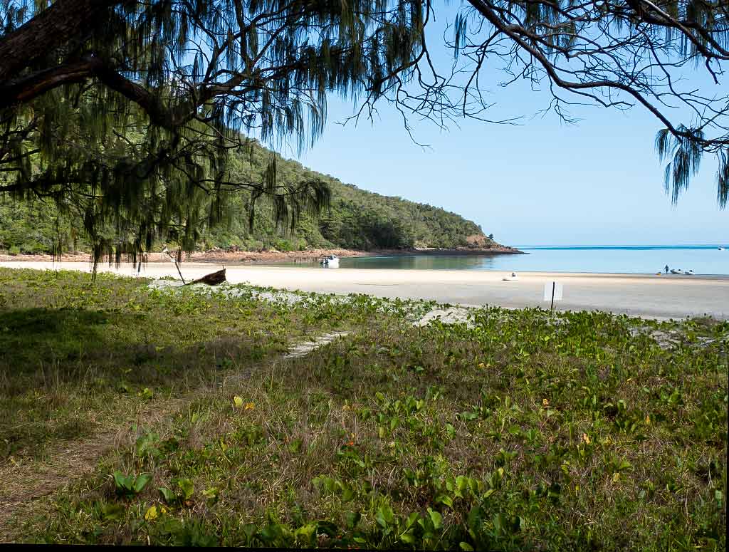
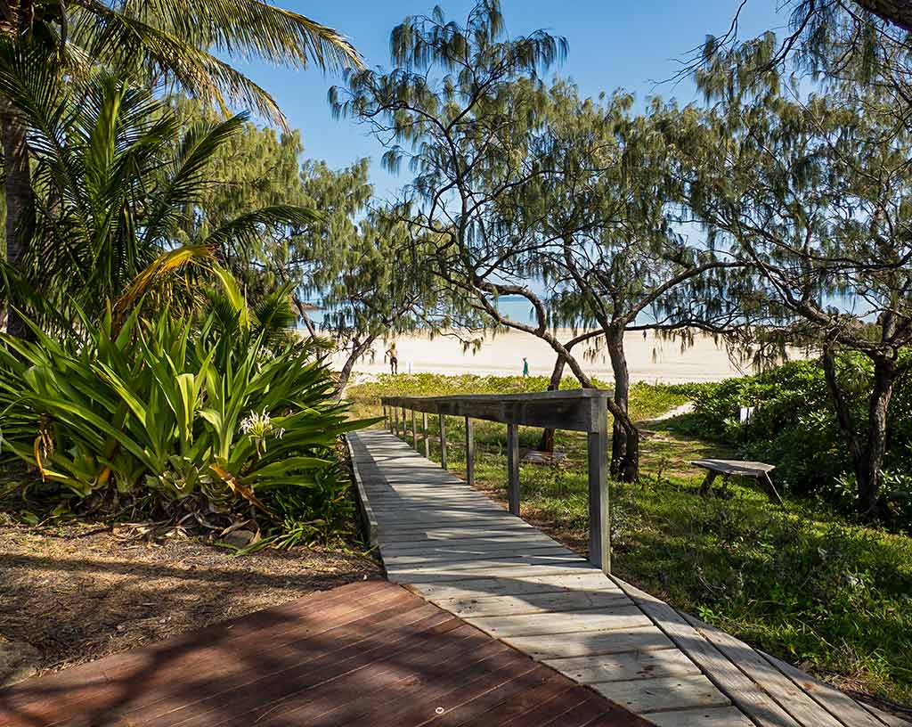
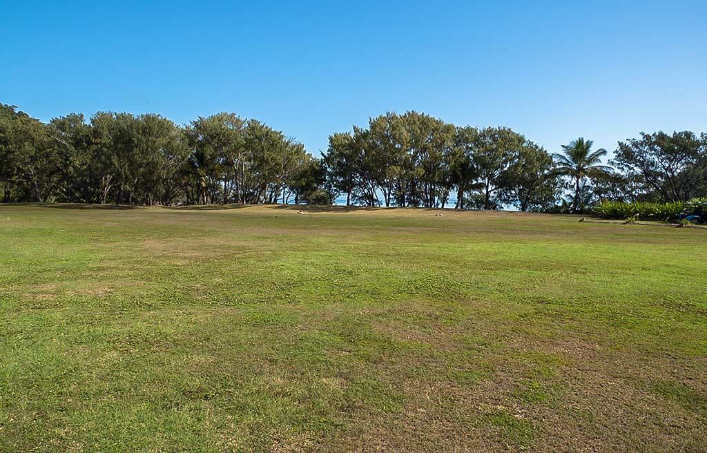
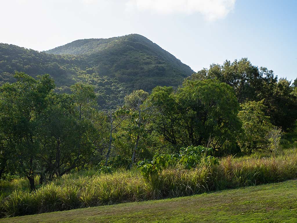
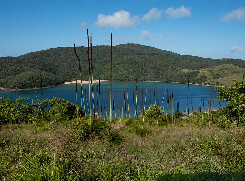
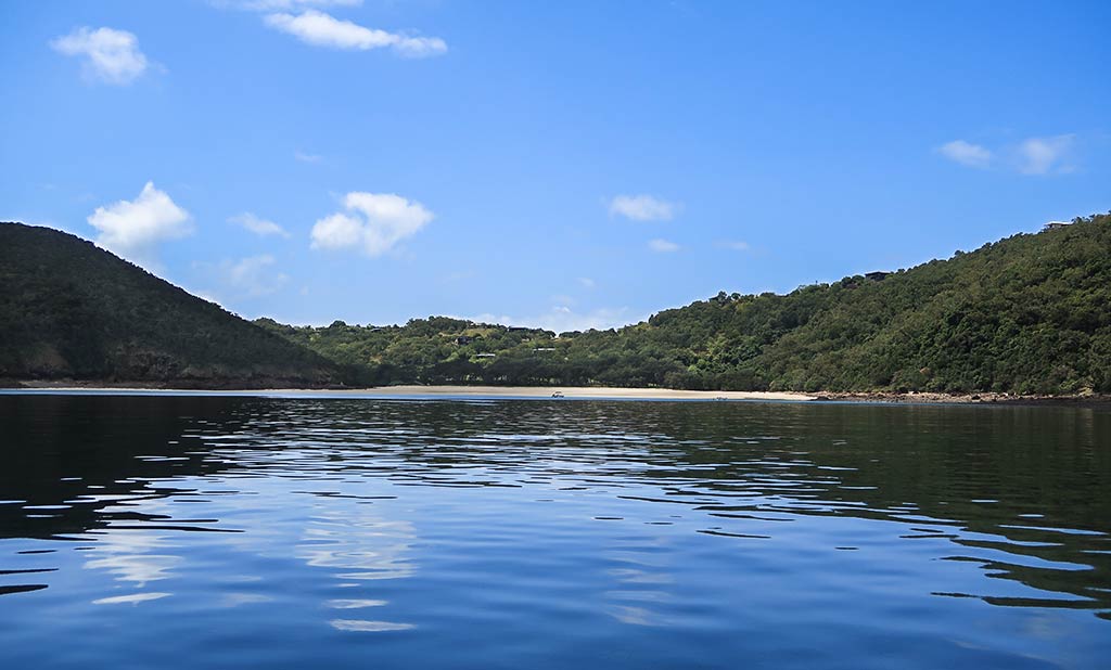
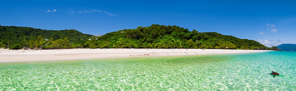
Heading onshore for our first visit to Keswick Island, we landed easily on the nearby Basil Bay Beach. Long, wide and protected, this was easily the nicest beach on Keswick Island. Behind the beach, there was an embankment topped with Australia’s “whispering” pine trees, known as she-oaks.
Below, a few photos of Basil Bay Beach. (Click any photo to enlarge.)
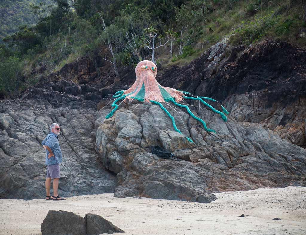
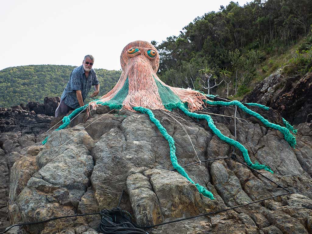
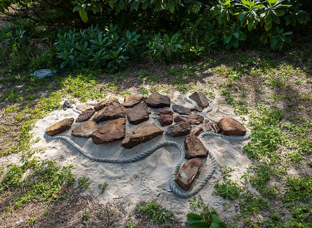
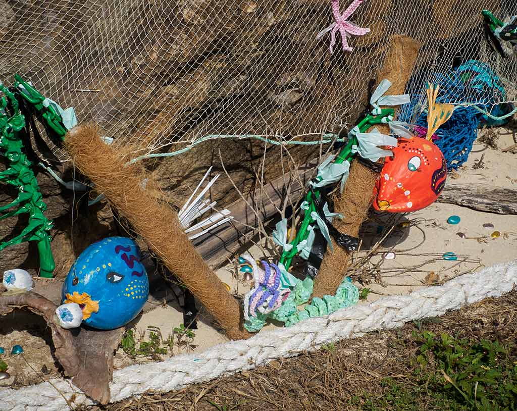
Looking down the beach near the inner headland, I noticed something strange on the rocks. We walked over for a closer look and were surprised to see a giant octopus perched on the boulders. Not a real one, but an artistic creation, made up of netting and natural materials. It was striking, but how very strange to find it here.
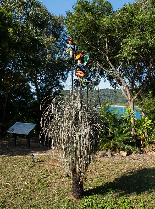
Walking up a ramp to the top of the embankment, we discovered, lo and behold, a sign for the Art Trail! This certainly explained the octopus. With that came a change of plan: we’d do the Art Trail today.
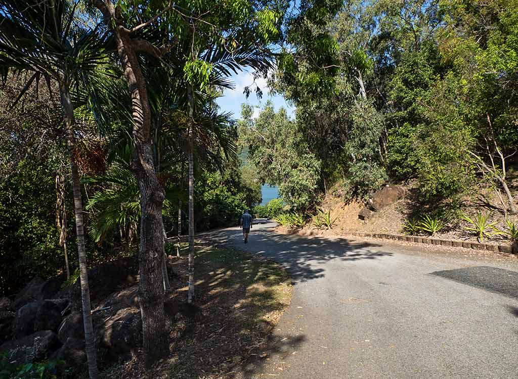
We followed the path to a visitor’s hut, spotting more artworks along the way. We soon discovered free map brochures with descriptions of the art pieces, just the sort of information I’d hoped for! (The Art Trail had just opened which explained the lack of information online.)
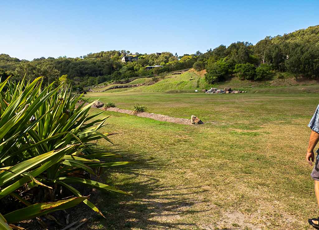
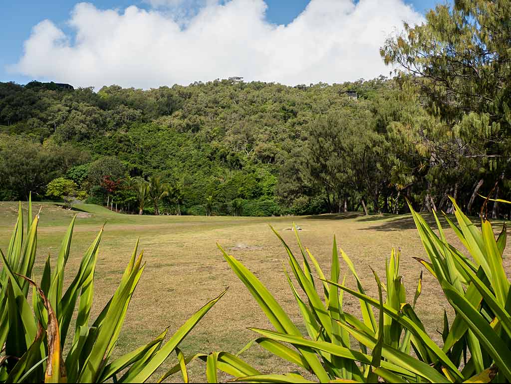
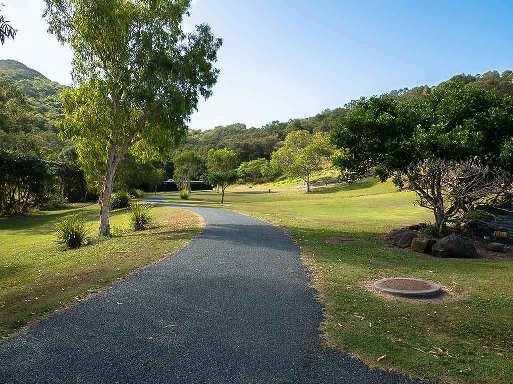
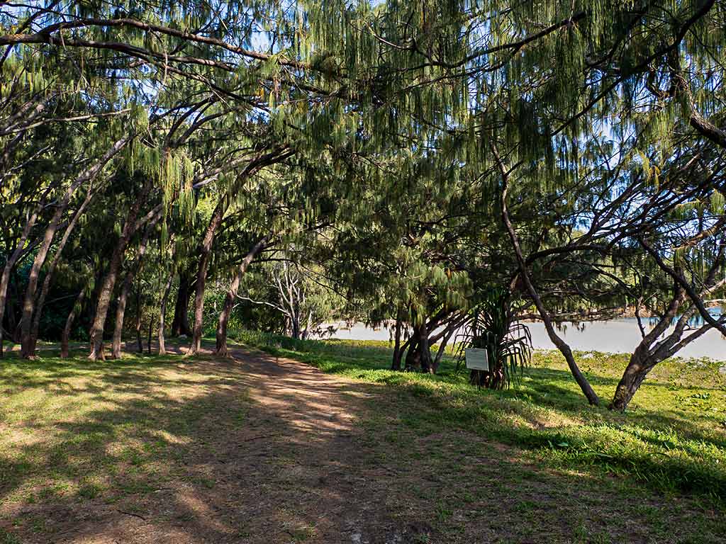
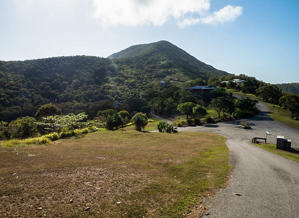
Behind the shoreline trees was a wide lawn area. Here, we joined the paved path that wound up a hill through tended grounds, serving as both the trail walk and a golf cart road. This was to be the site of an eco-resort (which sadly, as of this writing, seems to have been stalled).
What an interesting and unique-looking place this was! A combination of bushy native forest and manicured grounds, peppered with creative artworks and ocean views. Then there was the wildlife. We heard squealing from a colony of fruit bats, chattering cockatoos, and the haunting whoop-whoop cries of local birds called pheasant coucals.
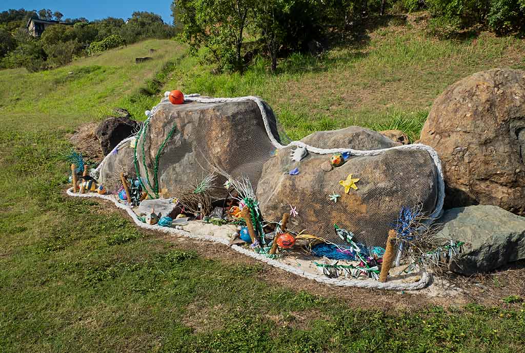
Below, a few photos of the walk and some of the art works . . .
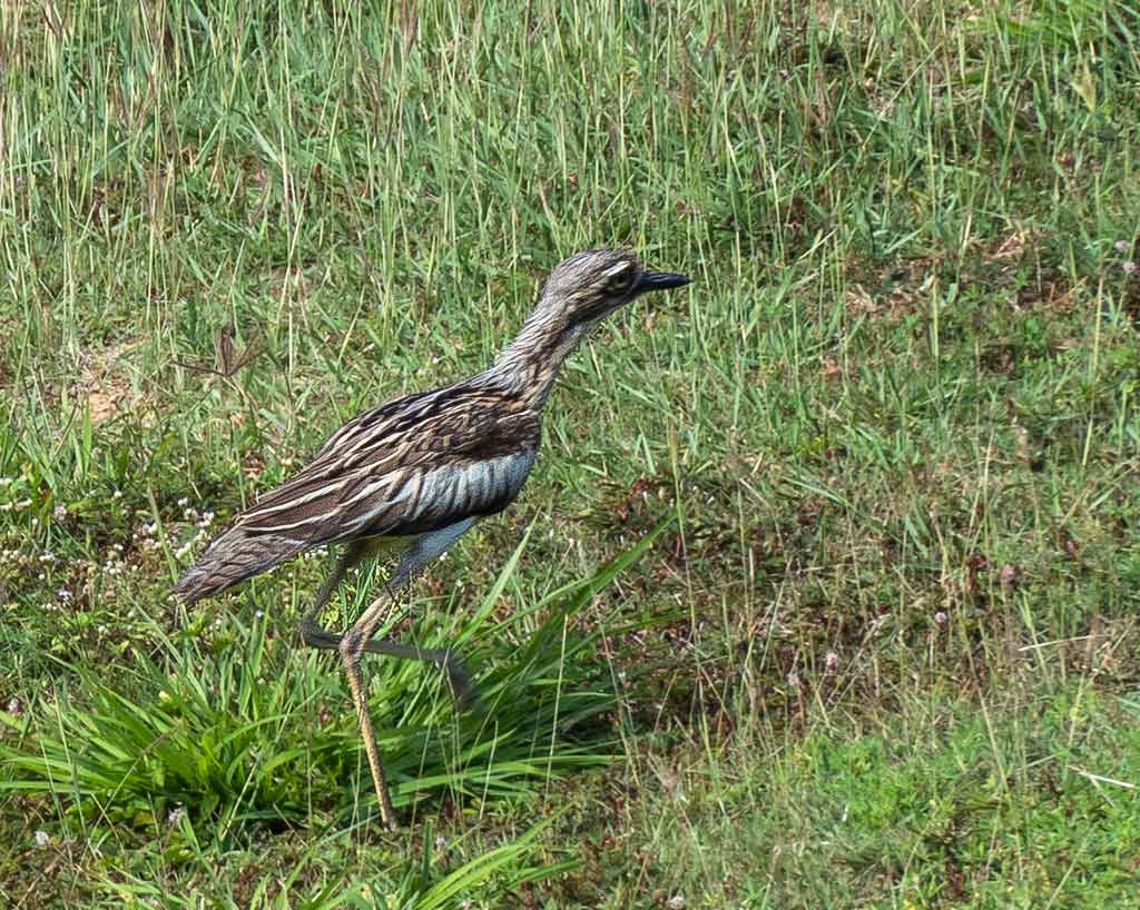
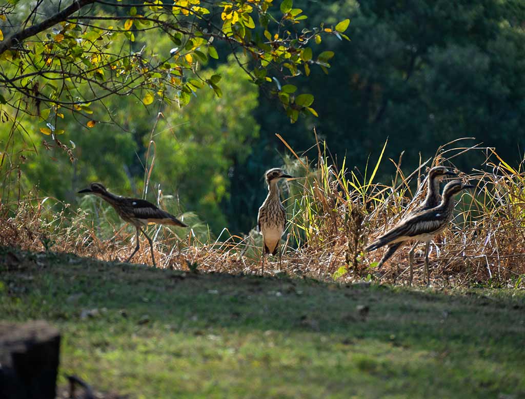
My favorite discovery of the day was the long-legged birds called Bush Stone-Curlews. They stand nearly 2-feet tall and prefer to walk in small groups rather than fly, reminding me of the little dinosaurs in Jurassic Park. They disguise themselves by freezing motionless and pretending to be a branch. At night, their wailing calls emanating from the bush can sound pretty eerie.
What first caught my attention was a bird that scurried past us, suddenly realized it was out in the open, and then froze instantly, doing its best tree branch impression. And it did look like a branch, but the problem was I had watched it go by us before freezing into position. It seems underestimating the intelligence of humans is also something this bird tends to do.
I felt almost sorry for the bird, that “awww, sweetheart” response when someone tries to do something and pathetically fails. So we pretended to be oblivious, fooled by the “branch” as we walked by. In the coming weeks I would discover another fun thing about these birds: their large round eyes are expressive. One time, getting very close to a curlew, another was watching and had an actively worried expression on its face. That is the first, and so far the only, time I have ever seen a bird look worried. Wary, yes. But not worried.
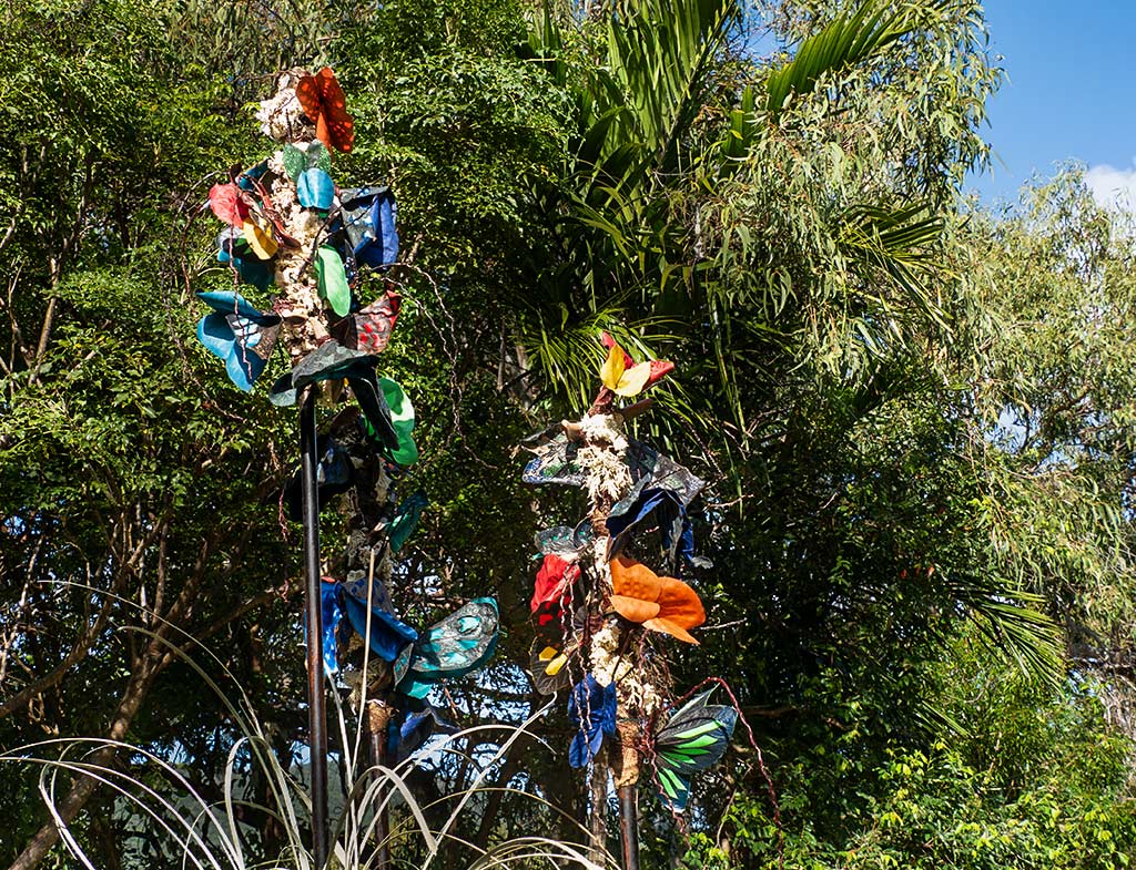
We walked to the top of the hill, admiring more art pieces along the way. Walking down the other side of the crest were lots of butterfly-attracting trees and flowers. We certainly saw plenty of butterflies, but it seemed most of the blue tiger butterflies I was seeking had migrated south.
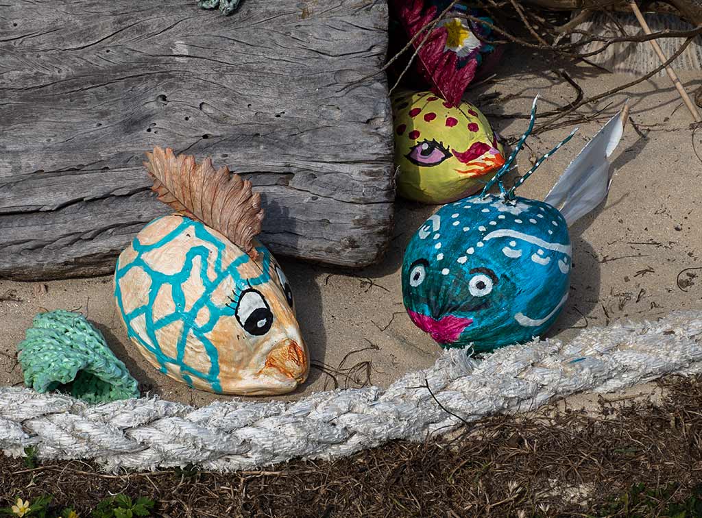
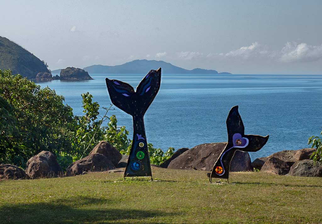
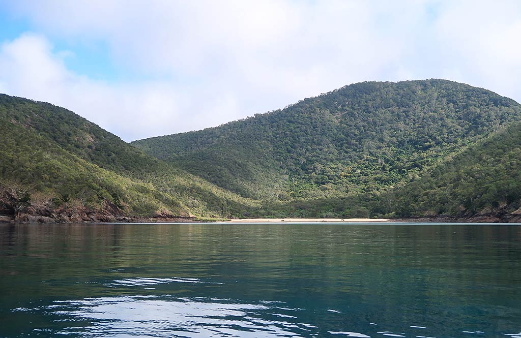
I did, however, find one of my two favorite art works of the day, a sculpture depicting butterflies on flowering stalks. Further down the hill was my other favorite sculpture: two whale tails, perfectly placed overlooking the sea. It was compelling in the way it captured the feeling of this area. Finally we walked further down to enjoy a view of the Egremont Passage between the islands, which we’d be going through the following morning.
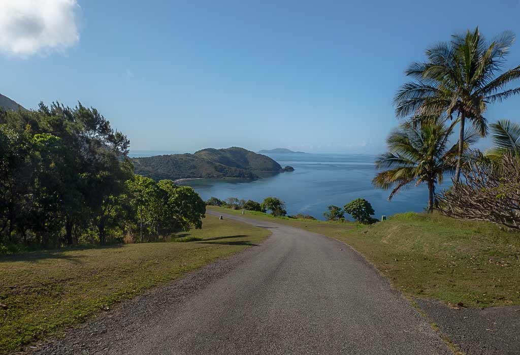
Alas, what comes down must go back up; so we turned and began a rather steep climb back up the road. A golf cart soon came up from behind us, and I made a wish that we’d be offered a ride. Wish granted! It was a caretaker who not only offered us a much-needed lift but gave us a tour of this area with stops at some beautiful viewpoints.
We also got to see what’s called the Beach House, the official rental property on the island. I was taken with its deck and view of the bay. Immediately I started envisioning having the fridge stocked; then arriving with a few books with plans to spend a week reading, sitting on the beach, swimming, hiking, contemplating the art work, watching birds and butterflies, meditating, and being unplugged. The area had such a peaceful, pleasant feeling that spending time here would feel rejuvenating.
We got a ride back to the beach and talked about buying some Keswick honey from the caretaker, but we didn’t have any money with us, nor a container in which to put the honey. We figured we might come back the next morning to do so.
Taking the dinghy back to Legacy, we passed a couple on paddle-boards who were oohing and ahhing at the coral beneath the water. We took notice but had no plans to snorkel until we moved further north. Our focus now was on land-based activities, trying to see some of these islands as best we could. Underwater exploring could wait until the Barrier Reef. –Cyndi
If you find this information useful, or entertaining, perhaps…
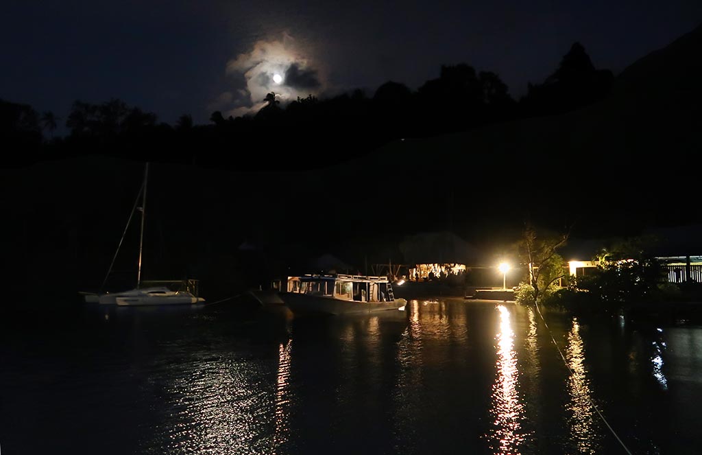
We’re anchored and stern-tied right outside D’Lagoon Resort. This has been an absolutely wonderful place to spend some time. They make us feel like family—they are so kind to us. We’re loving the amazing meals we have here.
D’Lagoon has truly been a sanctuary for relaxation and rejuvenation. And, oh yeah, I won’t forget to mention the unique diving they offer here. We’re planning to go out for a night dive with them soon and hopefully see the spawning Mandarin fish.
Posted on September 21, 2023
about September 18, 2022
It can be a little confusing to figure out exactly where the Whitsunday Islands begin and end within the larger Cumberland Island group, a chain of islands that lie off the coast of Queensland. Even Chat GPT is confused on this one. Information sources (going all the way back to Captain Cook who mapped this area) differ. But I think Wikipedia’s Cumberland Islands entry gets it right:
The Cumberland Islands group contains:
*The Whitsunday Group
*The Lindeman Group
*The Anchor Islands
*The Sir James Smith Group
*South Cumberland Islands National Park.
“More recently these islands have increasingly become known as the Whitsunday Islands and the general area more simply as “the Whitsundays”.”
Yep, I think this sums it up perfectly. While we were heading to what’s commonly referred to as “the Whitsundays,” we wouldn’t actually be in the Whitsunday Islands just yet. To make things more confusing, the term “the Whitsundays” often includes areas of the mainland coast, even though the Whitsunday Islands are, in fact, islands. Now that this is cleared up, I’ll get on with our story.
We planned to start our cruise in South Cumberland Islands National Park, just 14 miles from the Mackay Marina. From three possibilities, I chose Keswick Island. It ticked all the boxes:
*It had a protected anchorage for the forecast northerly winds.
*It had protection from the southeasterly swells courtesy of neighboring St. Bees Island. This island is only separated from Keswick by a channel less than a mile wide. In a sense, being in clear view of St Bees, we’d be getting two islands for the price of one.
*Its hilly terrain, covered in both rain forest and native Australian bush, gives it a unique topography, attracting an abundance of birds and migrating butterflies.
*It has do-able walking trails, including a rather mysterious Art Trail (for the life of me, I researched this Art Trail and could not figure out where it was or what art was on display).
This island is 80% national park, the rest containing a housing zone, a guesthouse, an airstrip, and plans for an eco resort. Below, a map of both Keswick and St. Bees Islands.
Our plan was to leave Mackay in the morning on an outgoing tide. Tides and currents, while less dramatic than those to the south, would continue to be a consideration throughout the Cumberland/Whitsunday Islands. Meanwhile the forecast called for a spell of light northerly breezes, an indication that the season was changing.
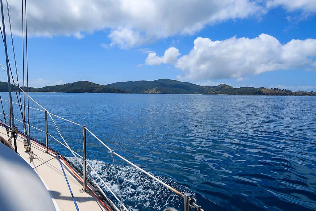
We turned in our keys at the marina office and got Legacy ready to go. Soon we were heading out into a very calm morning. We had a 14-mile trip to Keswick, and it would be a motor ride through glassy seas. The air felt pretty warm; so Rich turned on our patio misters and soon we were surrounded by a fine, cool water mist.
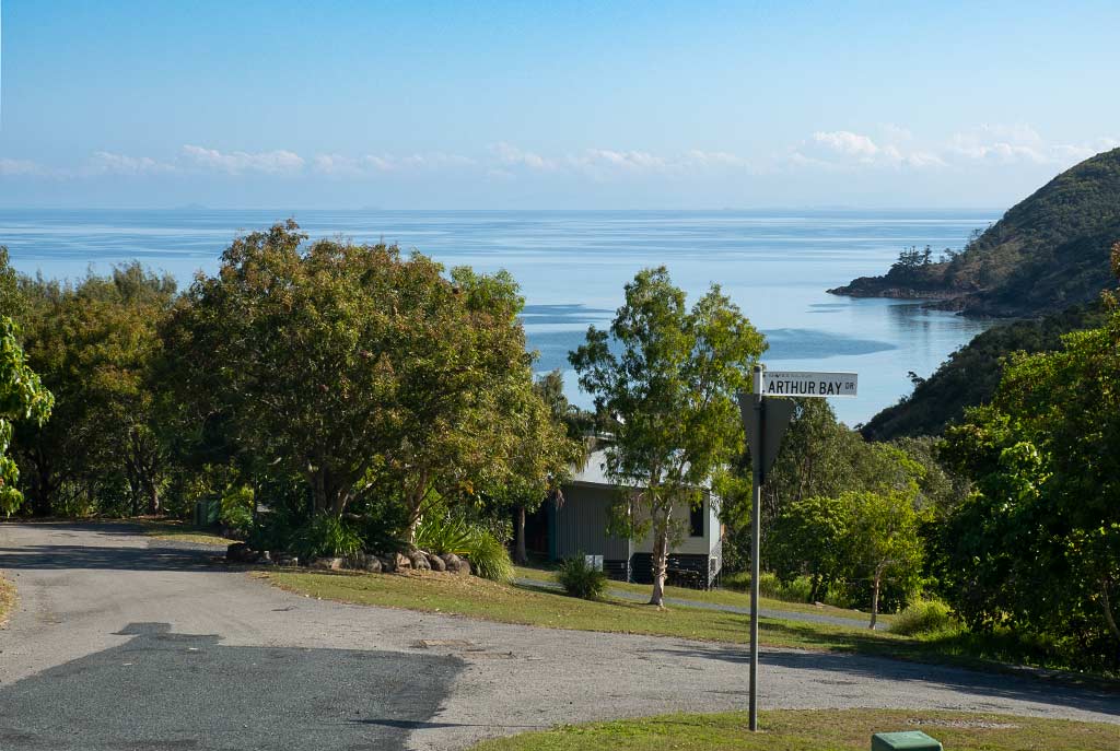
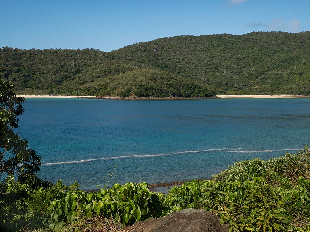
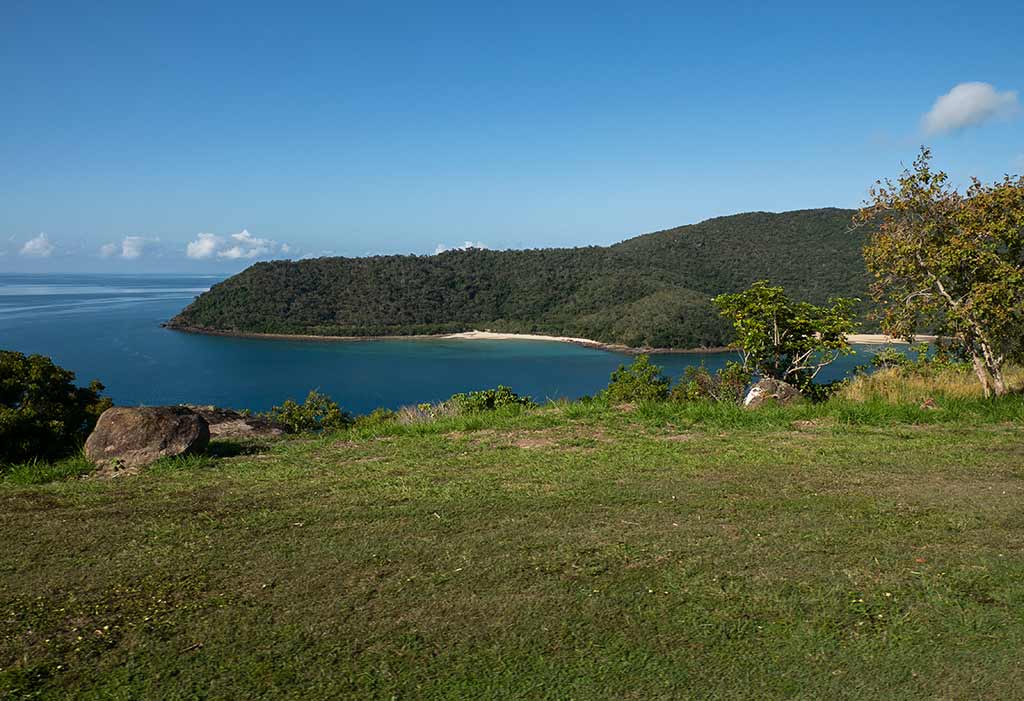
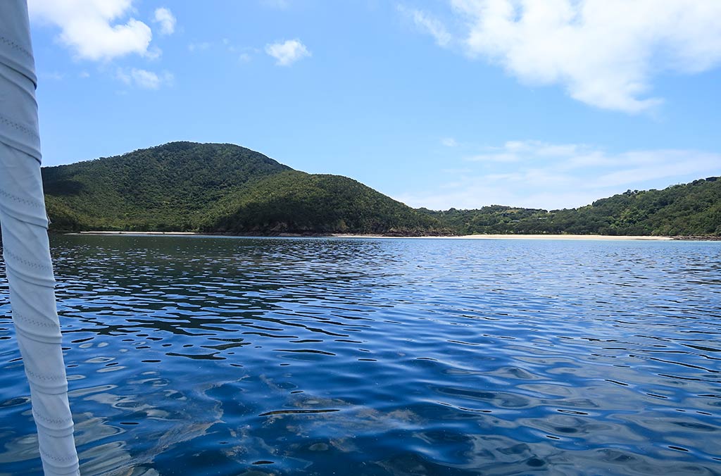
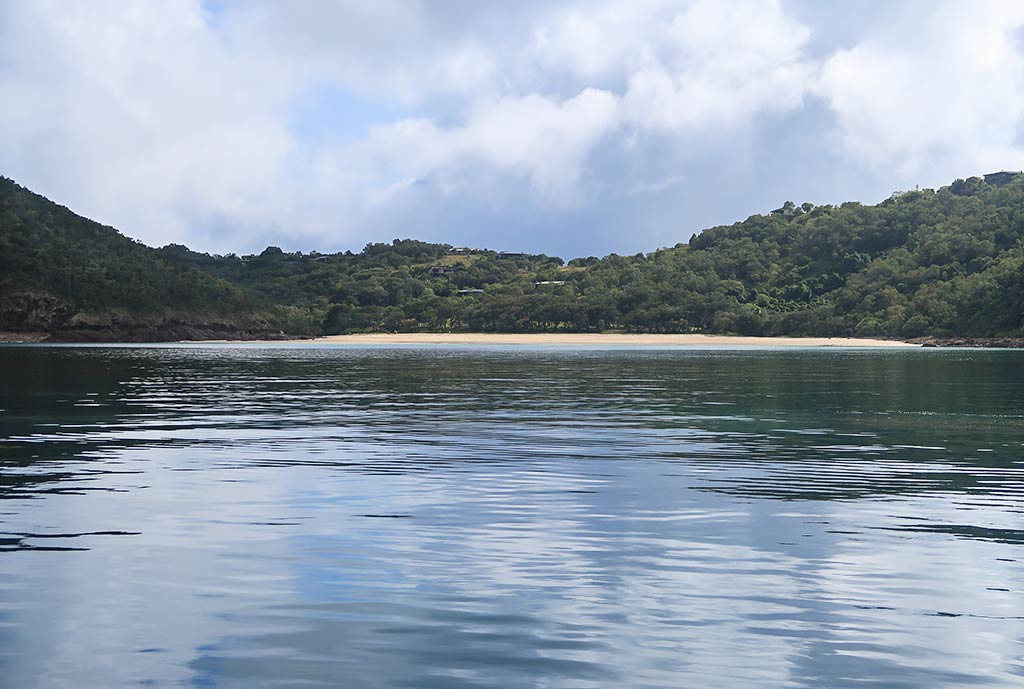
Our destination at Keswick was the large southeast bay containing two inner bights: Arthur Bay and Basil Bay.
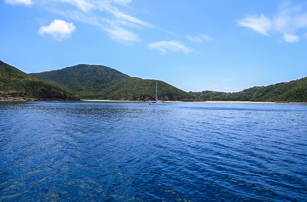
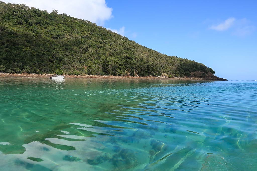
As we neared Keswick and St. Bees Islands, I felt encouraged. They looked hilly and green, and there was no swell whatsoever. As we got closer, the area’s natural beauty become even more apparent. There were two boats in the anchorage, one in our planned spot. But no matter; there was plenty of room. We picked a place near Basil Bay and dropped the hook. It was a bit rocky but the anchor caught. We had arrived! Below, photos of the view as we approached (click any photo to enlarge).
Oh my goodness, it was so nice here! The high hills had abundant greenery and surpassed my expectations. We had a clear view of both Basil and Arthur Bays and their lovely beaches. The water in the anchorage was glassy calm, dark but clear.
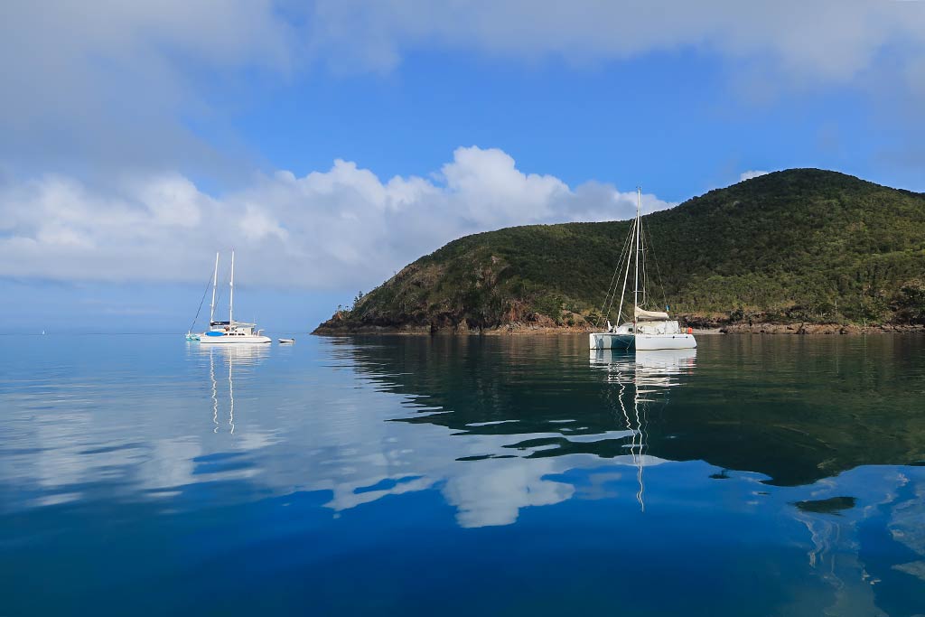
Looking at Basil Bay closest to us, I noticed the hills dipped into a saddle behind its impressive beach. I could see that what had been termed a “housing development,” consisted of hillside vacation homes scattered amid the trees, pretty places that melded in with the surroundings (and not at all the eyesore that I feared). The hills on either side of the beach were part of the national park and heavily forested. Southeast beyond the outer headland, I could part of St. Bees Island, hilly yet drier and grassier than Keswick. Below, some photos of our anchorage . . .
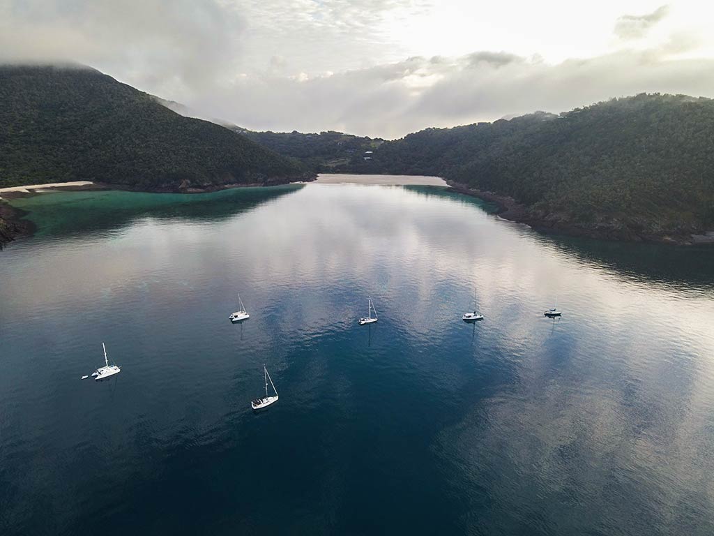
Plus a drone photo taken of the anchorage the next morning:
Soon, I started to hear bird calls, lots of whoop-whoops and squawking. A flock of white cockatoos screeched and chattered as they flew into the trees nearby. I had been anxious to get north and see these cockatoos again, and now here they were! Be careful what you wish for, though, as they made an impressive racket during the afternoon.
We relaxed awhile before I figured we ought to head ashore. Information about the trails had been nearly non-existent; so I hoped we’d find a trail map onshore. I had no idea where the Art Trail was, but at this point I hoped to find the forested trail to Arthur Bay, rumored to attract the island’s blue tiger butterflies.
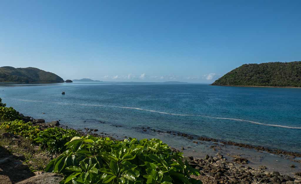
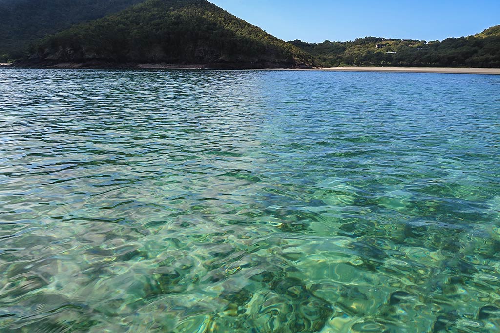
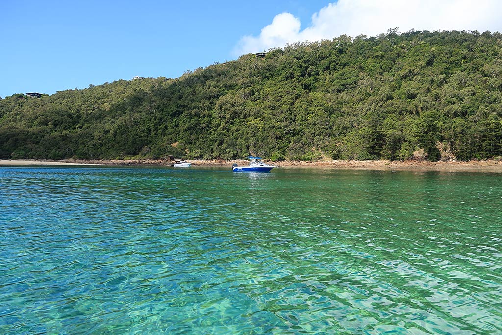
We got the dinghy into the water and headed in. As we neared the shore, the dark water transformed into pretty shades of blue-green with visible coral below us, including some impressive plate coral. While I wouldn’t rank it with the coral areas further north, it was fascinating and surprising to see this much here. It faded out as we approached the beach, but the water was so clear we could see every little rock on the bottom. I was anxious to see what surprises might await us on shore.
Below, a few photos from our dinghy ride to shore.
–Cyndi
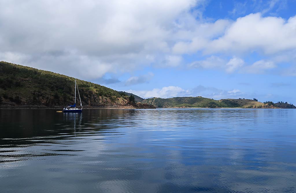
A Final Note of Interest to Yachties: If you take a close look at one of the interactive Google Maps, you’ll notice the image was taken during the southeast trade wind period. If you zoom in enough you can clearly see how the SE swell affects all of Keswick’s south-facing bays. We were lucky to have very light conditions when we came here, both for wind and swell. During heavier swells, many boats opt to take a mooring in the Egremont Passage between the islands or anchor in Connie Bay at the north end of the island.
If you find this information useful, or entertaining, perhaps…
AI Generated Image – see the bottom of this post for more info. Click on picture for larger version.
The Whitsunday Islands group is made up of 74 islands and dozens of islets scattered between the north Queensland coast and the Great Barrier Reef. They are part of a larger group of islands known as the Cumberland Group. (However, the entire Cumberland Group is often included when people talk about cruising “the Whitsundays.”)
Below, an interactive map of the Cumberland Islands, which the Whitsundays are part of.
While islands line the entire Queensland coast, it’s here in the Whitsundays where they take on a significant change–going from hilly and scrubby to more mountainous and green.
Since the Barrier Reef lies in close proximity to the Whitsundays, these islands are more protected than those further south. This allows for a greater number of suitable anchorages, some of which have fine white sand beaches with clear turquoise and green water near the shore. While coral exists further south, it’s more abundant here, enough to be a draw for snorkelers. Diving excursions can be taken further out at the Barrier Reef.
The wildlife is dense here, too, with a plethora birds, migrating butterflies, sea turtles, and at certain times of the year, migrating whales. The climate is warm, but winter trade winds offset the mainland’s heat.
Not surprisingly, these islands happen to be beautiful, especially those with white sand beaches. This makes the Whitsundays a popular tourist destination. While most of the area is national park, there are a handful of resorts scattered through the islands, some of them very upscale. The majority of visitors, however, prefer to travel through the Whitsundays on a sailboat, making this one of the most popular yachting destinations in the Southern Hemisphere. Since visiting here in one’s own yacht can entail weeks of travel, the charter boat business is a thriving industry.
And this makes for the biggest drawback of cruising these lovely islands: crowded anchorages. It’s particularly crowded during the winter cruising season when privately- owned boats descend on area. These same boats generally head south at the start of the summer cyclone season, but since the charter industry runs year round, it’s never empty.
Crowds aren’t the only hurdle. The peak of cruising season is also the peak of the trade wind season, and these winds can become quite strong (known as enhanced trades). Enhanced trades result in fewer viable anchorages, unpleasant conditions for moving around, and rollier anchorages. The trade winds die off during the summer months, but that’s when cyclone season begins. Not wanting to take that risk, cruising boats usually migrate south.
Boats that remain, and the charter boats, have another issue: the Irukadji jelly fish that ply the warm waters off north Australia during the summer. This is subject I’ll be posting about, but I’ll sum them up this way: they are tiny, and they can be lethal. Those who survive a sting endure excruciating pain until they can get to a hospital.
As a result, most people going into the water in the summer months wear something called a stinger suit, a lycra or neoprene suit that covers the body, with the addition of boots, gloves, a hood and preferably a mask. Those who chose to go without take a terrible risk. I will add that wearing this getup is not much trouble for scuba divers (usually just adding a hood to what you’re already wearing), but the idea of taking a swim in a full stinger suit, especially in the summer heat, is not all that appealing.
So cruising the Whitsunday Islands is not without its hurdles. In the winter it’s the crowds and wind, in the summer it’s deadly jellyfish and cyclones. But there’s one risk that exists year round: sharks.
Unfortunately there is something about Australia that makes critters such as snakes, spiders, jelly fish, and birds extra hazardous. Sharks such as bull, tiger and white sharks are dangerous enough as it is, but it seems they are even more so here. Australia has the highest number of fatal shark attacks in the world. Other places have more attacks, but they are less likely to result in a fatality.
It seems the Whitsundays are quite a nice place for big species of sharks to live. After doing some research, I believe the high number of tourists here contributes to the number of shark bites that have happened in this area. Unfortunately another contributing factor–in my opinion–has been the tourist industry squelching reports of attacks, to the detriment of boaters coming here and not realizing the risks. This is yet another blog post subject I’ll be addressing, not just regarding Australia but a few places we’ve traveled.
For now, we can all just acknowledge sharks are an issue in the Whitsundays. There are places absolutely not to swim, and others where people should not go in the water, and yet they do. And places where the risk is no greater than anywhere else in Australia.
So, the Whitsundays are beautiful islands with some fantastic beaches. But not without its issues. Cruisers can have a great time, but it’s wise to be informed and make conscious choices regarding conditions that are present at particular times of the year.
Some cruisers don’t mind crowds at all and love an event called Race Week, taking place in August. People on big rental catamarans may not mind windy conditions. On the other hand, people who love to swim will want to be conscious of when they come here and where they go (I think maybe Greece would be a good alternative. Just kidding. Sort of.)
While I am just starting to do blog posts about this area, I will say in hindsight that I found the Whitsundays beautiful and am glad we did it. Rich was not as impressed overall but did appreciate some of the individual places we saw. We went in the spring, after the crowds and strong winds, but before the jellyfish and cyclones. We didn’t go in the water much, and when we did we sat in shallow water along the shore; no actual swimming. Since we lived to tell the tale, it worked out pretty well!
I was going to look for a photo to sum up the look of the Whitsunday Islands, but I thought hey, maybe let AI generate an image. I told Rich the key features I’d like to see, he did some work, and voila, the photo at the top of this post! It’s not of a particular place but more to convey the look and feeling of the Whitsunday Islands. I think AI did a remarkable job! –Cyndi


