As I mentioned before, Port Davey is considered the jewel in the crown of cruising Tasmania. Its remote location is considered really difficult to get to. Aussies in general consider Tasmania a wild and dangerous place for a boat, while Tasmanians themselves consider the trip to Port Davey a wild and dangerous place for a boat. Thus, making the trip to Port Davey is considered, danger-wise, like doing a great white shark dive without a cage.
The reality: this can be a nasty piece of ocean, but if you make the trip in the dead of summer and wait for a good weather window, even the Little Girls on Legacy can manage it. We motored to Port Davey in calm seas, little to no wind, on a warm sunny day.
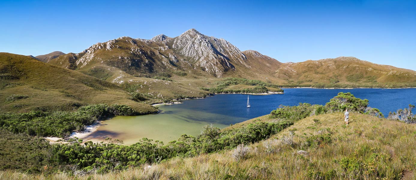
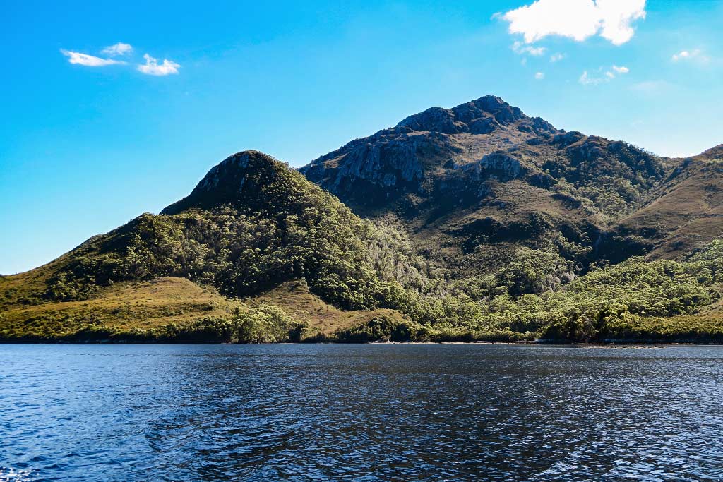
My initial expectations about Port Davey had been formed by the remarks of other people, saying it’s a wild and remote place. I pictured giant trees and thick rainforests, but I was wrong. Although it does have forests, much of it is rather tundra-esque.
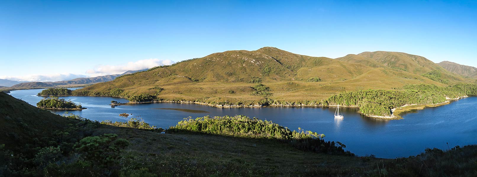
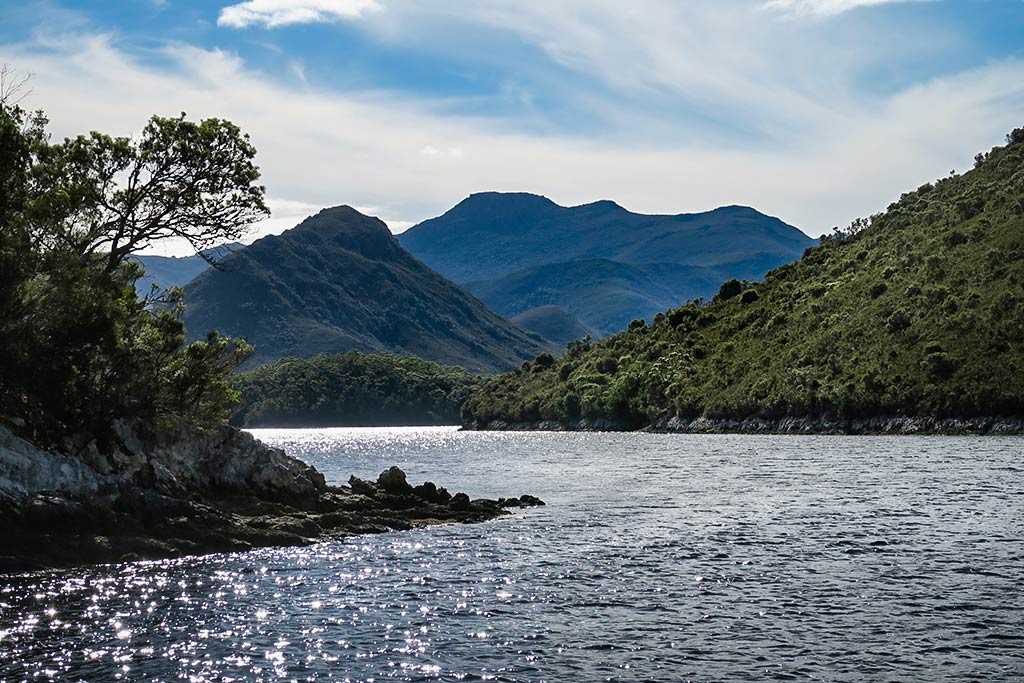
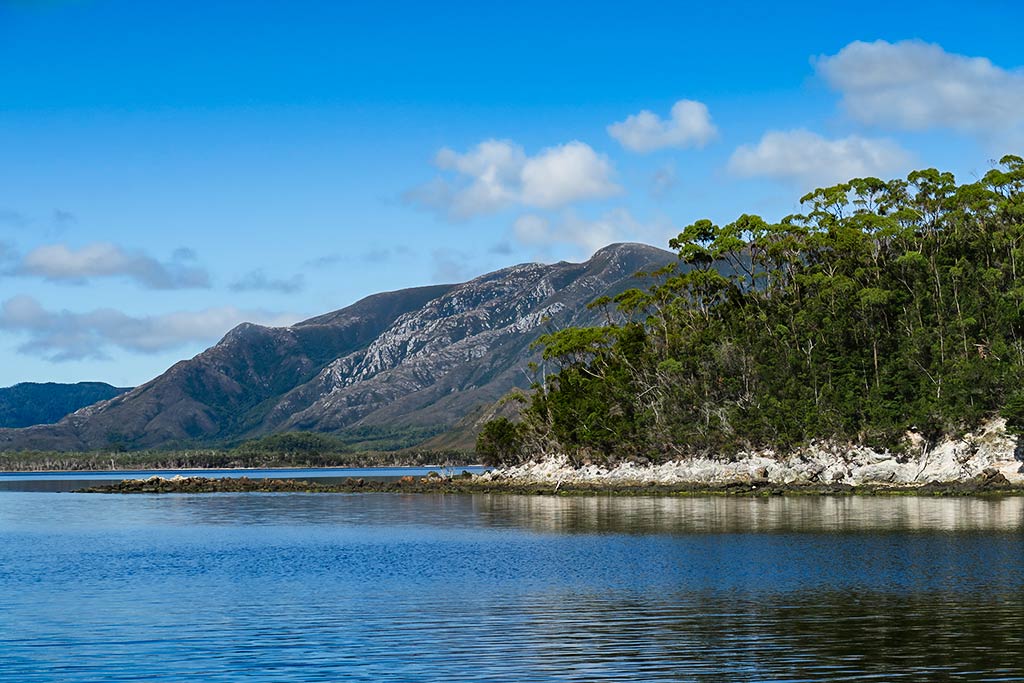
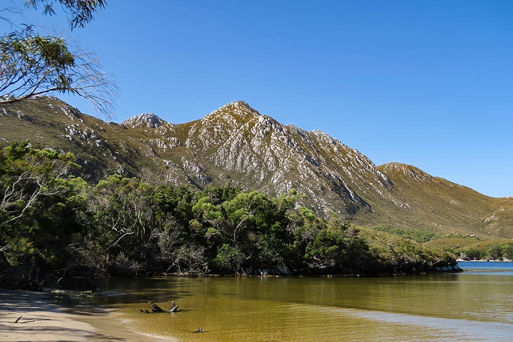
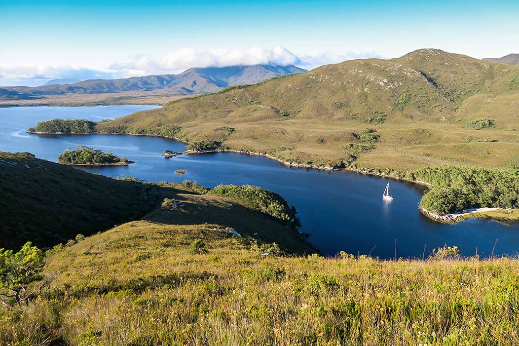
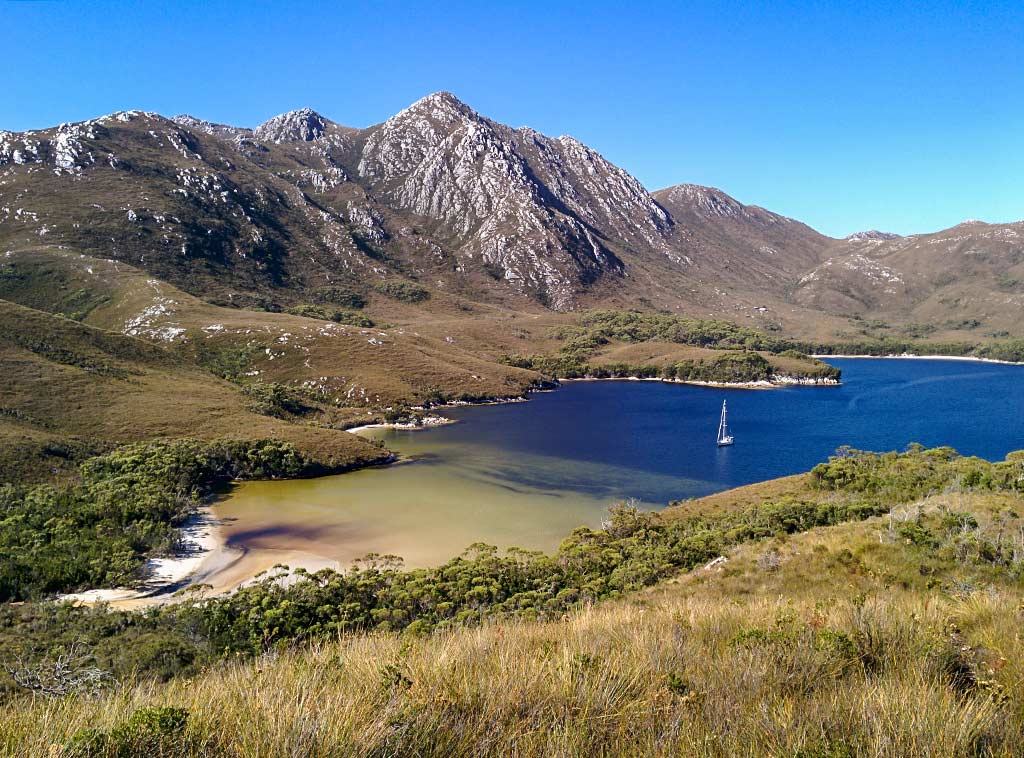
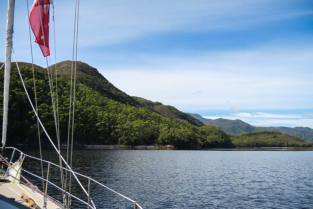
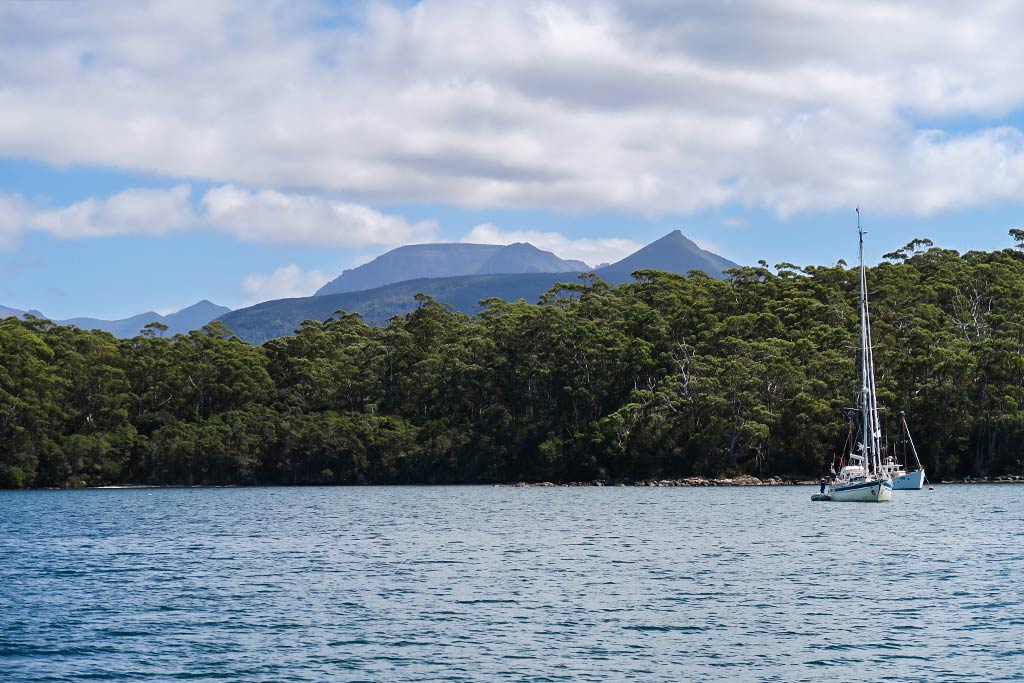
It’s definitely an exotic place, featuring a 7-mile long channel that runs, fjord-like, amid hills and mountains. The far end of the channel opens up into a large body of water called Bathurst Harbour which is much like a lake. Off this lake is another very narrow channel, about 3 miles long, which leads to Melaleuca, a large flat area of land with an old homestead, a small airstrip, and rare Orange-bellied parrots. Below, an interactive map of the area.
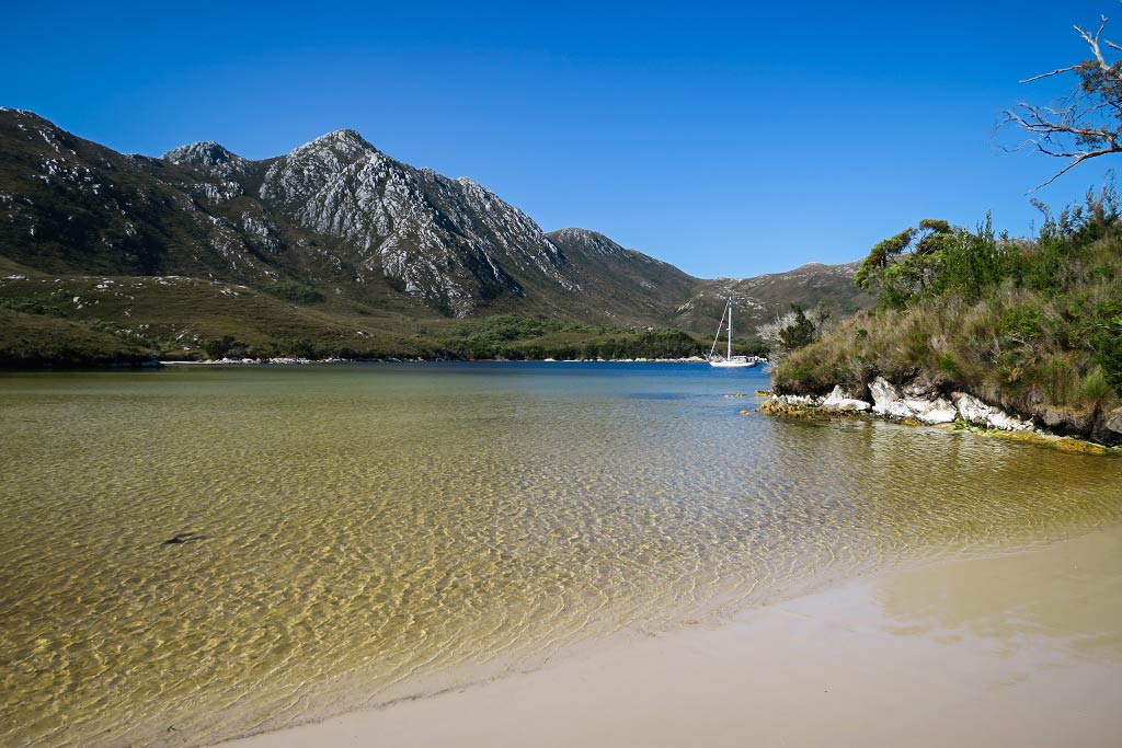
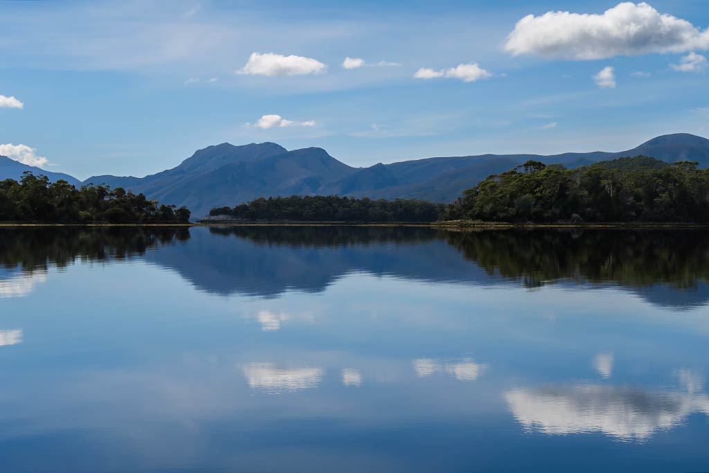
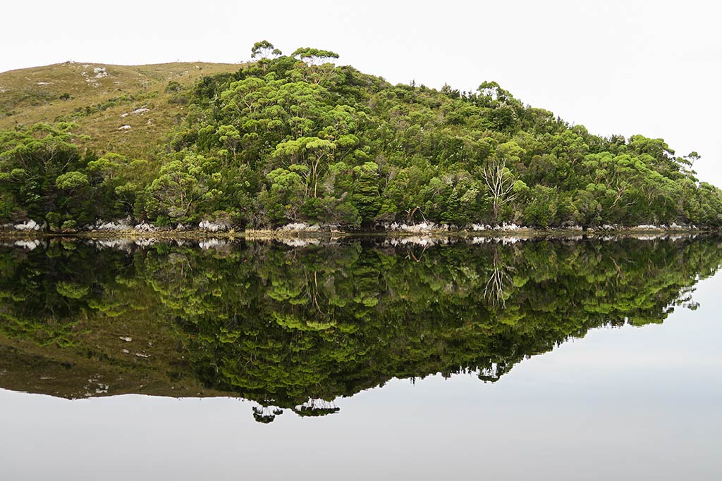
This area is ruggedly beautiful, but what makes it most special is the water: very clear and very dark–black where it’s deep and amber in the shallows because of the high tannin content (which leaches into the water from the area’s vegetation).
The dark tannic fresh water sits over a layer of clear saltwater. Some marine species that normally live deep in the ocean are also able to live here because of the layer of black water above. This is the only place in the world like this. The other thing the dark water does is beautifully reflect the mountains above it. When it’s still it creates a remarkable mirror image.
I will mention I wasn’t completely convinced ahead of time that we’d love this place as photos don’t really capture the feeling of it. It looked very rugged and remote, almost barren in some areas. Being here, though, has a feeling peace and beauty that doesn’t come through in photos. We spent about a week there, and it definitely lived up to the hype.
Travel Note: While being here on a boat is fantastic, it’s also possible to take a package tour, flying in by small plane, then getting to ride in one of the small boats they use to show visitors the area. They also offer dive trips that go under the black water layer to see the very strange marine life. Or, after you fly in, they can drop you at one of the hiking trails. Bottom line: you don’t need to have your own boat to experience Port Davey. Below, a few photos from our time here (click to enlarge/scroll).–Cyndi
We must be cursed. Maybe it was some old lady that I failed to help across the street. She put a hex on me for my failing. Maybe it’s the universe saying “You have it too good. Here comes some crap to balance things a bit.” I don’t know. I just know there are things that could be better right now. Here’s the story.
First, shortly before leaving Hobart, our computer crashed. It looked like one of our hard disks failed. I tinkered with it for a little while (OK, more like a long while) and got it working. Part of getting it working was reinstalling Windows and its cursed updates. That broke other things. I’ll get to that in a minute.
After cruising the D’Entrecasteax Channel, we left Recherche Bay on the 60 mile trip to Port Davey. As usual, I’d plotted a course on the computer and as we were leaving the bay, I plugged it into our chartplotter. As is my routine, I scrolled along the route to make sure we weren’t going to have to sail over any rocks or islands and to my surprise, I found the Navionics chart data disappeared about half way to Port Davey. Crap! We were just leaving a bay with no internet so there was no way to update the charts (which shouldn’t have needed updating as I got everything we’d need this season some time ago).
We’d resolved to use our iPad (which does have the detail on its version of the Navionics charts) for our navigation needs. Cyndi’s optimism about possible stray internet waves convinced me to take a look and to my surprise, we found 4G service just outside bay. We slowed the boat to a crawl and I took about a half hour to install the Navionics chart updater software and re-download the charts we’d need.
That done, we still didn’t have the missing details. Oh well. The iPad it is then. A few hours out, as I was playing with the chartplotter, I turned on the “Fish n Chips” view. Surprise – charts! That’ll work. (Yes, Fish n Chips is its real name. I didn’t make that up. I couldn’t come up with something that lame! It took the expert marketing team at Navionics to think of that.) Issue #1 resolved.
Enter issue #2. This morning, with no internet anywhere in the extremely remote Port Davey, we turned on our satellite phone for a weather forecast. No joy. It seems updating Windows killed the simple little email program we use to send and receive email via the sat phone. I tried reinstalling it (clever me – I kept the install file). No joy. It needed an internet connection to install. Maybe a different email program? I had others I could try.
A program called iScribe installed just fine but wouldn’t connect a sat phone call to send the email weather request.
I tried making a call with the sat phone – a diagnostic first step. No joy. I got a message that said “emergency calls only!” I guess my minutes must have expired. I usually get a notice before that happens.
A trip trough my computer was fruitless as I couldn’t find anything that wouldn’t require an internet connection that would tell me when I purchased the most recent stack of sat phone minutes. Aaaaarggh!!!
I don’t think we’re doomed yet. I can probably send and receive email, including weather forecasts with the HF radio (HAM radio) via Winlink. I haven’t done it in a while because the sat phone is just so easy (usually). If all else fails, we’ll just listen to the VHF weather forecast. We don’t like it but if that’s all we can get, it’ll have to do.
But that might be problematic. We checked in with Tas Maritime Radio on our way here and told them we’d check in again when we arrived in Port Davey. So far, I haven’t been able to make contact with them. I’ve tried VHF (they assured me that they had good VHF reception from Port Davey), and I’ve tried the HF radio frequencies they monitor. No joy. Could our VHF have a problem? Could our HF radio also have a problem? (Not likely. The issue is probably just the mountains around us and the remoteness of this place.)
Do you see why I think this must be the result of a curse?
(Obviously, you won’t be reading this until sometime after our communication issues are resolved, but it feels good to whine about it now.)
Update: March 22, 2017
To be fair and balanced (what, you thought I was Fox News!?), I should report the stuff that’s going very well.
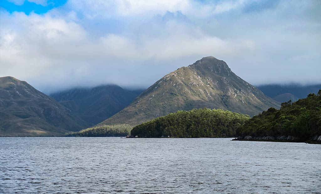
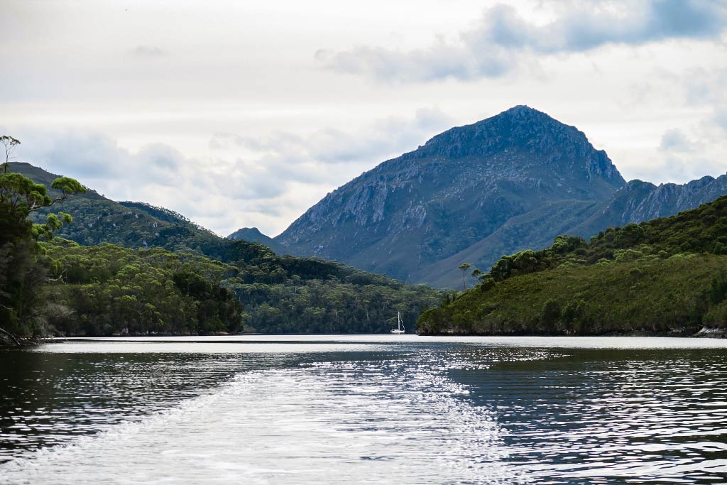
First, I’m surrounded by beauty (and I’m not just talking about Cyndi here!). Port Davey is truly amazing, and we’ve only just scratched the surface. Our first bay was at the base of a very large and very beautiful mountain. A short walk up a hill on the other side of the bay revealed stunning views of the pyramid islands near the entrance to this channel as well as an amazing view of Legacy at the base of Mount Stokes.
We timed things very well. Just a few days ago, this small bay had 40 boats, all part of an around Tasmania rally. They cleared out just before we got here.
And we did get our communication working via HAM radio. We’ve been able to get weather pretty easily. We’re not really liking the weather we see coming, but at least we know what’s ahead. -Rich
Having worked through the issues in our previous post, all was pretty good aboard Legacy. It was time to do a little motoring around Port Davey, see some sights and find a good place for last night’s 15 to 20 knot easterlies.
The tour went well. The wind came up a little early and we decided to duck into Casilda Cove for the night. I positioned the boat, Cyndi dropped the anchor and I backed to set it. One HUGE problem. I forgot to pull in the long line we use to tow the dinghy.
The inevitable happened. The prop sucked the line in and wrapped it around the shaft. The engine stalled from the load. We were coasting towards the rocks with no way to stop ourselves if the anchor failed to set.
I yelled to Cyndi, “Get the anchor out!!!” She thought I wanted her to get it out of the water and started to pull it in. I ran to the bow and corrected my miscommunication in time. She let more chain out and the anchor caught. The immediate disaster was averted. We were holding well and had at least another ten feet before we would have hit the rocks!
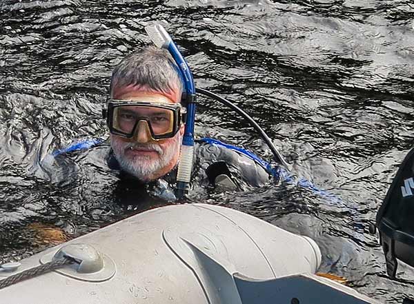
Now to investigate the damage I’d caused. I was pretty certain that it would take a trip into the water to unwrap the prop. Maybe I’d have to cut the line off the shaft. After climbing into the dinghy (now pulled up hard against our stern), I saw I was right. The cold, dark water of Port Davey and I would soon become well acquainted.
After suiting up in mask, fins and the lycra suit we use in the tropics (we have no wetsuits aboard), I jumped in. When I was able to breath again, I dove down and was able to untangle the prop and shaft in one dive.
You’re right. That’s not my happy face. You’d think I’d be more excited about diving in Port Davey, but it’s cold!
(OK, in the interest of full disclosure, the water was 64° F – or 17.8 C for those of you who still think the metric system is a pretty neat trick. I guess that’s not that cold but my testicles didn’t see it that way!)
Back aboard I took the first of (spoiler alert) what would be three hot showers. After I was warmed up, we tried the engine. For about twenty seconds, all was well. That was before the horrible squeak started coming from under the boat. My theory was that some line fragments worked their way into the cutlass bearing which overheated and grabbed the prop shaft. I thought that if I got back into the water, this time with scuba gear, I could probably pull out the stray line and trim the damaged cutlass rubber away. But before doing that (maybe I was just procrastinating), I wanted to get a look at the prop shaft coupling at the rear of the engine.
It didn’t look right. I couldn’t turn the shaft by hand and it looked like the flexible coupling between the engine and prop shaft was being pushed out of alignment. I removed the coupling bolts and the prop shaft shifted about an inch and a half to port. That’s bad!
I quickly developed a theory as to why this was the case. The theory, unfortunately, turned out to be correct. When the line wrapped, it yanked the shaft to starboard as it was secured on a starboard cockpit cleat. The force bent the prop strut to starboard, forcing the coupling on the engine end to port. That was very bad news.
The good news is that from what I was able to determine from turning the prop shaft (with great difficulty), it seemed that the prop shaft itself was not bent.
My plan was to get in the water, look the situation over and if warranted, secure a heavy line to the end of the strut which I’d run to the port side of the boat. Running it though a couple of turning blocks and to winches, I’d hoped to be able to pull the line hard enough to bend the strut back into the proper position.
A brief scuba dive and another hot shower later, we were ready to start winching. Cyndi watched the alignment below and I cranked the lines, using one of our big main winches and our electric cockpit winch. The forces were tremendous and scary but the process was working. After several pulls, we finally got to the point that the couplings would line up after the line tension was released.
I bolted the shaft back to the engine and checked the alignment. To my relief and surprise, the alignment was perfect. After getting in the water again to remove the line, we could give the engine a try. After a second scuba dive and a third hot shower, we fired up the engine.
I don’t know if you can imagine the relief when everything in our drive train was smooth and quiet. Sailing out of this small, tight bay without an engine would have been difficult at best. Sailing all the way from this remote corner of Tasmania to a place where we could haul out and make repairs would have been no fun at all. As it is, I’m pretty confident that we can continue on with the cruise as planned. We may need to replace the cutlass bearing during our next haul out (next year), and maybe check the strut alignment (I’ll rig some kind of laser pointer tool to check it out), but for now, all seems well. Whew!
Hey, and now I can say I’ve been diving in Port Davey! -Rich
Some random notes:
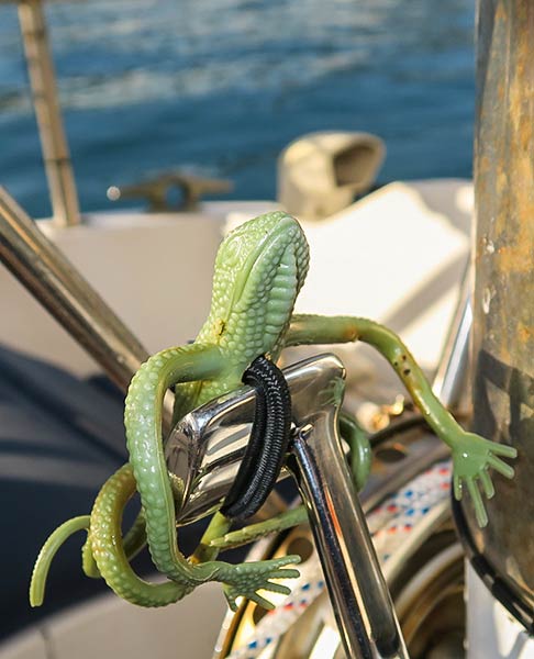
Why did this happen? Two reasons: I made a mistake and Remo fell down on the job.
Who’s Remo? That’s somehow short for “Reminder Lizard.” He’s a plastic gecko and when we have the dinghy trailing behind the boat, or a fishing line out, I ask him to sit on the throttle lever to remind me not to back without bringing in the lines. The little wires in his body are giving out and now he slips off the lever. I don’t always notice and so, you see, I mostly blame him!
Why are you telling us all this? Several reasons:
I don’t want you to suffer under the illusion that I’m perfect…
Or maybe, by telling you the story of how I was able to solve the problem, I want you to see how smart I am, or…
Maybe I just wanted you to take comfort in the idea that if I could solve this problem, anyone can.
What’s the mood like on Legacy? Very good, actually. We both took it in stride and went about our repairs in a pretty good mood (despite what I look like in the picture Cyndi took of me in the water). I give Lexapro a lot of credit for this. Both of us started on a very low dose a few years ago in Tonga and we’ve kept it up ever since. I’m a big fan. I think it counteracts some of the symptoms of aging in my brain. It doesn’t change who I basically am but I feel much less anxiety and stress and generally enjoy life more.
And the final reason I share all this stuff: I want you to see what real life is like out here. No Pollyanna stuff here. You get the good with the bad. Cruising life is good but it’s not perfect. It’s only life, after all.
Update:
Remo, with his new and improved lever-holder-oner.
(Yea, yea, that is rust on the binnacle stainless steel. If you don’t like it, bring your polishing cloth!)
We’re off from Recherche Bay to Port Davey, a route that will take us along the bottom of Tasmania and the furthest south Legacy’s ever been. This will likely be the last internet we’ll have for the next two or three weeks. I’ll update occasionally using our satellite phone. -Rich
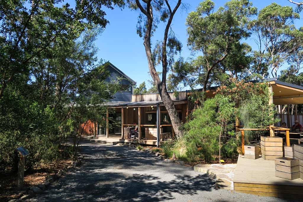
Someday we’ll do in-depth blog posts about Tasmania, but for now I just wanted to do a few general posts for anyone who’s interested, to give an idea of what cruising Tasmania’s like and why we loved it. I’ve done one post so far touching on some of the east and south coasts, and a bit of Hobart (here). Now, finally, here’s the next one.
After three wonderful weeks spent sightseeing and eating our way through Hobart–the pizza! the burgers! the seafood (damn)! the bread (that good)! the cheese (France has nothing on Tasmania)! the beer (Moo Brew and Denzel Frothington are big faves)! the wine (Tassie makes excellent ones)! the produce (including eating fresh wild blackberries picked from bushes that grew alongside sidewalks)!, the Asian noodles!, and other foods to numerous to mention–we reluctantly dragged ourselves away from this beautiful, historic city and garden of culinary delights.
Sightseeing highlights in and around Hobart were many, including touring wineries in Coal Valley, visiting beautiful Mount Field national park, going to the top of impressively-high Mount Wellington overlooking Hobart, and seeing the MONA museum which exceeded our expectations (and is one of maybe two museums in the world that hasn’t bored the heck out of Rich).
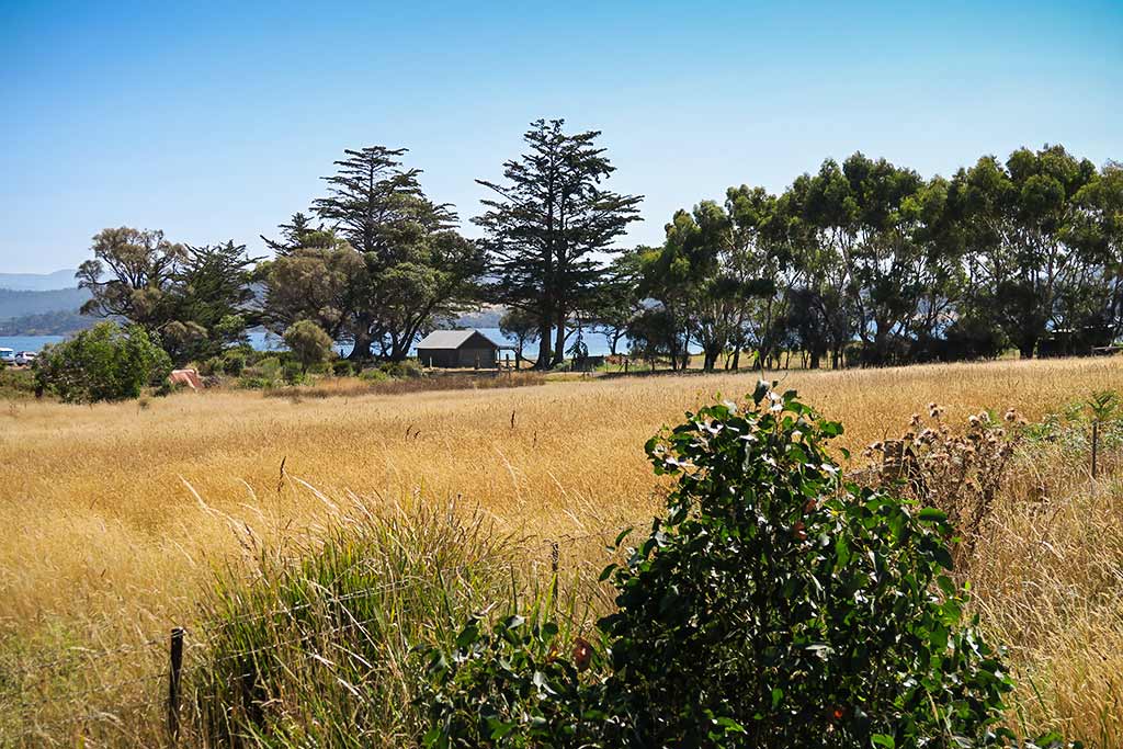
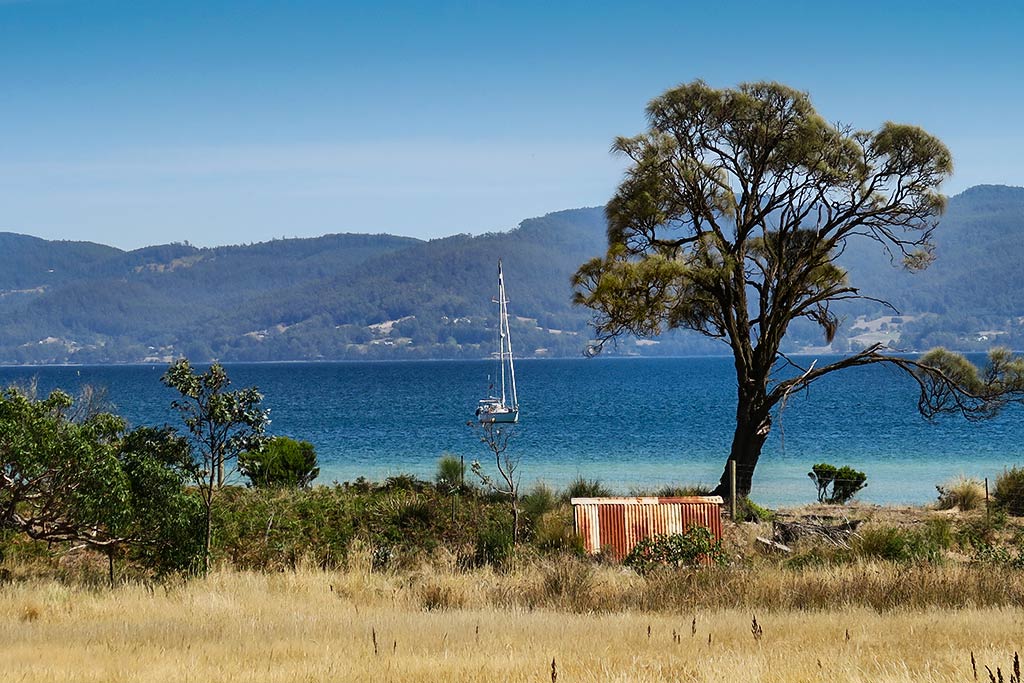
After Hobart, the next phase of our trip began when we traveled down the 25-mile long D’Entrecasteaux Channel. It’s a waterway that lies between the southeast coast of Tasmania and a long, hilly island called Bruny Island.
For those who live in Hobart, this well-loved cruising ground is the go-to place for boating trips. It’s well protected from sea conditions, has lots of anchorages, pretty towns, the lovely Huon River, and it benefits from Hobart’s pleasant summer climate: warm, sunny and rather dry. Between the green and mountainous west side of the channel and drier, hilly and grassy Bruny Island, there’s something for everyone.
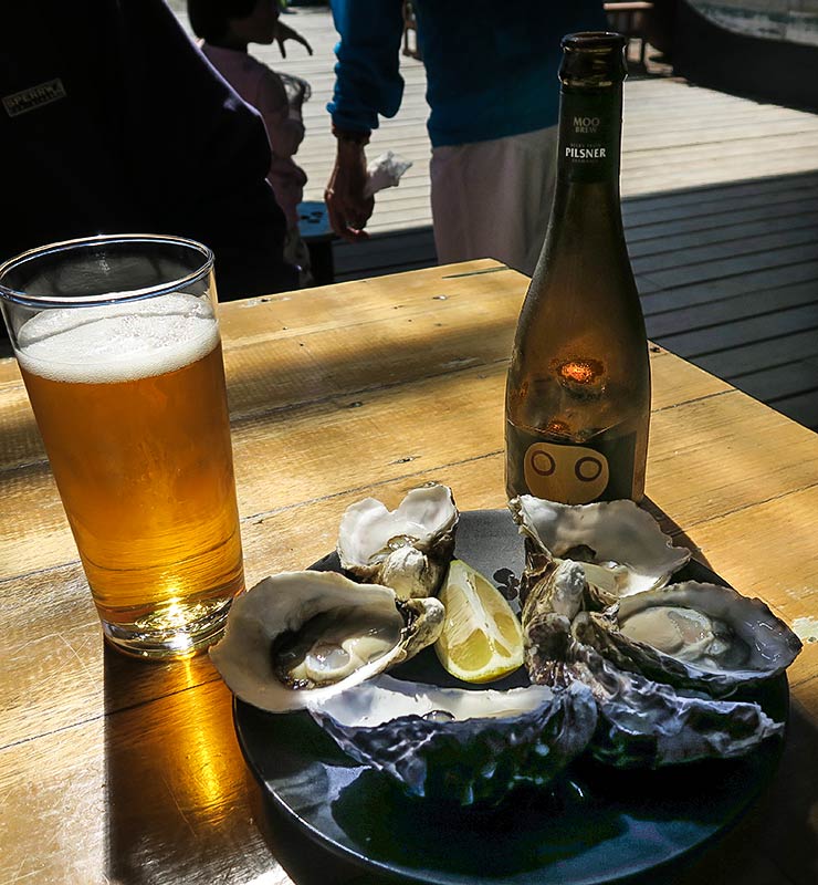
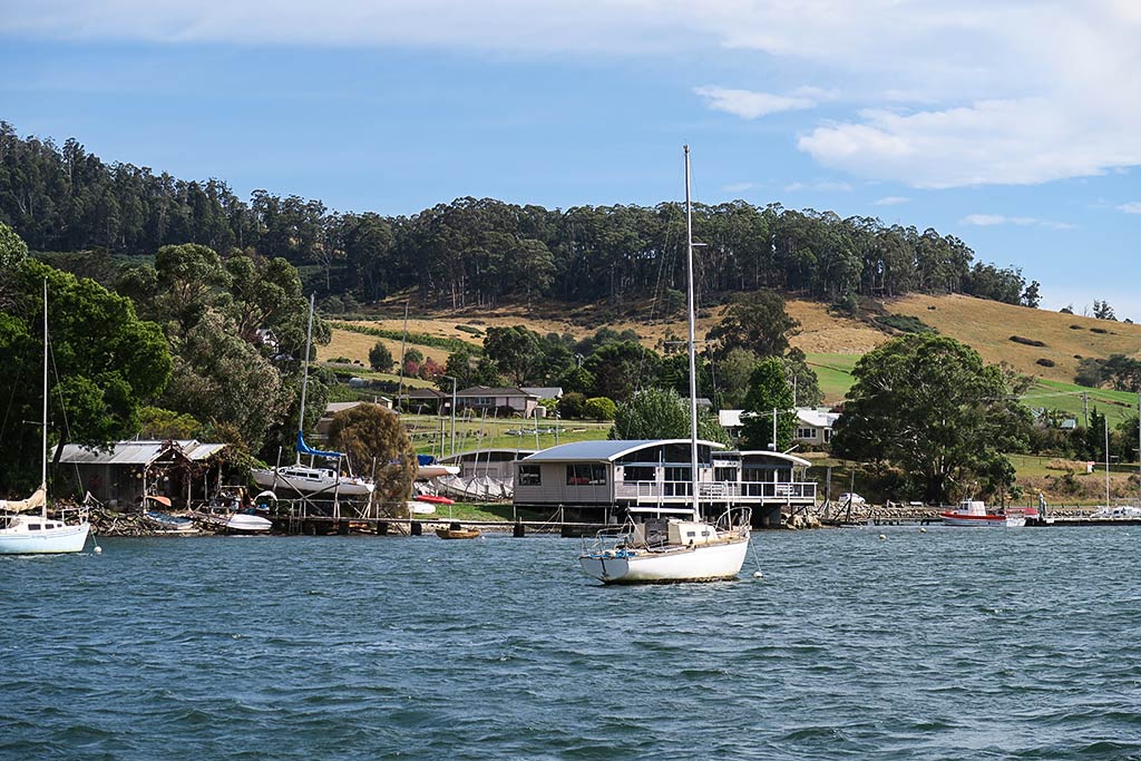
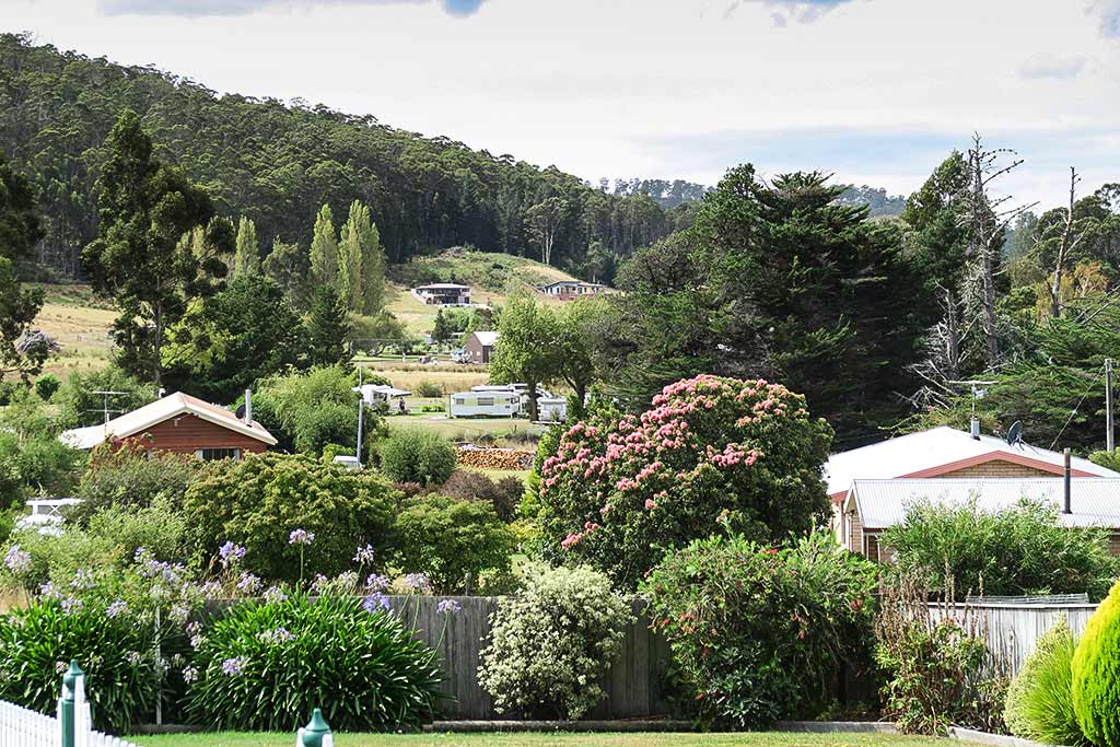
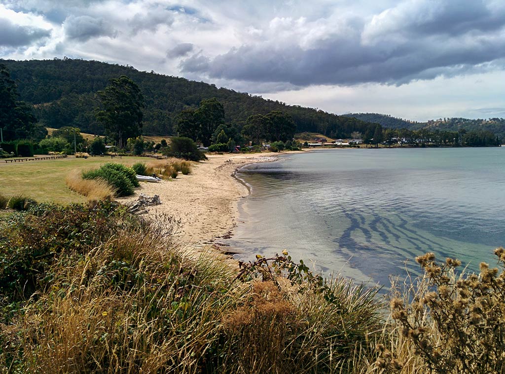
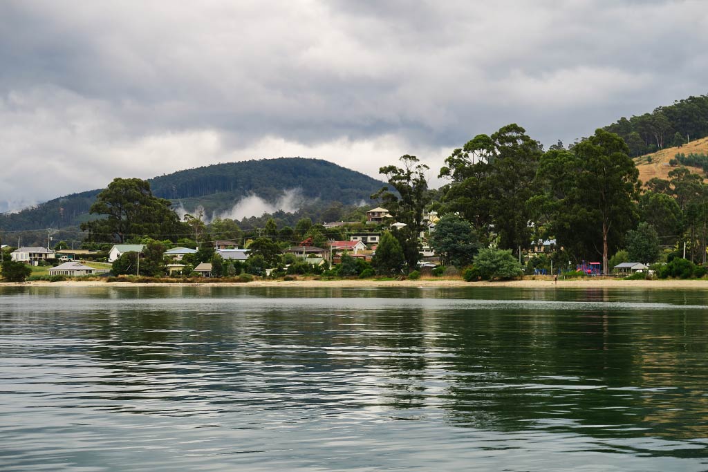
We’d planned to spend about 12 days in the area, but along came a weather window to Port Davey (our next destination) that we couldn’t refuse. Our 12 days became five, but we made the most of them, enjoying warm sunny afternoons sampling the incredible oysters, cheese, sourdough bread (even better than Hobart–which is saying a lot), and beer on golden-grassy Bruny Island, going up the Huon River to pretty Port Cygnet, wine tasting in the charming and pretty little seaside town of Dover, and taking in the remote beauty of Southport. Finally, we spent a day in the beautiful and remote Recherche Bay before making the jump to the west coast of Tasmania. Above, an interactive map showing our stops, some of which were just for an hour or two.
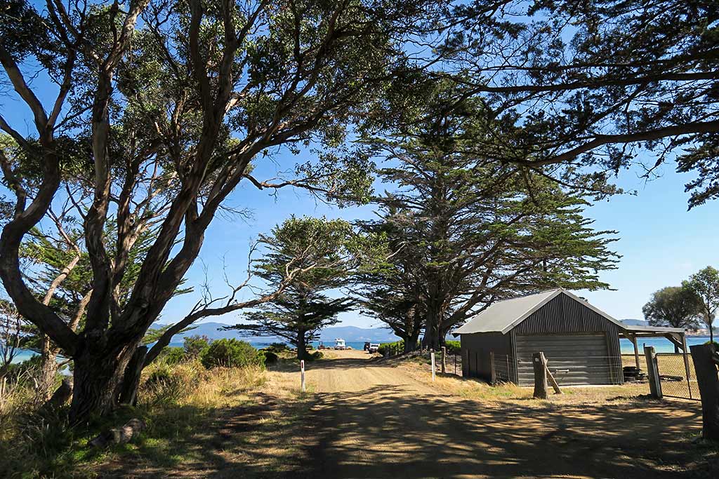
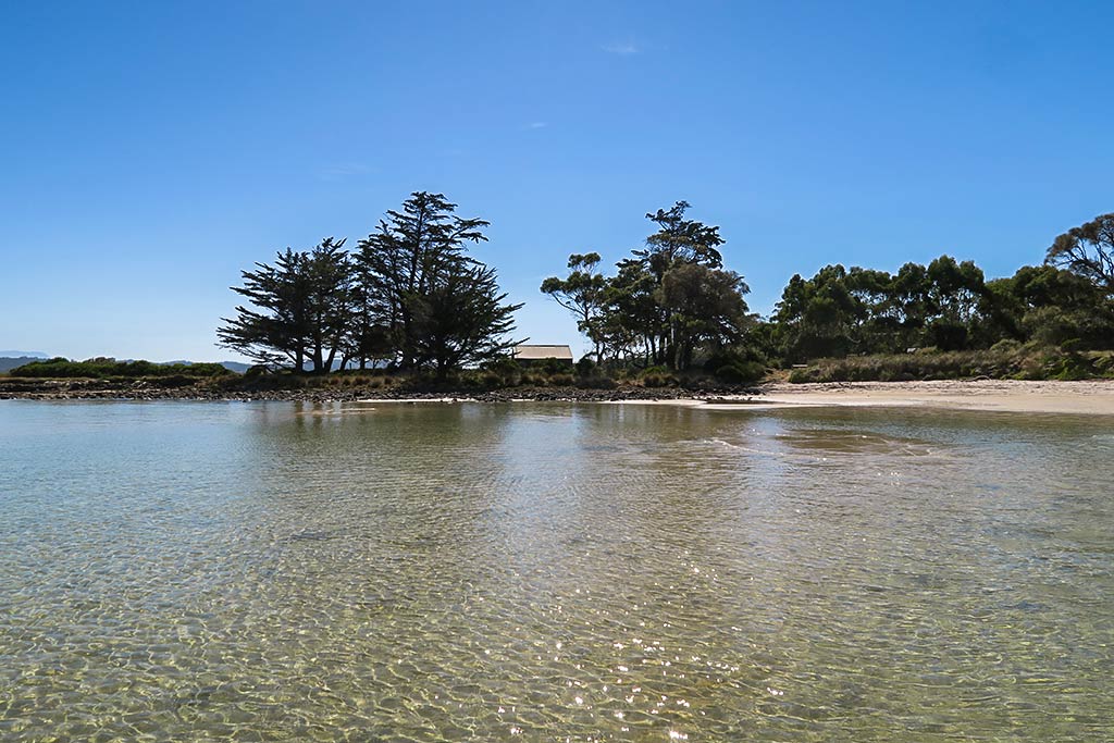
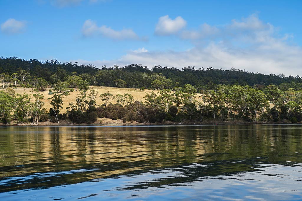
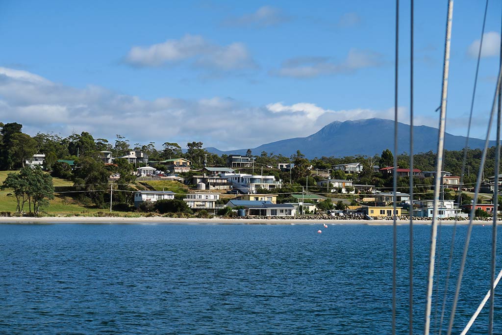
Below, a photo gallery of the D’Entrecasteaux Channel area, Dover, Southport, and Recherche Bay. (Click to enlarge and scroll through photos.)
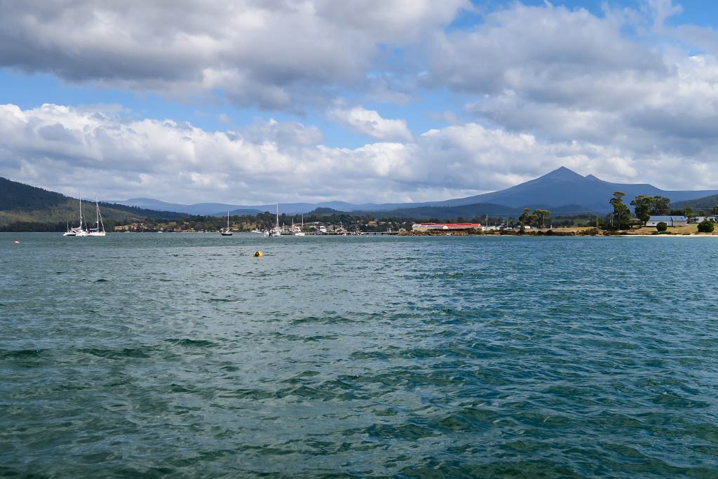
It was a shame to have to blow through this area so quickly, but the clock was ticking, not only on our visa but also for summer weather on the west coast, notorious for its potentially windy winter (including late fall and spring) conditions. We looked forward to seeing the jewel in the crown of cruising Tasmania: Port Davy, accessible only by boat or small plane.
And so we set out from Recherche Bay, down around the SW end of Tasmania and up a portion of the west coast. One local guy, hearing our plans, said, “Wow, that’s a dangerous trip!” Many others had seemed to wince at the idea of our going up the wild and wooly west coast. It seems a long history of boats ignoring or not knowing weather forecasts (and needing to be rescued as a result) has permeated the consciousness here–so many people seem terrified of this area of the ocean. As you can see from the photos below, being willing to wait for an appropriate weather window can result in a long day of motoring in calm seas, much preferable to sailing in gale conditions. Our main concern was having enough sunscreen.
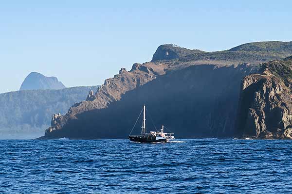
Here, a photo from rounding the dreaded Southwest Cape of Tasmania.–Cyndi