
Posted June 16, 2024 about
September 23, 2022
The name Chance Bay, our next destination on Whitsunday Island, actually refers to a large area that contains two distinct bays. Below, a map of the entire Chance Bay area:
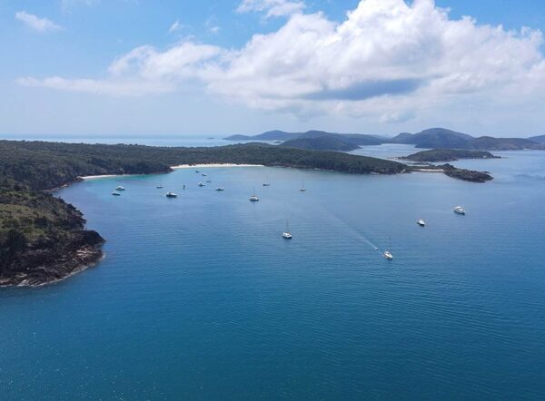
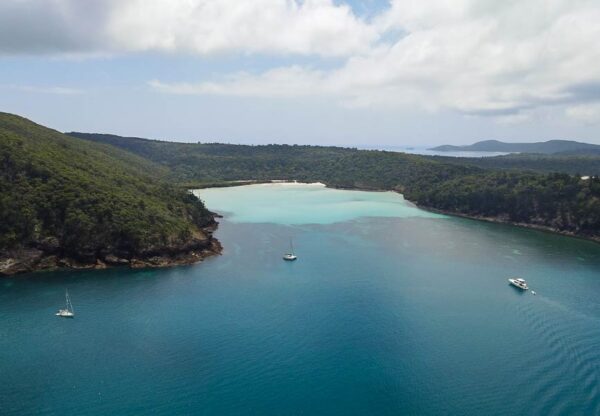
The beachy eastern bay is generally what people are thinking of when talking about Chance Bay. It’s wide, with two white sand beaches separated by a small headland. A large peninsula called Theo’s Point forms the western border of this bay. Below is a drone photo of the bay.
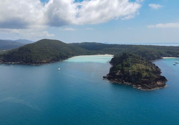
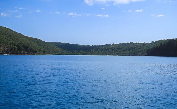
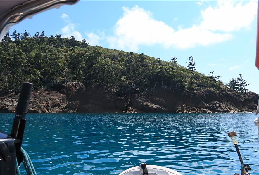
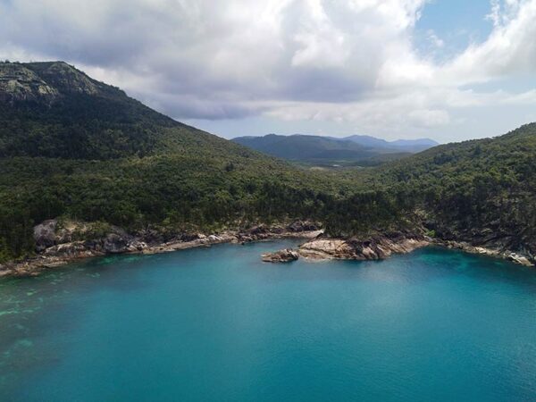
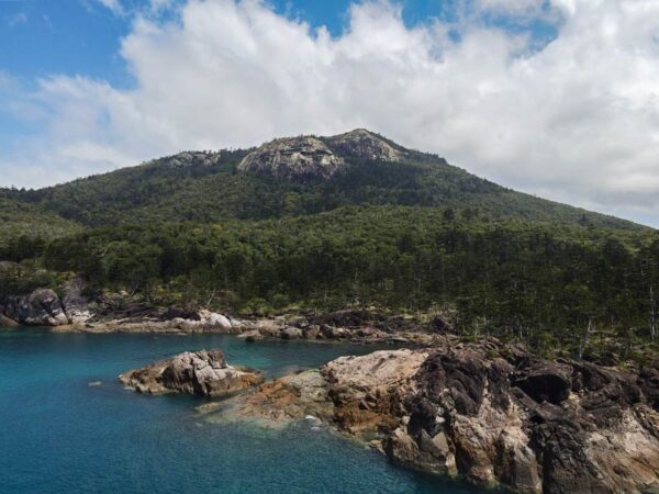
On the other side of the peninsula is a deeply indented bay called Crano Cove. Crano Cove is technically part of Chance Bay, but it’s very different in its look and feel and generally not visited by tourists. Below is a photo of Crano Cove.
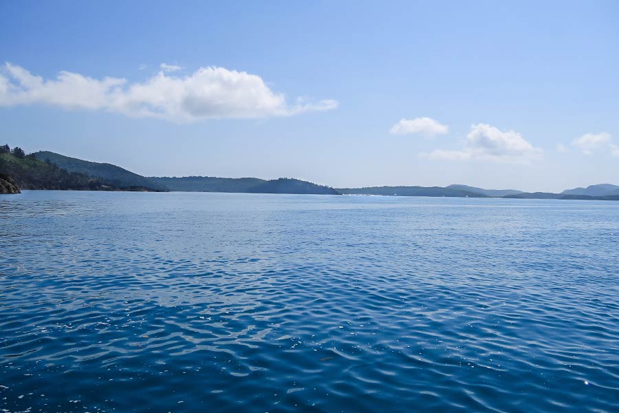
We headed off for our hour-long trip to Chance Bay. As we motored past an anchorage known as Crayfish Bay, I was disconcerted to see quite a few boats. Where did they all come from, and what were they doing there at Crayfish Bay (less of an attraction than Turtle or Chance Bay)? I worried this could be a sign that Chance Bay was crowded. Below, a photo of Crayfish Bay.
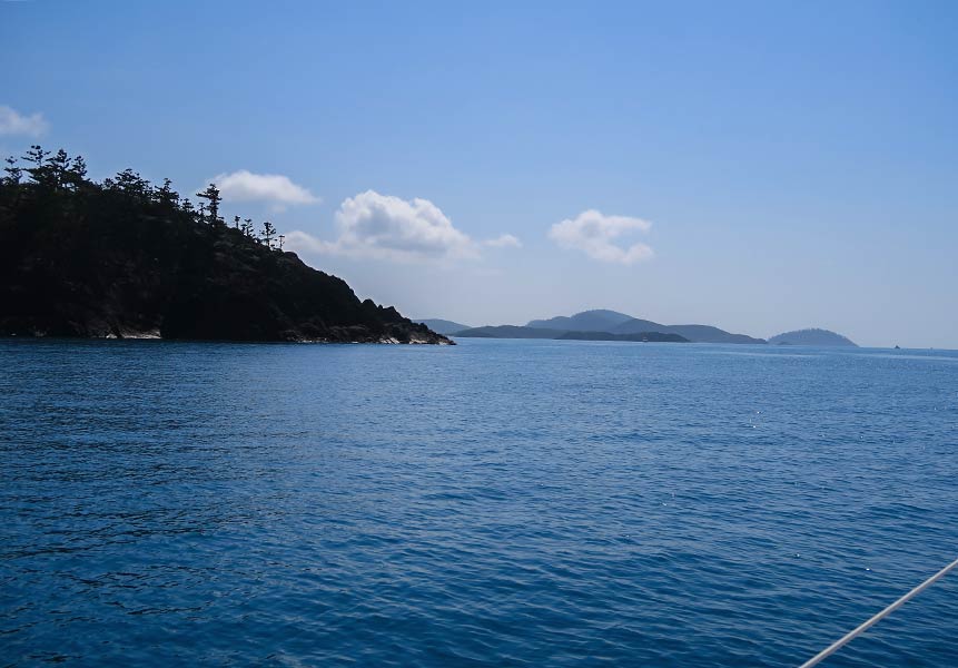
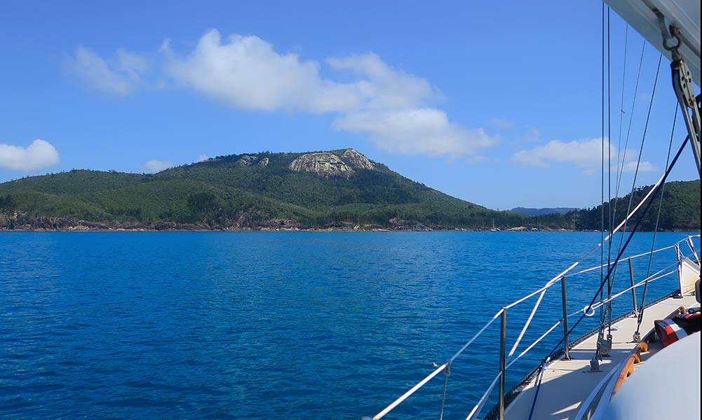
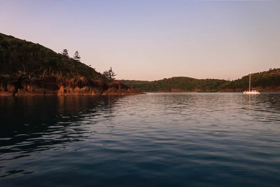
As we motored along, the scenery was attractively mountainous. It wasn’t long before we went around a rugged point (Craig’s Point), after which we were able to see the entire Chance Bay area. I was relieved to see Crano Cove, our Plan B spot, was not busy at all! Further on, though, eastern Chance Bay had a good number of boats.
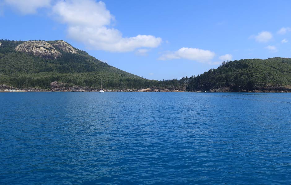
We motored over to get a closer look at the eastern bay. The hills here were very low, with drier vegetation and two strikingly white beaches. And boats. Lots of boats. With that, we decided to head back to Crano Cove, away from the crowd. We could still visit the beach by dinghy.
Below are photos of our trip, starting with our approach to Craig’s Point, then seeing the Chance Bay area ahead. Crano Cove hardly had any boats, while the beach area looked busy. After going in for a closer look, we returned to Crano Cove (the final photo).

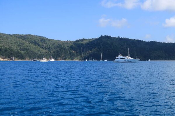
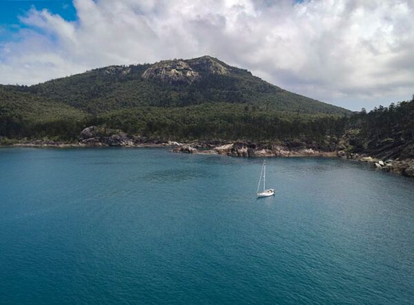
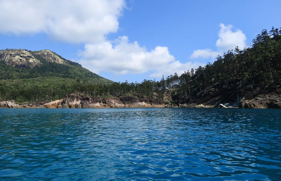
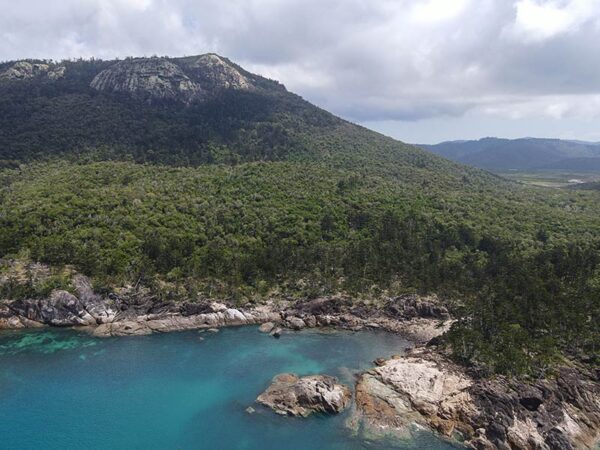
Crano Cove itself has an inviting beach, but it’s very shallow. This makes it necessary to anchor well outside of it, where the water is dark and the shore rugged and rocky. We were still inside the mountainous headland that borders Chance Bay to the west, and Theo’s Point peninsula to the east. An island southeast of Chance Bay adds some protection to the area.
Below is view of Crano Cove from the water and from above.
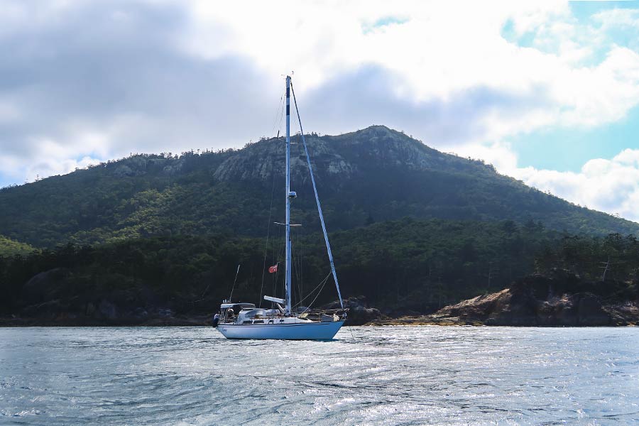
Rich picked a sweet spot tucked in behind a small island that was nearly attached to the shore, giving us our own little “bay” of sorts. Below, a photo of our spot . . .
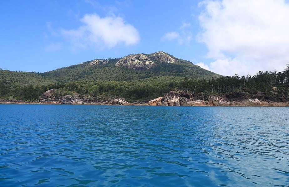
Here, the scenery had a mountainous beauty, with boulders, pines, and a mountain topped by a dramatic granite peak. This looked more like Tasmania than anything I’d associate with the Barrier Reef. And while it lacked the beachy vibe of what I’ll call East Chance Bay, it was stunning. We were very happy with this spot! Below are photos of the view around our boat.


And a few more photos from above, taken with the drone . . .
After we got settled in, it was time to dinghy over to eastern bay and its beaches, which will be the subject of the next post. –Cyndi


