
Published November 8, 2023
about September 19, 2022
Having transited the Egremont Passage between Keswick and St Bees islands, we were now headed north to Brampton Islands National Park, consisting of Brampton Island and neighboring Carlisle Island.
In some ways, this area would be similar to where we’d just been, featuring a pair of islands separated only by a narrow channel, with an intriguing outlying island to the east, Cockermouth Island. There was even an abandoned resort in the mix.
Below is a map of the park’s two islands. If you zoom out, you can see outlying Cockermouth Island.
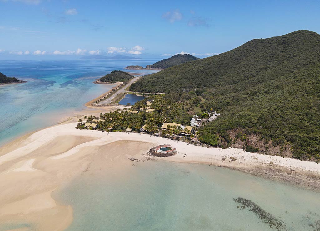
Today, we were headed to the island with the resort, Brampton Island. Unlike Keswick, the anchorage here would be shallow, the lighter blue water marbled with white sand spits. Its striking appearance likely inspired the development of the now-historic resort overlooking the bay.
This resort closed in 2011 for remodeling and never reopened. It now sits in a state of decay, but its once-vibrant presence fostered a network of trails, including a circuit track and a path leading up to the 700-foot Brampton Peak.
Neighboring Carlisle Island holds less allure for visiting boaters, but it does have a camping area for landlubbers who manage to make their way out there. The channel between Brampton and Carlisle Island is shallow, navigable only for very small boats at high tide.
Today’s 14-mile trip from Keswick Island to our chosen anchorage at Brampton would be under motor, taking about 3 hours since we’d have no wind assistance. The morning was completely still and already warm enough to turn on our misters.
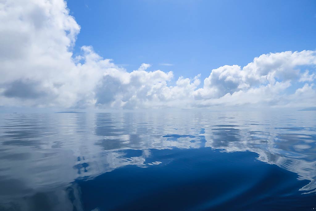
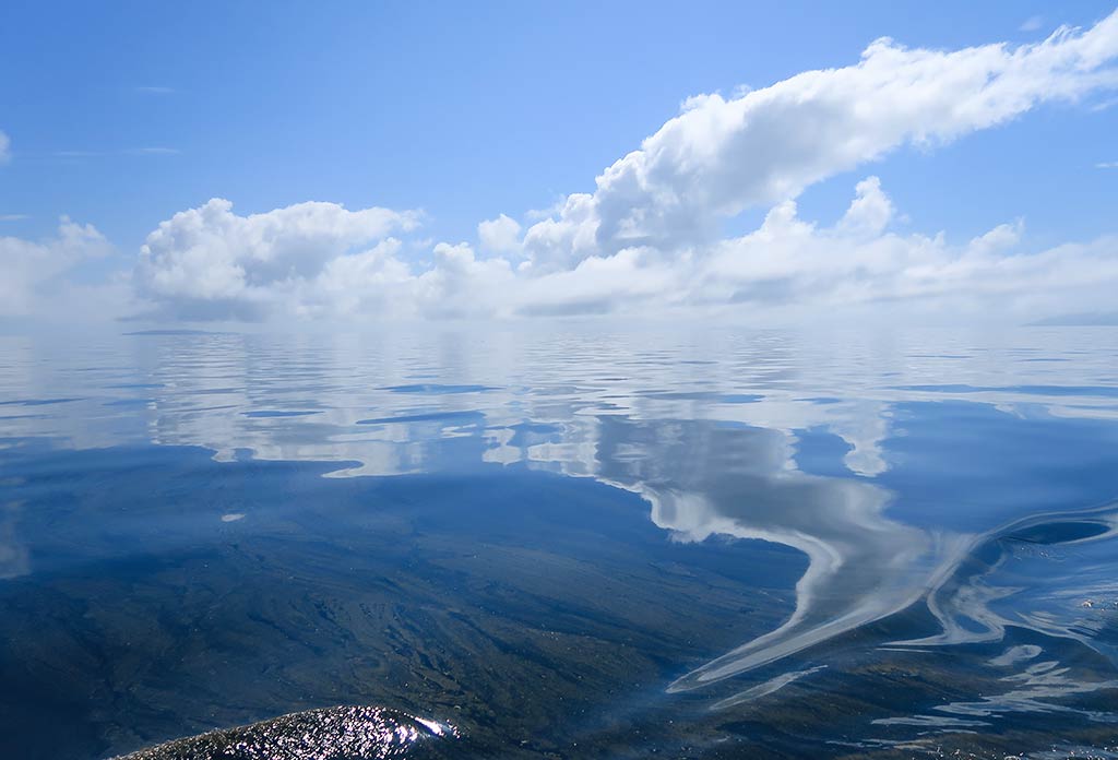
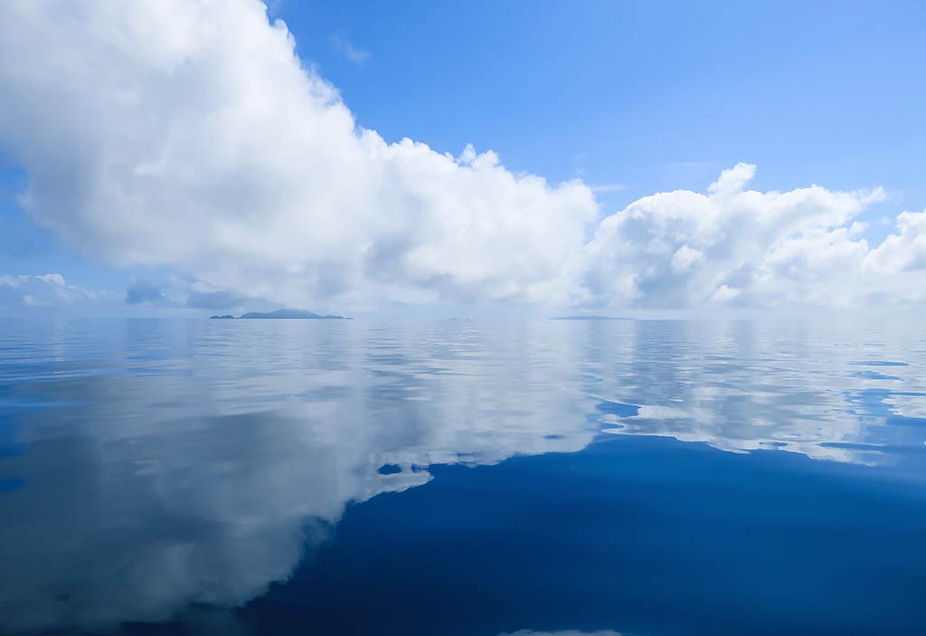
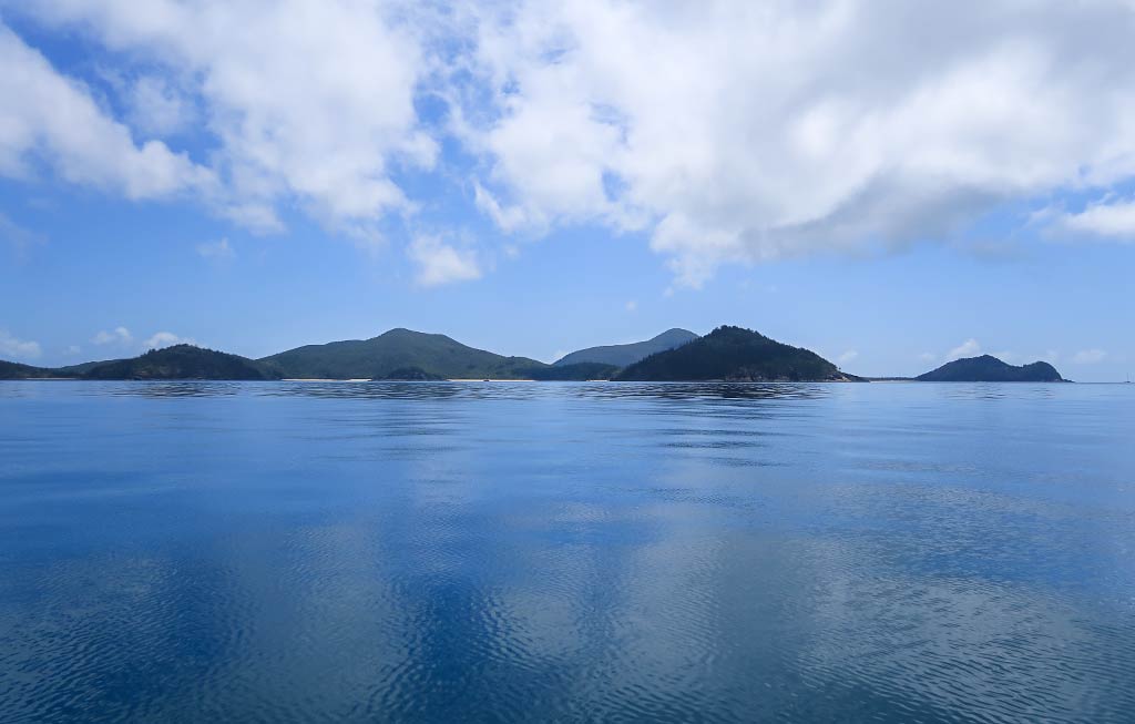
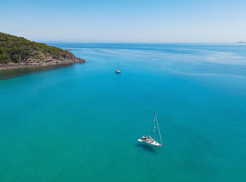
The sea was still and glassy, creating mirror-like reflections of the clouds above it. The somewhat misty sky gave the scene a dreamy effect, the sky seeming to meld into the sea below. Below are some photos of the water and clouds . . .
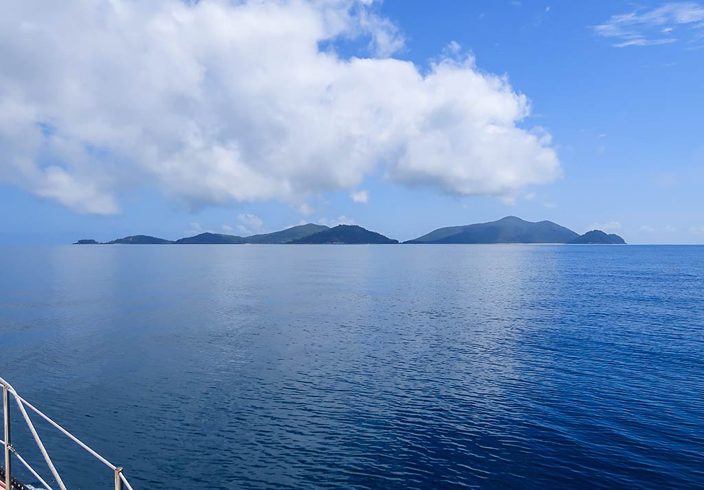
Approaching Brampton and Carlisle islands from the south, they presented a striking appearance–a mosaic of hills covered by bushland and rain forest.
We noticed one yacht enjoying Brampton’s south anchorage featuring three visible beaches, causing me to second guess our decision not to stop there.
However, I really wanted to see the old resort and beach on the north side, and weather-wise it was a perfect time to do so. We continued on.
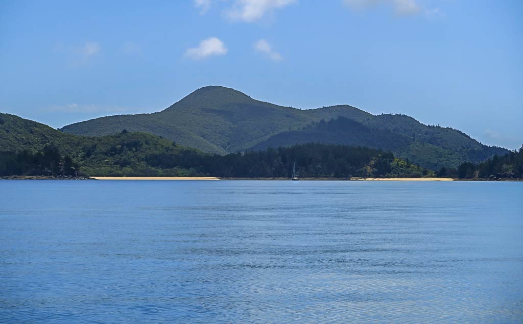
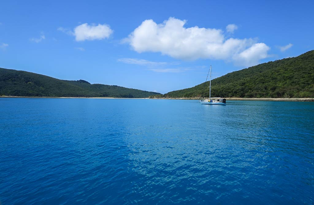
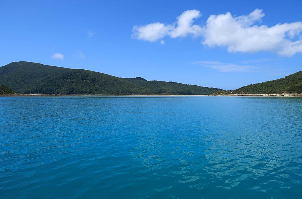
Once we passed the west headland, we turned and headed along the island’s north side. This region was dominated by a single, elongated hill with a graceful peak. It tapered down to a sandy point that marked the passage between the islands. This white sand point was accentuated by a long sand spit that stretched towards Carlisle island. It wouldn’t surprise me to learn a person could walk from one island to the along this sand spit and adjoining sand bars at low tide.
Below, a map of the area . . .
Carlisle island had a much higher hill, a mountain actually, lush and green as it must see a good deal of rain. It, too, sloped down to its own sandy point at the channel’s entrance.
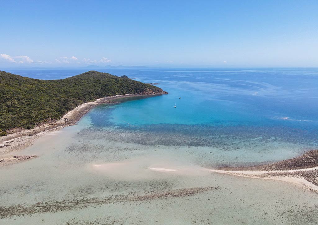
Below are some drone photos of the area. To me, the photos capture not only the look, but the feeling of this place.
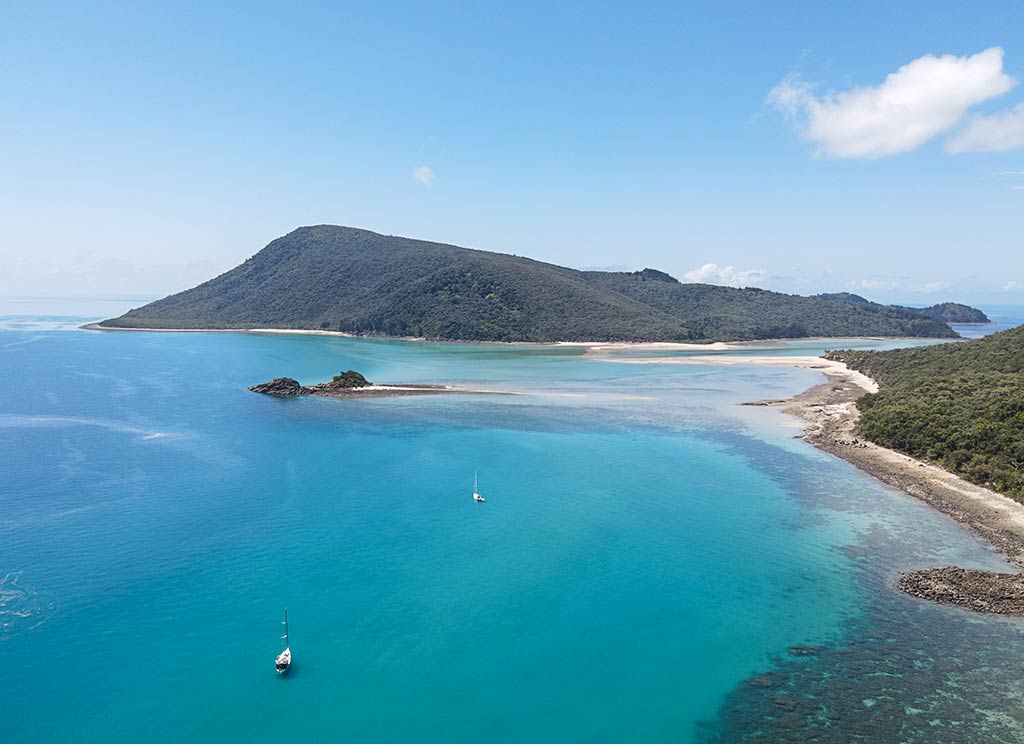
We motored into our anchorage, which was bordered by a sand spit connecting Brampton to a little islet in the bay, Pelican Island. Here, we found clear blue-green water covering a sand bottom, and I was excited to notice sea turtles! We soon discovered they were actually residents of this bay, often visible from our boat. Below are a few photos of the anchorage from our boat . . .
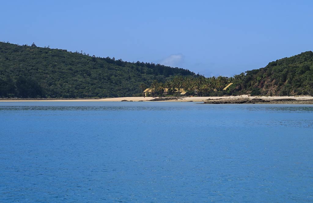
After dropping anchor, I paused to take in the surroundings. We had an expansive view of the north horizon, dotted with distant islands both large and small. The shore along our anchorage was rocky all the way to the sand spit, but beyond the spit was a beach stretching to the sandy point, backed by dense bush forest and the profusion of palm trees surrounding the resort.
We could hear some parrot-y squawks and whoop-whoops emanating from the island, but the only birds we glimpsed were crows. This place had all the ingredients to be enchanting, but instead it felt lonely and maybe a tad desolate. Maybe the dilapidated resort combined with flocks of cawing crows gave it a weird energy.
As a rule, abandoned resorts retain a caretaker to safeguard the place, and this place was no exception. We decided to go ashore after having some lunch for a better view of the property, but we’d take care not to cross the line into trespassing. I also hoped to check out one of the trails, perhaps even walk up the hill a ways. With today’s heat, however, neither of us felt up for the long walk to the peak.
It was also too hot to have our lunch outside. So we stayed below and fetched the large fan we rely on in warm weather—sometimes setting it to blow air directly on us, at other times adjusting it to circulate the air through the boat. Today it did the trick, keeping us cool as we munched on bagel and lox sandwiches, one of my favorite things to eat when cruising. Admittedly smoked salmon is a bit pricey, but for a lunch that’s easy to make, soul-satisfying, and somewhat nutritious, it’s worth the extra expense.
After lunch, it was time to explore ashore. –Cyndi


