
Posted on September 21, 2023
about September 18, 2022
It can be a little confusing to figure out exactly where the Whitsunday Islands begin and end within the larger Cumberland Island group, a chain of islands that lie off the coast of Queensland. Even Chat GPT is confused on this one. Information sources (going all the way back to Captain Cook who mapped this area) differ. But I think Wikipedia’s Cumberland Islands entry gets it right:
The Cumberland Islands group contains:
*The Whitsunday Group
*The Lindeman Group
*The Anchor Islands
*The Sir James Smith Group
*South Cumberland Islands National Park.
“More recently these islands have increasingly become known as the Whitsunday Islands and the general area more simply as “the Whitsundays”.”
Yep, I think this sums it up perfectly. While we were heading to what’s commonly referred to as “the Whitsundays,” we wouldn’t actually be in the Whitsunday Islands just yet. To make things more confusing, the term “the Whitsundays” often includes areas of the mainland coast, even though the Whitsunday Islands are, in fact, islands. Now that this is cleared up, I’ll get on with our story.
We planned to start our cruise in South Cumberland Islands National Park, just 14 miles from the Mackay Marina. From three possibilities, I chose Keswick Island. It ticked all the boxes:
*It had a protected anchorage for the forecast northerly winds.
*It had protection from the southeasterly swells courtesy of neighboring St. Bees Island. This island is only separated from Keswick by a channel less than a mile wide. In a sense, being in clear view of St Bees, we’d be getting two islands for the price of one.
*Its hilly terrain, covered in both rain forest and native Australian bush, gives it a unique topography, attracting an abundance of birds and migrating butterflies.
*It has do-able walking trails, including a rather mysterious Art Trail (for the life of me, I researched this Art Trail and could not figure out where it was or what art was on display).
This island is 80% national park, the rest containing a housing zone, a guesthouse, an airstrip, and plans for an eco resort. Below, a map of both Keswick and St. Bees Islands.
Our plan was to leave Mackay in the morning on an outgoing tide. Tides and currents, while less dramatic than those to the south, would continue to be a consideration throughout the Cumberland/Whitsunday Islands. Meanwhile the forecast called for a spell of light northerly breezes, an indication that the season was changing.
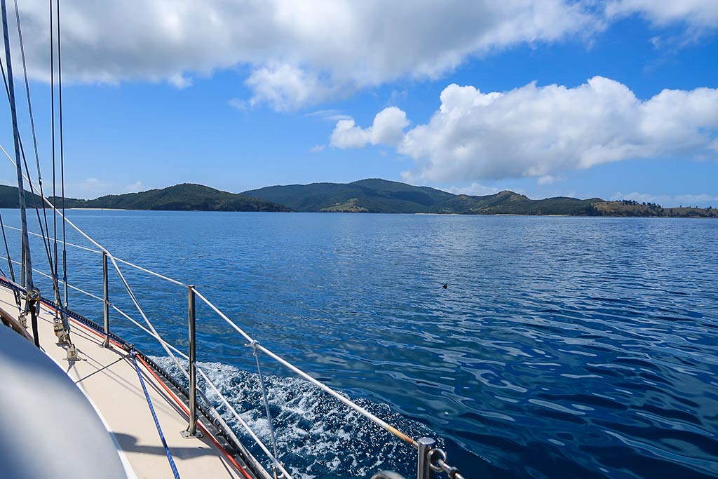
We turned in our keys at the marina office and got Legacy ready to go. Soon we were heading out into a very calm morning. We had a 14-mile trip to Keswick, and it would be a motor ride through glassy seas. The air felt pretty warm; so Rich turned on our patio misters and soon we were surrounded by a fine, cool water mist.
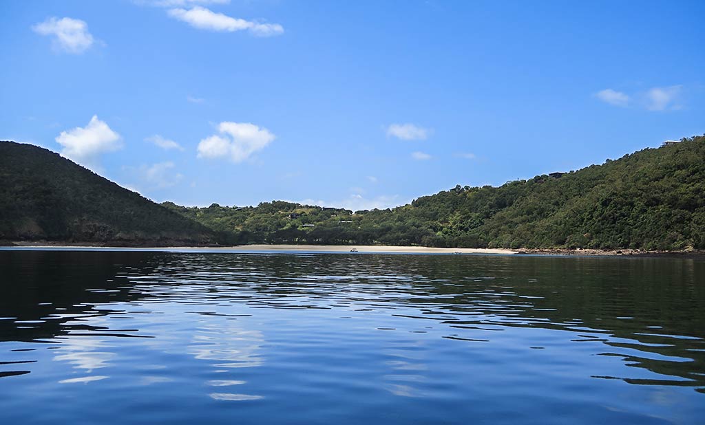
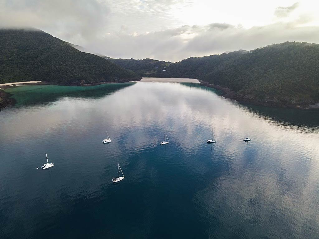
Our destination at Keswick was the large southeast bay containing two inner bights: Arthur Bay and Basil Bay.
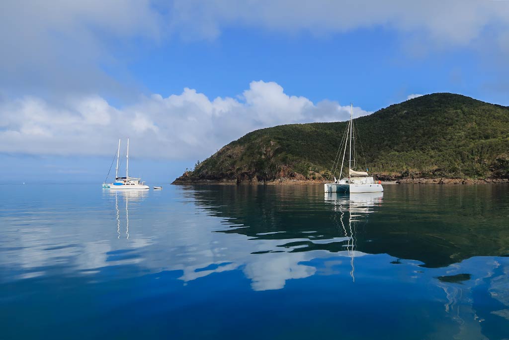
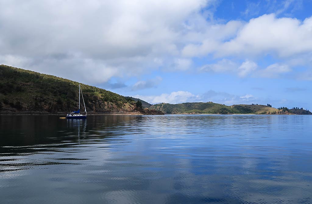
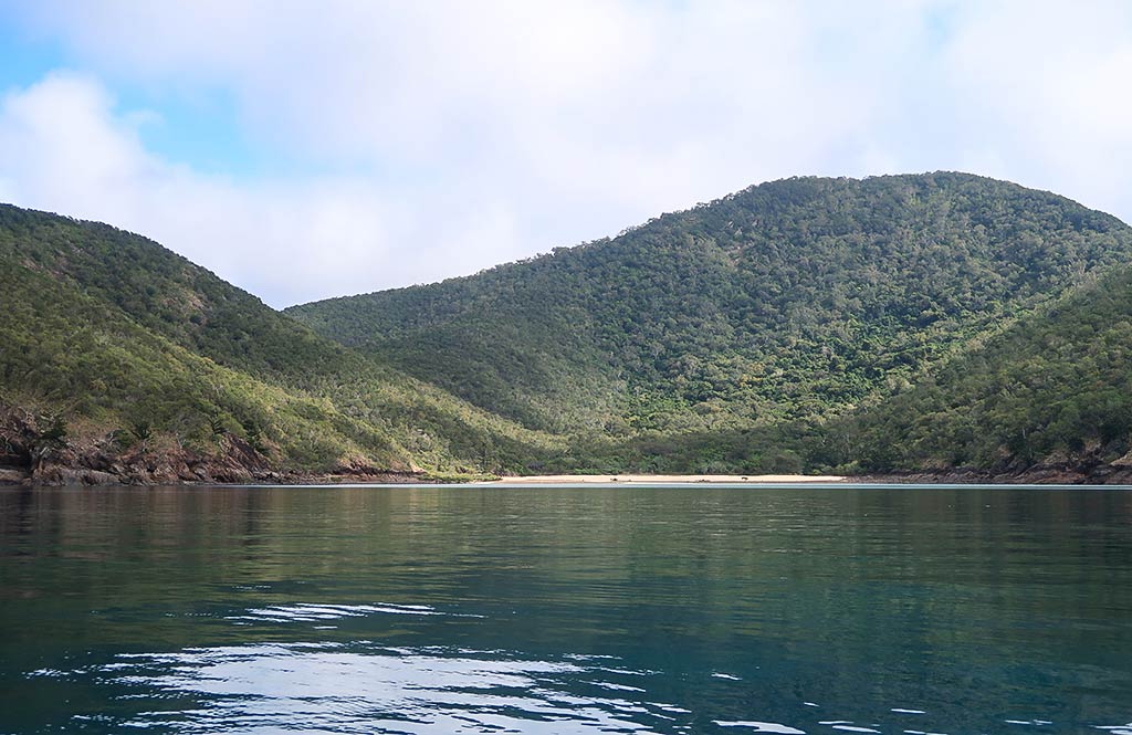
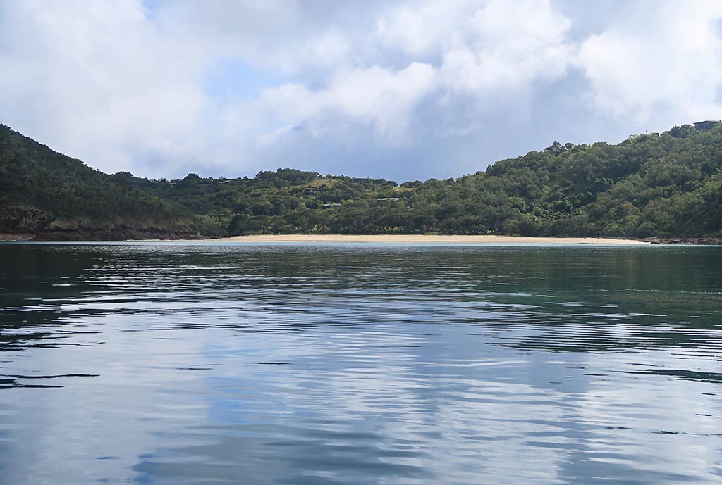
As we neared Keswick and St. Bees Islands, I felt encouraged. They looked hilly and green, and there was no swell whatsoever. As we got closer, the area’s natural beauty become even more apparent. There were two boats in the anchorage, one in our planned spot. But no matter; there was plenty of room. We picked a place near Basil Bay and dropped the hook. It was a bit rocky but the anchor caught. We had arrived! Below, photos of the view as we approached (click any photo to enlarge).
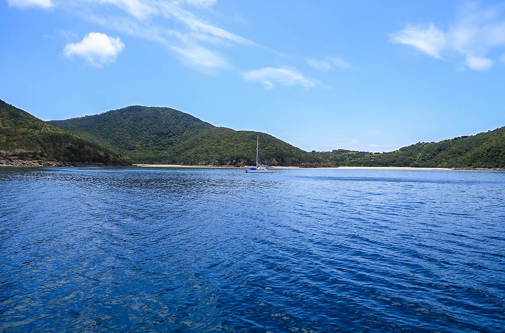
Oh my goodness, it was so nice here! The high hills had abundant greenery and surpassed my expectations. We had a clear view of both Basil and Arthur Bays and their lovely beaches. The water in the anchorage was glassy calm, dark but clear.
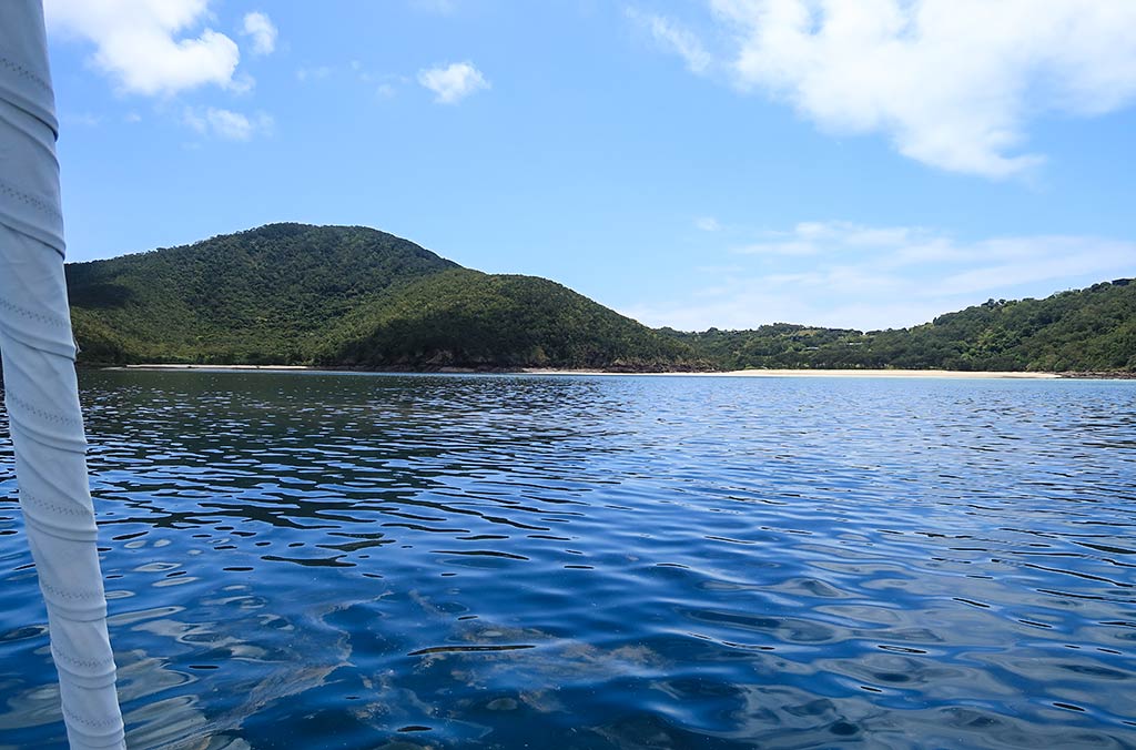
Looking at Basil Bay closest to us, I noticed the hills dipped into a saddle behind its impressive beach. I could see that what had been termed a “housing development,” consisted of hillside vacation homes scattered amid the trees, pretty places that melded in with the surroundings (and not at all the eyesore that I feared). The hills on either side of the beach were part of the national park and heavily forested. Southeast beyond the outer headland, I could part of St. Bees Island, hilly yet drier and grassier than Keswick. Below, some photos of our anchorage . . .
Plus a drone photo taken of the anchorage the next morning:
Soon, I started to hear bird calls, lots of whoop-whoops and squawking. A flock of white cockatoos screeched and chattered as they flew into the trees nearby. I had been anxious to get north and see these cockatoos again, and now here they were! Be careful what you wish for, though, as they made an impressive racket during the afternoon.
We relaxed awhile before I figured we ought to head ashore. Information about the trails had been nearly non-existent; so I hoped we’d find a trail map onshore. I had no idea where the Art Trail was, but at this point I hoped to find the forested trail to Arthur Bay, rumored to attract the island’s blue tiger butterflies.
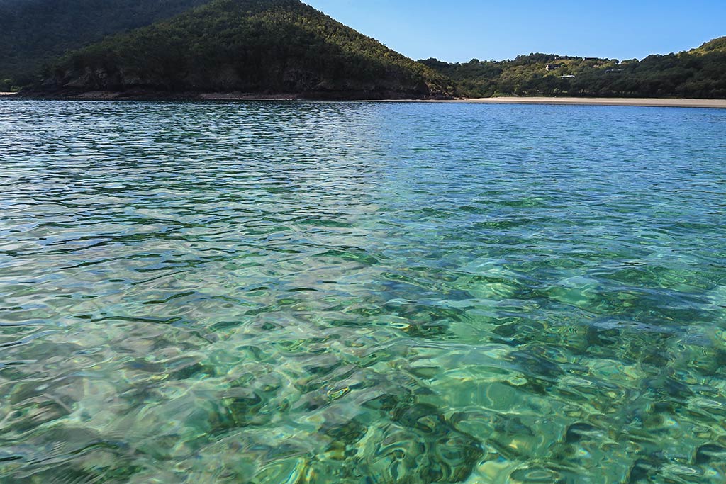
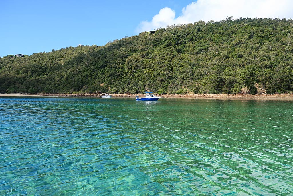
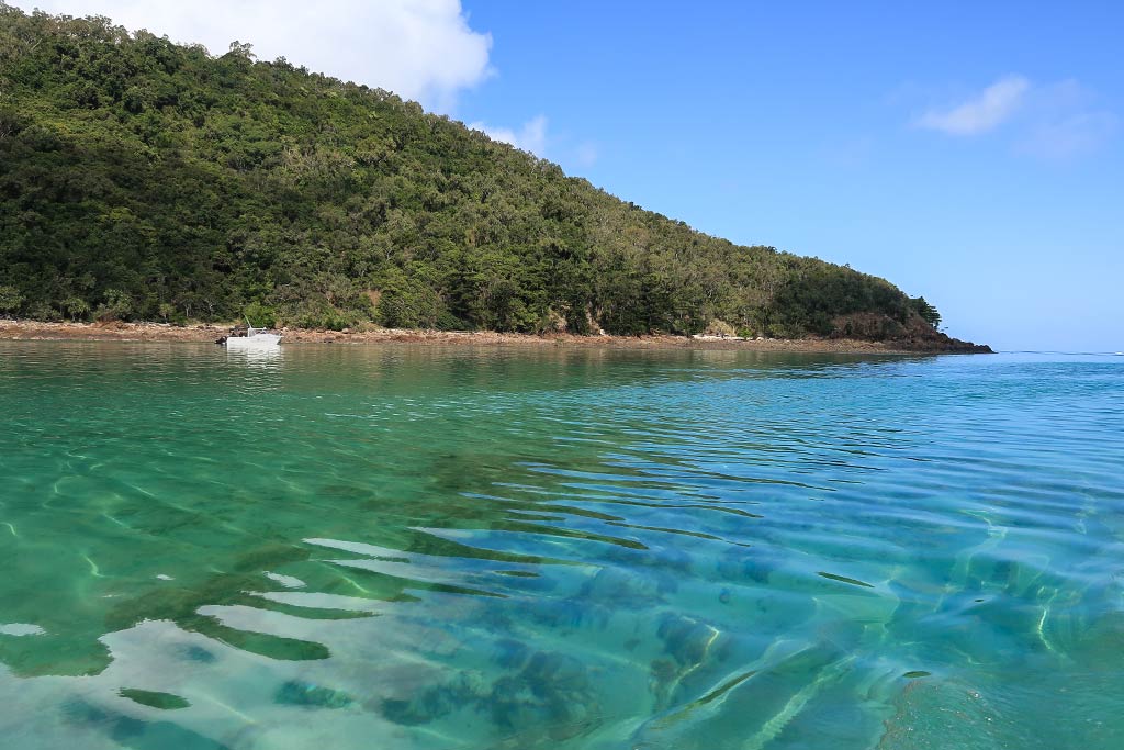
We got the dinghy into the water and headed in. As we neared the shore, the dark water transformed into pretty shades of blue-green with visible coral below us, including some impressive plate coral. While I wouldn’t rank it with the coral areas further north, it was fascinating and surprising to see this much here. It faded out as we approached the beach, but the water was so clear we could see every little rock on the bottom. I was anxious to see what surprises might await us on shore.
Below, a few photos from our dinghy ride to shore.

–Cyndi
A Final Note of Interest to Yachties: If you take a close look at one of the interactive Google Maps, you’ll notice the image was taken during the southeast trade wind period. If you zoom in enough you can clearly see how the SE swell affects all of Keswick’s south-facing bays. We were lucky to have very light conditions when we came here, both for wind and swell. During heavier swells, many boats opt to take a mooring in the Egremont Passage between the islands or anchor in Connie Bay at the north end of the island.
If you find this information useful, or entertaining, perhaps…


