December 27, 2015
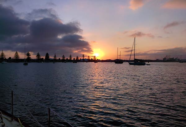
We arrived in Tauranga (and Mount Maunganui) in the dark last night after an unintentional 84 mile trip. More on that in a second. Here’s the scene we woke up to.


Unintentional? We started the day near the tip of the Coromandel with the intention of only traveling 30 miles or so to a suitable place to stop for the night. We never found that place. Every time we’d consider a bay, either the wind or the swell was or would be rolling in before morning. We even anchored at Slipper Island for 30 minutes or so, until the wind backed to the northwest and it got bouncy in the bay. We just kept going and going until we arrived in Tauranga.
I wish I could say our well-after-dark arrival was uneventful, but no. Tauranga is a big shipping port with lots of big ships. It seems that they all wanted to leave the port just as we wanted to come in. One after another… 500 feet long, 600 feet long, traveling at 5 knots, 12 knots, turning left, right, up, down (well maybe not the last two). Wow, AIS is a wonderful tool. We could see their AIS signal long before they turned the corner at the mount. Even at that, it was still scary.
Anchoring wasn’t much more fun. So many boats. Every Kiwi is required to own three, and use them all at once, even at night. I finally gave up on what my eyes were telling me in the real world and stuck to the radar overlay on the chartplotter. We got in. We drank. We slept! Now we’re safely tucked in our berth at the Tauranga Bridge Marina. It’s nice to be back in one of our homes.
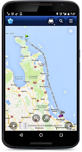
Speaking of AIS:
This is what our long day looked like on Marine Traffic Ship Positions on my phone. This is a fun app. I really don’t know how useful it is but it sure is fun. Bob on Bright Angel has been using it to spy on us. He seems to know where we are before we do!
It uses a network of AIS receivers and relays the info to the internet.
You can also see that info on their website: www.marinetraffic.com so you too, can spy on us.
-Rich


