Mbavatu Harbor Arrival, Part 2 (Vanua Balavu, Fiji)

September 24, 2013

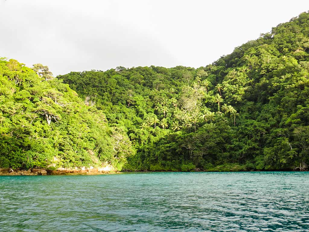
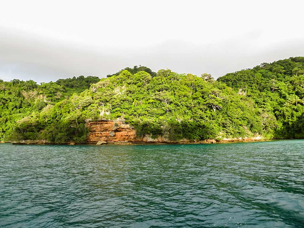
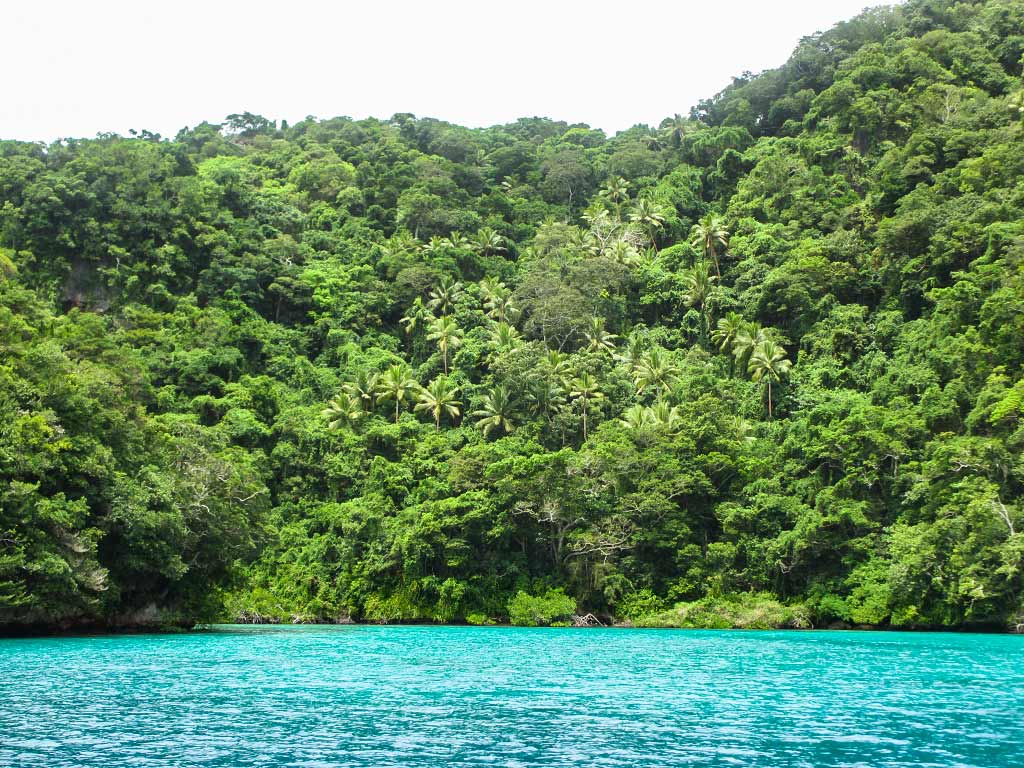
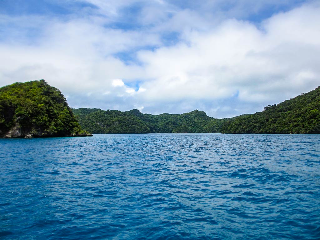
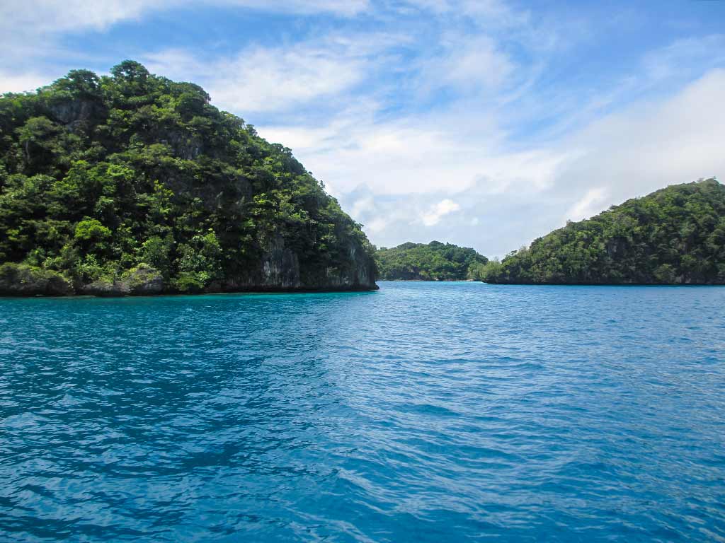
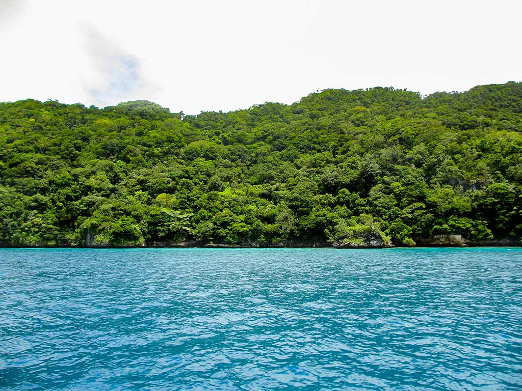
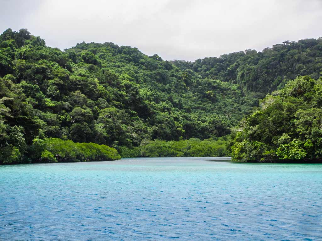
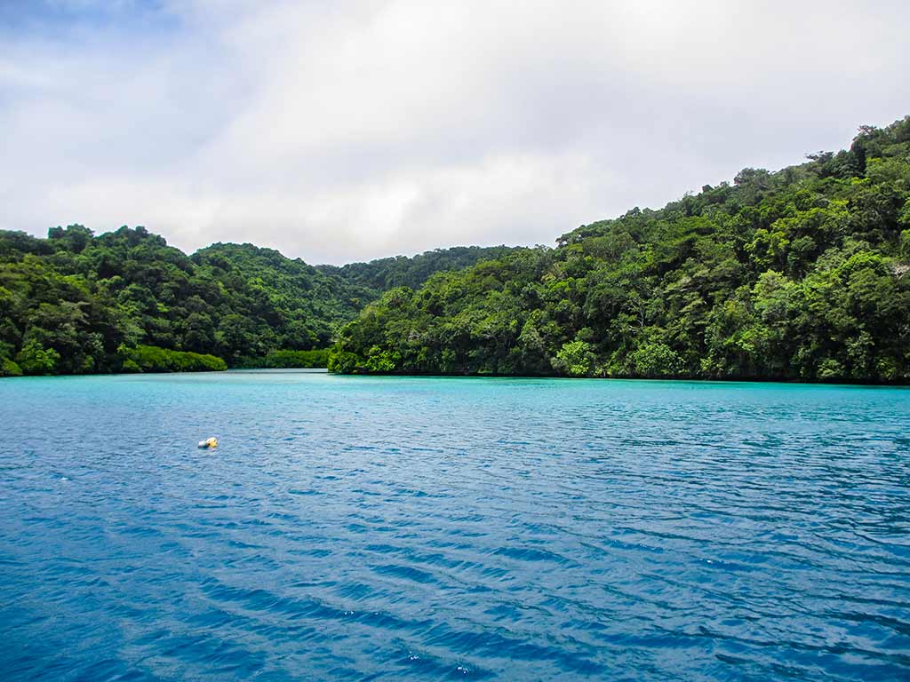
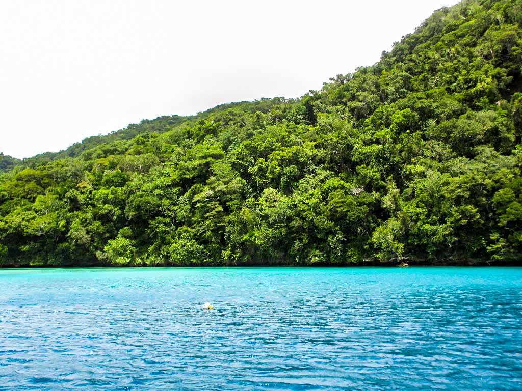
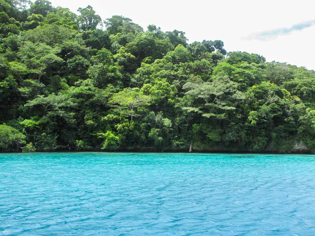
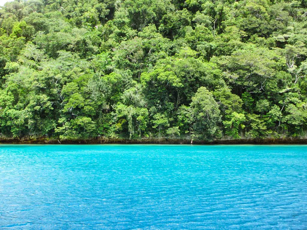
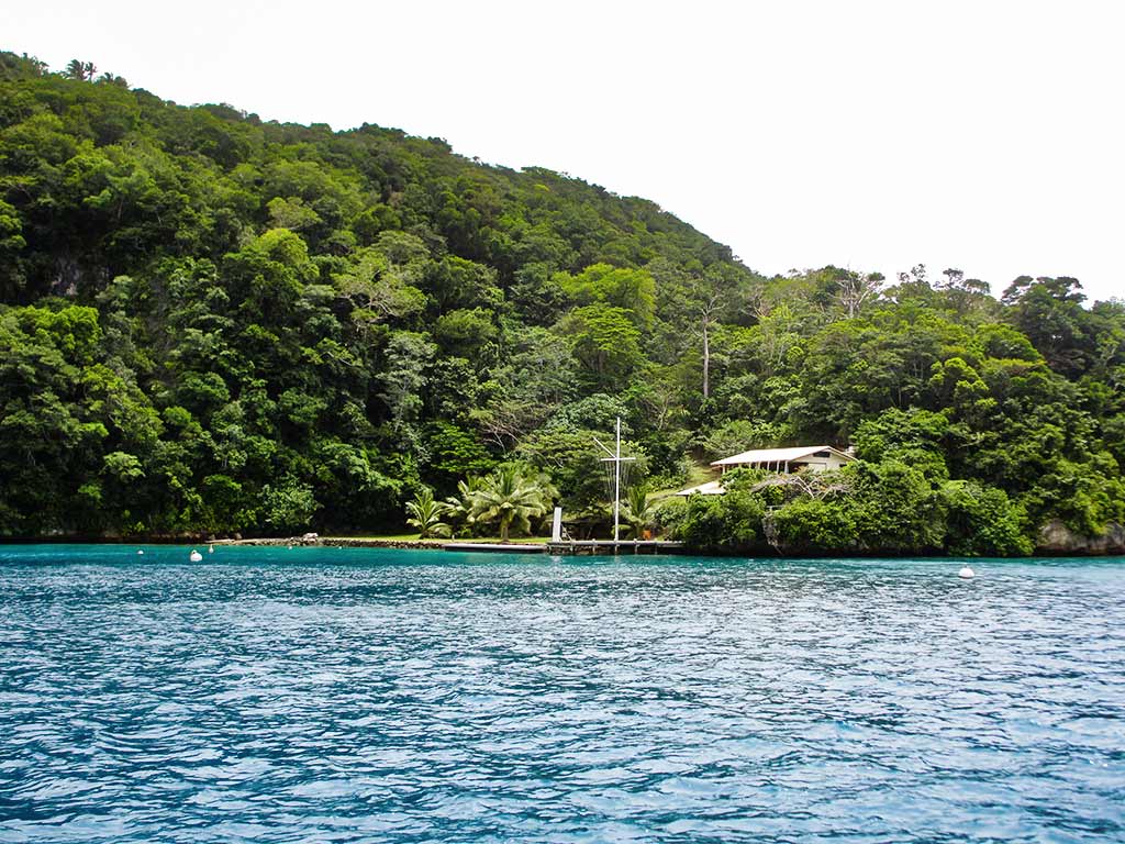
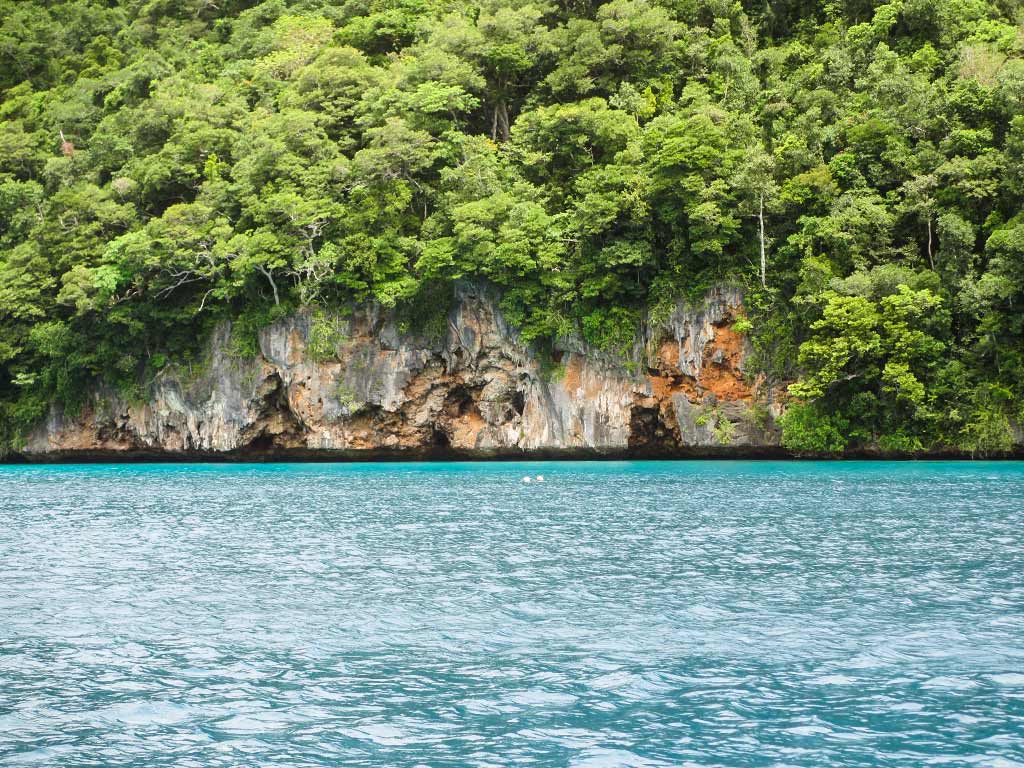
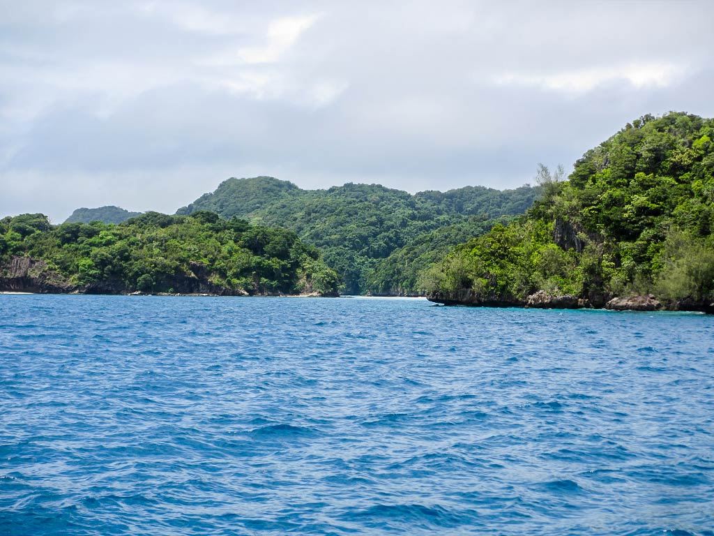
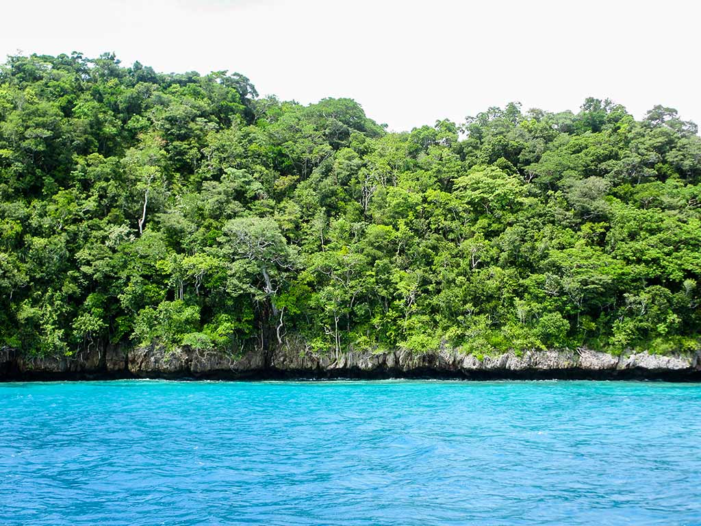
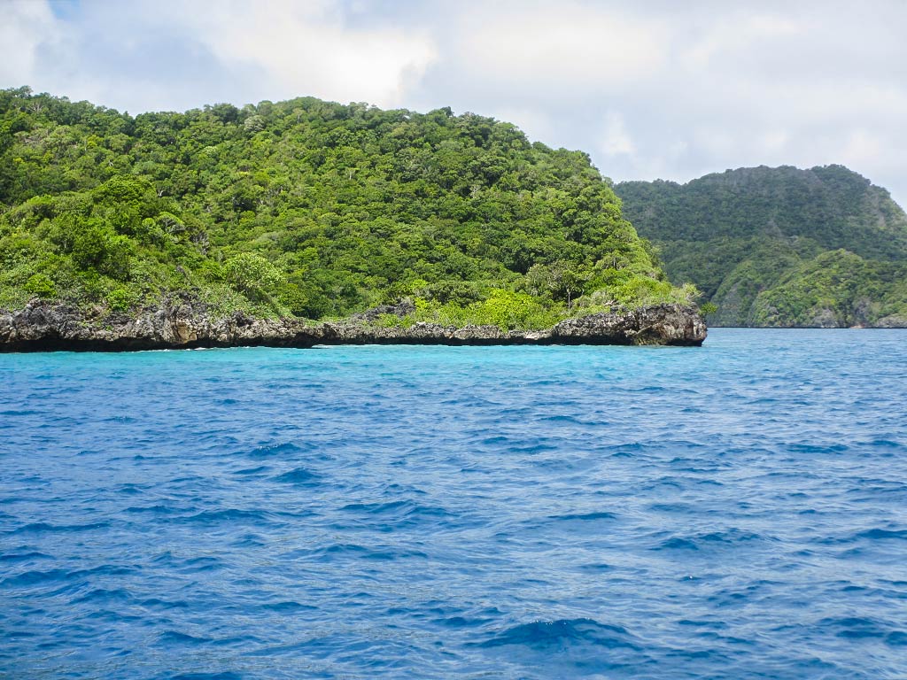
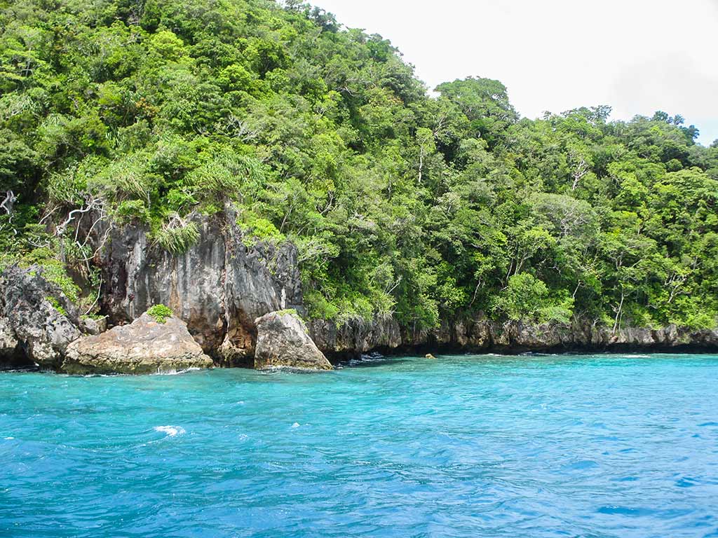
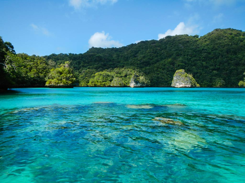
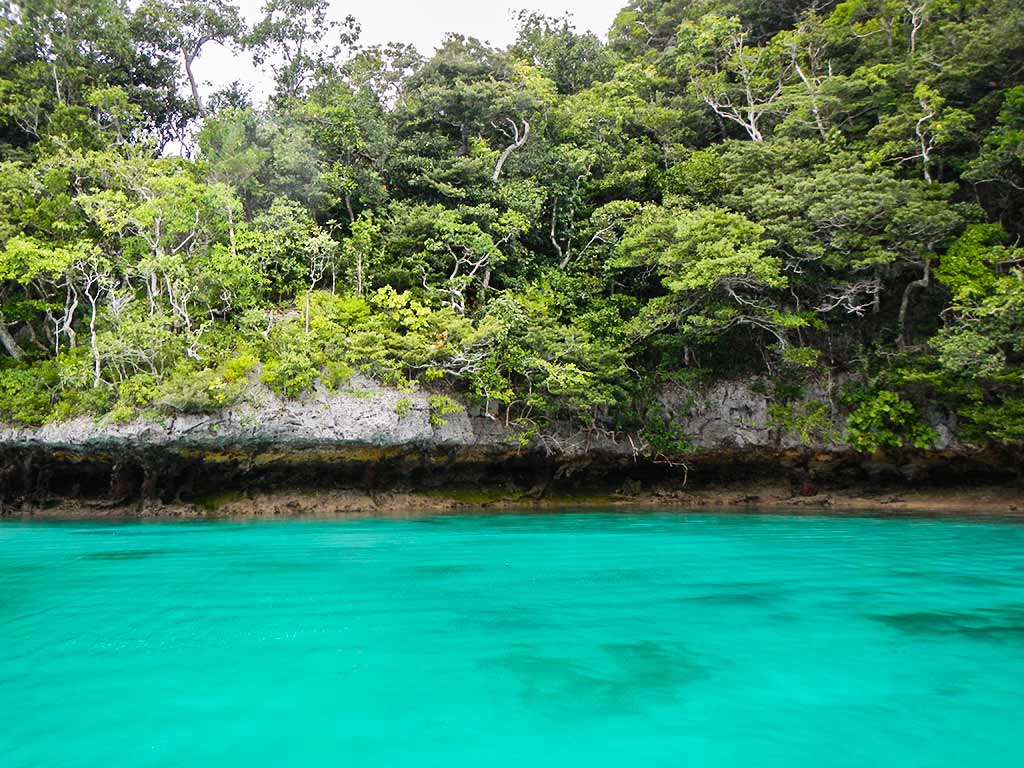
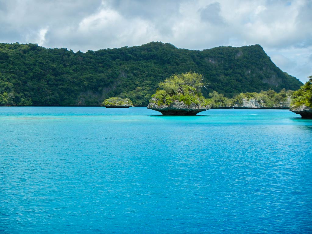
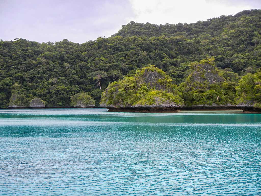
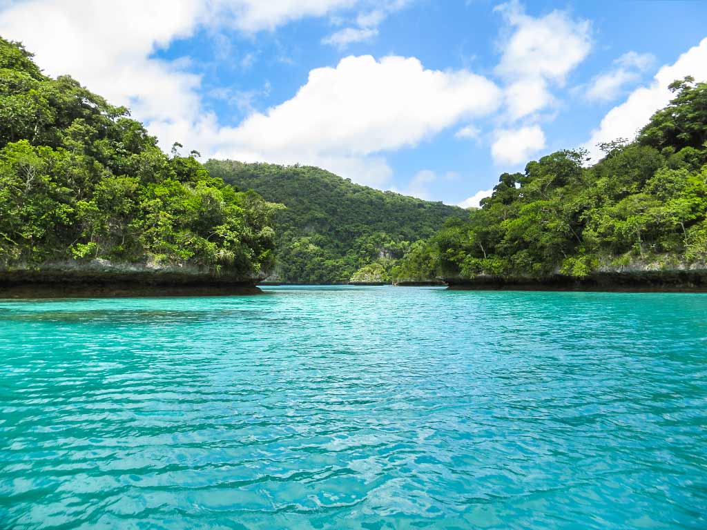
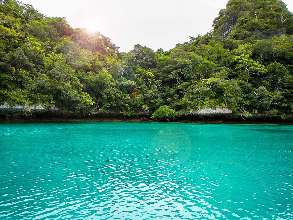
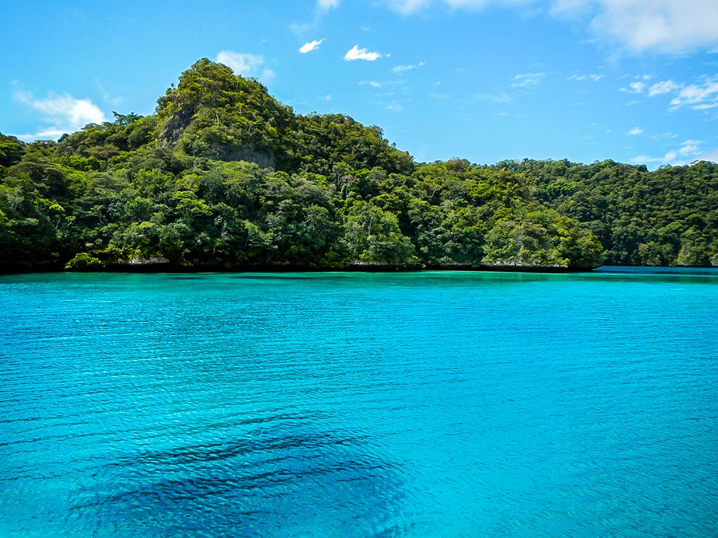
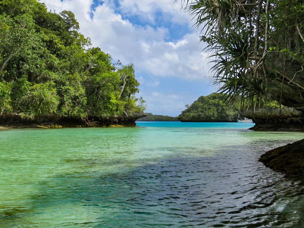
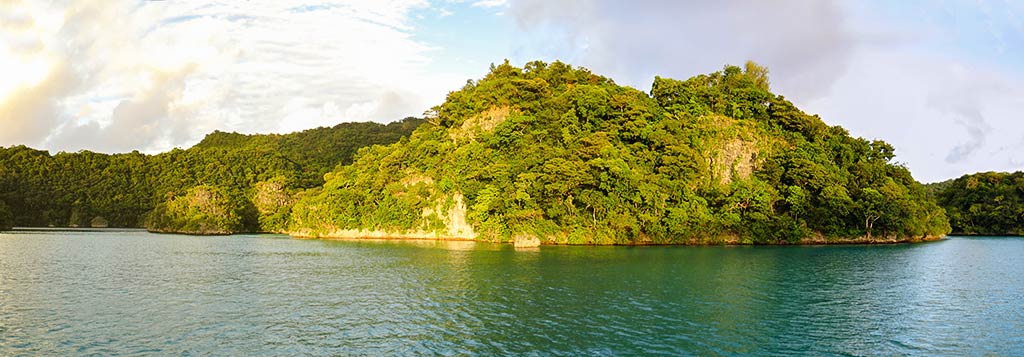
As we motored down towards the head of Mbavatu Harbor, the scenery became more and more impressive. The mountains were higher and steeper, covered with lush rainforest.

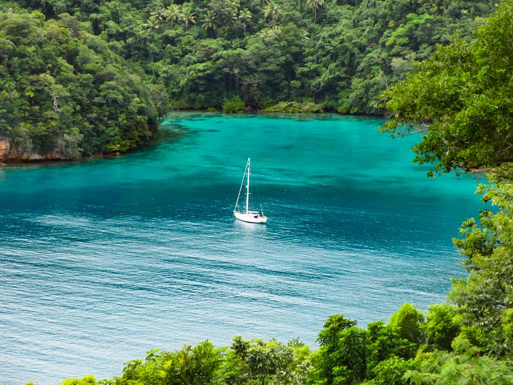
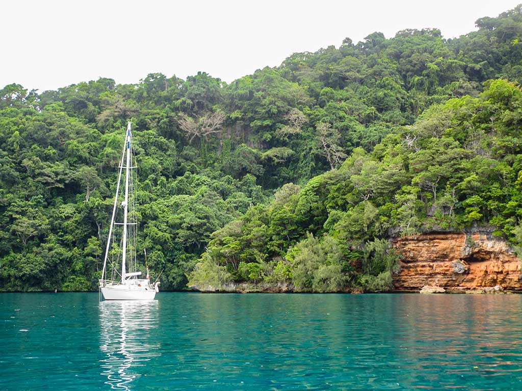
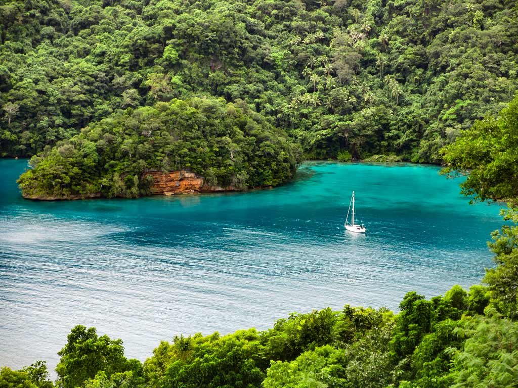
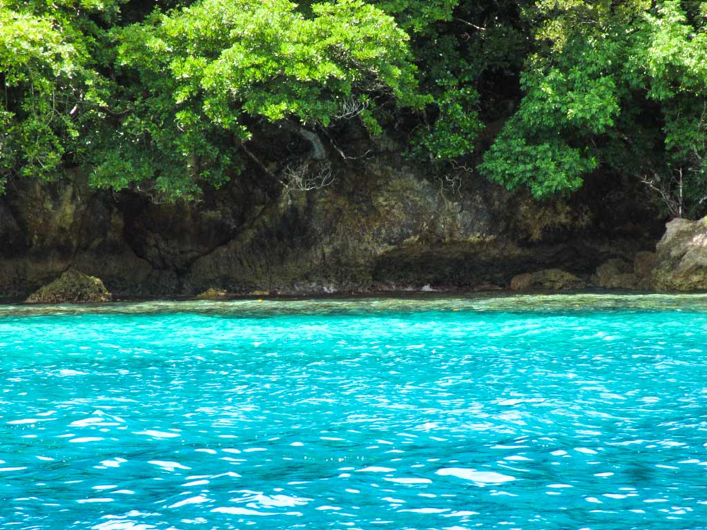
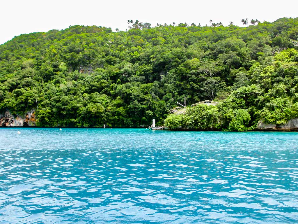
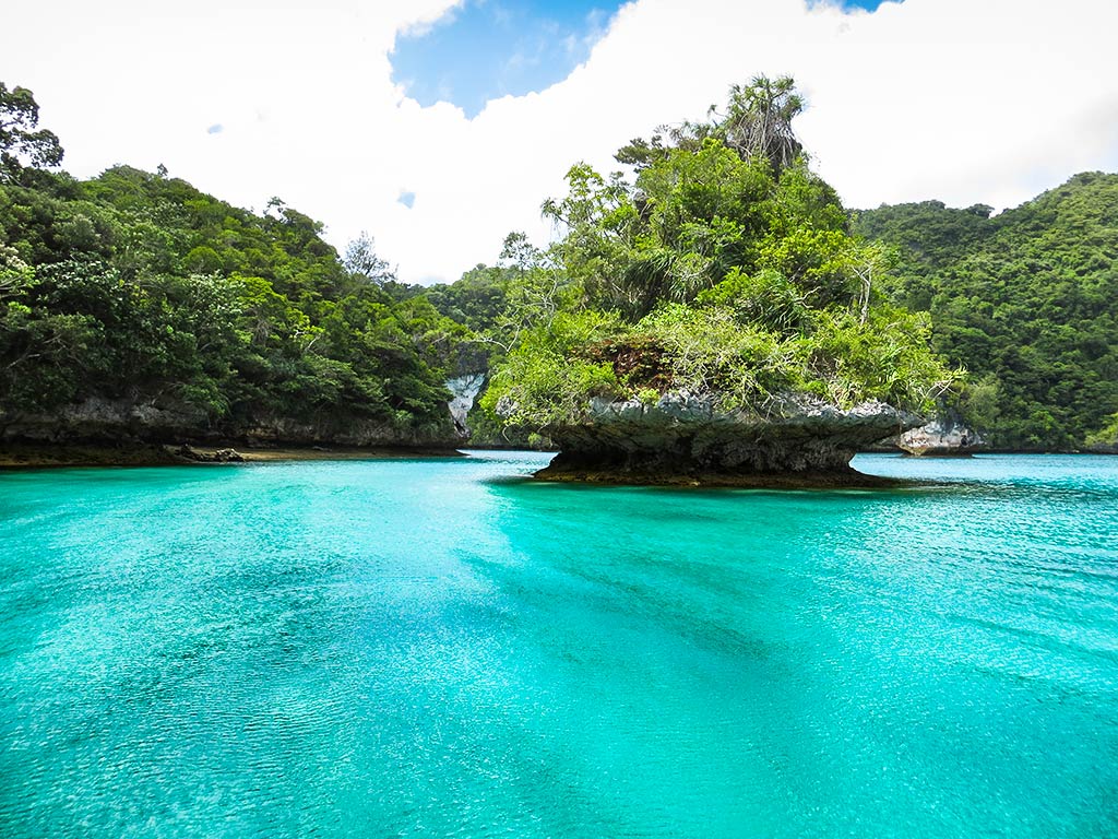
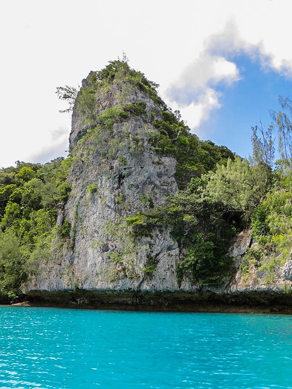
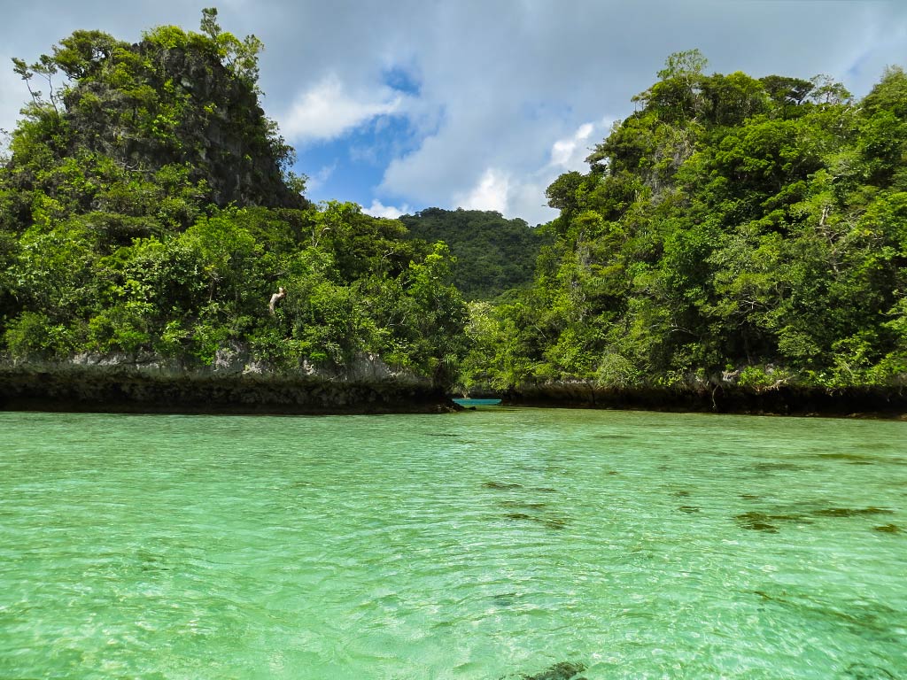
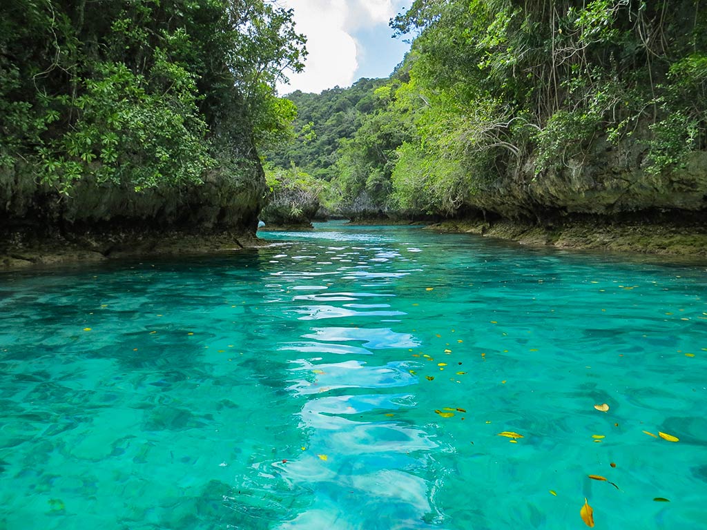
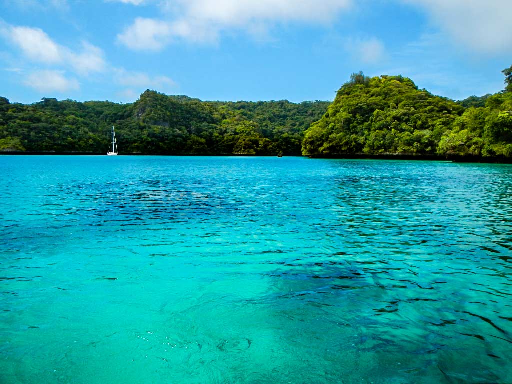
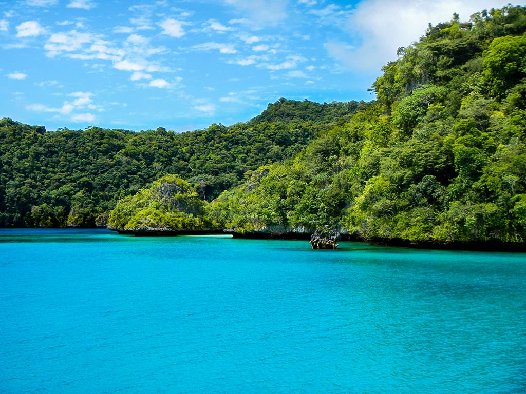
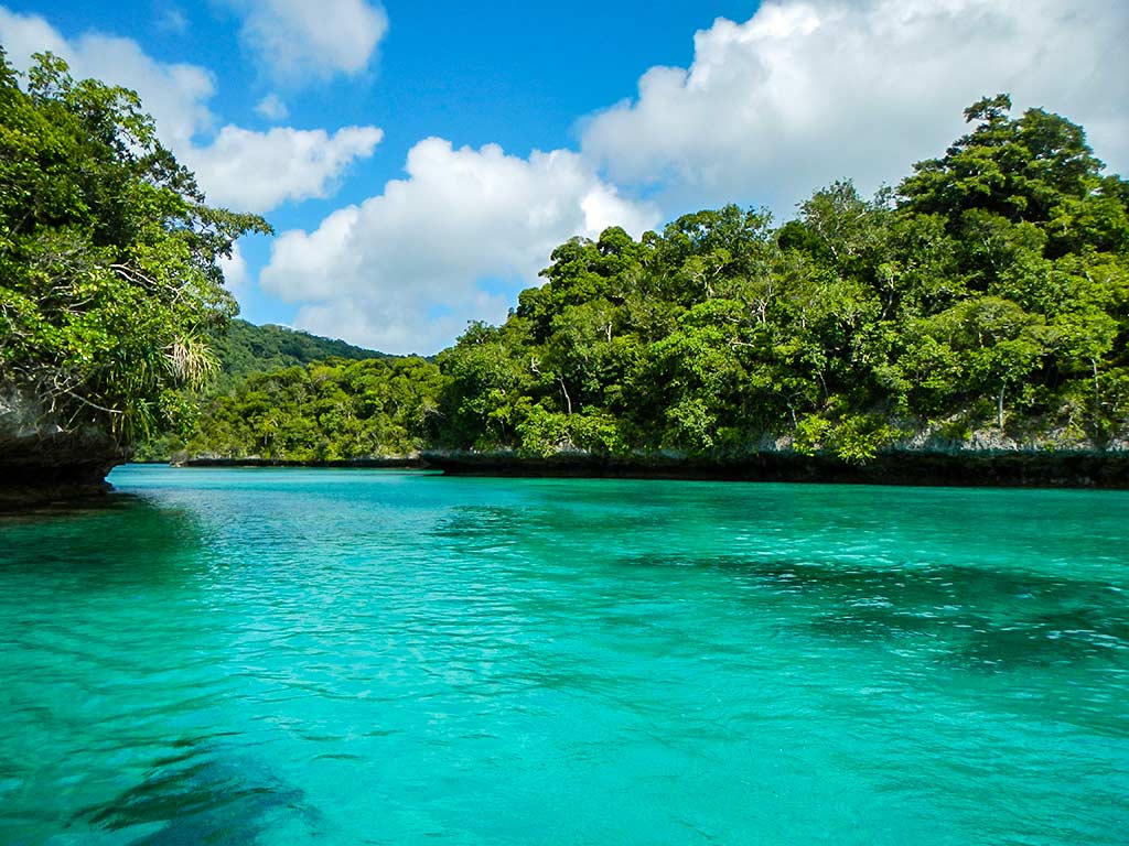
There was a small island up near the head of the bay, the shallow water around it a beautiful blue-green. We made an attempt to anchor nearby and found that the water went abruptly from too shallow to very deep, about 70 feet and didn’t have good holding. Getting more worried about our predicament, we brought the anchor up, moved to another spot, and tried again. This time it was much better, not perfect but satisfactory.

The silver lining to this situation was we were close to the dinghy dock and a famous stairway that leads to the top of the mountain. This was a trek we hoped to make while we were here, but (with our dying outboard) it would have been too long of a dinghy ride from the other anchorages. Thus, we really found the perfect spot. And besides, I think of the anchorages we looked at, this one was the prettiest.

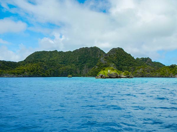
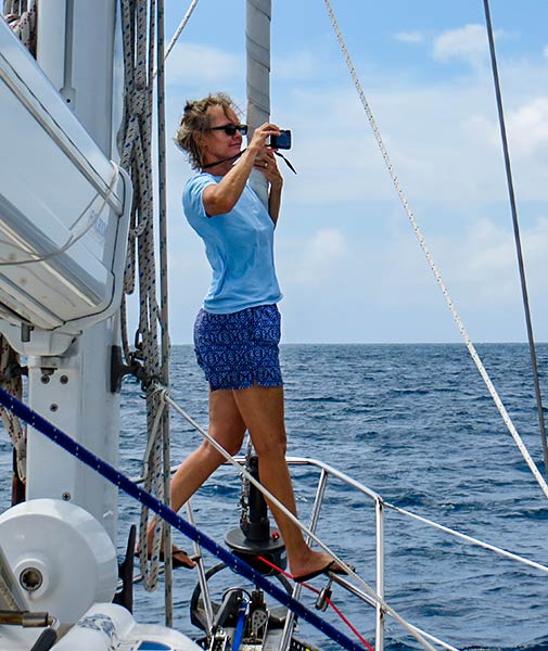
(Below a few photos from where we ended up anchoring, including some photos taken during the following day’s hike up the mountain. Click to enlarge and scroll through gallery.) –Cyndi

Mbavatu Harbor Arrival, Part 1 (Vanua Balavu, Fiji)

September 24, 2013

Mbavatu Harbor is an impressively deep and mountainous bay, but in spite of its size we were soon to discover it’s not an easy place to anchor. (Below, a few photos of the entrance to the harbor; you can click to enlarge and scroll through any of the photo galleries that follow.)


Of three potential spots, we had chosen to start our visit in well-protected bay near the entrance to the harbor (generally referred to as the south or west anchorage).


This turned out to be a beautiful bay, very green and lovely but there was a problem: some jackass had put a mooring ball smack in the middle of the bay, perfectly placed so that it was impossible to anchor in the reasonably shallow areas around it. Since it was too deep to anchor further out in the bay, we sadly had to turn and leave. (Below, a few photos of the pretty anchorage made unusable by the mooring ball.)


Next we headed to the other side of the harbor by the yacht club. Unfortunately, it seemed this club was open only when the cruising rallies made special arrangements to check in here (about every other year or so). Otherwise it’s unmanned; so we had no one to ask if we could use one of their several moorings. We thought about just picking one up, but we didn’t know if they were being maintained and kept in good condition. Could we anchor outside the moorings? No, it was too deep. (Below, a few photos of the yacht club area.)


This was getting downright unnerving. We decided to motor down to the head of the bay in hopes of finding a spot there. –Cyndi

(More to come in Part 2)

Journey to the East Side of Vanua Balavu (Fiji)

September 24, 2013

Today’s trip would take us up and over the top of Vanua Balavu to a deep harbor on the east side of the island called Mbavatu Harbor. Normally this would take 2 hours or so, but today we decided to take advantage of the sunny and still weather to head out the north pass through the reef. By doing so today we could create a track to follow if the conditions were less favorable when we actually did leave. We’d heard of people hitting the reef going in through this somewhat complex pass and wanted to do all we could to avoid the same fate.


The trip up the west side of the island was beautiful, especially the mountainous little cove with a palm tree-lined beach I spotted. Soon after we arrived at the pass, and I headed forward to keep a bow watch as we made our way out. It turned out Rich’s waypoints were good and getting out was relatively easy.

After we headed back in though the pass and over the island we had some narrow channels to navigate so I stayed at the bow to keep an eye out for any surprises. It looked intimidating but turned out to be easy.

Cyndi keeping a vigilant bow watch as we approached the north pass into Vanua Balavu.
The view from the north pass looking into Vanua Balavu’s lagoon. It may look harmless but under that water lies a lot of dangerous coral reef.
Taking the occasional opportunity get some photos we we motored along the north shore of Vanua Balavu.

The ride took us along some very pretty coastline with green hills, craggy rocks, small coves, and the occasional beach. Below, a few photos of Vanua Balavu’s north coastal scenery (click to enlarge and scroll). –Cyndi

Good-Bye Bay of Islands (Vanua Balavu, Fiji)

September 19 – 23, 2013

While we looked forward to our next destination on the other side of Vanua Balavu, it was sad to leave the Bay of Islands. We’d visited many beautiful places, but this one was extra special.

I can sum it up best by mentioning a dinghy ride we took shortly after we arrived here. We’d spent the afternoon exploring and snorkeling and were headed back to the boat when Rich, noticing I seemed quiet and subdued, asked what was wrong. In fact there was nothing wrong, but the day’s scenery had somewhat overwhelmed me, taking me to that place beyond enthusiasm to feeling humbled and the need for quiet contemplation. It was a lot to take in, and I was glad to have some days ahead to do so.

During the days that followed, there were moments when I thought this might be the most beautiful place I’d ever seen. Rich felt the same way, and while it’s impossible to ever pick a favorite place; Rich and I were thinking if we had to pick right then, that this and Fatu Hiva (in the Marquesas) may well go in our top two.

What made this so extra gorgeous? I think it’s the tall hills and mountains around this bay, then the islets themselves with their electric bands of color beneath them and the gorgeous little worlds they create, and the tall motus covered with green vegetation that’s more Pacific Northwest in feel than the drier vegetation of the southern Lau. This is greener, wetter, and cooler than Fulaga, and more mountainous.

So to answer the question of which we liked better, the Northern or Southern Lau, we’d say for us, the Northern Lau was closest to our hearts. On the other hand, how do you compare a place like this to the thousand-shades-of-blue water and white beaches of Fulaga? You really just can’t.

We would advise any cruisers trying to chose between the two places to not take the word of the majority who’d pick Fulaga, but instead to look at photos of both places and see which calls to you more. Better yet, try to get to both if you can.

Below, a gallery of a few miscellaneous photos of Vanua Balavu’s Bay of Islands (you can click to enlarge and scroll though the gallery below).

By the time we pulled our anchor and headed to our next destination, I felt satisfied with all we’d experienced here and good about heading on. Still, this is a place I hoped to return to someday. –Cyndi


Good-Bye Beautiful Anchorage (Bay of Islands, Vanua Balavu, Fiji)

September 19 – 23, 2013

The time was coming for us to leave the Bay of Islands and head over to the east side of Vanua Balavu. We’d been here less than a week but that was plenty of time to get attached to the place. We even had “pets,” some remoras that hung out under our boat and appreciated the daily food scraps we fed them.

We’d miss the beautiful colors of our anchorage, our remoras, the good swimming and snorkeling, and (aside from the occasional passing kayak), the feeling of having it all to ourselves, that it was “our” place. But now supplies were running low, the season was getting on, and it was time to visit some new places.

Below, a “second chance” gallery featuring photos that didn’t quite make the cut to get chosen for previous photo galleries. These photos were all taken in our anchorage, most of them from the boat. (You can click to enlarge and scroll.)

And finally, a panorama of the anchorage during the evening.–Cyndi

Vanua Balavu – click for larger image.