Welcome to our blog. Here, you’ll find stories, pictures, and hopefully, some helpful information about traveling around on a sailboat.
To some, our blog may seem chronologically challenged, but it’s really not. You see, our resident Capricorn, Cyndi, posts everything in the exact order in which it occurred. Rich, with his short attention span, posts stuff the moment it occurs to him. While we’re in our 12th year of this cruise, Cyndi is only up to our second year in New Zealand as well as adding in some Australia stuff from two years ago. Rich has already lost interest in last Monday. To sum it up:
Cyndi is continuing to write posts about our second season in New Zealand, but she throws in a few current-time posts, too. At the moment she’s being a bit more timely and writing about our current season starting in Australia.
Rich is writing about the here and now in Indonesia.
One answer we have to that all-too-common question is Click-n-Learn, the Android app we’ve been developing for nearly a year now.
We’ve been using Duolingo since we’ve been in Indonesia to try to learn some of the local language. That was going well until they dumped about 30 new words on me in one lesson. That was so overwhelming, I “forgot” to use the app for weeks.
We used flash cards to learn the new words, but that didn’t work well for me (I hate flash cards). I started thinking about how I would create an app to help with the learning. Click-n-Learn was born.
We’re getting very close to being finished with it. We went through the Google required, two weeks of testing only to get turned down for inclusion in the Play Store. It seems we didn’t have enough engagement from our testers. That turned out to be a good thing as now we’re making some changes that are turning into a major improvement.
We’re making the app free now and adding voice pronunciation. We’re going to charge a monthly subscription fee for pronunciation, not only to help with our weak and dying cruising kitty, but to also cover the cost of the Google text-to-speech service we’re using. I am really thrilled with how this is turning out.
When it’s released for testing again in the next week or two, we’d really love to know what you think, and for your help with testing. Thanks in advance.
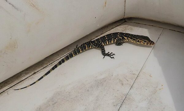
We’ve had a few very interesting animal encounters here in Indonesia – this one just a few days ago.
We’d motored our dinghy about half way to the pier when something skittered over my leg. I looked down to see what my mind believed at the time to be a 12 foot crock. I screamed, which is kind of rare for me. It was a short scream, cut off by the realization that it was just a large, little lizard.
Cyndi then picked up the slack when she was startled by my scream and then saw the “crock” in our dinghy. Her scream was the best horror movie scream I’ve ever heard and went on for at least 20 seconds. Her scream was followed by at least a minute of my hysterical laughing (yep, I’m not a nice person!).
The lizard didn’t want anything to do with the noisy creatures in this boat but he couldn’t get up the slick sides of the dinghy to escape. He hid the best he could and we pretended he wasn’t there the best we could.
When we got to the dock, we were able to use an oar to persuade him to leave.
Our other animal encounter was finding a 12 foot python in our galley at 2 AM. Here’s a post about that.
-Rich
Note from Cyndi: I love critters like lizards plus non-deadly insects/snakes. But this one startled me. By the time I finished my scream, I realized it wasn’t a sea snake (my biggest fear) but a monitor lizard. I felt terrible for screaming and apologized profusely for scaring our little friend. He/she (they?) actually poked its head out and looked us both, one at a time, in the eye, as though assessing our intentions. Poor thing was feeing vulnerable, though, and tried to hide the rest of the way to the dock.
We went to make our beer purchase, hoping it would vacate the dinghy, but it was still there when we returned. Rich got it onto an oar paddle and simply transferred it to the water. No worries, it was a water monitor that’s a good swimmer. It was nice to see the oar used for a peaceful purpose, and not as an argument instigator for us Boomers (to this day, they remain “the yelling sticks.”) Here’s our original post about them.
I know we haven’t posted anything in a long time and we won’t offer lame excuses. Truthfully, we just really haven’t felt like posting! We’ve been in Bali now, anchored in Serangan Harbor since December 17th. If you’d ask me how long we’ve been here, I’d say 3 weeks. Looking back at Google Timeline was shocking. We’ve been here over two months!
We are a bit up in the air as to what we’ll do next and when we’ll do it. We need to fly out of Indonesia to renew our visa in early April. This would be a good place to leave Legacy and a convenient airport to fly from. But we also want to go to an area on the northwest corner of Bali called Menjangan. Whether we do that before or after the visa trip is still under consideration by the powers that be (Cyndi).
In the mean time, we’ve added a map of this area to our cruising info pages. Here it is below:
Posted October 2, 2024
about about September 26, 2022
We planned to get a slip in the town of Airlie Beach, but our expanded insurance coverage would take another day to activate, giving us one more night to fill.
Where to go? The logical next stop was one of the islands paralleling the Queensland coast: Long Island, the Molle Islands, or Daydream Island. Though officially part of the Whitsundays, these islands also form Molle Islands National Park.
The coastal islands are definitely set apart from the other Whitsunday islands. Their long and narrow shapes, lower hills, drier vegetation, and proximity to the mainland–averaging 1 to 2 miles offshore but merely ¼ mile away at the closest point–give them a unique look and feel.
The anchorages on the west side of these islands face the mainland, offering a tranquil view of calm seas framed by palm trees and hilly landscapes. Though the westside beaches are coarse with coral rubble, that tropical wonderland view is something special.
Given the view and their proximity to the mainland, it’s no surprise these islands were once home to the area’s key resorts. In their heyday, the resorts on South Molle Island, Long Island, and Daydream Island were very popular. But like many island resorts off the Queensland coast, two of the three now sit abandoned and decaying.
I’ll cover the abandoned island resorts of Queensland in a future post, but their typical pattern is one of financial struggle followed by cyclone destruction, which literally delivers the fatal blow. Of the many damaged resorts along the entire Queensland coast, only three have been revived, including the one on Daydream Island in Molle Islands National Park.
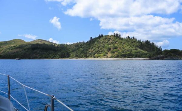
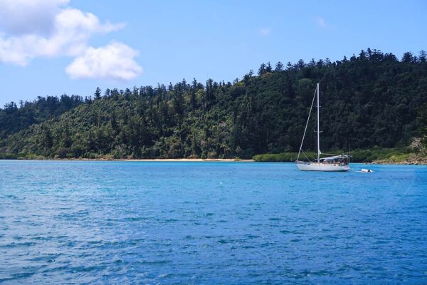
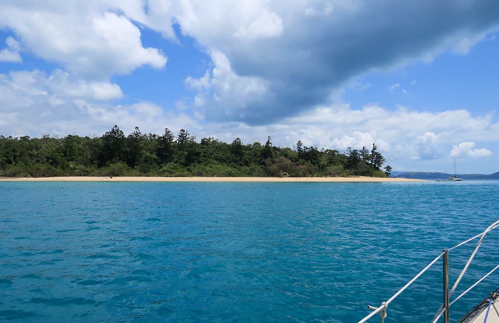
Today, our choice was between South Molle Island and Long Island, only 3 miles apart.
The anchorage at Long Island, named Happy Bay, was home to the remains of the closed-down Long Island Resort. The anchorage looked pretty, and from what I heard, the old hotel had a caretaker and was only mildly spooky. But this spot would be out of our way.
South Molle Island also boasted an attractive anchorage, Sandy Bay. This island was also home to a defunct resort, but it was located in another area, well away from the anchorage. This meant no creepy, haunted-house buildings to contend with. Sandy Bay also lay directly on our route to Arlie Beach. With that, we chose South Molle Island as our next stop.
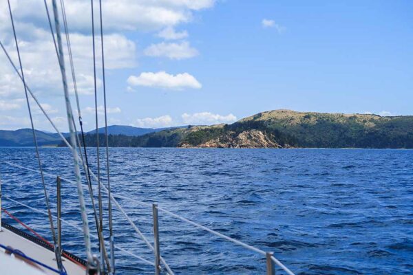
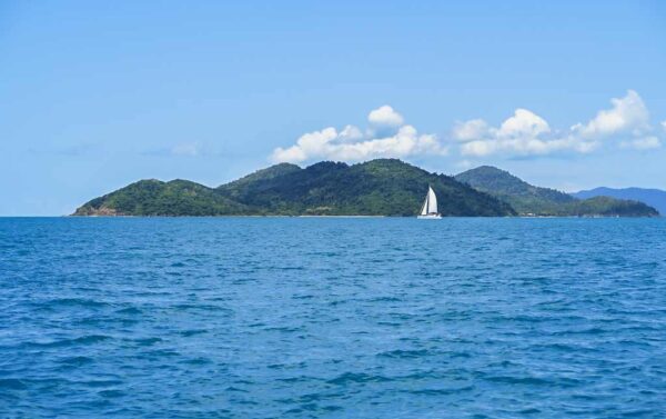
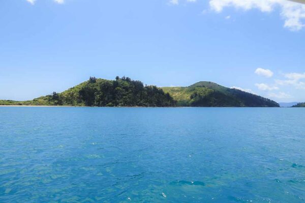
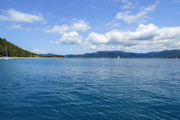
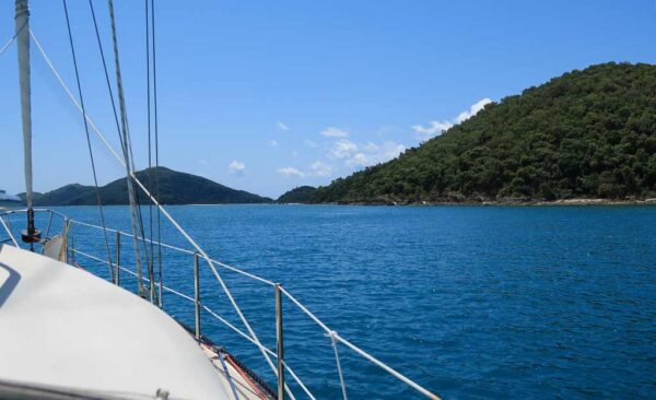
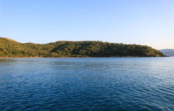
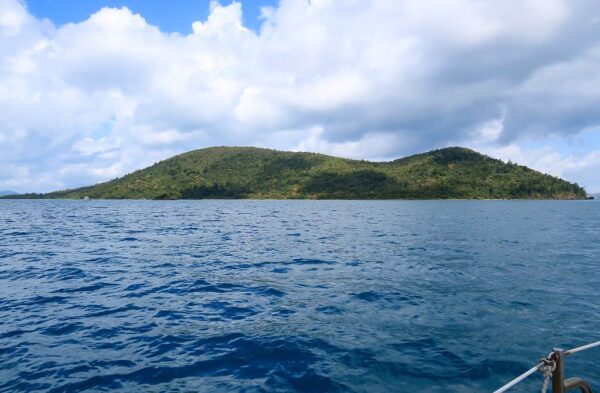
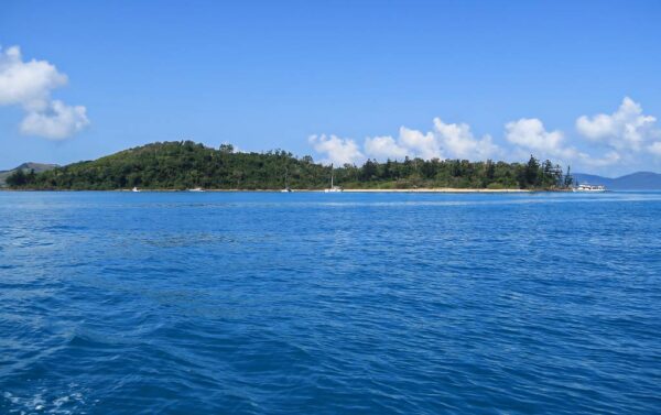
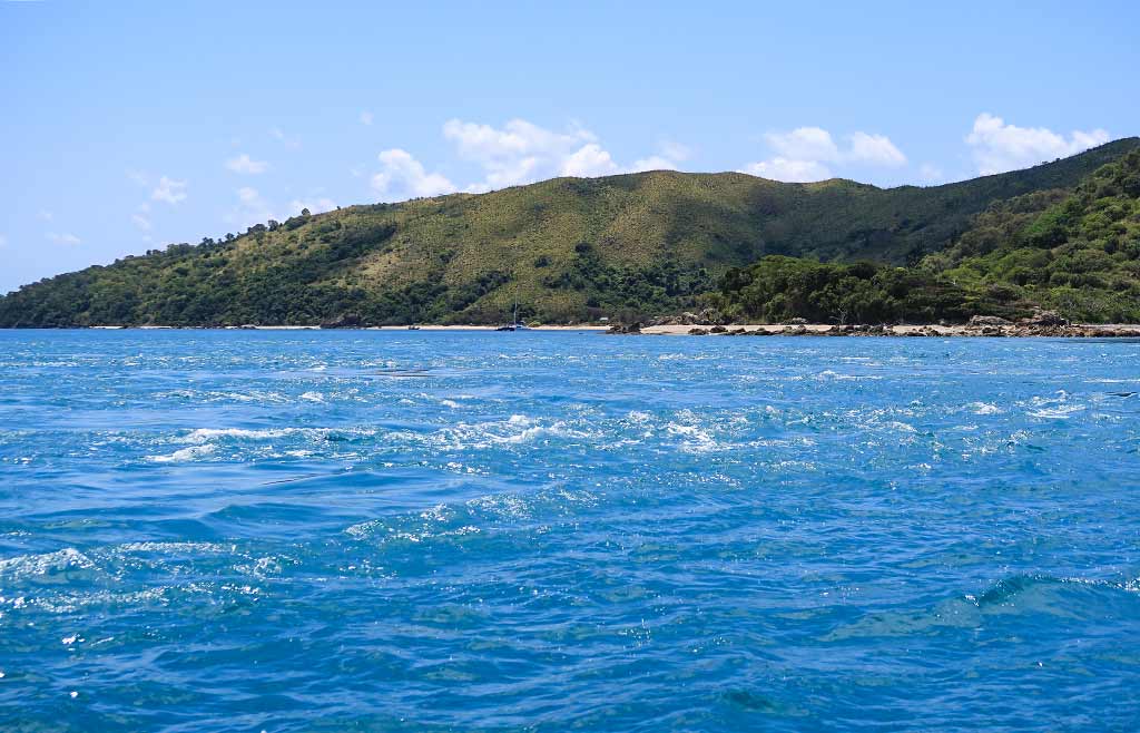
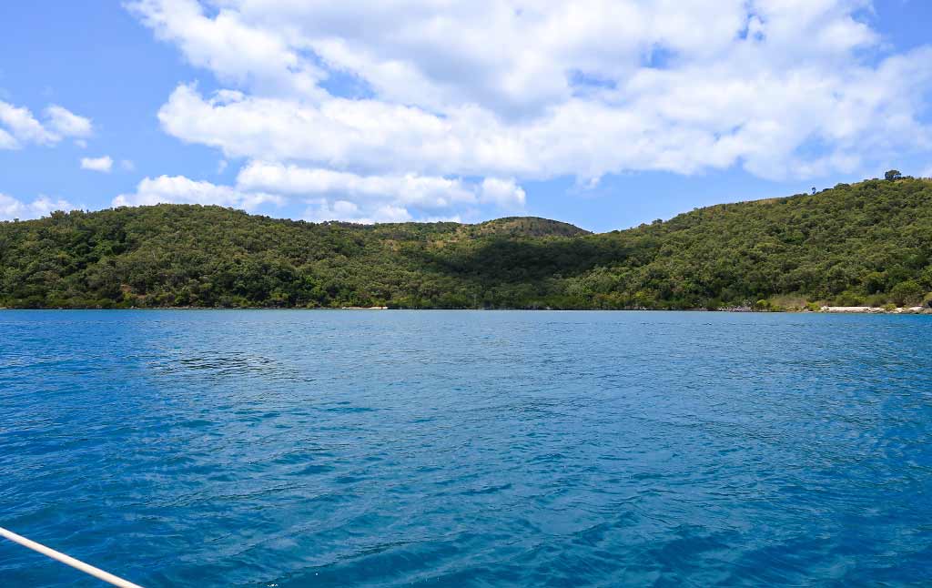
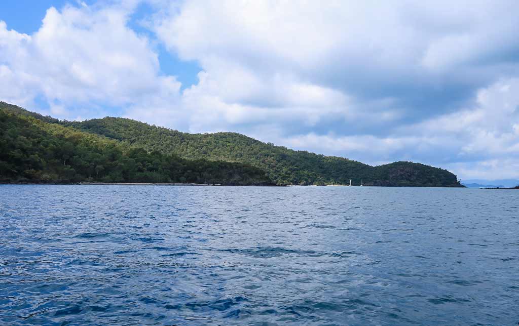
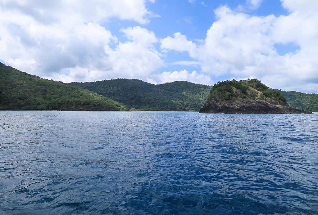
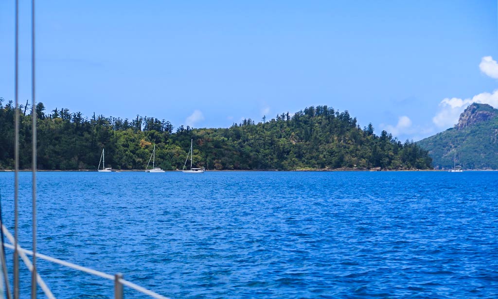
It was a pleasant day for our 2-hour motorsail trip to the destination, with sunny skies and a light breeze. Our route took us between South Molle Island and Long Island, giving us great views of both islands.
South Molle IslandLong Island
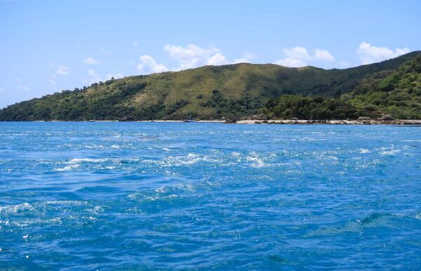
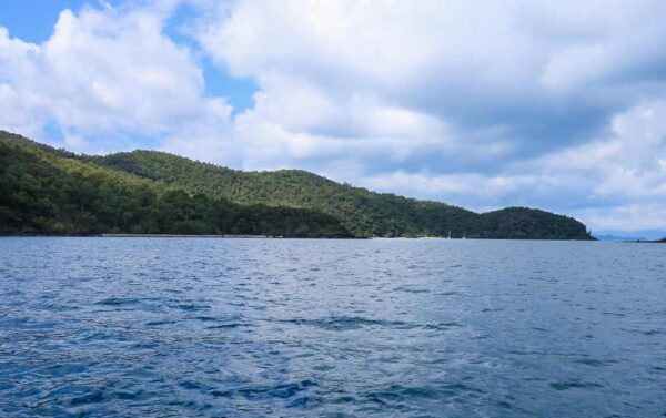
I briefly second-guessed the decision not to stop at Long Island, but I let it go as we approached the west side of South Molle Island. Below, a couple of photos of our approach to South Molle Island.
Things got interesting when our helpful current met a counter-current, stirring up whirlpools and turbulent water all around us. Thankfully, Sandy Bay appeared to be outside this zone of chaotic water. We didn’t mind motoring through it, but it’s not something we’d want to anchor in. Below, a video:
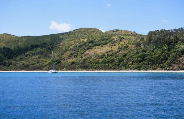
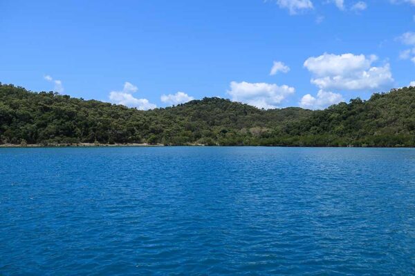
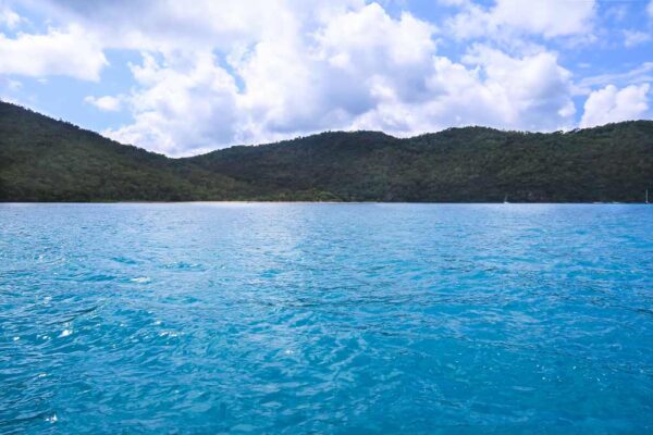
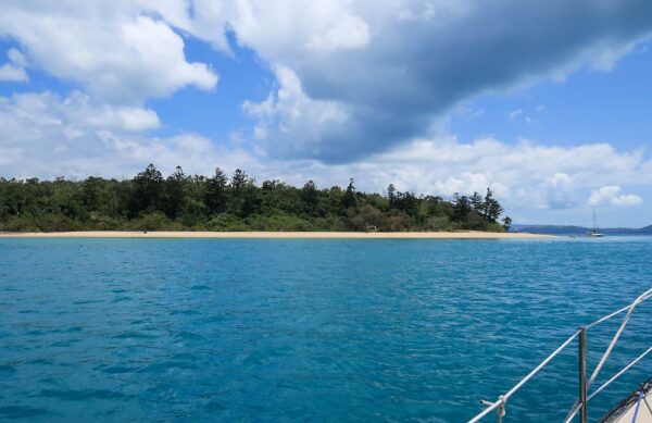
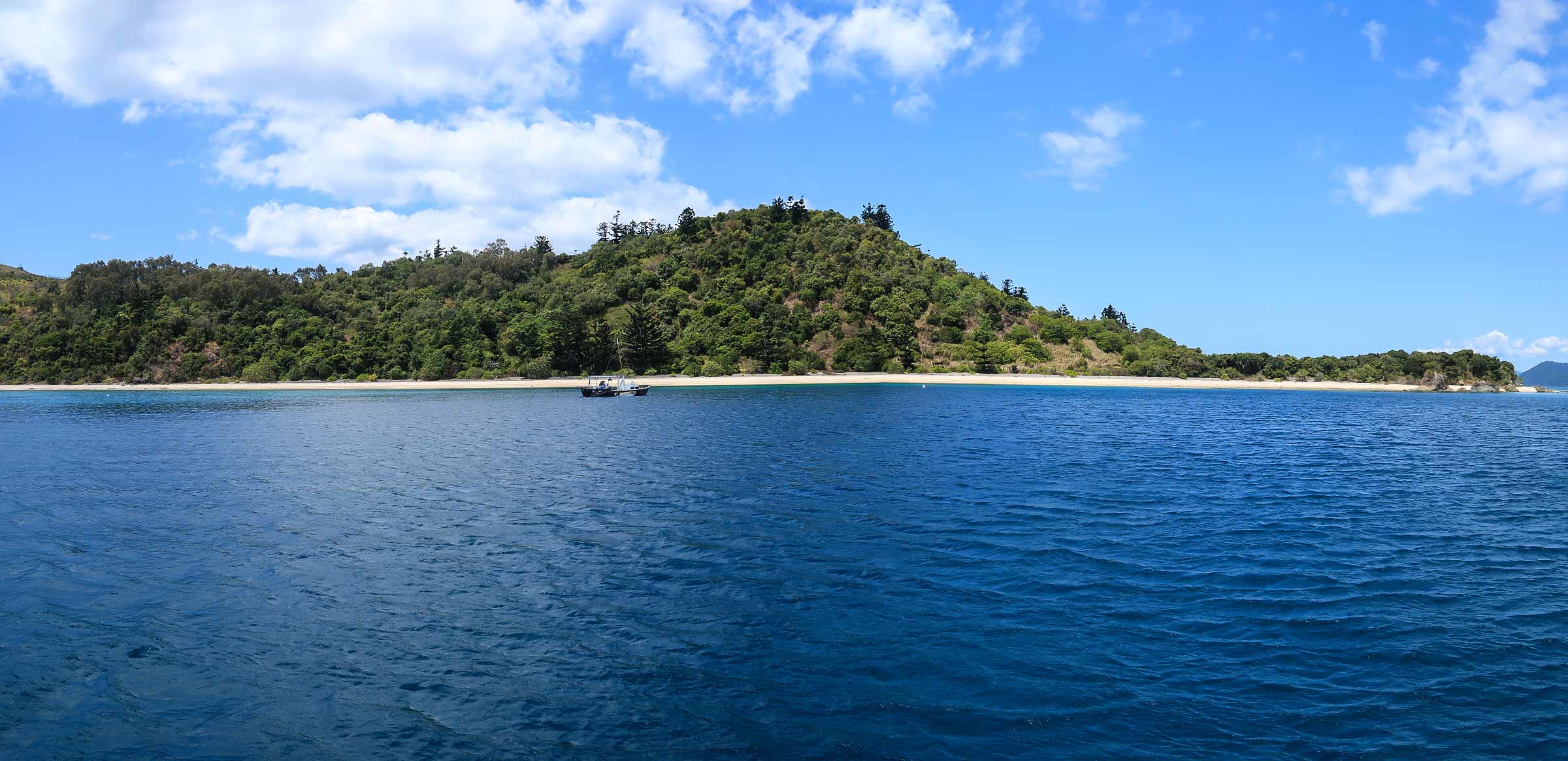
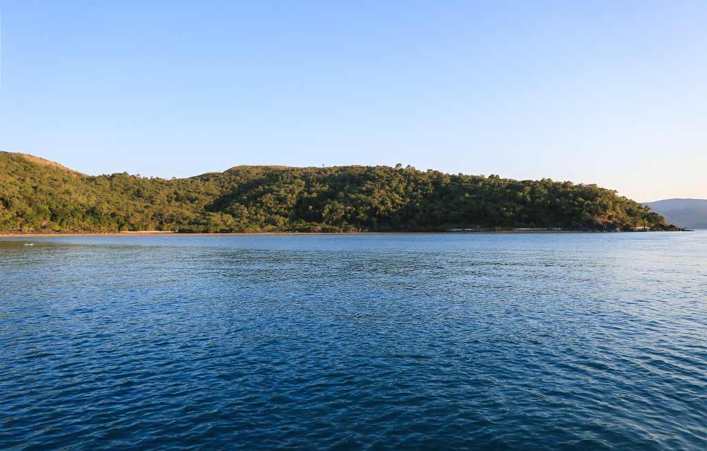
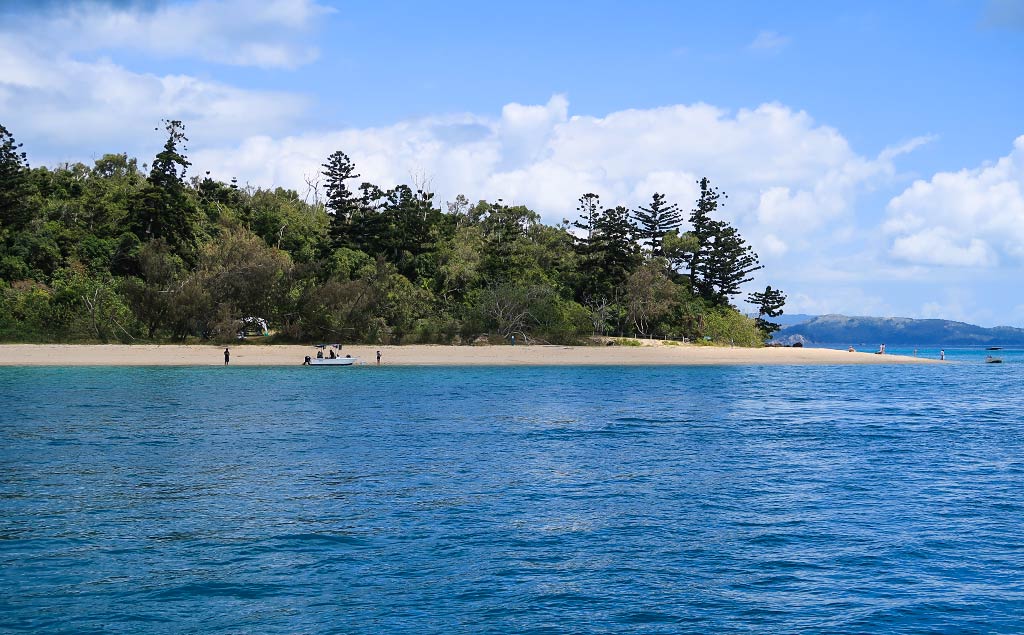
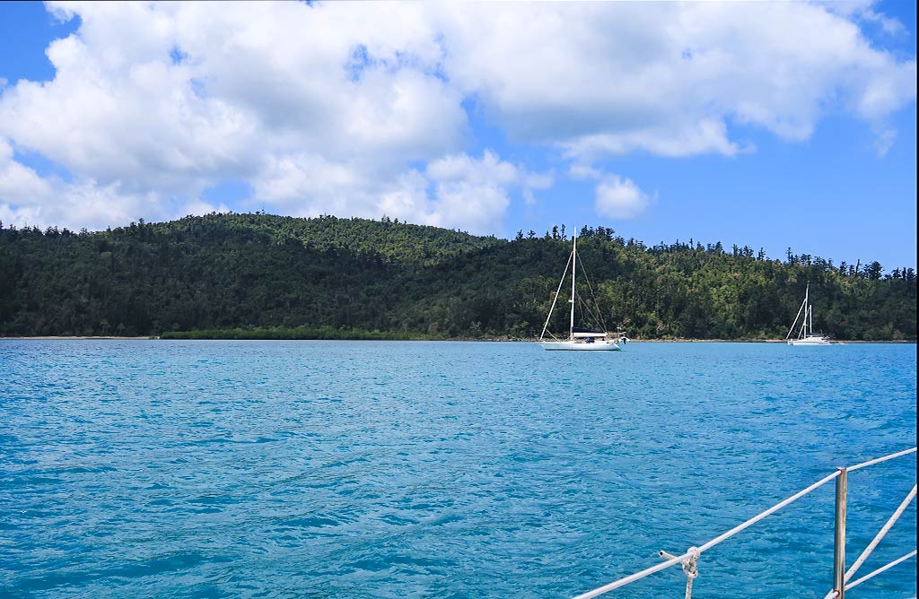
At first Sandy Bay seemed like a great anchorage, boasting an attractive beach backed by high grassy hills. But while there were only a couple of boats there, the presence of private mooring balls meant there was far less space than there’d initially appeared to be, and the anchoring zone between the reefy shore and the swift current was not so roomy. We could have eked out a spot if we were desperate, but Rich already had his eye on another anchorage near the north end of the island. Below, a photo gallery of lovely, but not-so-roomy, Sandy Bay.
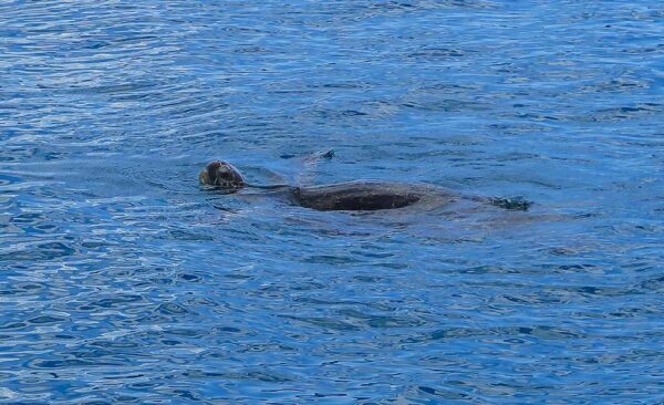
And a large sea turtle that was hanging out in the area . . .
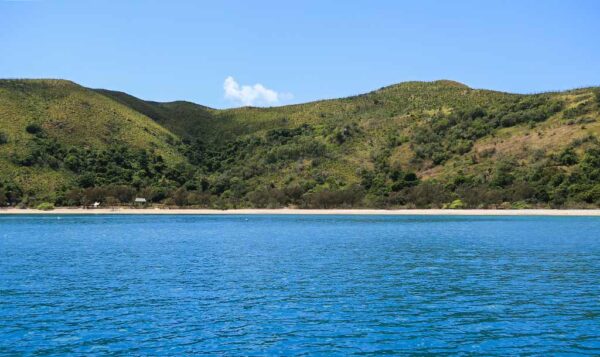
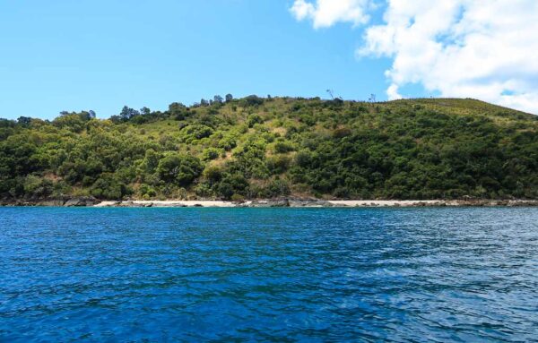
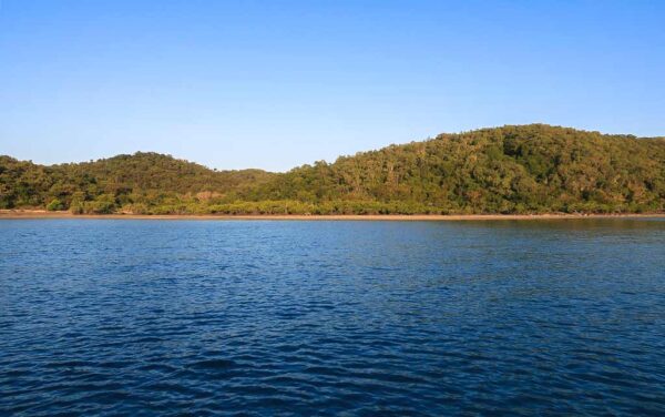
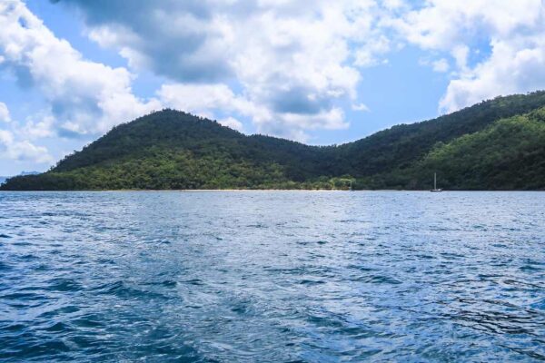
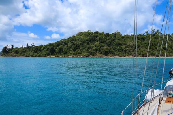
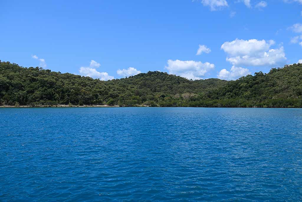
As we headed north we checked out another area, Camp Bay. At first glance it looked like a potential anchorage, but a closer look revealed the bay was quite reefy. Still, it was pretty from a distance. Below, a photo of Camp Bay.
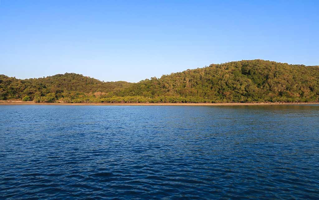
Soon, we arrived at the spot Rich found. There wasn’t much of a beach or any striking visual features, but it was calm and quite pleasant. The low hills here were thickly forested, and the rocky shore was dotted with mangroves. Soon, it became apparent this spot had one standout feature: birds. We heard a cacophony of bird calls, including kookaburras and cockatoos, especially around sunset. As the daytime calls faded, the night birds took over.
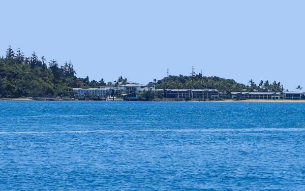
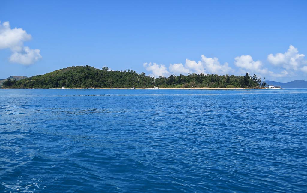
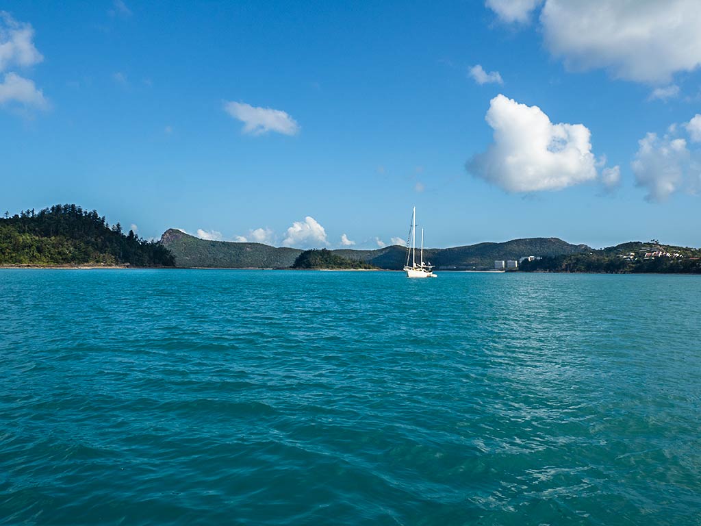
We also had views of Mid-Molle Island (which is connected to South Molle by an isthmus and not truly a separate island) as well as hilly, green North Molle Island, still a wilderness. Then there was the renovated resort on Daydream Island, less than a mile away, which I was very interested in seeing. I’d initially considered taking our dinghy over to see if they were cruiser-friendly, but after a look through the binoculars, it didn’t seem worth the effort. Below, a photo of Daydream Island Resort.
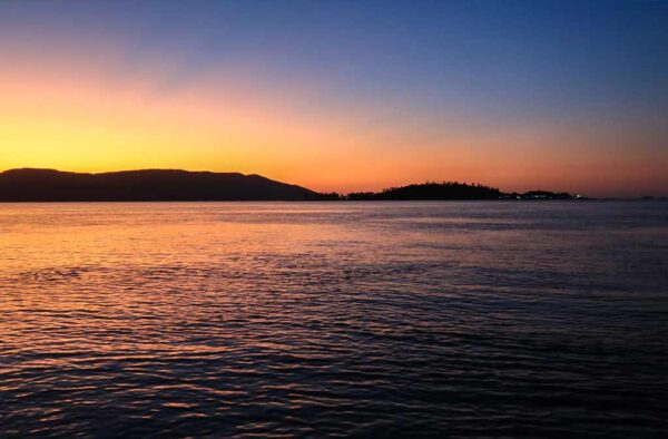
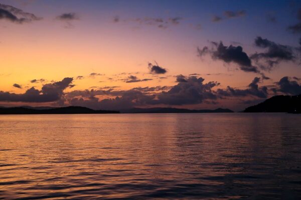
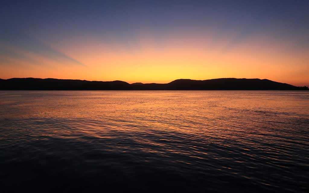
We stayed put, enjoying the golden evening light from the cockpit, followed by yet another beautiful Queensland sunset, serenaded by countless birds.
The next day, we’d be heading into a whirlwind of a busy, heavily-touristed town; so it was nice to have this last peaceful, nature-filled evening. –Cyndi
Posted September 18, 2024
about September 25, 2022
Today we had a couple of anchorages to check out. The first was nearby, on Cid Island just outside of the harbor. It wasn’t our first choice, but if it seemed enticing enough, that was where we’d stop.
Below, a map showing the general area.
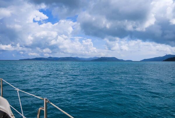
We left Cid Harbour, motoring out through the north channel. This gave us a look at the harbor’s north side, followed by a stunning view of Hook Island’s mountainous silhouette, a place we planned to visit in the future.
Enticing Hook Island was not far north of us.
Today, however, we were heading in a different direction, and our first potential anchorage was just around the corner on Cid island (photo below).
Today, however, we were headed for Cid Island just outside Cid Harbour.
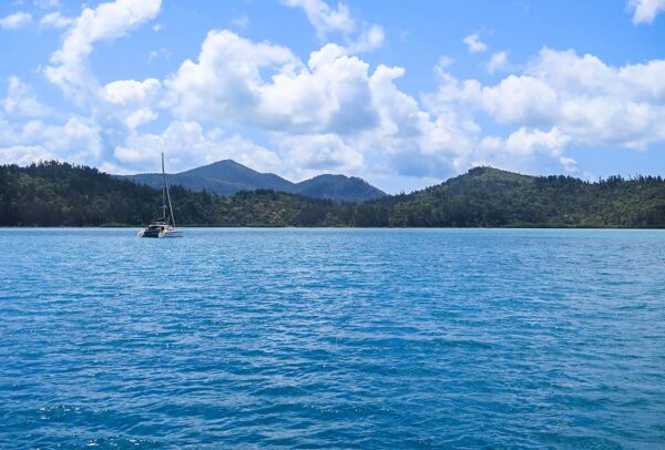
As we passed Cid Island, we could see a few boats anchored off the beach in an area known as Homestead Bay. Though it looked nice enough, we didn’t feel enticed to stop.
Instead, we decided to go a bit further, to a pretty little island we’d passed the previous day, Henning Island.
There are a few anchorages around the Whitsunday Islands that have installed moorings, both to protect the coral and enable boats to stay reasonably close to shore. Henning Island is one of those places.
Unfortunately, being on a mooring in an area with strong currents, like the Whitsunday Islands, has a serious drawback. When the current is pulling the boat away from the mooring, all is well. But when it goes slack or switches unfavorably, the boat can end up next to the mooring float and banging against it. It’s hard to overstate just how unpleasant it is to listen to the consistent banging of a mooring ball against the hull. This noise steals both sleep, and sanity.
We’ve had this problem before, and sometimes it’s possible to actually pick up the float and put it on deck, or hang it from the bow so it’s out of the water. However, these particular moorings had clear signage warning that shortening the mooring line was prohibited and could result in a fine for the boat owner. To further discourage this practice, these floats had been made to be particularly heavy, too heavy to lift onto the boat.
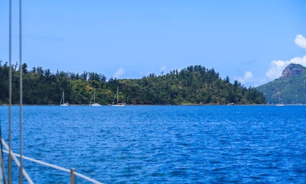
Despite this, we decided to give the mooring a try for a few hours. Once we were tied up, we had a lovely view of Henning Island’s beach and native bush vegetation.
(Below, photos of our approach to Henning Island, our mooring float, and our view of Henning Island from the mooring.)
But soon, the inevitable banging noise began, and our reaction was, “No, just no.” After a bad experience with a similar mooring situation in New Zealand, we have lost all tolerance for that obnoxious noise. We dropped the mooring and headed back over to Whitsunday Island.
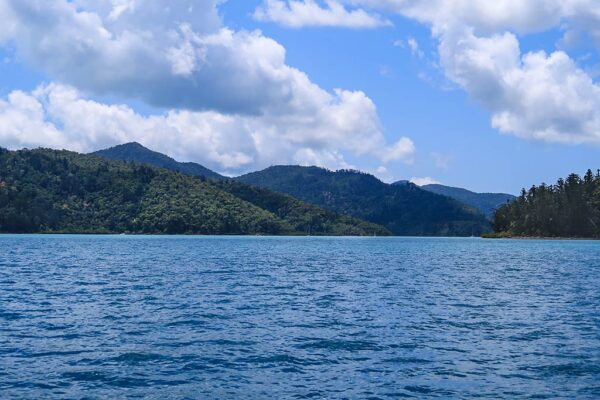
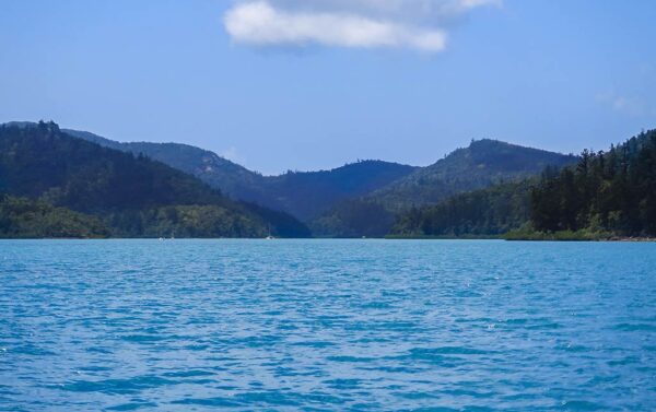
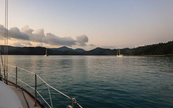
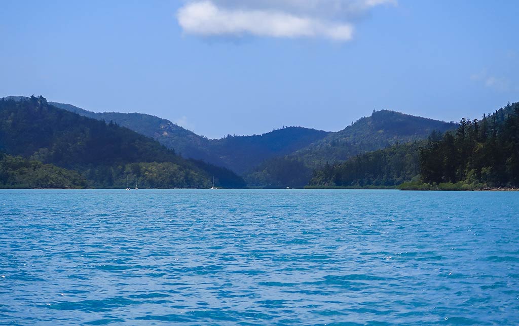
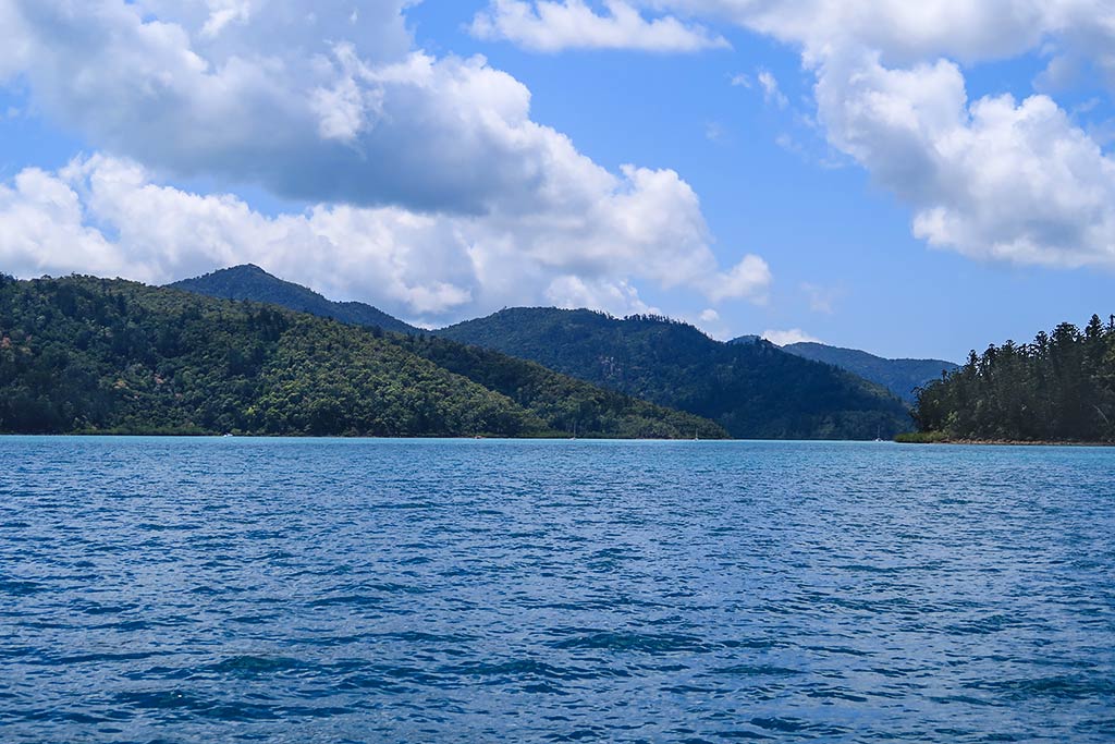
Rich had been intrigued by an area known as the Gulnare Inlet, a deep and narrow harbor cutting into the island. We took a look and it was beautiful, with mountains lining both sides of the inlet. It was an impressive sight, but much of the inlet was too shallow for our boat.
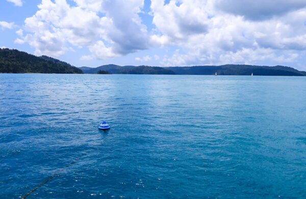
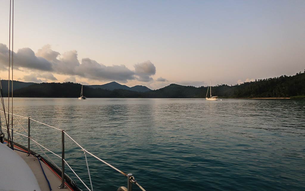
Instead, we decided to anchor at a spot near the inlet’s entrance. It turned out to be a lovely place to spend the rest of the day. We also had a surprisingly close-up view of Hamilton Island just to the south.
(Below is a photo gallery of the anchorage including our view of Hamilton Island in the bottom right photo.)
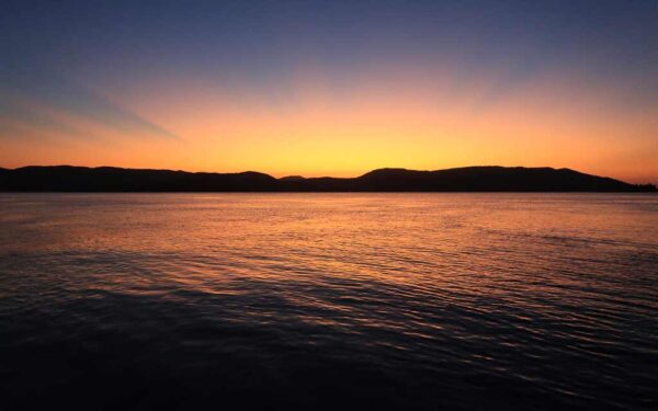
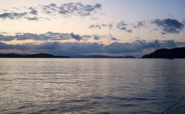
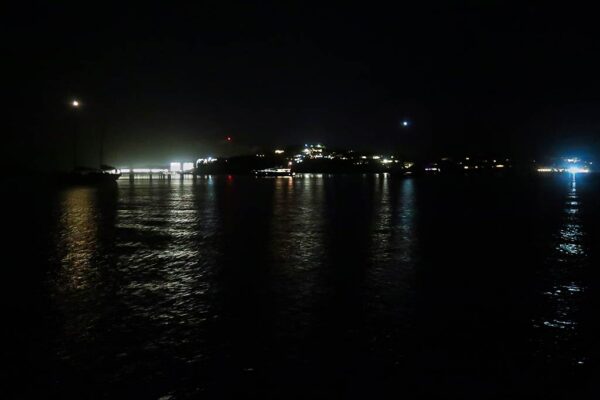
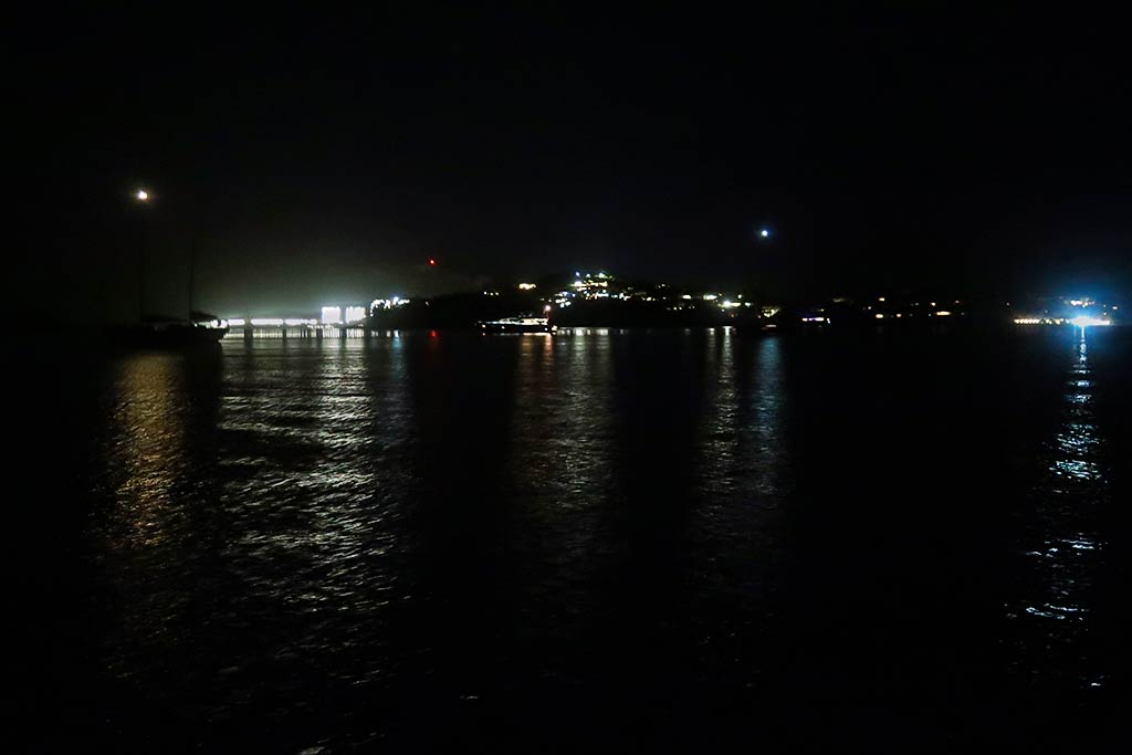
Later, we enjoyed a lovely sunset, followed by the sight of a dusky sky filled with flying foxes (fruit bats) heading out for their nocturnal activities. As darkness settled in, the bright lights of Hamilton Island came into view.
Earlier today, this area felt remote and wild, but tonight the city lights were a reminder that civilization wasn’t far away. –Cyndi