
October 29, 2013
Once again, at Koro Island, we had our dawn coffee in the cockpit and watched the big thunderheads southeast of us. The difference today was that we were leaving and that was about the direction we were headed. Rich went down and double-checked the weather: we were in for light winds today and needn’t worry about the clouds. In fact it was going to be so calm we’d have to motor all the way to Makogai! If we waited one more day we might have had helpful winds, but we just weren’t up for another sweltering day.
Makogai is located about 25 miles east-south-east of Koro Island, which at first glance wouldn’t seem to make much difference in our air temperatures. But there’s another factor: Makogai lies off Fiji’s south island, Viti Levu, a huge and mountainous land mass. Those lovely mountains are rainmakers for much of Viti Levu’s east side and some of the islands that lie off it. Rainy, cloudy weather can change a sunny, miserably hot day into a reasonably comfortable one. Plus we hoped those mountains might block some of the evening sun.
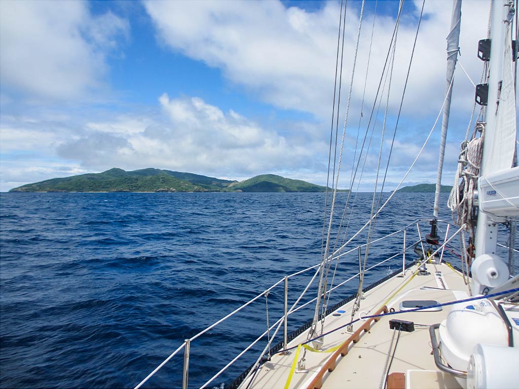
And so we motored east and south towards Viti Levu. What a nice surprise when some clouds seemed to come out to greet us along the way! We were in a long line of them after that. I was very happy because to me it both looked and felt cooler. Rich was not so happy; he had to take off his sunglasses because all the gray was depressing him. (Below, an interactive map showing our approximate route.)
The sun was peeking out here and there as we arrived at Makogai. We knew the approach would be more complicated than it looked as there’s quite a lot of hidden reef. There are two passes to the anchorage: one on the west side and one seldom-used pass on the north end. We’d opted for the north entrance and it turned out to be pretty easy with our good waypoints.
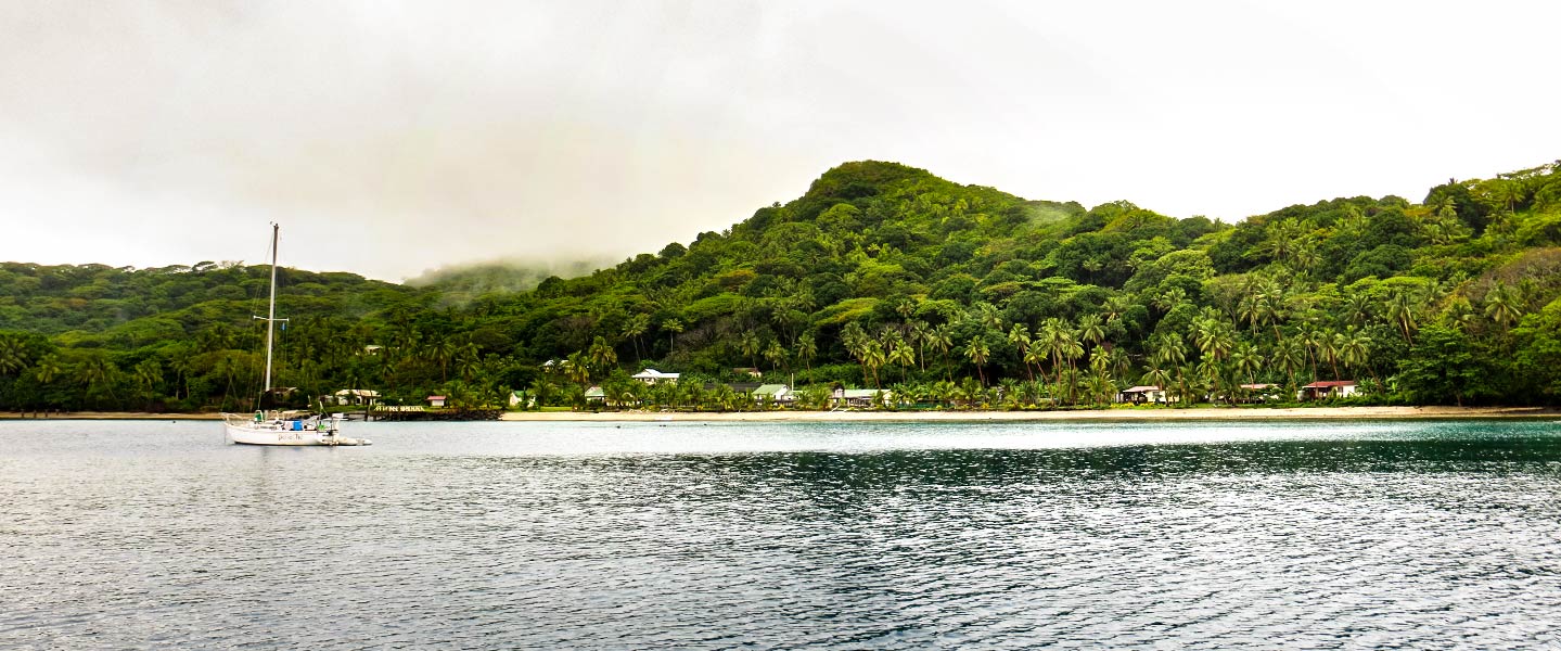
We got through the pass, then motored by a small off-lying island into the anchorage at Dalice Bay. Only one other boat was there. We picked a spot, dropped the anchor, and after a bit of dragging it set. (Below, an interactive map showing our approximate route into Dalice Bay and some photos of our approach into the anchorage.)
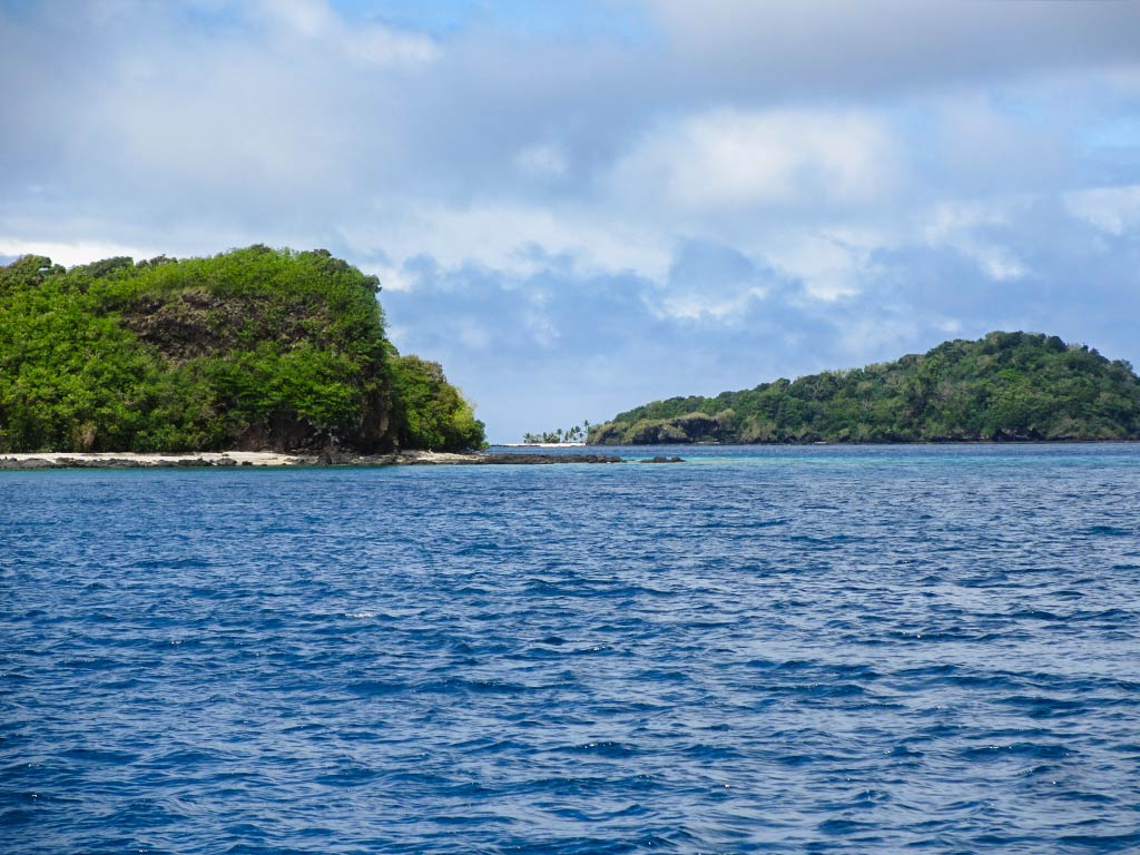
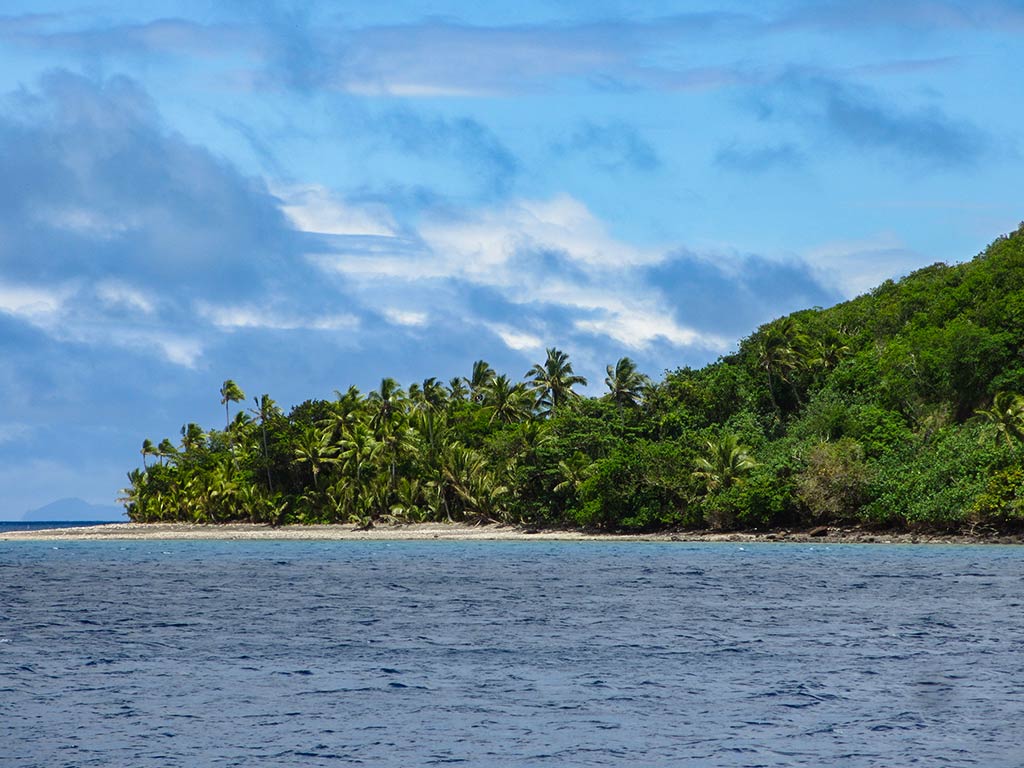
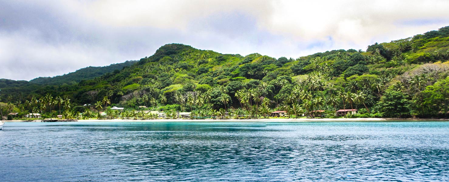
Wow, what a beautiful spot! Verdant green hills sloped down to a narrow, palm-covered flatland. A few small red rooftops peeked out from lush greenery, and along the shore was a small white beach. The anchorage was protected by a small off-lying island, Makodroga, and a reef stretched part of the way between it and the small rabbit hump of an island off the south headland. To the north, another headland stretched out to give further protection. Aside from that, the entire island of Makogai was nearly surrounded by reef.
Between the islets, reefs and hills, this place felt very enclosed and protected. A saddle dipping down between the tall hills made an attractive curved line that allowed some breeze to pass through. As I hoped, it seemed to be much cloudier here than it was in Koro and Vanua Levu, yet the sun peeked out frequently enough that I could get some nice photos. The water in the outer anchorage was a deep, dark green, becoming a very attractive teal blue near the shore.
We did not expect this place to be so beautiful as people tend to focus their descriptions on the leper colony ruins and the giant clams. Those things sounded interesting, but this place was pretty enough to warrant a visit based on that alone.
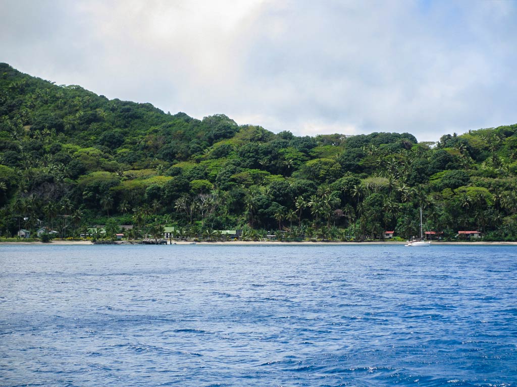
Below, photos Dalice Bay when the sun is out, and under the clouds.
The reason I called this place Mysterious Makogai was that (at this point) we only had bits and pieces of information about it, some of it conflicting. All we knew was that there were the remains of a leper colony somewhere on this island, that there were giant clams somewhere on the bottom of Dalice Bay along with old metal bed frames from the leper colony, that the village was not located in Dalice Bay but a rather long walk inland (and did they expect us to come do a sevusevu?), and that there’s a caretaker here who’s not a chief but might expect kava. We could see some small houses ashore—were there people living here besides the caretaker? It seemed we had a lot to figure out.
Thankfully the guys from the other boat, Panache, came over to visit and cleared up many of the mysteries. Turned out that right here were the leper colony remains, a clam farm (where they grow giant clams in an effort to repopulate many of Fiji’s reefs), and the caretaker. The main village was a long walk from here, but a handful of islanders had moved over here and now had a very small settlement. There was no chief, but the caretaker does kind of act as chief and yes, he likes cruisers to come do a sevusevu with him! In return for the gift of kava, he gives a tour which includes the leper colony, the graveyard, and the clam farm. It seemed this was a combination historical site and marine reserve, and the caretaker was combination park ranger and chief.
After some lunch, we planned to head ashore to check this place out.–Cyndi


